
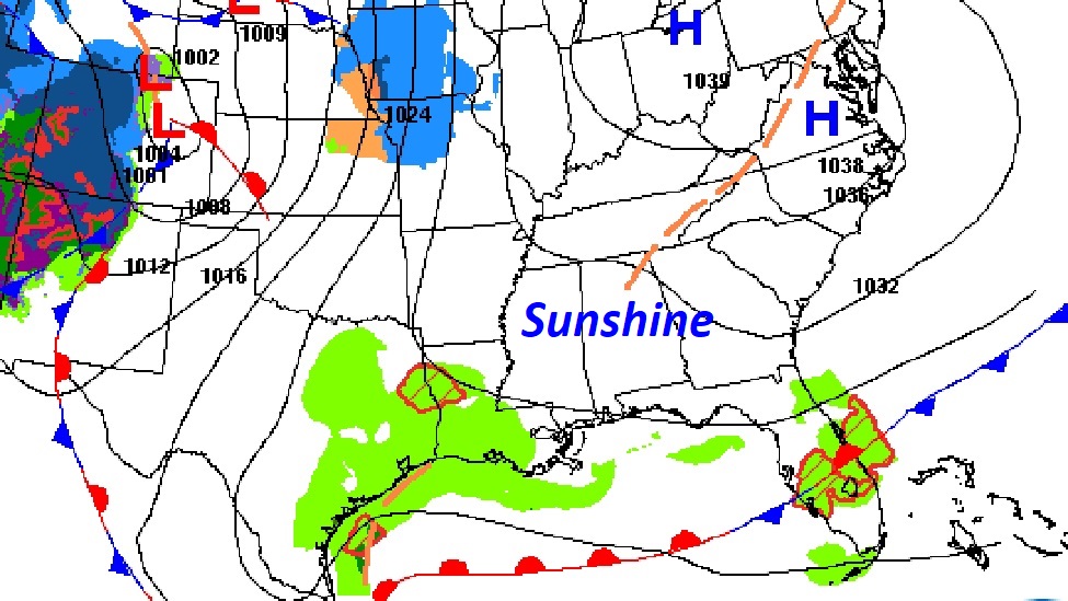
Good morning! On this Valentines Day, we are enjoying this nice break between storm systems. Sunshine will dominate. Today’s high will actually be normal. (Normal 64/40) But looming in our near term future is yet another storm system which will dominate the weekend forecast for much of our nation. For Alabama, and most of the Gulf South, we are facing yet another severe weather threat. The most likely window for Severe Storms and possible tornadoes will be Saturday night, especially in the overnight hours. Behind this system, it will turn sharply colder Sunday and Monday. Arctic air is returning. We’ll be in the upper 20’s by Monday Dawn. Monday’s high will struggle to reach the low 50’s. Next week will be quite chilly, indeed. Frankly, it’s looking colder and colder. Here’s my brief video forecast discussion.
.
TODAY: A Sunny Valentines day. East wind at 10 to 15+ mph. High 64. Increasing clouds tonight. Isolated shower late? Low 52.
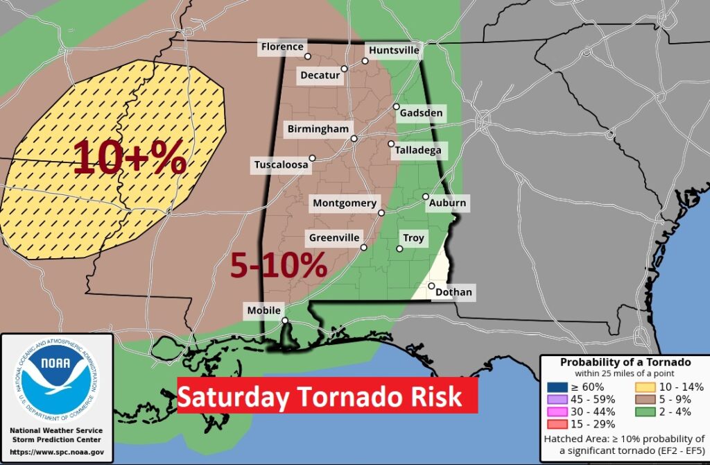
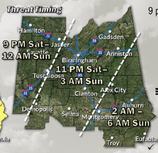
SATURDAY SEVERE RISK: Another potent storm system will bring yet another Severe Threat to the Gulf states including All of Alabama. Right now, most of us are in a Level 2 Risk especially Late Saturday night, in through the overnight hours. All modes of severe weather are possible including tornadoes. Right now, the greatest threat level (Enhanced – Level 3 out of 5) covers parts of west Alabama.
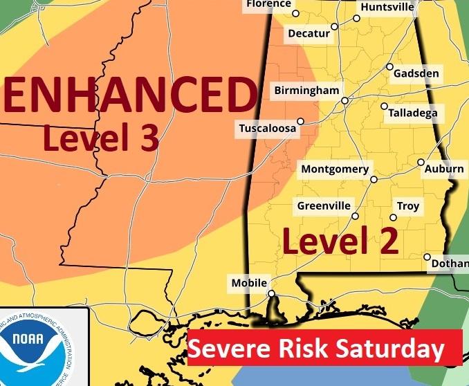
The BEST news this morning from the Storm Prediction Center is that the strongest tornado threat is WEST of out state, covering parts of Mississippi and Louisiana. This could shift, but we like this trend.
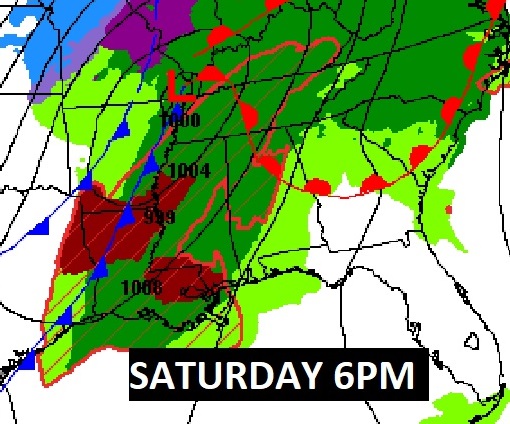
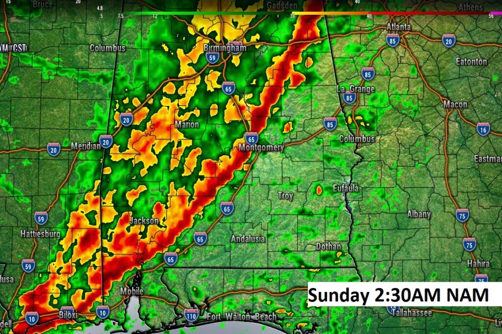
Here’s a hi-res Future Radar snapshot. Unfortunately this will be another overnight event for us,.
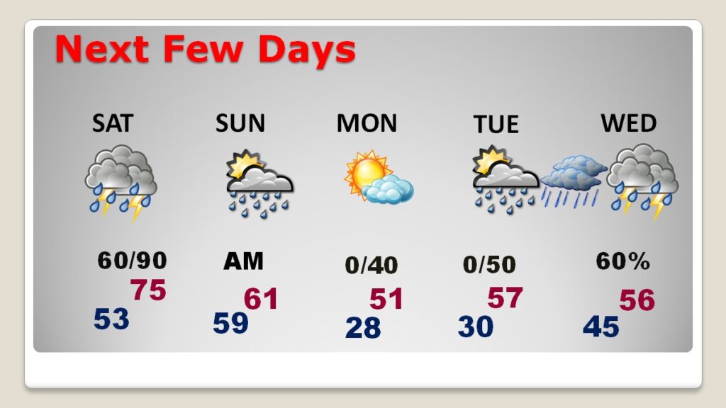
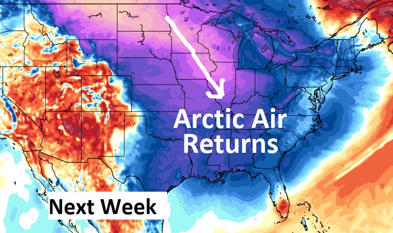
NEXT FEW DAYS: Behind this system, it will turn sharply colder Sunday into Monday. We’ll be in the upper 20’s by Monday Dawn. Monday’s high will struggle to reach the low 50’s. Another freeze is expected Monday night. Next week looks very cold. Get ready for another big change of climate.
Here’s the 10 day model blend temperature trend. The ARCTIC Flood gates will open again, unfortunately. Could there be some mid week winter weather issues in parts of Alabama? Maybe… Stay tuned.
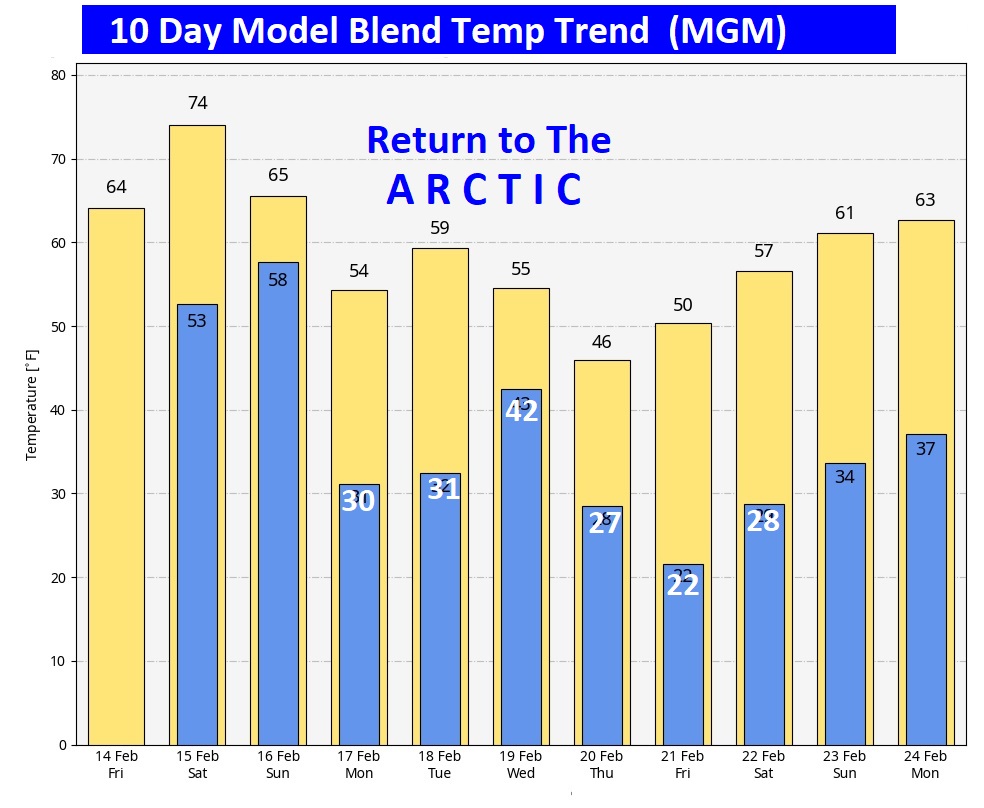
Evil Arctic Air Next Week. ☹
Thanks for reading this blog update. This morning everything is normal. We’ll be LIVE on NewsTalk 93, from 6 to 9AM. There will be another Blog Update and Forecast Video discussion in the 4’o’clck hour tomorrow morning. Have a nice Valentine’s Day!
–Rich