
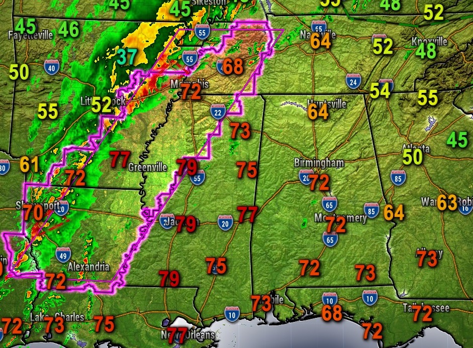
5:25 PM:
Here’s the big picture. One long tornado watch from LA to western TN till 10PM. Juicy air ahead of the squall line (QLCS) with temperatures in the 70’s and dewpoints in the 60’s. No tornado warnings now, but some imbedded tornadoes a good bet in the line over the next several hours, well into the overnight hours. Enhanced – Level 3 Severe Risk. #alwx
NOON UPDATE:
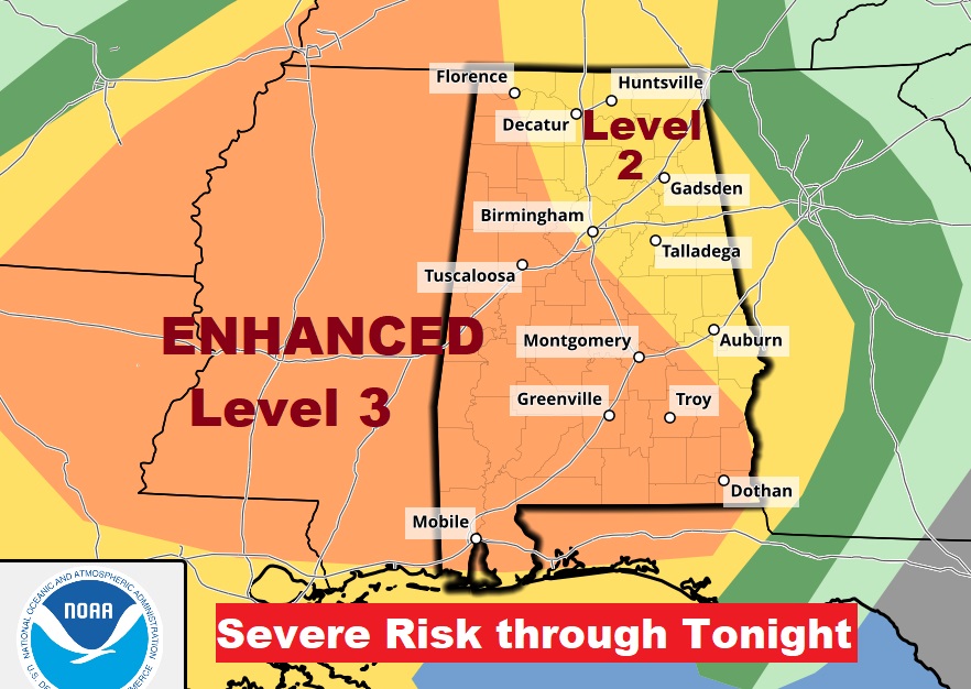
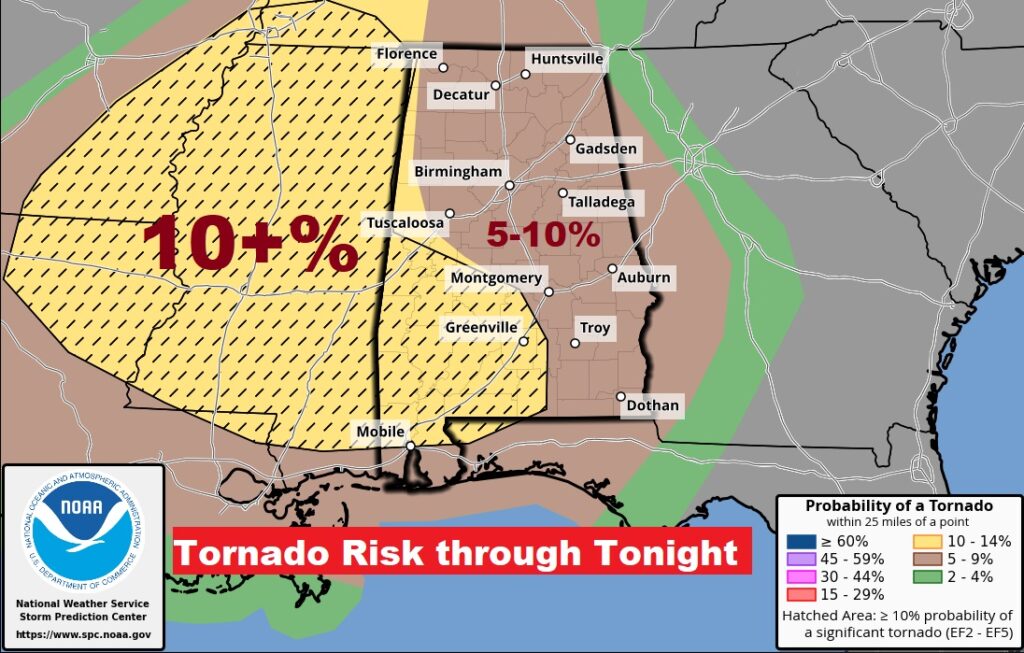
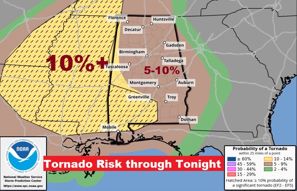
Unfortunately, recent updates from the Storm Prediction Center have not be encouraging. They have once again expanded the Level 3 Enhanced risk as far east as a Birmingham/Eufaula line. The 10%+ Tornado Risk covers all of southwest Alabama as far east as Butler county. The hatched area indicates the greatest risk of strong tornadoes – EF-2 or greater. There will be another SPC Day 1 update around 2:00PM.
Good morning! Another potent storm system will bring yet another Severe Weather Risk to Alabama late tonight, including the Risk for Tornadoes and damaging wind gusts 60+ mph, along a line of strong storms (QLCS). This system will move through faster then the Wednesday night system. Behind it, much colder air will funnel in. Sunday will be a day of falling temperatures and gusty wind. We’ll be sub-freezing by Dawn Monday. A second surge of even colder Arctic air arrives by Wednesday evening. The coldest day will be Thursday. The coldest morning will be Friday around Dawn. Get ready for some more winter.
.
TODAY: Cloudy. Warmer. High 75. Widely scattered showers possible this afternoon. Breezy. South wind 10 to 20 mph, shifting to west after Midnight. Showers and locally Severe storms will move through in the overnight hours. Temperatures will be in the 60’s overnight, until the cold front passes through, then start to drop.
Tonight’s SEVERE RISK: Another potent storm system will bring yet another Severe Threat to the Gulf states today and tonight. Right now, most of us are in a Level 2 Risk especially Late tonight, in the overnight hours. All modes of severe weather are possible including tornadoes. Right now, the greatest threat level (Enhanced – Level 3 out of 5) covers west Alabama, generally west of I-65.

TORNADO RISK: Most of us are in the 5-10% tornado risk. That hatched area in SW Alabama and Mississippi indicates a 10% or greater risk and the threat for strong tornadoes EF-2 or greater.
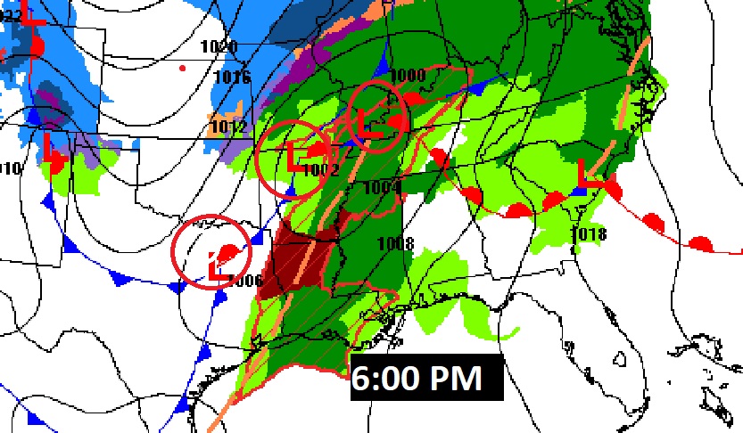
This situation will be a little different than Wednesday night’s storm system. Most of the action will be along a squall line (QLCS), and it will move through quicker than the Wednesday night system. Here’s a couple of different hi-res model examples.
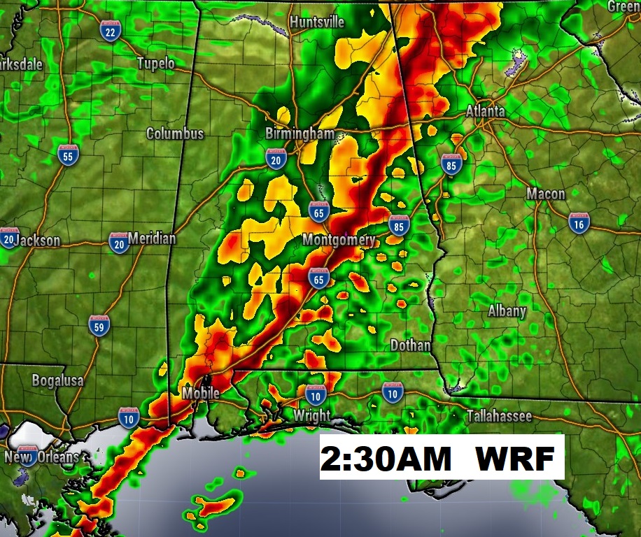
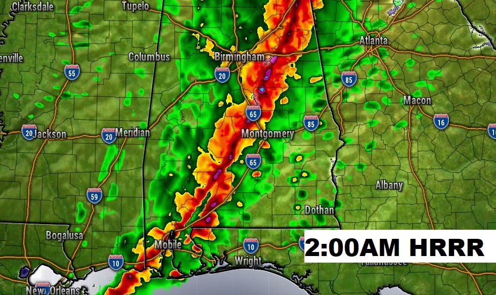
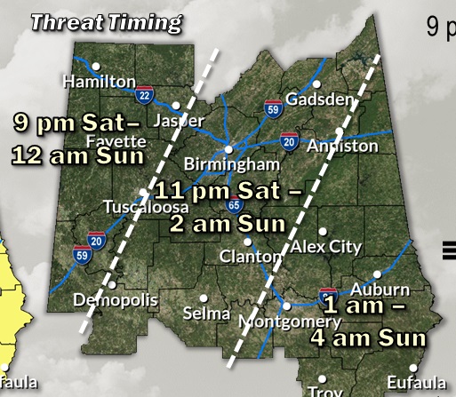
This will help you on the expected timeline.
NEXT FEW DAYS: Sunday will be a day of falling temperatures and gusty wind. We’ll be sub-freezing by Dawn Monday. Monday’s high will struggle to reach the low 50’s. There’s more rain in our future Tuesday night and Wednesday. It gets even colder late week. There’s
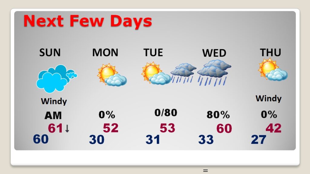
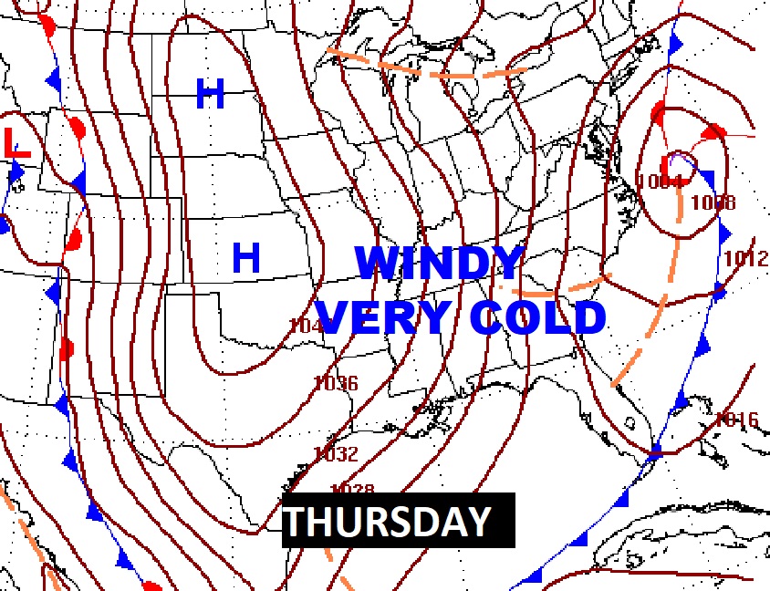
A second surge of even colder Arctic air arrives by Wednesday evening. The coldest day will be Thursday. The coldest morning will be Friday around Dawn.
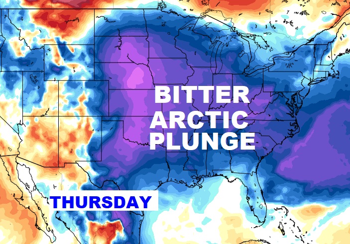
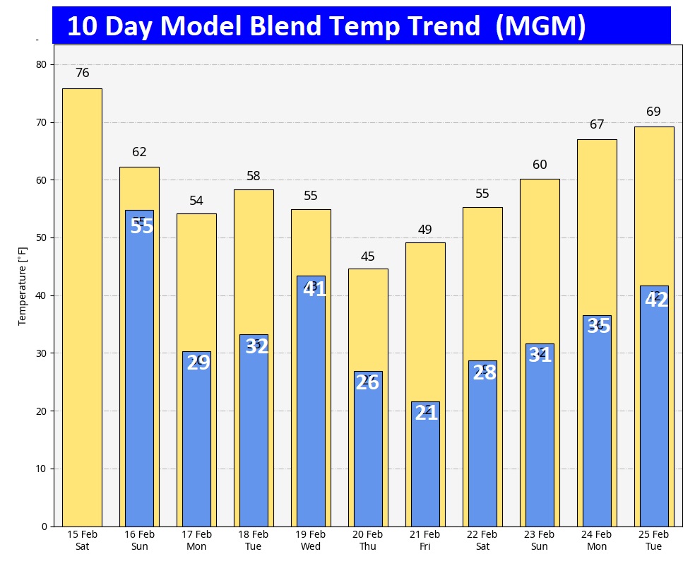
Here’s the 10 day model blend temperature trend. The ARCTIC Flood gates will open again, unfortunately. Take a look at next Thursday. Not pleasant. There will be several nights of sub-freezing temperatures.
Thanks for reading the blog. The next scheduled FULL blog will be Monday morning. Obviously, I’ll be updating you on the storm system as new information becomes available.
–Rich