
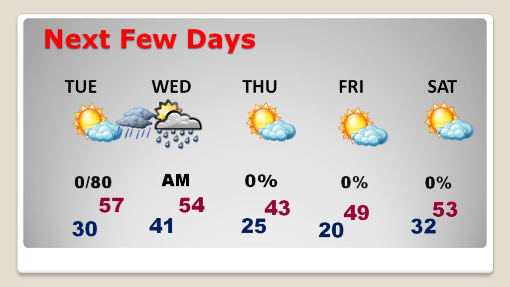
Good morning! Following the big weekend storm, much cooler air has returned to our state. Today, on this President’s Day we will be 10 to 15 degrees below normal. We’re headed for another freeze tonight. But, hang on. There’s yet a front on the way by mid-week. Showers will move in after midnight Tuesday night and through Wednesday morning. Then, get ready for another Arctic Plunge. The coldest day will be Thursday. High in the lower 40’s. The Coldest night will be Thursday night/Friday morning, Low near 20. Fortunately, no severe weather this week. Here’s my brief video forecast discussion.
.
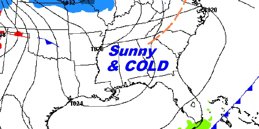
TODAY: Sunny and cold. High 52. Northwest wind 10 to 15, gusting to 20 MPH. Mainly clear and cold tonight. Low near 30.
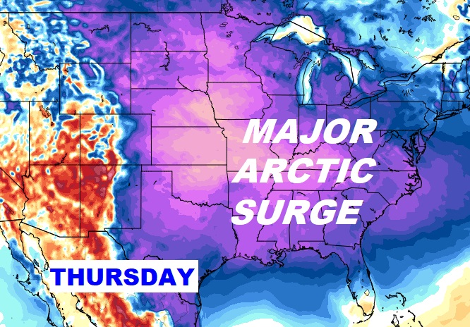
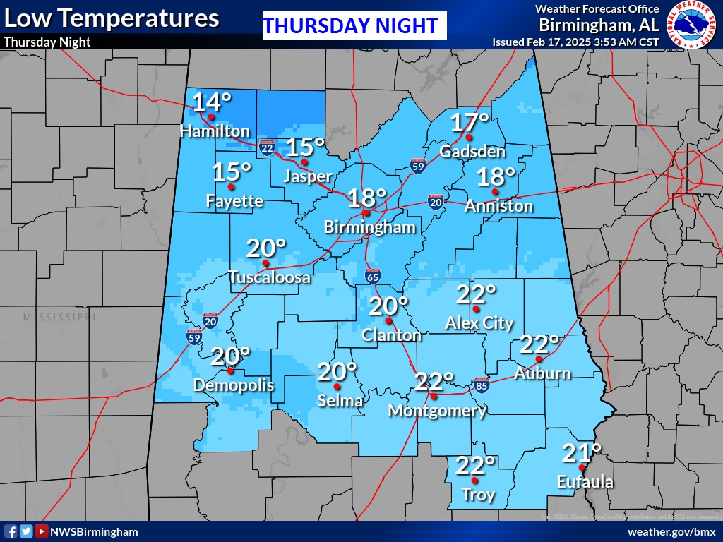
NEXT FEW DAYS: The next chance of rain, ahead of the next arctic cold front will arrive Tuesday night into early Wednesday before the next Arctic Surge. The coldest day will be Thursday. High in the lower 40’s. The Coldest night will be Thursday night/Friday morning, Low near 20.
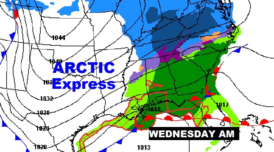
Next Arctic Surge funnels in Wednesday behind the next front.
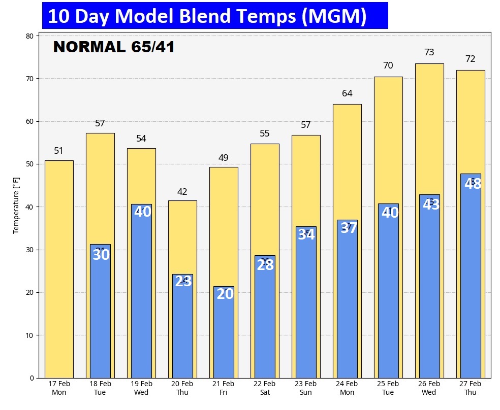
Here’s the 10 day model blend temperature trend. Cold this week. Fortunately, recovery next week. Warmer. Back to the 70’s.
A few snapshots from Saturday Nights powerful Severe Weather events. These snapshots from eastern Montgomery county. NWS crew will survey Montgomery, Macon, Elmore and Tallapoosa counties today after identifying a EF-1 tornado in Perry/Hale counties yesterday.
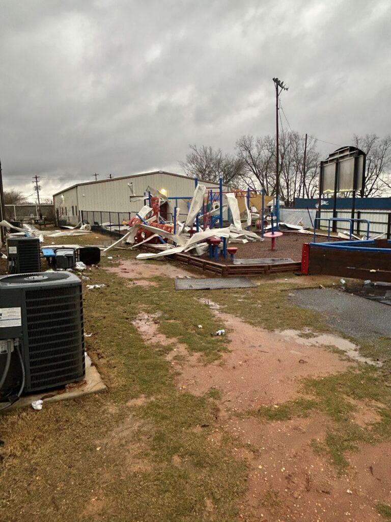


The power of 70+ mph straight-line winds in last night’s squall line (QLCS) event. Look at the size of this tree. Fell on a house in Prattville. Amazing. in Atlanta, one dead after a tree falls on a home.

Thanks for reading this special blog update. This morning everything is normal. We’ll be LIVE on NewsTalk 93.1. There will be another Blog Update and Forecast Video discussion in the 4’o’clock hour tomorrow morning. Have a good day.
–Rich