
Good morning! Our below normal temperatures continue, but there’s even colder air on the horizon in the not too distant future. Today will slightly warmer than yesterday with a high in the upper 50’s to near 60. We should be dry through the evening hours. Showers are likely by the wee hours, in the overnight hours tonight and Wednesday morning. Sharply colder Arctic air will funnel in behind the front. Expect low to mid 20’s Wednesday night. Thursday will be extremely cold with a high barely in the low 40’s. The coldest morning will be Friday AM with a low near 20 and wind chills in the low to mid teens. The weekend will be not quite as cold, but still well below normal. Temperatures will warm-up next week. Here’s my brief video forecast discussion.
.
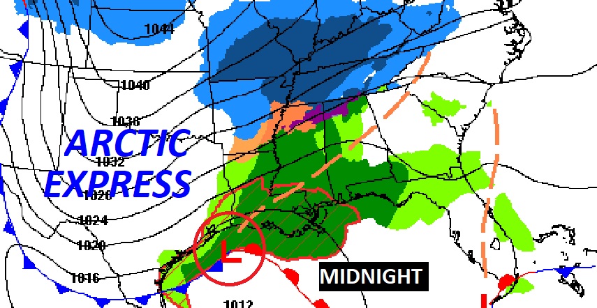
TODAY: A sun/cloud mix. A little milder than yesterday. High 58 to 60. Light wind. Becoming cloudy tonight. Showers likely beginning in the overnight hours and into Wednesday morning. Low tonight 42.
NEXT FEW DAYS: The next Arctic Cold front will sweep through early Wednesday, ending the shower threat.
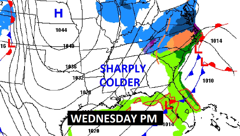
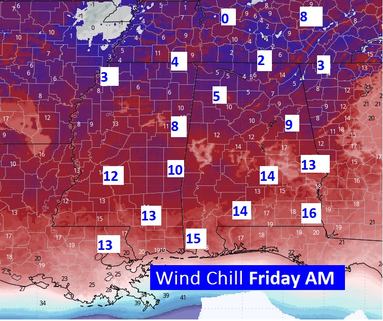
It will turn will windy and colder. Wednesday night, temperatures will plunge to the low to mid 20’s. The coldest day will be Thursday. High in the lower 40’s. The Coldest night will be Thursday night/Friday morning, Low near 20, wind chill will be in the low to mid teens.
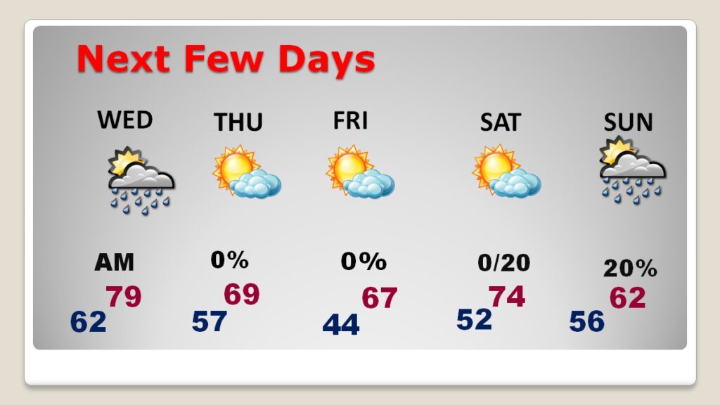
The coldest day will be Thursday. The coldest night will be Thursday night.
Wind Chill will be a factor, particularly Thursday and Friday morning.
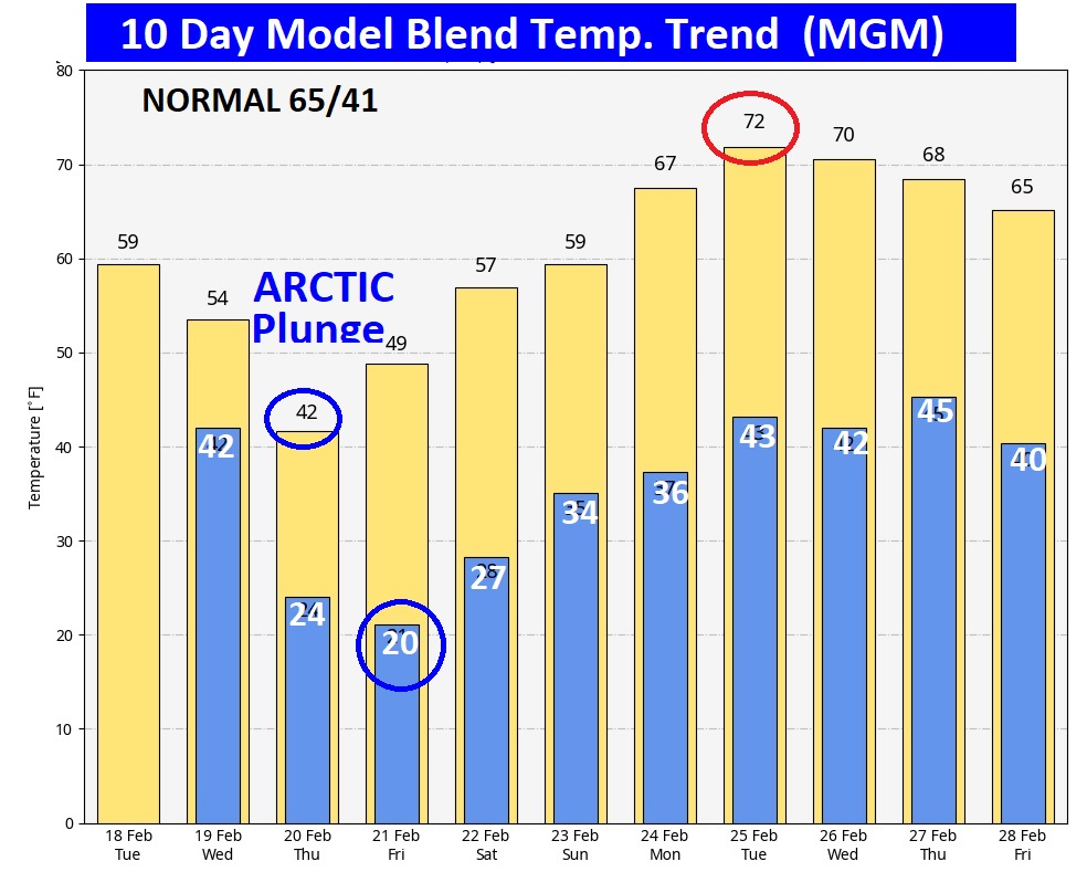
Here’s the 10 day model blend temperature trend. Looks like a Rollercoaster. From near 20 Friday morning to 72 on Tuesday.
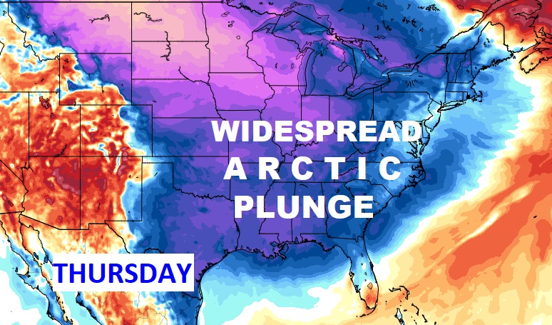
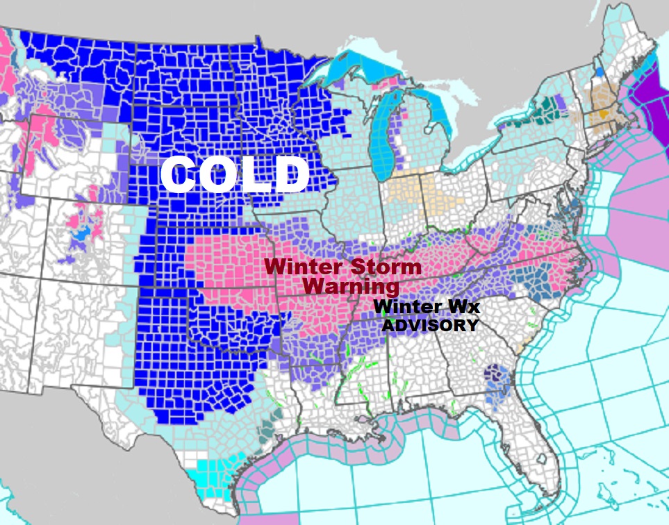
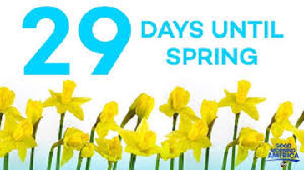
Lots of Extreme Winter Weather expected from Kansas/OK to the Atlantic, including a Winter Weather Advisory for North Alabama for a Wintry mix tomorrow morning. All of this couple with an extremely cold Artic Plunge covering much of our nation. Winter sucks. 29 days till Spring!
TORNADO SURVEYS: NWS surveys confirmed 3 tornadoes in the wee hours of late Saturday night and early Sunday morning. Yesterday a NWS crew identified two EF-1 tornadoes, one in Tallapoosa and one in Macon county. Here’s the survey details:
https://partnerservices.nws.noaa.gov/products/a453b80cf538bf876eee5615ef4ac5ca
Thanks for reading this special blog update. This morning everything is normal. We’ll be LIVE on NewsTalk 93.1. There will be another Blog Update and Forecast Video discussion in the 4’o’clock hour tomorrow morning. Have a good day.
–Rich