
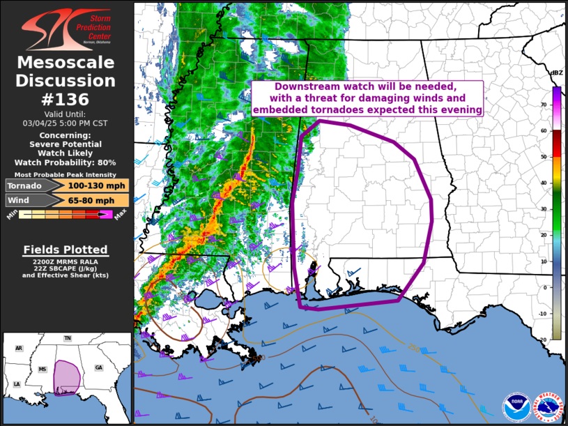
4:30 PM:
SPC says: 80% chance of a “downstream” tornado watch for much of central and south Alabama. No time frame mentioned yet, Damaging wind gusts and embedded tornadoes are a good bit as the squall line (QLCS) swings eastward into AL this evening.
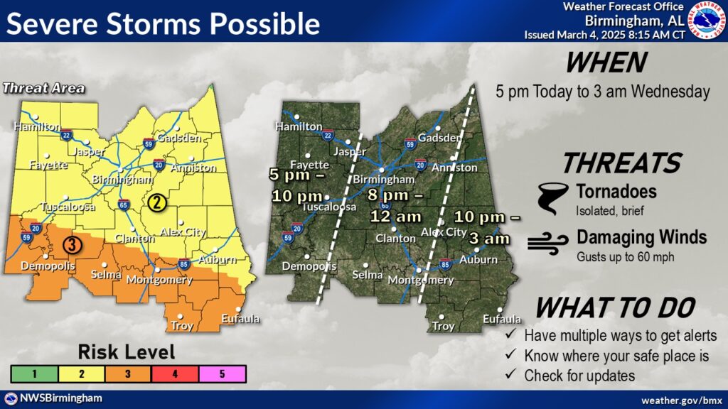
9:00AM UPDATE:
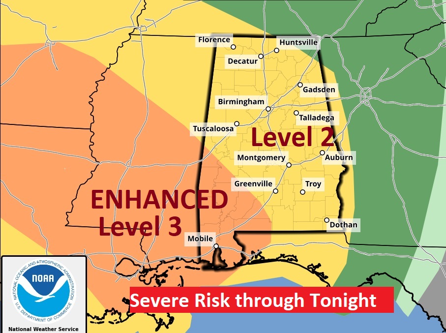
Increased ENHANCED LEVEL 3 SEVERE RISK Tonight
(9:00AM 3/4/25)
This is certainly news we did NOT want to see, Our Severe Weather Threat Level (for most of us) is now Level 3 out of 5. As far north as a Tuskegee Wetumpka, Marion Line.
Expect a line of strong to severe storms to move through the area this evening and tonight. A few tornadoes are likely. Hail up to ping pong size. Scattered wind gusts to 70 mph. Please make sure to allow notifications on our Weather App, and make sure your Weather Radio is plugged up and in the alert mode. Do not depend on Weather Sirens. If you live in a manufactured or mobile home, be ready to go to a more substantial structure when a Tornado Watch issued.
Good Morning! A potent storm system will bring a Severe Weather Threat to the Gulf states today & tonight. The greatest threat here in Alabama will arrive this evening and move across the state tonight. The greatest threat will be damaging straight-line winds and the risk of tornadoes along a strong squall-line (QLCS). Tranquil weather returns Wednesday. Thursday will be unseasonably cool with a high in the upper 50’s. The next storm system to affect the state will be over the upcoming weekend. Here’s my brief video forecast discussion
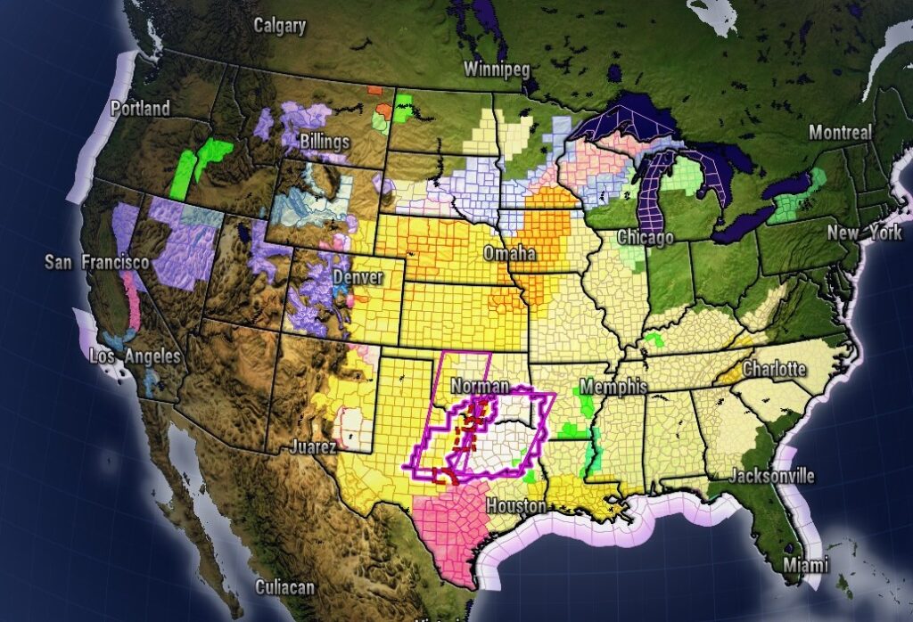
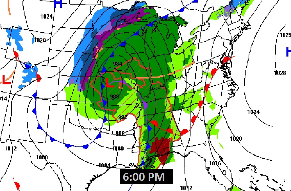
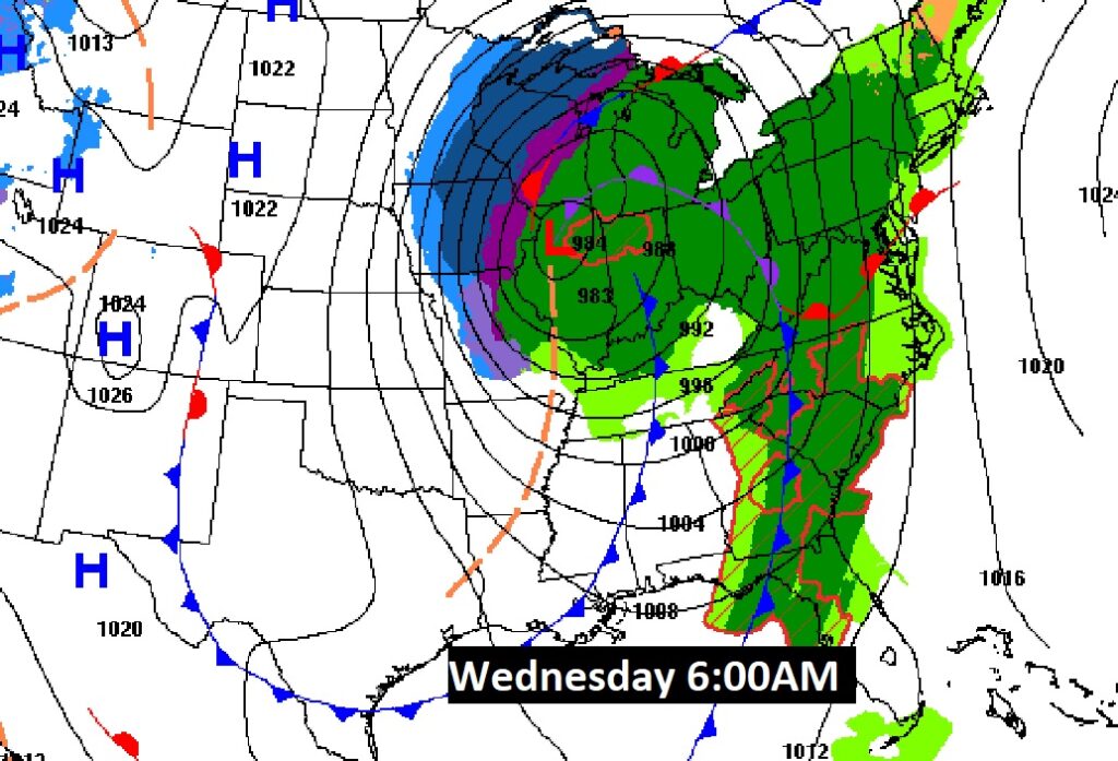
The MASSIVE storm system which will bring a Severe Weather Threat to Alabama tonight, is affecting a multi state area with various alerts from blizzard warnings to Tornado Watches/warnings to wind advisories and so much more. Rarely will you see the NWS Hazard map look this busy. The actual LOW moving out of Kansas toward Illinois could break a March barometric pressure record of 980 mbs. Equivalent to a hurricane. Historic.
TODAY: WIND ADVISORY begins by afternoon with South wind 15 to 20 gusting to 35 daytime and 40 mph by evening. Limited sunshine. High 78. A line of strong to severe storms moves through tonight. Some storms strong possibly severe. Low 57.
SEVERE RISK TONIGHT: The greatest threat will be damaging straight-line winds and the risk of tornadoes along a strong squall-line (QLCS). SPC has most of us in a Level 2 out of 5 threat level. Southwest Alabama has an ENHANCED Level 3 risk.
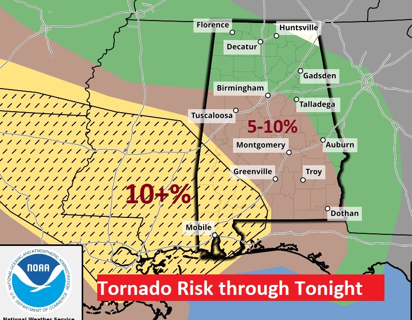
Most of us are in that 5-10% risk for a tornado, within 25 miles of any given point. Notice the tornado risk is higher in southwest Alabama. That hatched area on the map is where the greatest likelihood of strong, long-lived tornado exists. (EF-2 or greater)
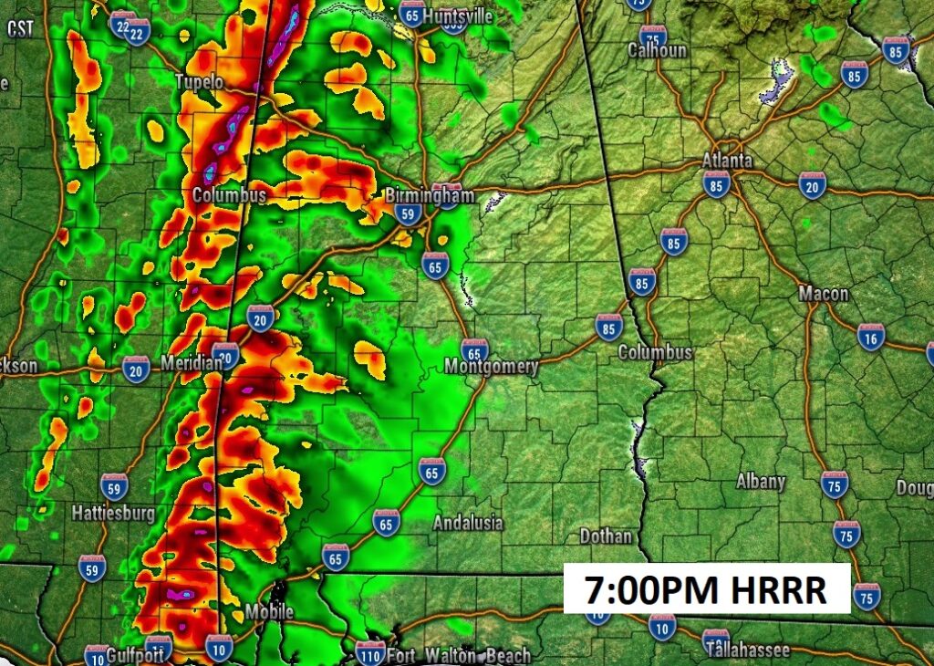
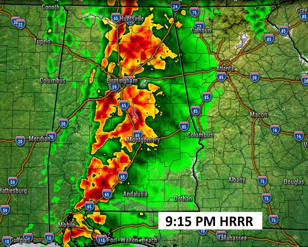
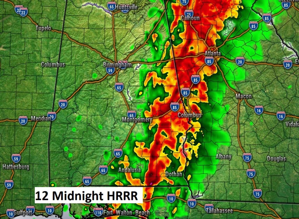
Here’s a sample of FUTURE RADAR on one of the hi-res models. (The usually reliable HRRR model) Tonight’s squall line will be moving fairly quickly, and at least it will not be in the middle of the overnight hours.
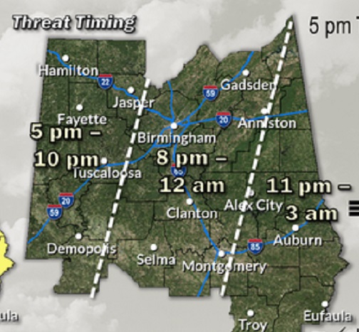
Here’s the updated timing map from NWS. This is a little faster time line than we saw yesterday,
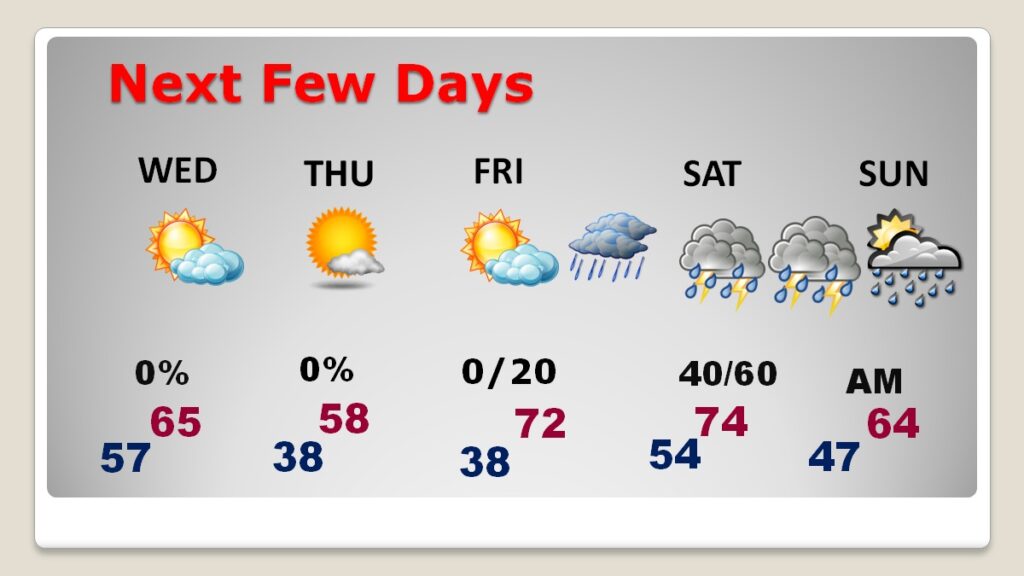
NEXT FEW DAYS: Quiet weather returns tomorrow. Thursday will be unseasonably cool with a high in the upper 50’s. We’ll be 70 or above Friday and Saturday. The next storm system to affect the state will be over the upcoming weekend. Scattered showers and thunderstorms Saturday and especially Saturday night, possibly into Sunday morning. This next storm system does not look nearly as potent as tonight’s storm.
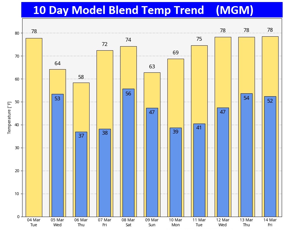
Here’s the 10 day model blend temperature trend.
Thanks for reading this blog update. This morning everything is normal. We’ll be LIVE on NewsTalk 93.1. There will be another Blog Update and Forecast Video discussion in the 4’o’clock hour tomorrow morning. Have a good day.
–Rich