
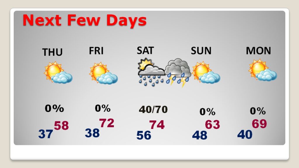
Good Morning! The mega storm system which brought strong winds to our state downed thousands of trees. Power outages, as of 3AM in Alabama, total more than 69,000. Today the strong gradient winds will continue through mid-day. Wind Advisory continues. Thursday will be unseasonably cool with a high in the upper 50’s. We’ll be 70 or above Friday and Saturday. Risk of showers by Saturday afternoon. Scattered showers and thunderstorms become likely Saturday night. Much cooler Sunday behind the storm system. Here’s my brief video forecast discussion
CLIMATE DATA: Tuesday’s low at MGM was 41, High 78. (Normal 69/44) Rainfall: 1.41” Peak wind gust 48 mph.
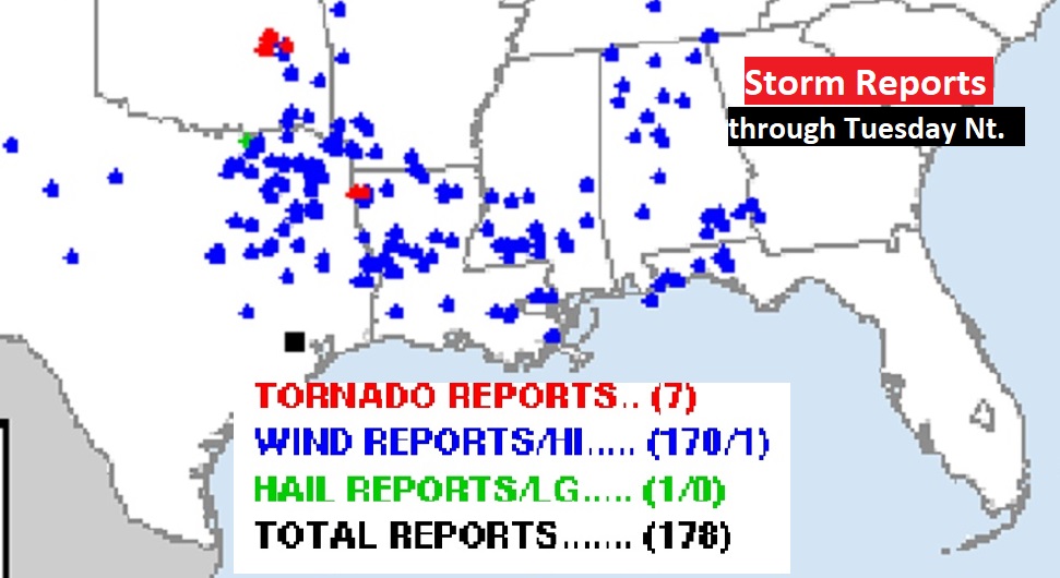
170+ Storm reports over an 8 state area. Especially wind damage reports. Two deaths reported in Mississippi.
TODAY: WIND ADVISORY continues in effect until 3PM. West winds 10 to 20 gusting to 35 mph. Mostly sunny. Much cooler. High 62. Partly cloudy, chilly tonight. Low 37.
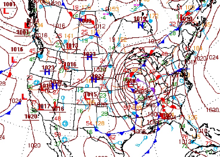
This morning, that MASSIVE historic Low pressure storm system is SW of Chicago.
NEXT FEW DAYS: Thursday will be unseasonably cool with a high in the upper 50’s. We’ll be 7in the lower 70’s Friday and Saturday. Risk of showers by late Friday night into Saturday. Risk of showers by Saturday afternoon. Scattered showers and thunderstorms become likely Saturday night. Much cooler Sunday behind the storm system.
Here’s the 10 day model blend temperature trend.
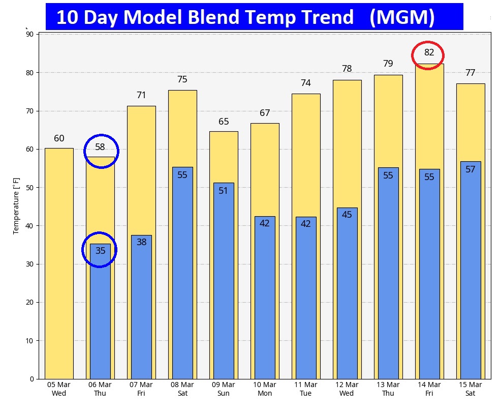
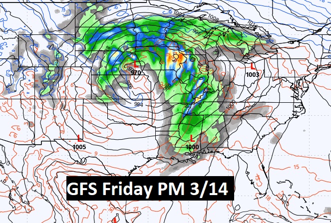
NEXT BIG DEAL? Here’s a peek at another potential big deal storm system around March 14th.
Thanks for reading this blog update. This morning everything is normal. We’ll be LIVE on NewsTalk 93.1. There will be another Blog Update and Forecast Video discussion in the 4’o’clock hour tomorrow morning. Have a good day.
–Rich