
Good Morning! Our temperatures are starting to turn around. We’re expecting lower 70’s today and upper 70’s Saturday. Get ready for a 2-part weekend storm system which could have a big impact on your plans. The highest probability of rain will be Saturday night and again Sunday night. Be flexible with your plans. Looking ahead, next week looks quite a bit warmer. The next potentially “big deal” storm system would come next weekend March 15/16. Perhaps toward Saturday night 3/15. Here’s my brief video forecast discussion
TODAY: Mostly sunny. Not as cool. South wind 10 to 15 mph. High only 71. (Normal 70/45) Increasing clouds tonight. Not as cool. Low 54.
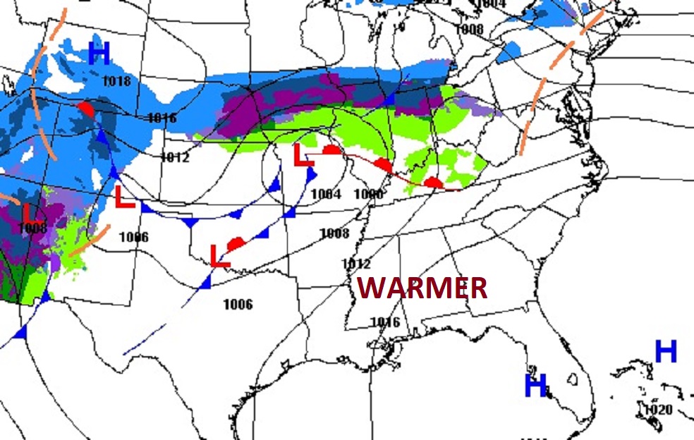
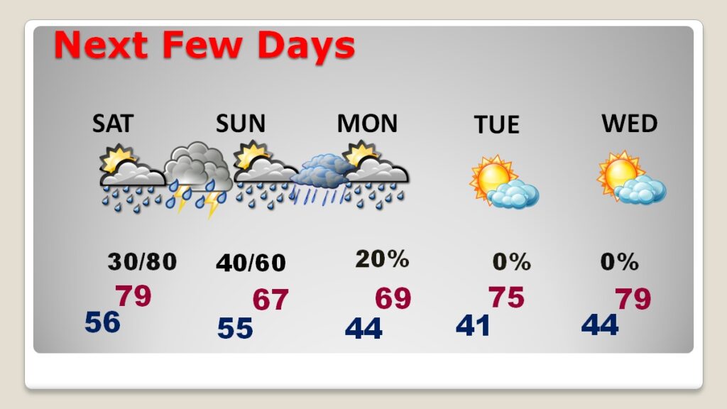
NEXT FEW DAYS: It’s not going to rain all weekend – at all. But, we have a 2-part storm system. The highest probability of rainfall will be Saturday night and again Sunday night. Saturday will be the warmest day of the weekend with a high in the upper 70’s. Sunday and Monday will be cooler. Then, look for a big warm-up toward the middle of next weekend.
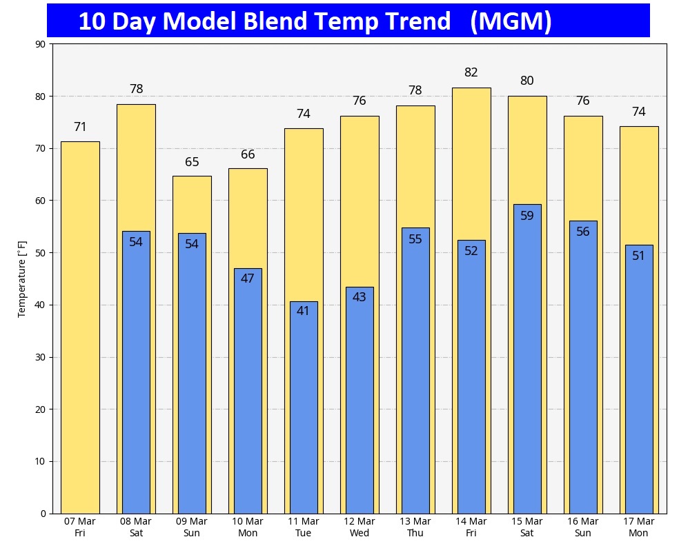
Here’s the 10 day model blend temperature trend. Take a look at the warmth next week!
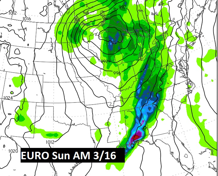
NEXT BIG DEAL?: The next potentially “big deal” storm system would come next weekend March 15/16. Perhaps toward Saturday night 3/15.
SPRING FORWARD: This is the weekend we change the clocks. Ahead one hour late Saturday night. We lose an hour of sleep this weekend.

Thanks for reading this blog update. This morning everything is normal. We’ll be LIVE on NewsTalk 93.1. There will be another Blog Update and Forecast Video discussion in the 4’o’clock hour tomorrow morning. Have a good day.
–Rich