
Good Morning! It will be wet at times this weekend. But, much of the weekend will actually be dry. Most of this day wilk be dry and warmer. The highest probability of showers and thunderstorms will be late tonight and again Sunday night. There could be some leftover showers Monday. Another risk of showers and thunderstorms returns Wednesday night and Thursday. Warmer days are in our future next week. We’ll be back to the 70’s Tuesday through Thursday.
TODAY: Sun/cloud mix. Warmer. High 78. Northwest wind 6 to 12.
TONIGHT: Risk of Showers and thunderstorms. Then, showers and storms becoming likely late tonight. Becoming windy. Low 51.
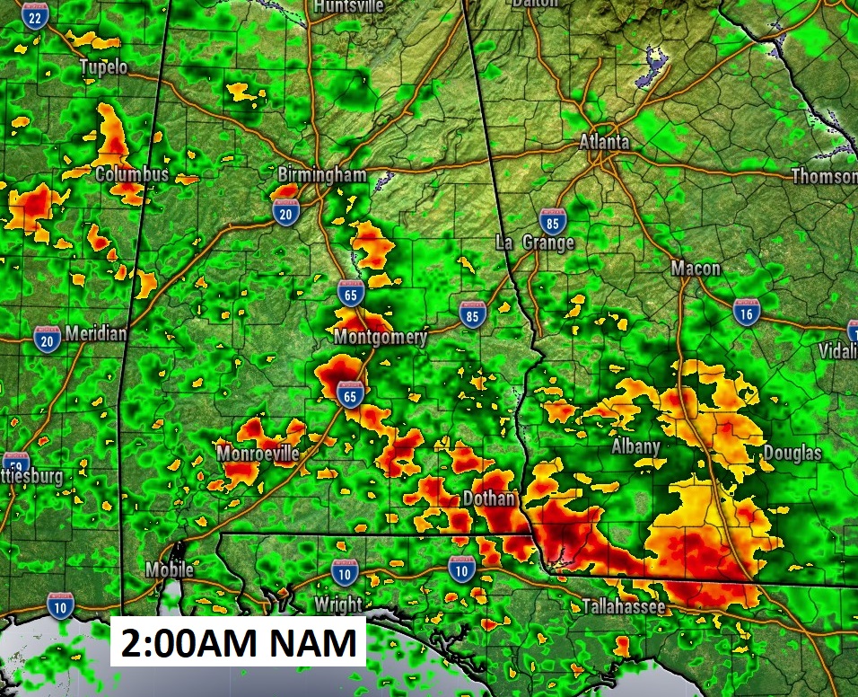
Here’s a FUTURE RADAR snapshot at about 2AM. (When we change the clocks) Showers and storms will become numerous.
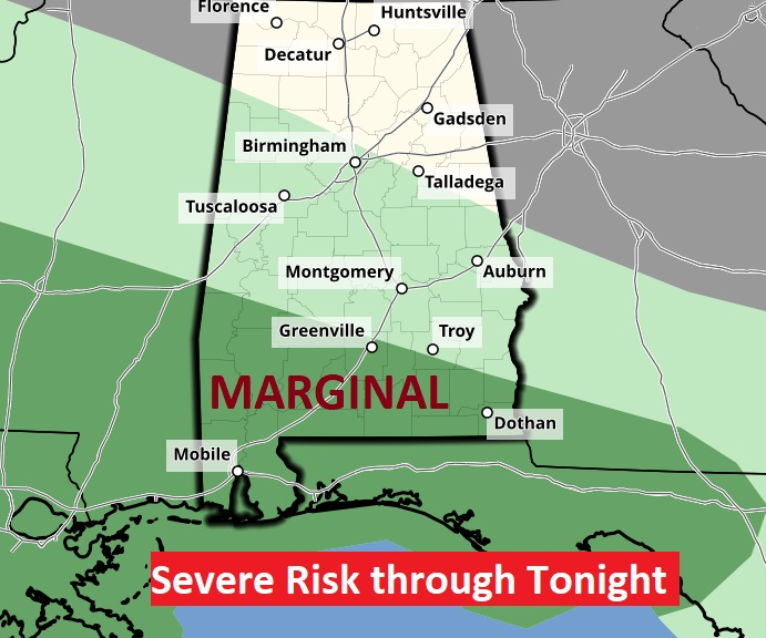
Marginal Severe Risk covers south Alabama mainly from Greenville southward.
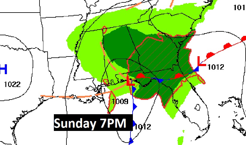
Here’s the map setup tonight and Sunday evening. It’s essentially a two part storm system. It won’t rain all the time. Rainy at times this weekend.

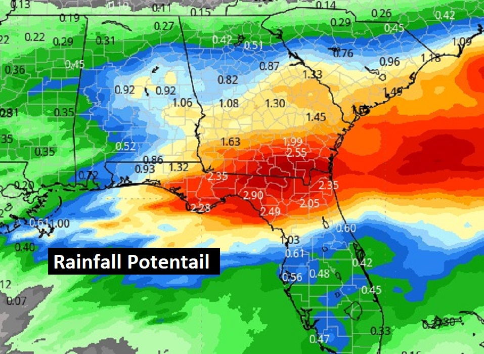
Here’s the rainfall potential. Notice the highest totals will be near the coast and over north Florida.
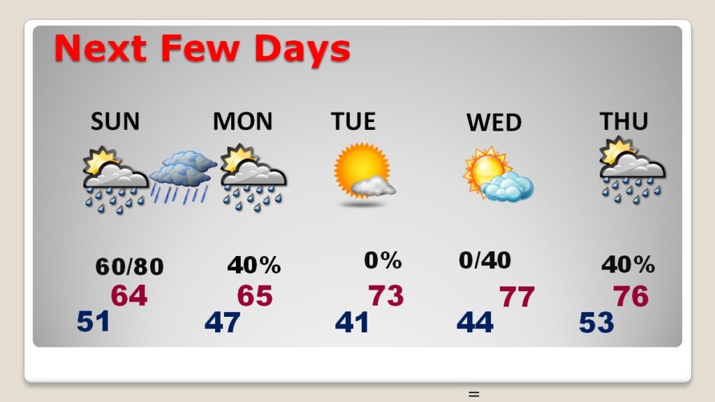
NEXT FEW DAYS: Risk of rain continues Sunday and especially Sunday night. There could be some leftover showers Monday. Tuesday and daytime Wednesday look dry. Risk of showers and thunderstorms returns Wednesday night and Thursday. Warmer days. Back to the 70’s Tuesday through Thursday.
Here’s the 10 day model blend temperature trend. Are we done with Arctic Air? I hope so.

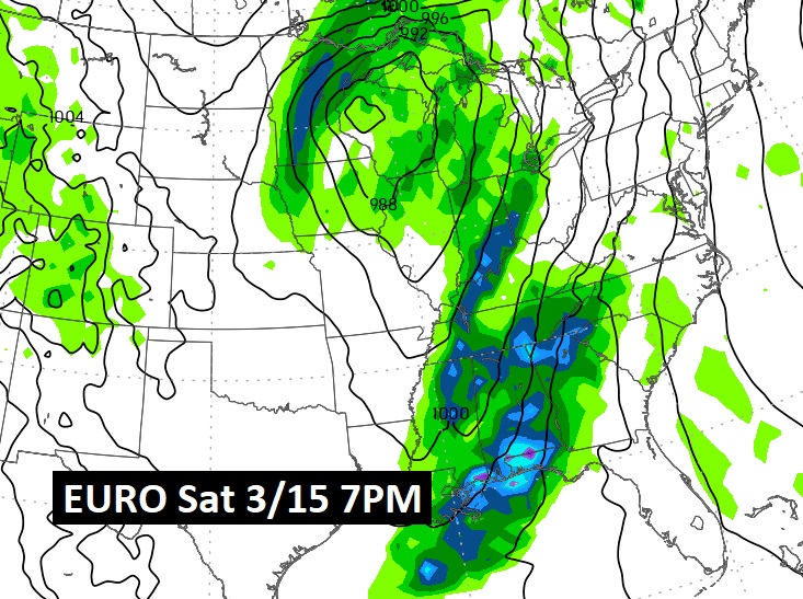
NEXT BIG DEAL The next potentially “big deal” storm system would come next weekend March 15/16. Perhaps toward next Saturday night 3/15. Severe threat? Probably. Don’t know for sure yet.
SPRING FORWARD Tonight: Tonight we change the clocks. We spring forward one hour late tonight We lose an hour of sleep this weekend.

Thanks for reading the blog. The next scheduled full blog will be Monday morning, Have a nice weekend!
–Rich