
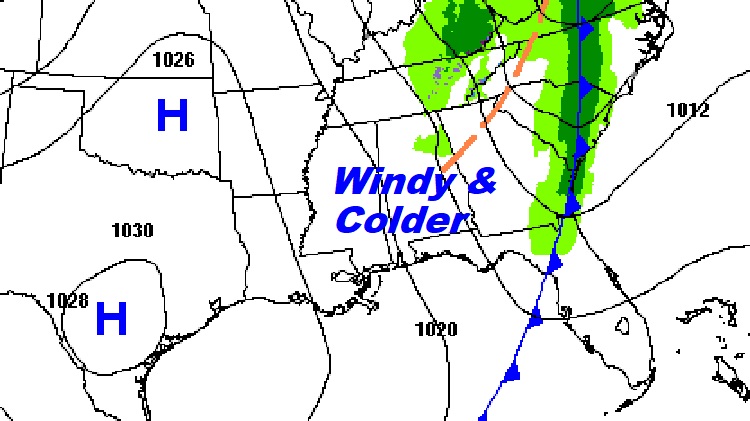
Good Morning! A narrow line of showers/few storms is moving through, early this morning, pre-dawn, along a cold front. Welcome to Spring – officially. It’s the Vernal Equinox and temperatures take a giant step backwards, as colder air funnels into our state. High temperatures today may not surpass the mid 50’s. West winds gusting to 30 mph will make it seem colder. Many towns will flirt with a freeze by Dawn Friday? It’ll be a close call. Frost will be widespread. Expect a weekend warm-up. Middle 70’s Saturday. Near 80 Sunday. Another chance of showers and storms arrives Sunday night. SPC has now added a Level 2 – 15% Severe Risk covering the northern part of Alabama. It’s likely that we’ll see a Level 1 Marginal risks elsewhere, when we get closer to the event. Here’s my brief video forecast discussion.
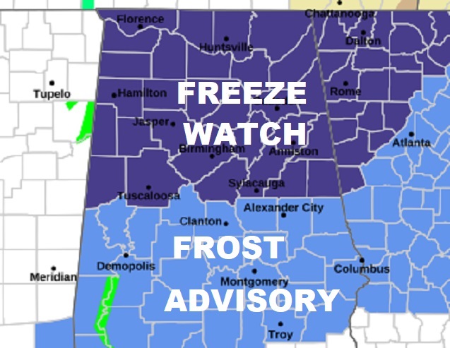
TODAY: FROST ADVISORY TONIGHT. Sharply colder. Brisk. Mostly sunny. High 56. West wind 10 to 15 gusting as high as 30 mph. Clear and quite cold tonight. Low 33 Some towns will reach freezing. Widespread frost by morning.
.
NEXT FEW DAYS: After a frosty Friday morning, expect a decent recovery by afternoon. Mid and perhaps upper 60’s is still below normal, but we’re moving in the right direction. It will be warmer over the weekend. Another chance of showers and storms arrives Sunday night. Mid 70’s Saturday. Near 80 Sunday. Monday and Tuesday look sunny, nice and comfortable.
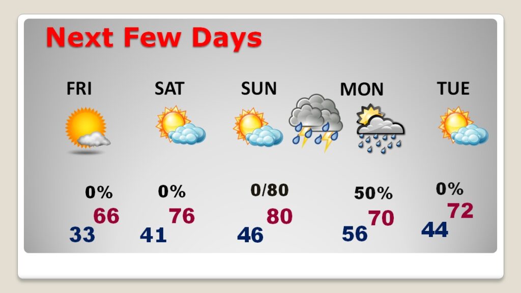
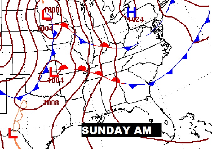
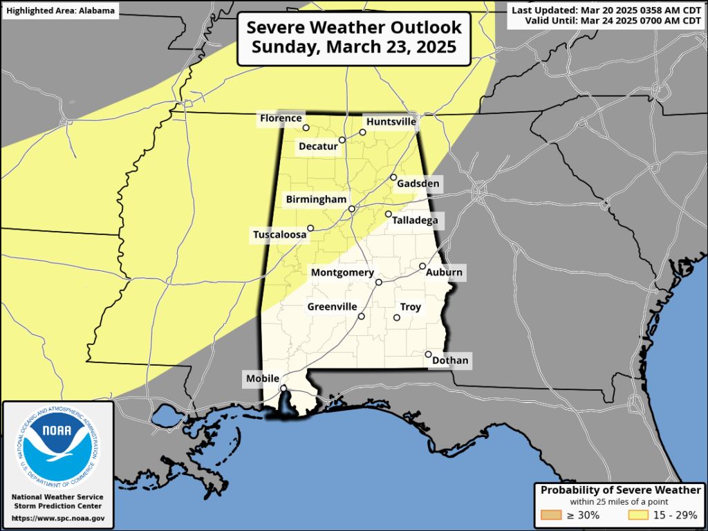
Next batch of showers and storms will move is Sunday night/early Monday.
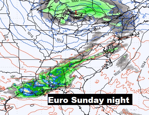
SPC has now added a Level 2 – 15% Severe Risk covering the northern part of Alabama. It’s likely that we’ll see a Level 1 Marginal risks elsewhere, when we get closer to the event. ‘Tis the season.
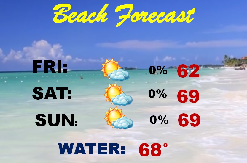
Spring Break continues! Here’s the Beach Forecast for the Beaches from Gulf Shores to Panama City.
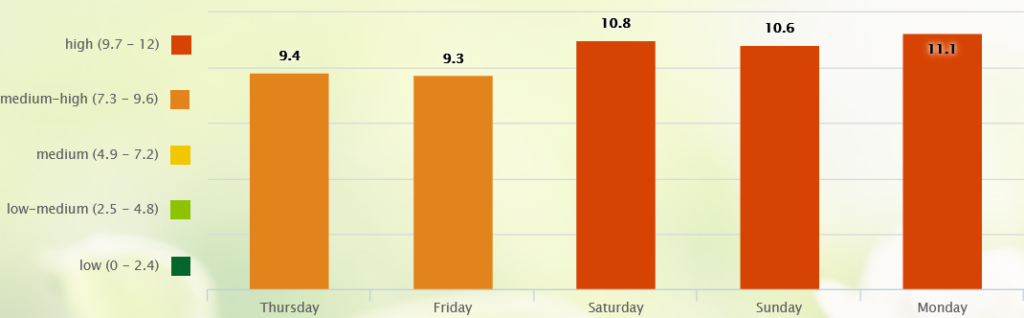
Here’s the 10 day model blend temperature trend. The coldest day is today. Coldest night tonight. Warmest days are Days 7-10.
POLLEN: Still quite high through the end of the week.
WELCOME TO SPRING: Spring began this morning at 4:01AM. The vernal equinox. At the equator, equal day/equal night. Here today, sunrise at 6:48AM, sunset 6:56 PM. 12 hours, 8 minutes, 47 seconds of daylight.
FINAL TORNADO TOTAL?: NWS Birmingham (BMX) Tornado outbreak update: Storm survey update: We have identified AT LEAST 14 tornado tracks from the storms on Saturday, 3/15. https://mesonet.agron.iastate.edu/wx/afos/p.php?pil=PNSBMX&e=202503192204Ground… surveys are likely completed. Additional analysis via satellite imagery & other sources is still ongoing, so some details are subject to change. This now includes Seven STRONG tornadoes:
EF3: 1
EF2: 6
EF1: 4
EF0: 3
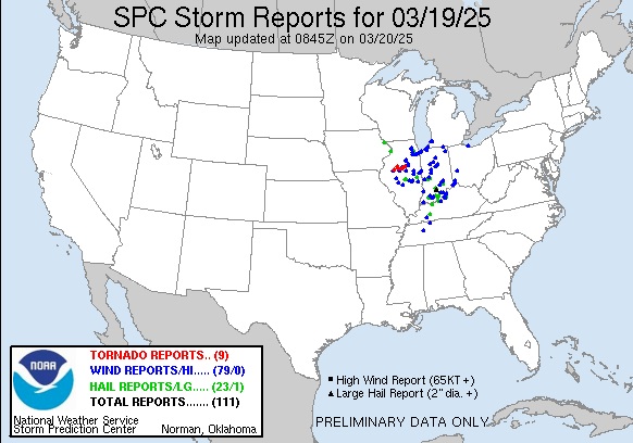
What a 7 day period for tornadoes in the United States starting last Friday through Sunday at over 100 tornadoes. Then, 9 more tornado reports yesterday in the Midwest. Some destructive.
Thanks for reading this blog update. This morning everything is normal. We’ll be LIVE on NewsTalk 93.1. There will be another Blog Update and Forecast Video discussion in the 4’o’clock hour tomorrow morning. Have a good day.
–Rich