
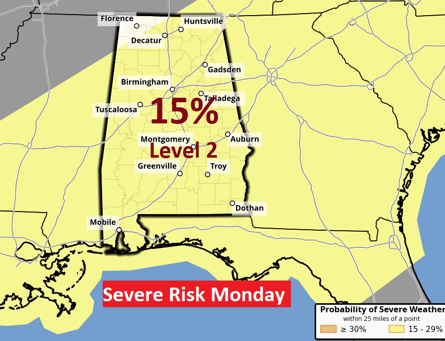
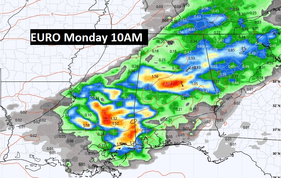
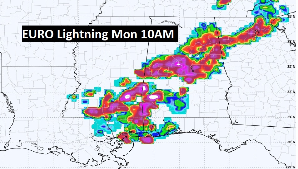
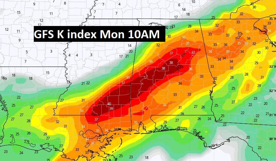
Good Morning! Our Storm-free pattern continues for a little while longer, today through Friday. Expected highs today through Saturday at or above 80. Mid 80’s are a good bet Sunday. An unsettled pattern will begin this weekend and continue at least through Monday, as a series of storm systems approach. Part one will bring a round of showers and storms on Saturday and Saturday evening. More scattered thunderstorms Sunday, with an increasing threat Sunday night. The main event is becoming more and more likely Monday, perhaps starting pre-dawn, and through the morning and mid-day hours, into early afternoon. The Storm Prediction Center is still highlighting a Level 2 (15%) Severe Risk. All modes of severe weather are on the table, including tornadoes. The EURO and GFS seem to be in better agreement, including on the timeline. Here’s my brief video forecast discussion.
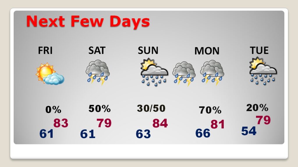
TODAY: Sun/cloud mix. Sun filtering through high clouds. Milky sunshine. Continued warm. Light East wind 5 to 10 mph. High near 81. Mostly cloudy tonight. Mild Low 61
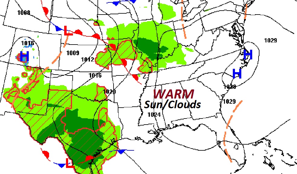
NEXT FEW DAYS: Friday our storm-free pattern continues. Continued warm. Highs today through Saturday will be 80 or above. Mid 80’s are a good bet Sunday. An unsettled pattern will begin this weekend and at least through Monday, as a series of storm systems approaches, Scattered showers and thunderstorms, at times Saturday, Saturday night and Sunday. Expect and increasing risk of showers & storms Sunday night. The Main Event, including severe weather, will begin early Monday, through mid-day and into the early afternoon. All modes of severe weather are possible. More below. There could be some leftover showers Tuesday. It’s possible there might be some more severe weather in the Wednesday/Thursday time frame next week. But details are quite sketchy.
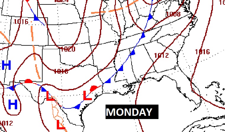
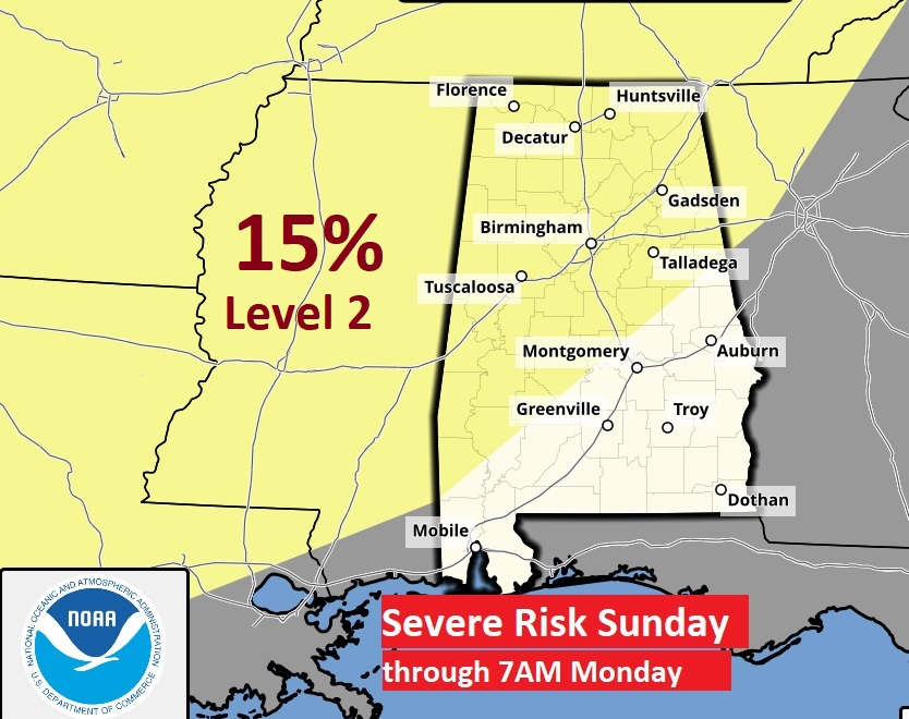
MONDAY SEVERE WEATHER EVENT: Still looks like the main event begins Monday morning into Monday afternoon. SPC is still highlighting a Level 2 (15%) Severe Risk on the Day 4 outlook through 7AM Monday, and the Day 5 Monday outlook. Expect all modes of severe weather including damaging winds, tornadoes and possible large hail.
Monday will be primetime for the greatest severe risk as a front approaches.
Models continue to ramp up on the ingredients for potential Severe Storms and tornadoes. The timing is in better agreement.
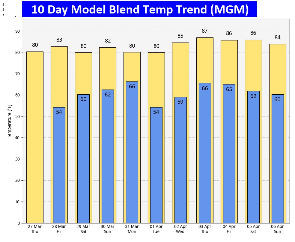
Here’s the 10 day model blend temperature trend. The warmth will continue.
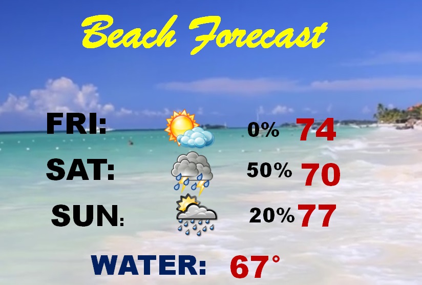
BEACH OUTLOOK: Dry Friday. Scattered showers and thunderstorms over the weekend. Spring-breakers: it will not be a washout. Strong storms arrive by Monday. Highs in the 70’s. Gulf water is 67.
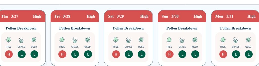
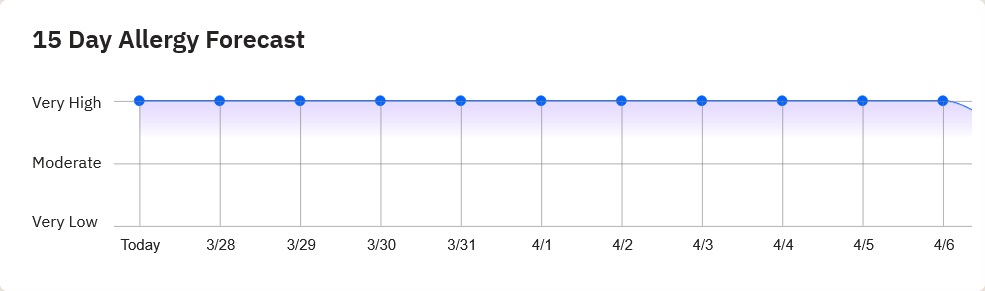
POLLEN: Looks like pollen will continue to be a major issue for the next several days.
Thanks for reading this blog update. This morning everything is normal. We’ll be LIVE on NewsTalk 93.1. There will be another Blog Update and Forecast Video discussion in the 4’o’clock hour tomorrow morning. Have a good day.
–Rich