
9:15 AM UPDATE:
These are the counties currently under a Severe Thunderstorm watch. And, SPC says a new watch is coming downstream, east of the current watch counties soon.
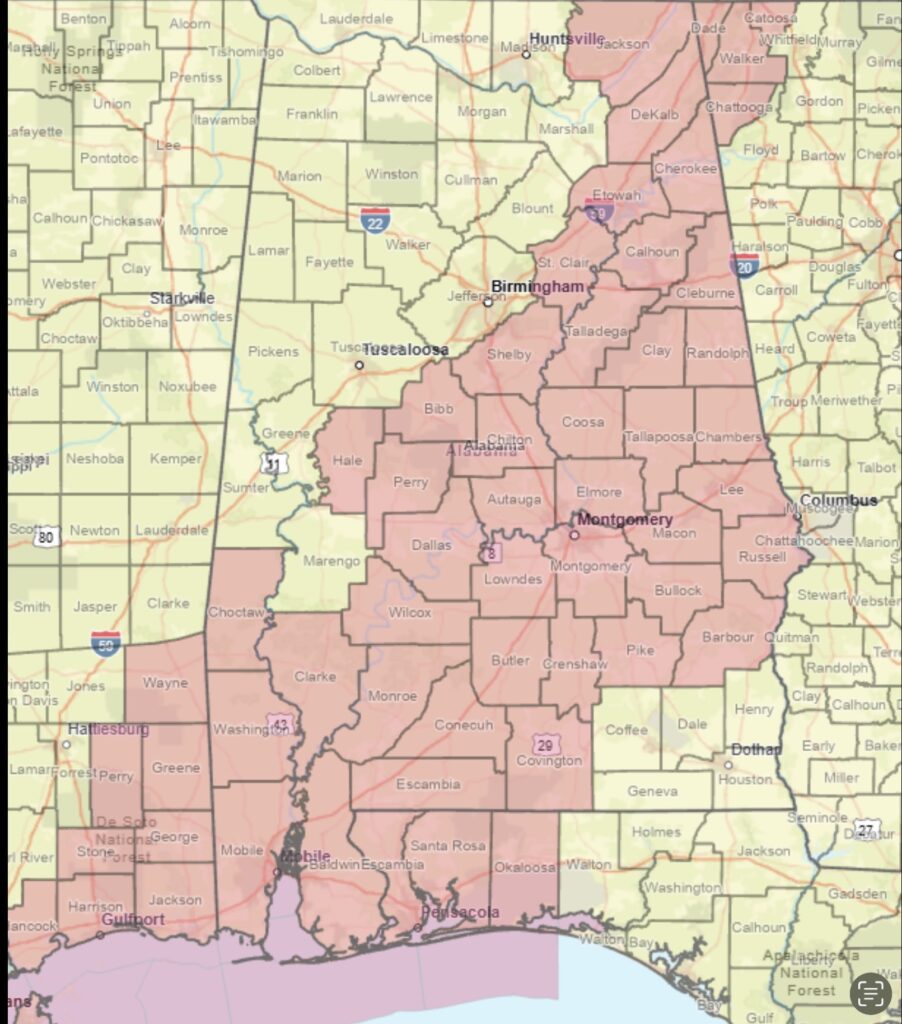
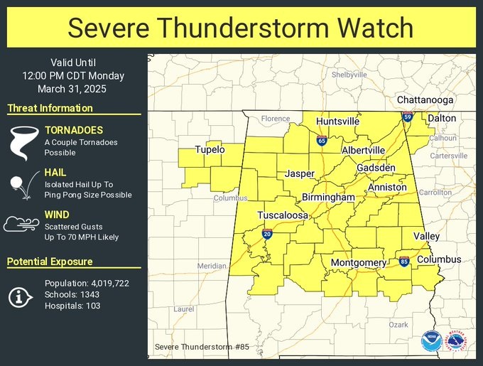
A severe Thunderstorm Watch covers much of north and central Alabama until Noon. Scattered wind gusts to 70 mph. A couple of tornadoes possible. Hail up to ping pong size. The watch extends as far south as Montgomery county. #alwx
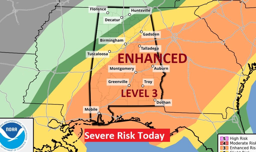
Good Morning! Get ready for a stormy start to this new week. The Storm Prediction Center has much of our state in a Level 3 out of 5 Enhanced Severe Risk. All modes of severe weather are on the table, including tornadoes, along a line of severe storms which will sweep through the state. Damaging wind gusts are the main threat, but embedded tornadoes are possible. Large Hail is not out of the question.
A severe Thunderstorm Watch is in effect until 12 Noon as far south as Montgomery county. Scattered wind gusts to 70 mph. A couple of tornadoes possible. Hail up to ping pong size.
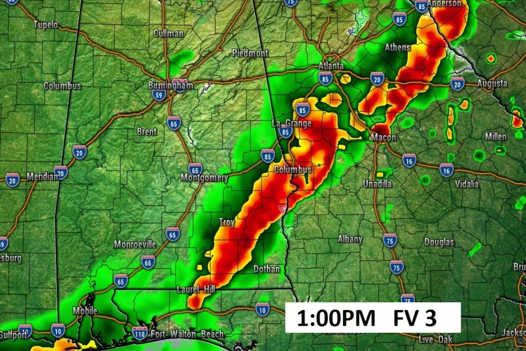
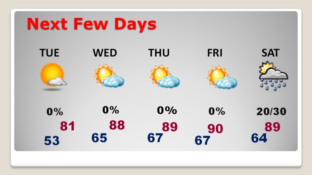
By early afternoon, the strong line/band of storms will have reached southeast Alabama, and then exiting our state. The rest of this week looks storm-free and progressively warmer, as the month of April begins. Expect upper 80’s Wednesday and Thursday and maybe the first 90° of 2025 on Friday. Here’s my video forecast discussion.
TODAY: Showers and strong to Severe storms. Damaging wind gusts are possible. Embedded tornadoes are possible. Threat of large hail. The greatest threat will be in the morning hours. Expect improvement in the afternoon. High 78. South wind 10 to 15 gusting to 25 mph. Partly cloudy and cooler tonight. Low 52.
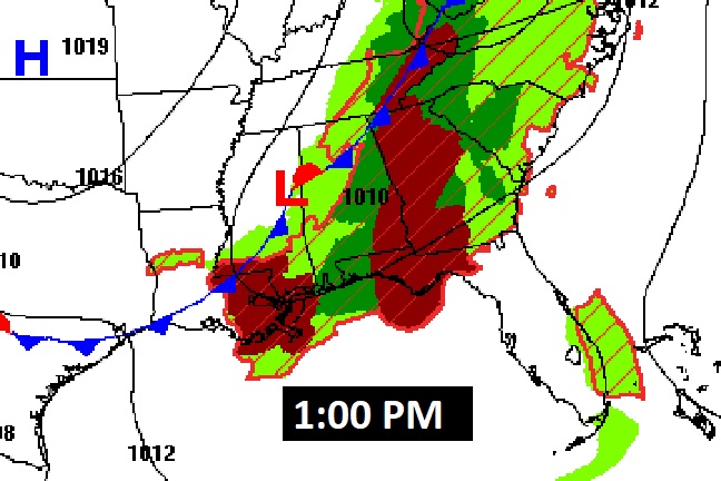
SPC is still highlighting a Level 3 out of 5 Severe Risk for much of the state.
The frontal system reaches extreme northwest Alabama this morning and progresses southeastward.
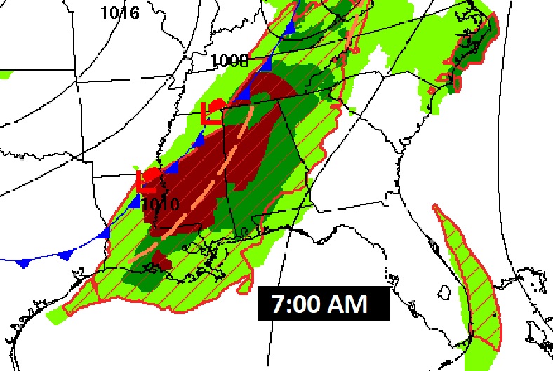
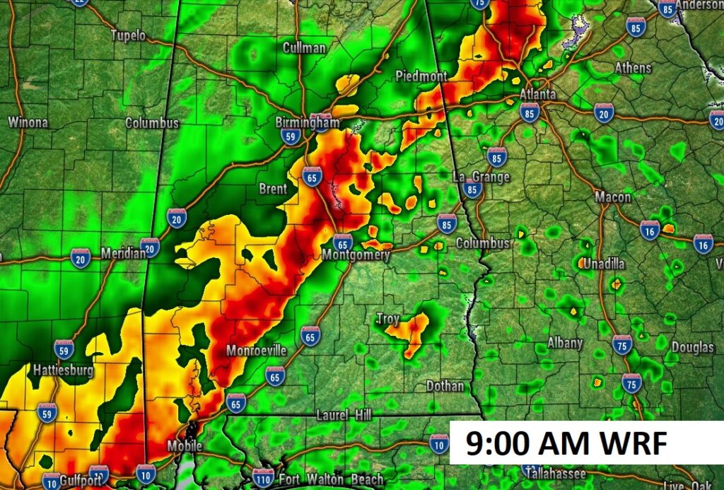
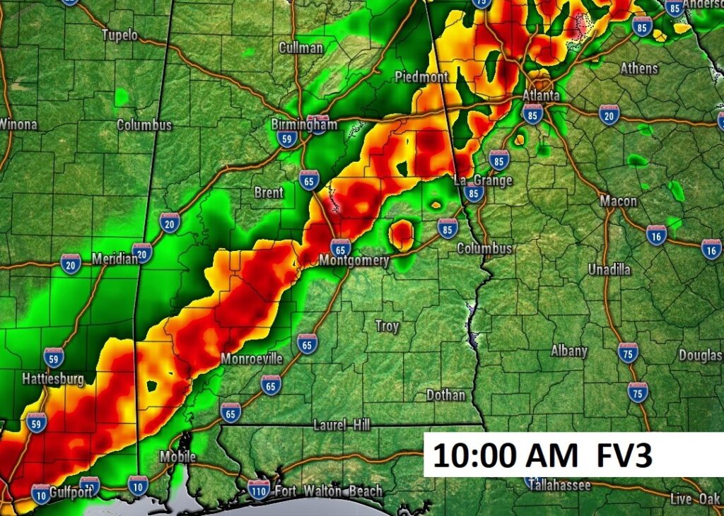
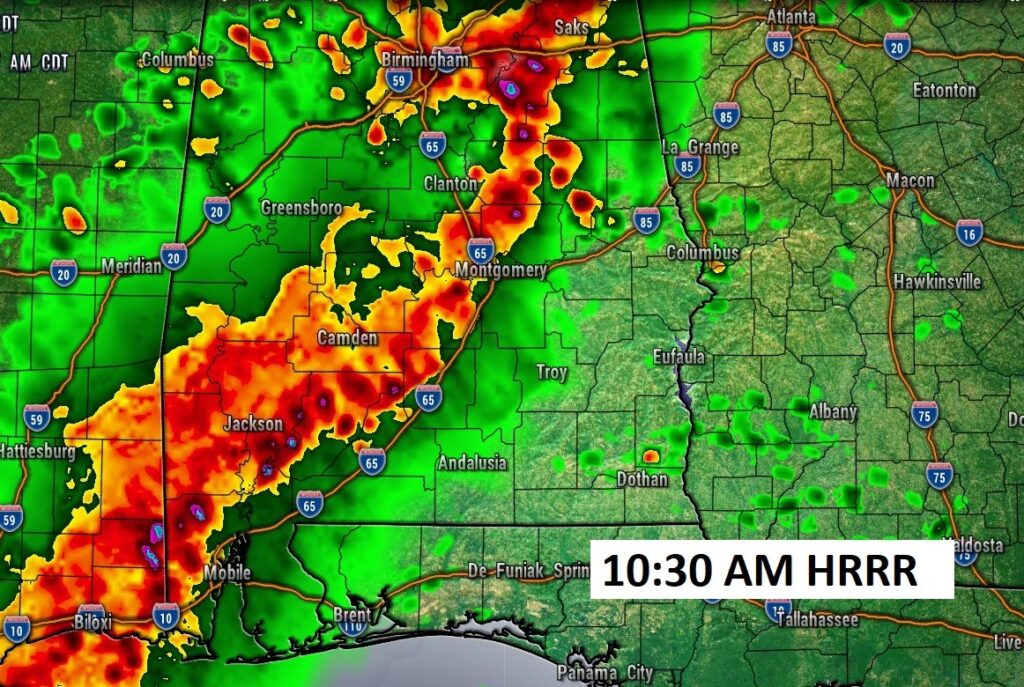
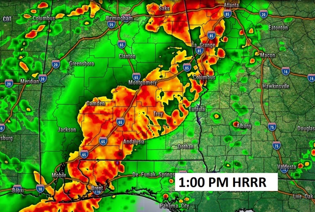
Future Radar shows the robust Squall Line (QLCS) sweeping through the area starting in the early hours of this day in through mid-day. Here are some hi-res model samples. Some models are faster and some slower on the time line. The WRF model appears fastest on the movement of the line. But, I have also included the FV3 and HRRR model samples
NEXT FEW DAYS: Look at the heat later this week. Warmest of 2025 so far.
Thanks for reading this blog update. This morning everything is normal. We’ll be LIVE on NewsTalk 93.1. There will be another Blog Update and Forecast Video discussion in the 4’o’clock hour tomorrow morning. Have a good day.
–Rich