
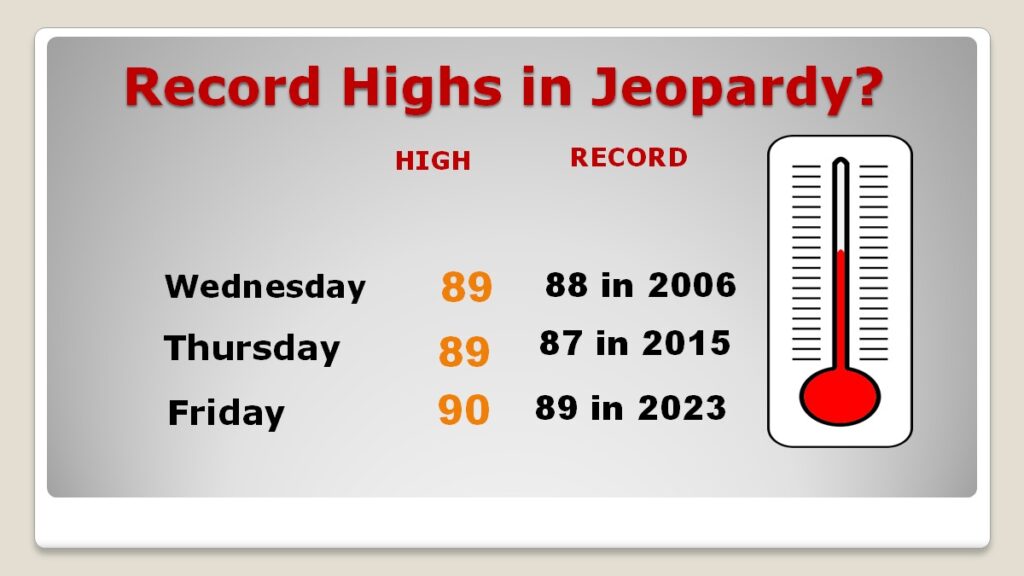
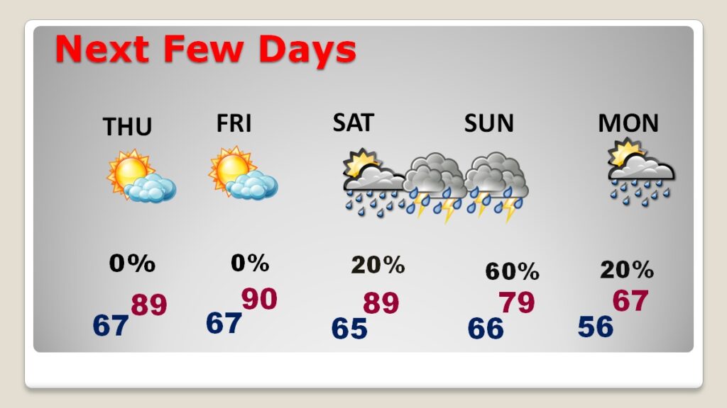
Good Morning! We’re in a nice place, weatherwise right now. It’s a storm-free dry forecast through Friday at least. We may tie or break record highs today, tomorrow and Friday. The high today and tomorrow and Friday will reach the upper 80’s to near 90. Normal 79/46. Widely scattered showers and still warm Saturday. Showers and storms likely on Sunday. Then, MUCH cooler by Monday and Tuesday. Here’s my brief video forecast discussion from the National Tropical Weather Conference – South Padre Island Texas.
TODAY: Patchy fog early. Partly sunny, breezy and near record warmth. High 88-90. (Record High 88 from 2006/2017) South wind 10 to 10 gusting to 30 mph. Partly cloudy, mild tonight. Low 67.
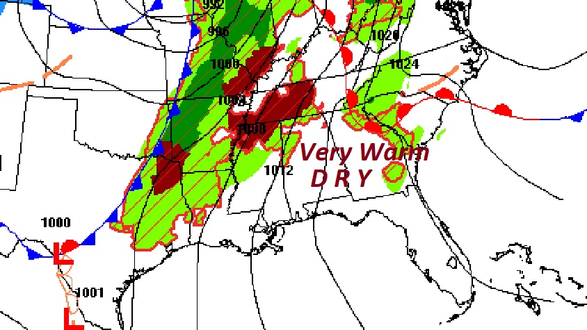
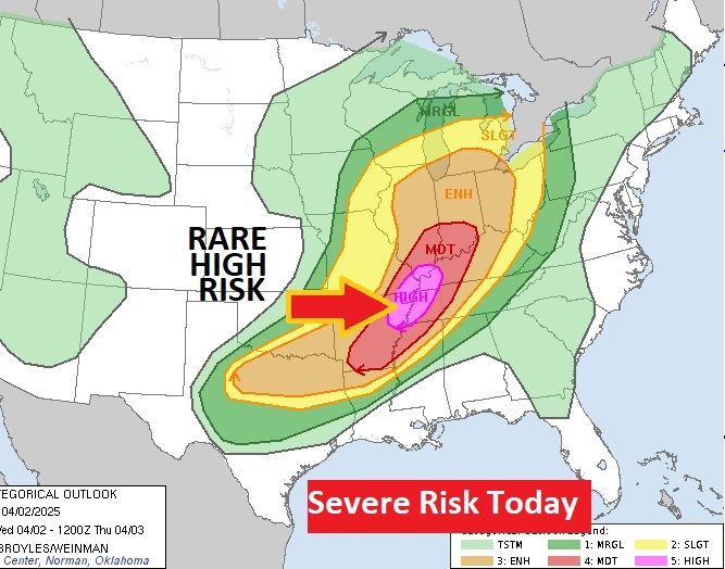
Here’s the set-up today. Note the storm system west and northwest of us. The Storm Prediction Center has a rare High Risk. A dangerous TORNADO OUTREAK is expected today.
RECORD HIGHS: Today, tomorrow and Friday, we may tie or break records at MGM. #alwx
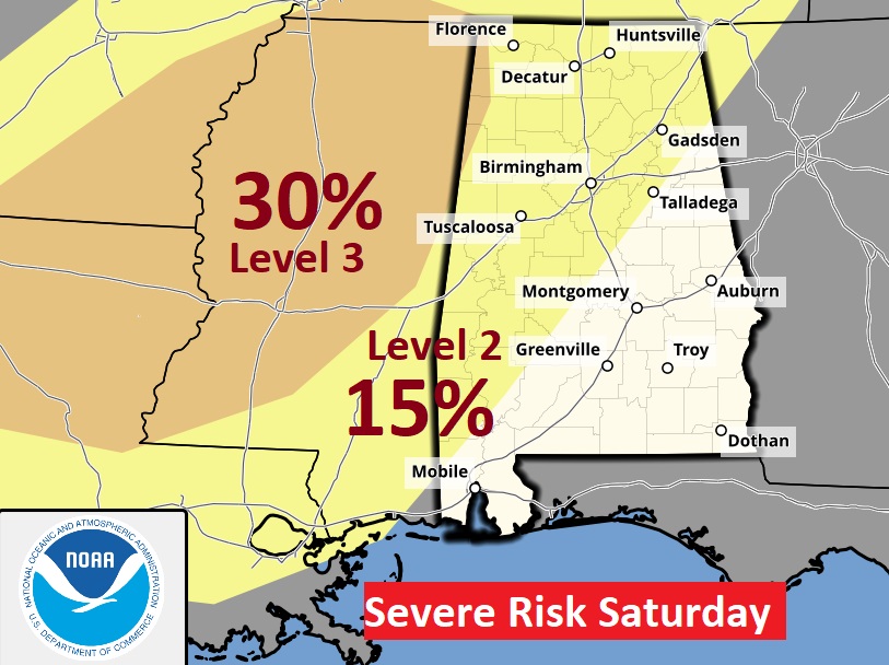
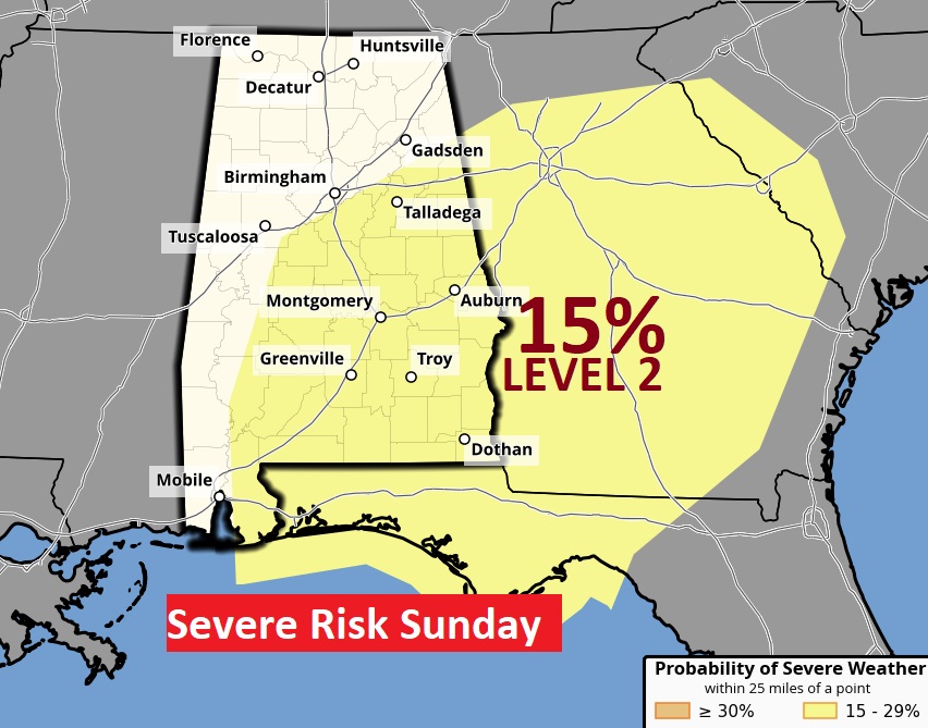
NEXT FEW DAYS: We’re dry and warm on Thursday and Friday. Upper 80’s to near 90 Thursday. Friday will be very warm. We may break that records. Widely scattered showers and still warm Saturday. Showers and storms likely on Sunday. Possible Severe weather Saturday night and Sunday Then cooler.
Here we go again. We’re looking at yet another Severe Threat over the weekend by Saturday night into Sunday.
Here’s the 10 Day Model Blend Temperature Trend. Warm now, but look at the big drop next week.
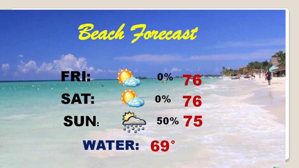
BEACH FORECAST: Comfortable. Storm-free through Saturday. Scattered showers and thunderstorms Sunday. Highs in the 70’s. Gulf water temperature 69.
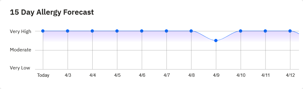
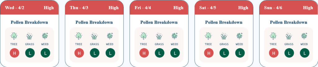
POLLEN: Crazy high levels for several days.
Thanks for reading this brief blog update. I’m at the National Tropical Weather Conference, South Padre Island, Texas for the rest of this week.

I’ll have another update in the morning from here in Texas. Have a good day.
–Rich