
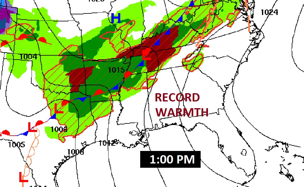
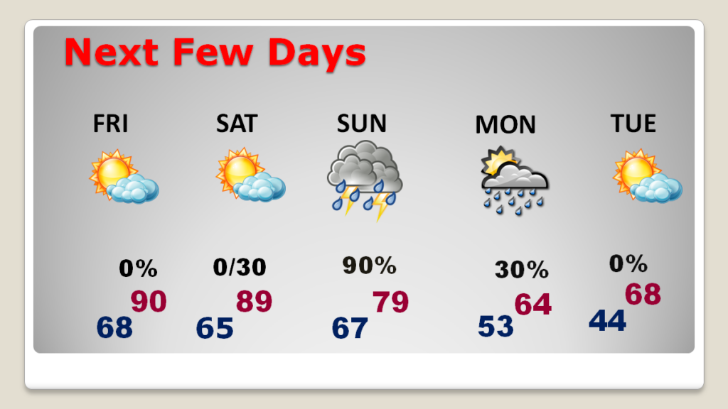
Good Morning! The calendar says April, but it feels more like June. Yesterday’s high of 89 broke the record of 88 from 2006. Record highs are likely today and tomorrow. Even Saturday we’ll be close to a record. It’s still storm-free and dry for us today and through the daytime Saturday, as other states in the middle deal with another dangerous tornado outbreak and record flooding. A front is stalled to the north, which is good for us, at least for now. By the early pre-dawn hours of Sunday AM, the severe threat eases in west Alabama. For most of us the greatest threat of Severe storms and possible tornadoes is on Sunday. Much cooler air will follow. Monday’s high may only reach 64. Expect low 40’s by dawn on Tuesday. Here’s my brief video forecast discussion.
TODAY: Partial sunny and very warm. High near 90. (Record high 87 from 2015) South wind at 5 to 15 and gusty. Partly cloudy, mild tonight. Low 68.
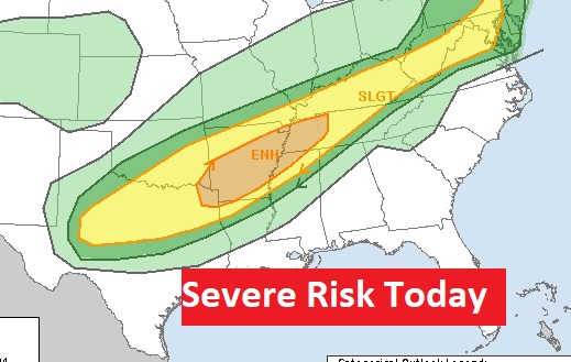
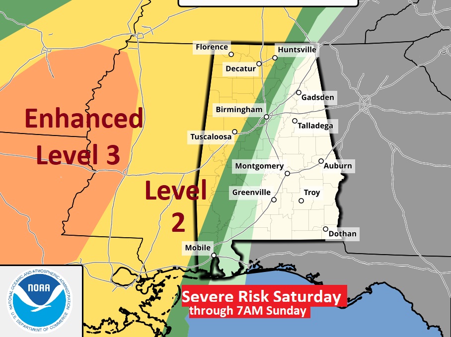
A frontal system stalled to the north of us will be the focus for another dangerous severe weather day in the middle of the country.
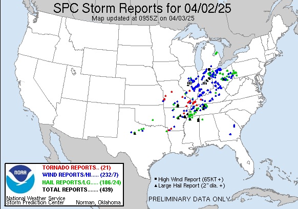
Yesterday was an extremely dangerous day in multi-state area including near two dozen tornadoes, some STRONG, large tornadoes.
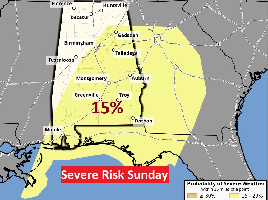
NEXT FEW DAYS: Record warmth continues through Friday. Even Saturday we’ll be close to a record. It’s still storm-free and dry for us today and through the daytime Saturday. By the early pre-dawn hours of Sunday AM, the severe threat eases in west Alabama. For most of us, the greatest threat of Severe storms and possible tornadoes is on Sunday. Much cooler air will follow. Monday’s high may only reach 64. Expect low 40’s by dawn on Tuesday. A big change of climate is on the way.
By the early pre-dawn hours of Sunday AM, the severe threat eases in west Alabama. For most of us the greatest threat of Severe storms and possible tornadoes is on Sunday. Much cooler air will follow.
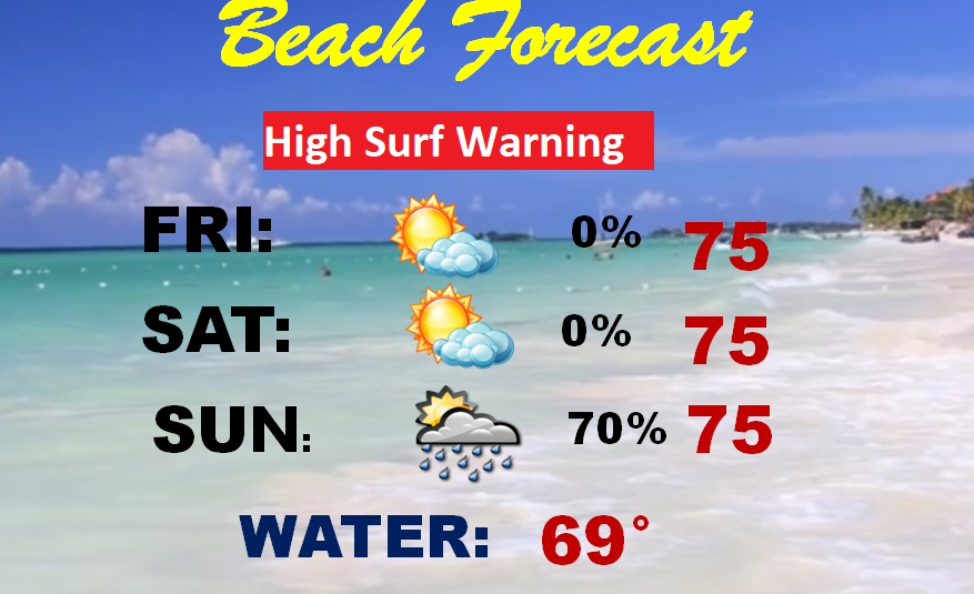
BEACH: Friday and Saturday are dry and comfortable. Showers and locally severe storms are likely Sunday. Be careful. A High surf warning continues in effect.
Thanks for reading this brief blog update.
I’m still here at the National Tropical Weather Conference, South Padre Island, Texas through the rest of this week. Nice venue adjacent to the Beach.
The world’s foremost Hurricane Meteorologists are here. This morning Dr. Phil Klotsbach from Colorado State University will unveil their much awaited 2025 seasonal forecast. I will be also interviewing Dr. Phil today at 3PM for three TV stations.

I am so incredibly honored to be selected for the John Coleman Broadcast award. Broadcaster of the year. It means a lot to me.

Meanwhile, back in Alabama, Chase looks comfortable in Prattville!

I’ll have another update in the morning from Texas. Have a good day.
–Rich