
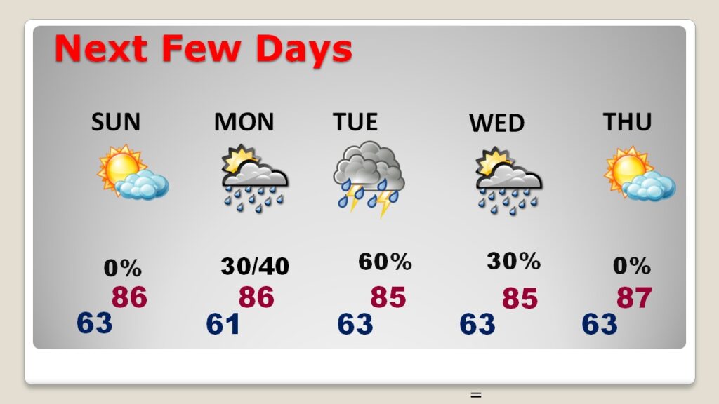
Good Morning! Our remarkable string of warm, dry, storm-free days is not quite over yet. Timing is everything and our Easter Weekend forecast, all things considered, looks great. In fact, I think we will be teasing a record today. We‘ll be in the neighborhood of the record of 89 from 2006. It’s still a dry forecast through Easter Sunday. Widely scattered storms will arrive Monday as the front in the country’s mid section approaches. The front will enter the state and stall Tuesday and Wednesday before dissipating. Otherwise, it’s a very warm forecast through Thursday and beyond. The expected rainfall totals for the week ahead is now lower thank what we thought a few days ago.
CLIMATE: Yesterday’s lo/hi 48/87. Normal 53/79. No Rain.
TODAY: Will we tie or break the record high of 89 from 2006? We’ll certainly be in the neighborhood. Expect a sun/cloud mid. High near the record of 89. Mostly cloudy very mild tonight. Low 63.
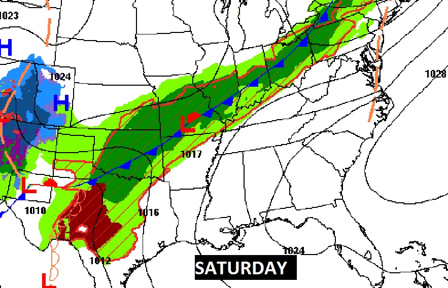
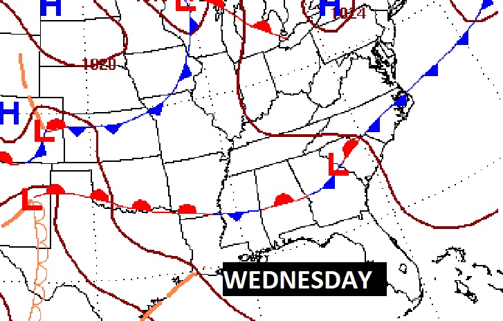
NEXT FEW DAYS: We are dry through Easter Sunday. Sunday will be mostly cloudy and warm. High 86. Notice the active weather along the front in the middle of the country. That’s where the severe threat exists today and Sunday.
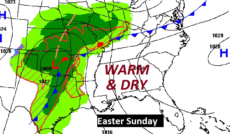
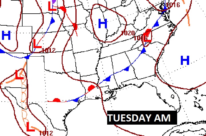
By the time the front gets close to us, the severe weather threat will ease and probably fall apart. The front will enter the state and stall Tuesday and Wednesday before dissipating.
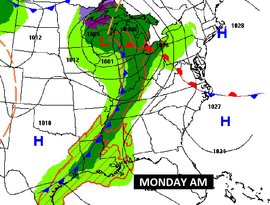
The highest probability of showers and storms will be on Tuesday.
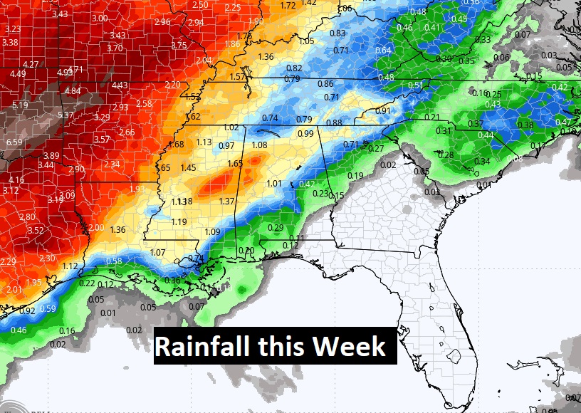
Here’s the expected rainfall this week. The expected scenario has changed. Southeast Alabama may not see any rain at all. Northwest Alabama will have the best probability of significant rainfall.
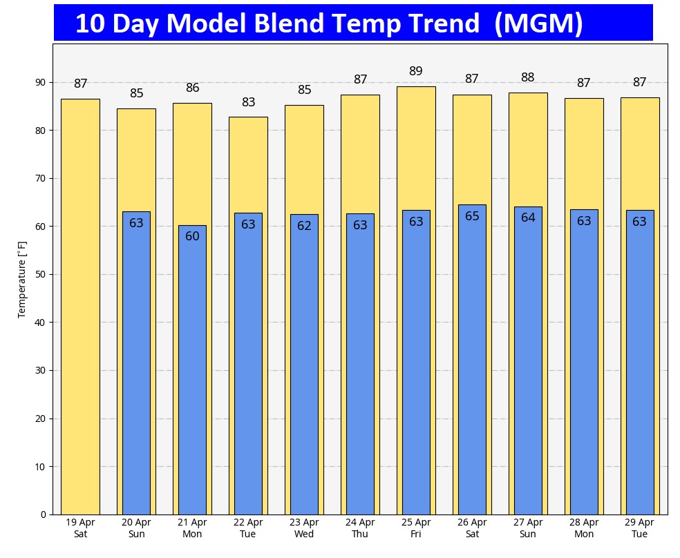
Here’s the 10 day model blend temperature trend. It’s a very warm pattern. (Normal 79/53)
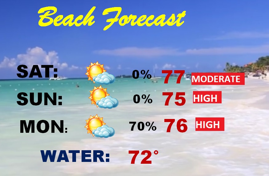
BEACH FORECAST: Wish I was there! Should be dry and comfortable. It’ll be about 10-12 degrees cooler than Montgomery. Gulf water still cool at 72. High rip current risk on Easter.
Thanks for reading the blog. The next scheduled full blog will be Monday morning, Have a nice weekend!
–Rich