
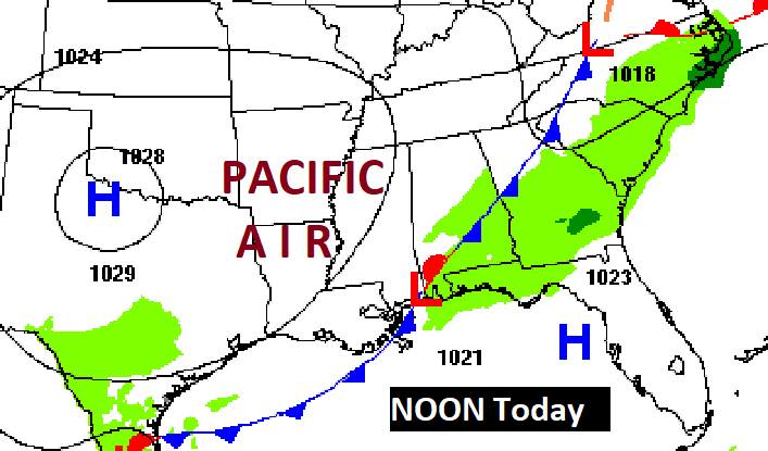
Good Morning! Our very warm pattern continues. A weakening front is approaching the state. Our forecast has been rain-free for several days. But, by this afternoon and tonight that could change, as widely scattered showers and storms start to pop up. Coverage on the number of thundershowers will increase Tuesday as the front stalls in north central Alabama. Even on Wednesday there could be a few leftover showers and thunderstorms. It will be a very warm week. We could be teasing 90 by Friday and Saturday. Here’s my brief video forecast discussion.
TODAY: Continued very warm. Limited sunshine. High 86. Light south wind 5 to 10 mph. Widely scattered showers and storms are possible this afternoon, this evening, and tonight as a weakening front approaches. Very mild tonight. Low 63.
The Front enters the state and stalls.
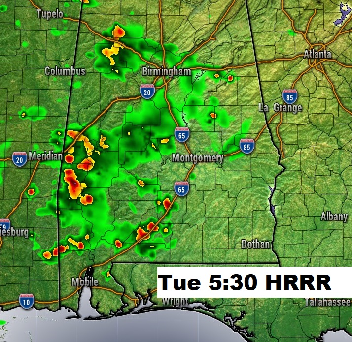
Future radar: Spotty storms late this afternoon and this evening, becoming a little more numerous tomorrow.
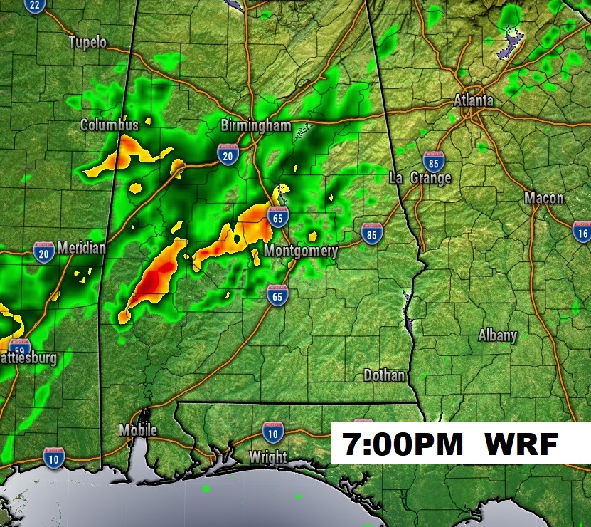
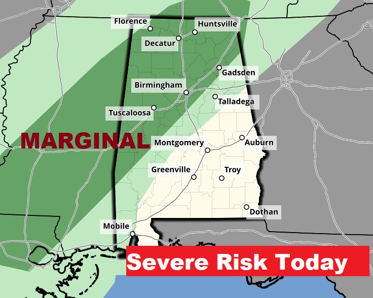
Marginal Severe Risk covers NW Alabama today.
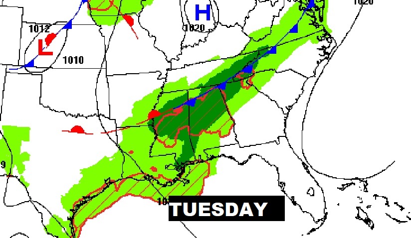
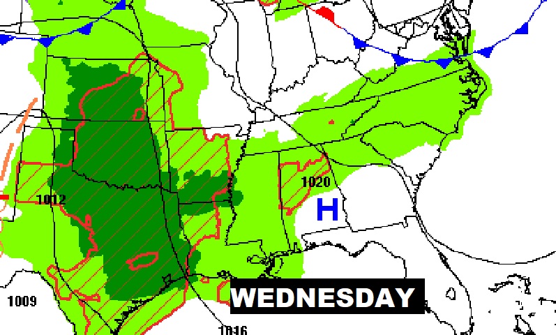
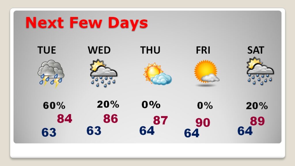
NEXT FEW DAYS: The weakening front approaching will stall across north central Alabama. Scattered showers and storms will be a little more prominent Tuesday. Some widely scattered storms ae possible Wednesday. It’ll be a very warm week. In fact, we could perhaps even tease 90 toward Friday and Saturday. No severe weather is expected.
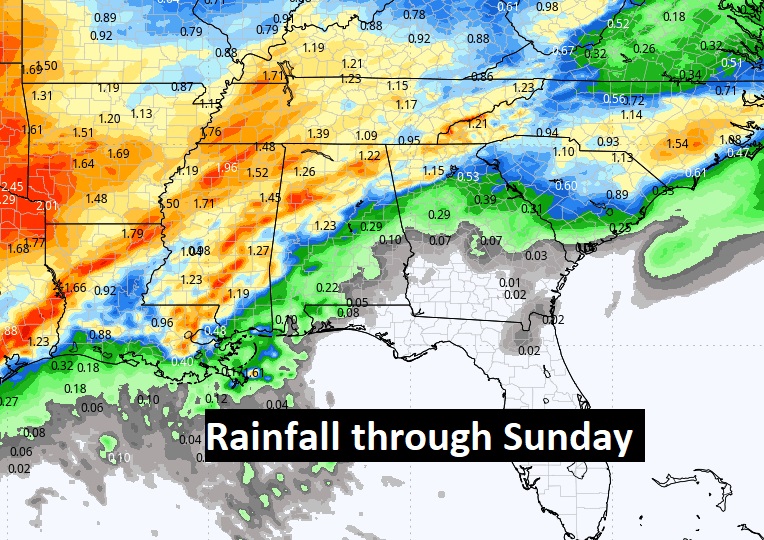
Here’s the expected rainfall this week. Not much, all things considered. We need some rain.
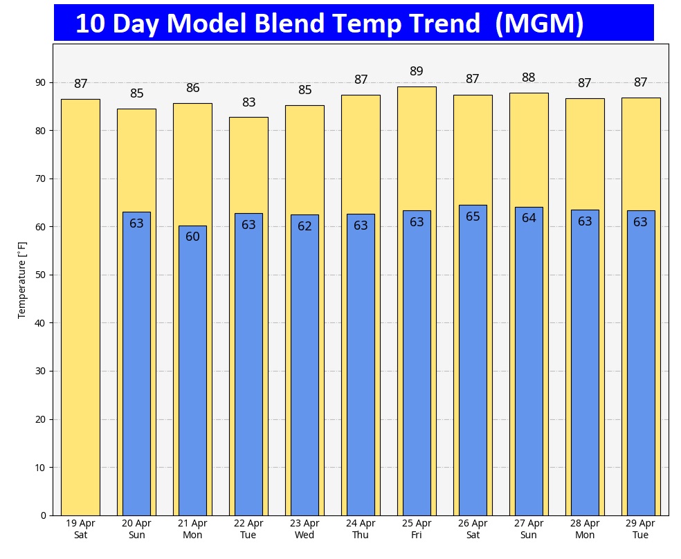
Here’s the 10 day model blend temperature trend. It continues to be a very warm pattern.
Thanks for reading the blog. Today everything is normal including LIVE on the Radio of NewsTalk 93.1 WACV. There will be another video forecast discussion and Blog Update in the 4 o’clock hours tomorrow morning. You can always find my forecast updates hourly on the 8 station Bluewater family of stations every day of the year.
–Rich