
Good Morning! No big changes are expected on this last day of April and on the first day of May tomorrow. The warmth will hang on with upper 80’s both days. Random widely scattered showers/storms are possible, but most towns will stay dry. An approaching cold front will bring the risk of scattered showers and thunderstorms into the forecast starting Thursday night into Friday. And, there’s a new wrinkle in the weekend forecast that could affect some outdoor plans. The front will hang up and stall. Scattered showers and thunderstorms have been added to the forecast. Cooler air is on tap starting Saturday through early next week with daytime highs near 80 through Monday. The coolest mornings will be Monday and Tuesday with mid 50’s by dawn. Here’s my brief video forecast discussion.
TODAY: Partial sunshine. Very warm again. High 66. Widely scattered showers and storms this afternoon and this evening. South wind 4 to 8 mph. Low tonight 66.
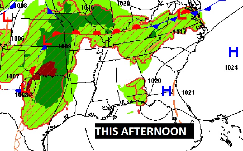
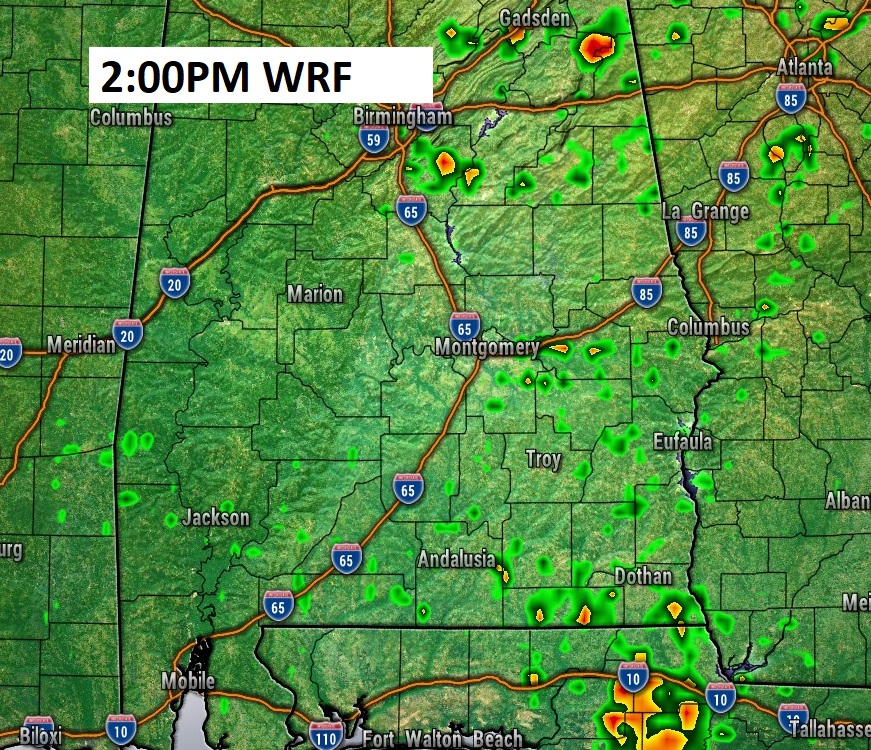
Future Radar: Widely scattered showers are possible again today, but not many. Most towns will stay dry.
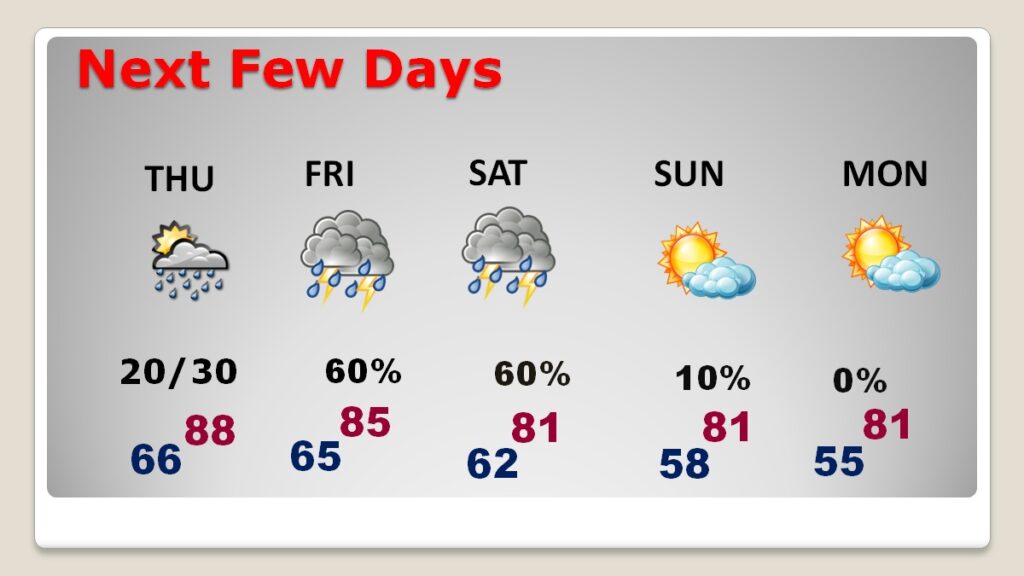
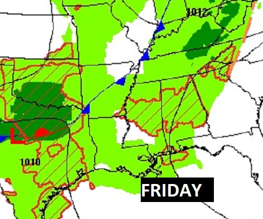
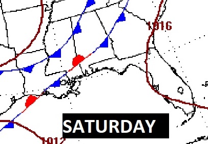
NEXT FEW DAYS: The first day of May will be much like the last few days of April. Rather warm. Upper 80’s. Risk of scattered showers and storms begins late Thursday night, increasing Friday and now it appears the risk of showers and storms will stick around Saturday. Be flexible with your Saturday plans. Cooler air is on tap starting Saturday through early next week with daytime highs near 80 through Monday. The coolest mornings will be Monday and Tuesday with mid 50’s by dawn.
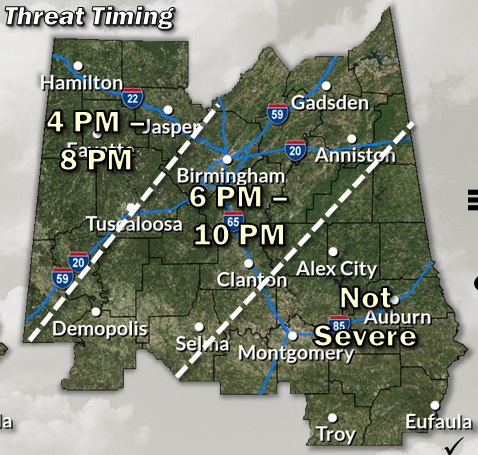
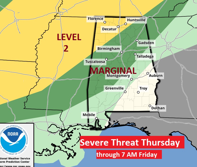
There could be some stronger possibly severe storms Thursday night across the northwest half of the state northwest of a Clanton/Selma line. Marginal risk. In fact, there’s even a level 2 risk in far northwest Alabama.
The Cold Front on the way which will bring the rain threat, has new timing. The front will slow down and stall. That will keep the threat of showers and storms in the forecast through Saturday. This is a significant new wrinkle in the forecast which could affect some plans.
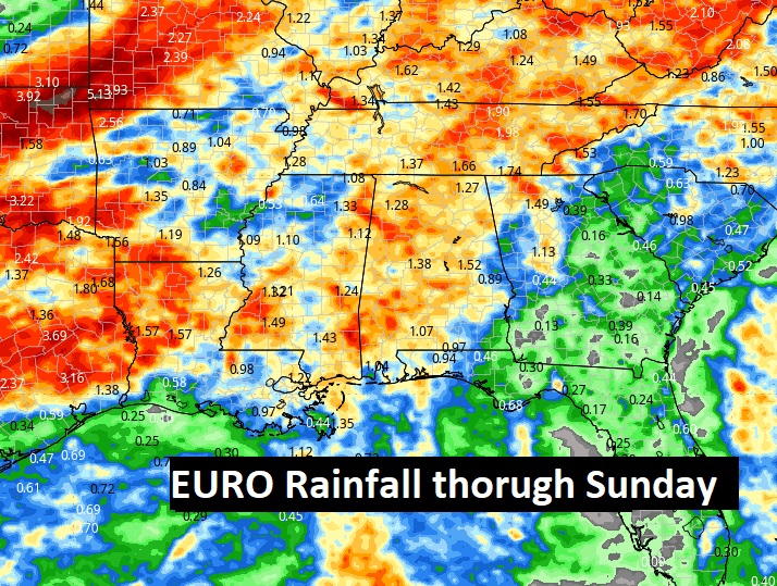
Here’s the expected rainfall through Saturday. The EURO model is a little more generous on the projected rainfall than other models. We need the rain.
Here’s the 10 day model blend temperature trend. Cooler this weekend. The coldest mornings in the mid 50’s will hold off till Monday and Tuesday AM.

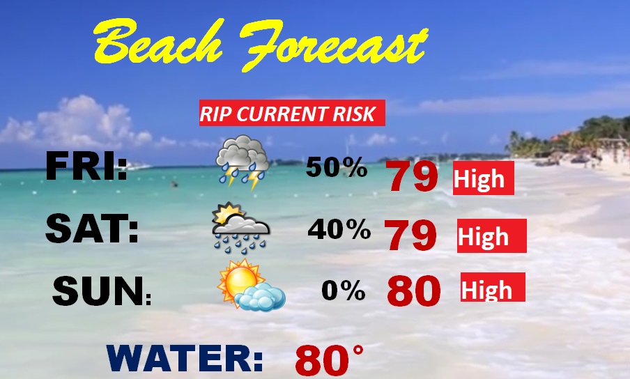
BEACH FORECAST: Risk of scattered showers and storms could affect your Beach plans Friday and Saturday. High rip current risk especially from Destin eastward. Gulf water temperature now at 80.
Thanks for reading the blog. Today everything is normal including LIVE on the Radio of NewsTalk 93.1 WACV. There will be another video forecast discussion and Blog Update in the 4 o’clock hours tomorrow morning. You can always find my forecast updates hourly on the 8 station Bluewater family of stations every day of the year.
–Rich