
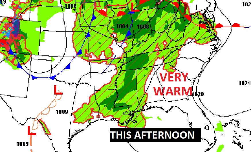
Good Morning! Welcome to May. Today will be another very warm day. Clouds will dominate. Sunshine will be limited. Random widely scattered showers/storms are possible by afternoon. An approaching, slow moving cold front will bring the risk of scattered showers and thunderstorms into the forecast starting tonight and Friday. A few stronger storms are possible, especially across the northwest half of the state. As the front actually enters the state, showers and storms will be most concentrated on Saturday. Be flexible with your outdoor plans. Cooler air is on tap, starting Saturday through early next week with daytime highs only in the 70’s. Nights will be quite chilly, indeed. The coolest mornings will be Monday and Tuesday with lows close to 50 at dawn. Here’s my brief video forecast discussion.
TODAY: Limited Sunshine. Mostly cloudy. Very warm again. High 87. South wind 5 to 10 mph. Widely scattered showers and storms by this afternoon. Scattered showers and thunderstorms tonight. Low tonight 66.
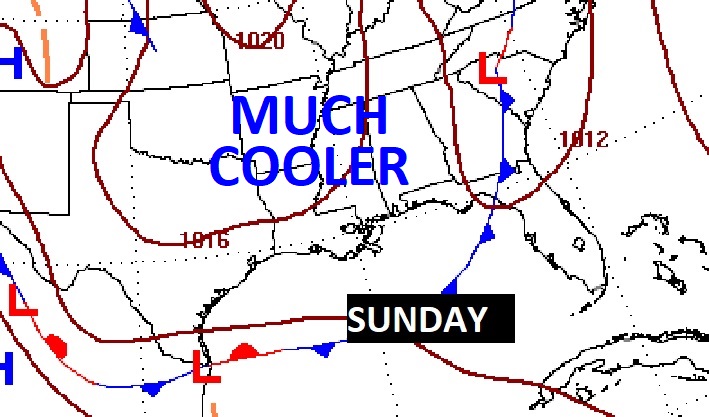
NEXT FEW DAYS: The slow moving cold front approaching will bring some much needed rain to our state. Showers and storms will be quite numerous Friday, Friday night and especially Saturday. A few stronger storms are possible. Behind the front, expect sun shine and a change of climate.
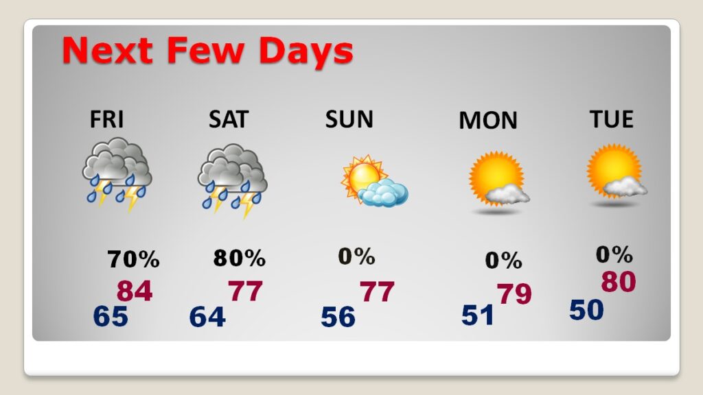
Cooler air is on tap, starting Saturday through early next week with daytime highs only in the 70’s. Nights will be quite chilly, indeed. The coolest mornings will be Monday and Tuesday with lows close to 50. Very chilly. Jacket/sweatshirt weather.
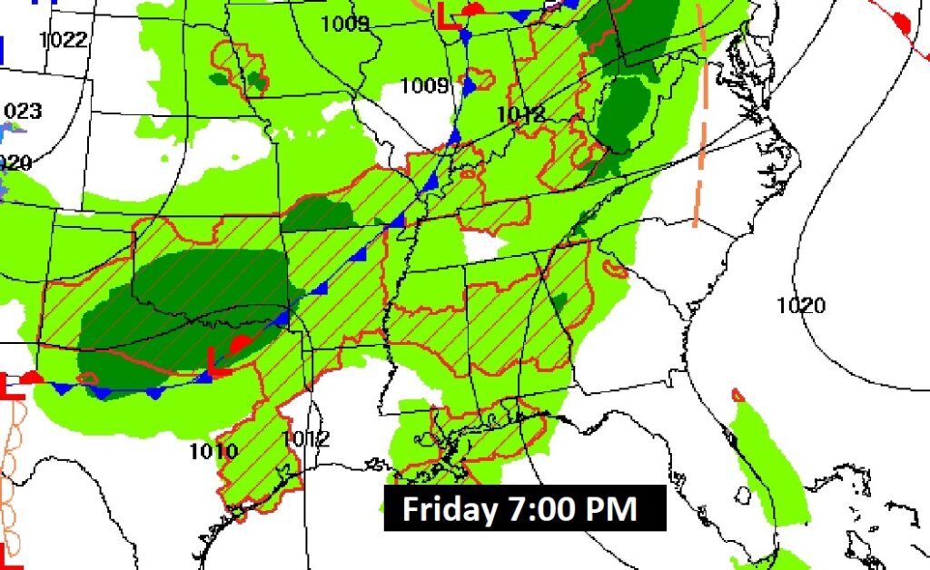
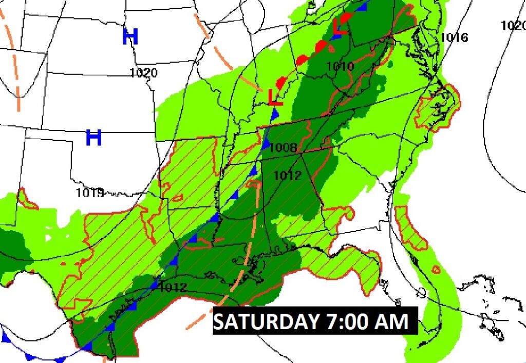
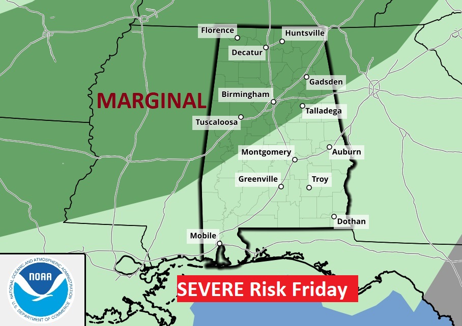
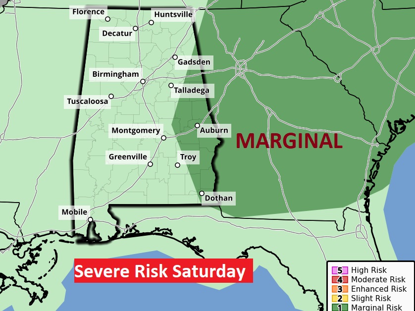
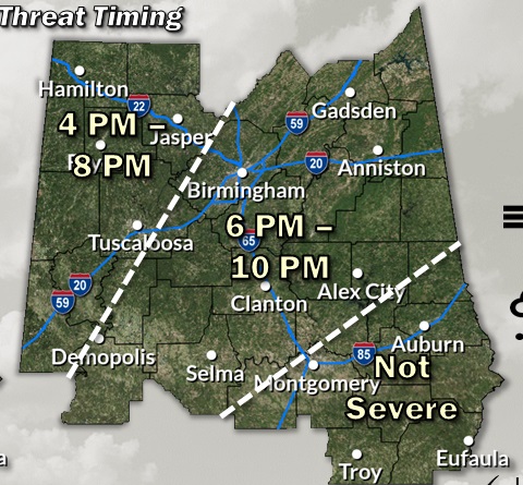
SPC has a Level 1 Marginal Severe Risk for this evening and tonight covering most of northwest Alabama. Damaging wind gusts are the main threat. Again, Friday, the Marginal Risk covers a large part of the state including most of west and northwest Alabama. By Saturday, the Severe Risk shifts to far east and southeast Alabama.
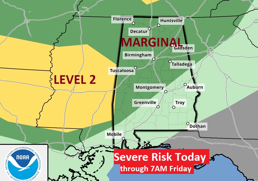
Here’s the timing map for this evening’s Severe Threat.
Be flexible with your outdoor plans Friday and Saturday especially, The slow moving Cold Front on the way which will keep the threat of showers and storms in the forecast through Saturday. Sunshine and much cooler, behind the front on Sunday.
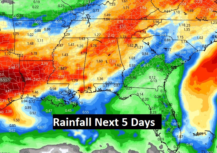
Here’s the expected rainfall through the weekend. Some towns should see some very beneficial totals. We need the rain.
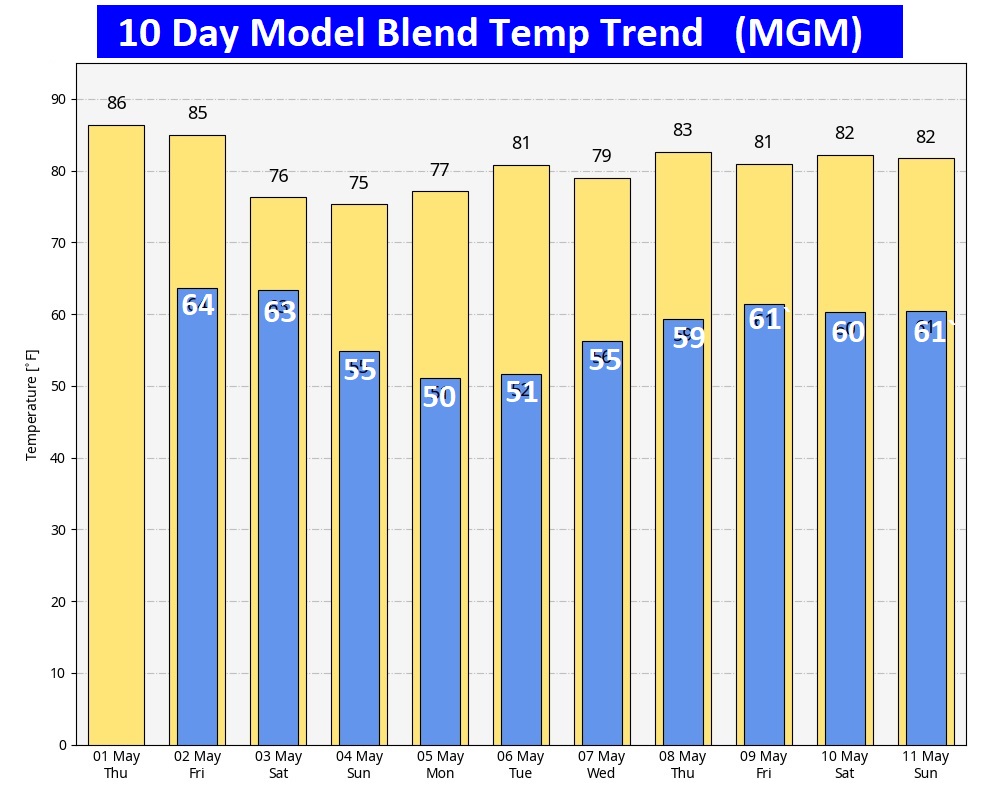
Here’s the 10 day model blend temperature trend. We’ll be in the 70’s starting Saturday for several days. Cooler air begins this weekend. Coolest mornings will apparently be close to 50 Monday and Tuesday AM. Expect slow warming next week. (Normal 82/56)
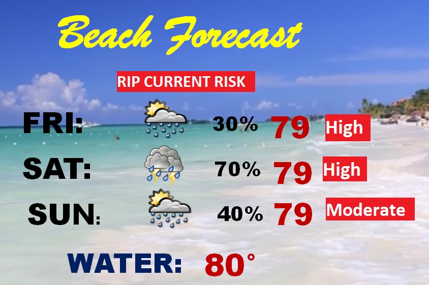
BEACH FORECAST: Risk of scattered showers and storms could affect your Beach plans Friday and Saturday. High rip current risk especially from Destin eastward. Gulf water temperature now at 80.
Thanks for reading the blog. Today everything is normal including LIVE on the Radio of NewsTalk 93.1 WACV. There will be another video forecast discussion and Blog Update in the 4 o’clock hours tomorrow morning. You can always find my forecast updates hourly on the 8 station Bluewater family of stations every day of the year.
–Rich