
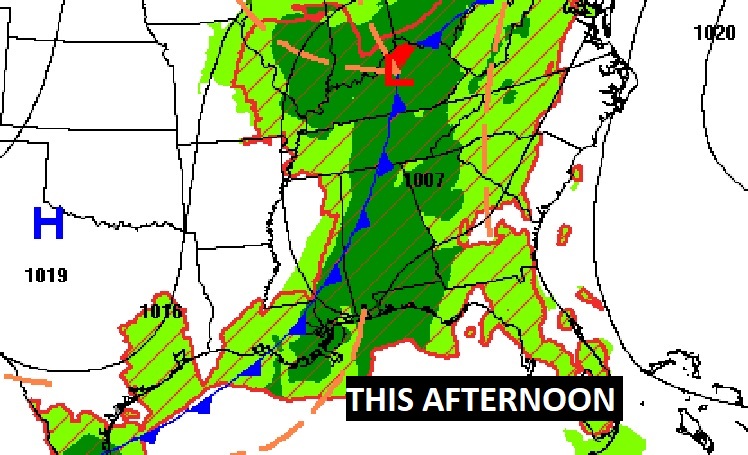
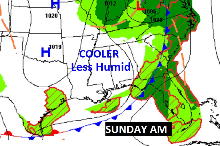
Good Morning! Be flexible with your outdoor plans. Showers and storms will be rather numerous at times. A few stronger storms aare possible. Damaging winds are the main risk. There is a Level 1 Marginal Severe Risk. Showers and storms will taper off by late tonight, before ending. Behind the Cold Front, much cooler, less humid air is also on the way. Highs will be in the 70’s Sunday and Monday. Chilly nights. The coolest mornings will be Monday and Tuesday. Near 50 Monday morning, and lower 50’s Tuesday AM. More scattered showers and thunderstorms starting Tuesday night through Thursday. In fact, that looks like a rather wet storm system. Check out the rainfall potential map on this Blog update.
TODAY: Scattered showers and thunderstorms likely. A few stronger storms possible. Damaging winds are the main risk. High 78. Showers and storms will taper off by late tonight, before ending. Low in the mid 50’s.
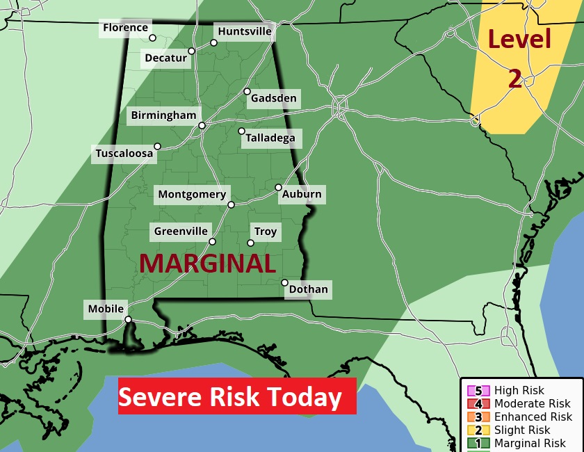
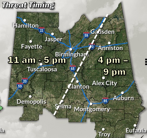
The Storm Prediction Center has all of the state in a Level 1 Marginal Severe Risk. Damaging wind gusts are the main threat.
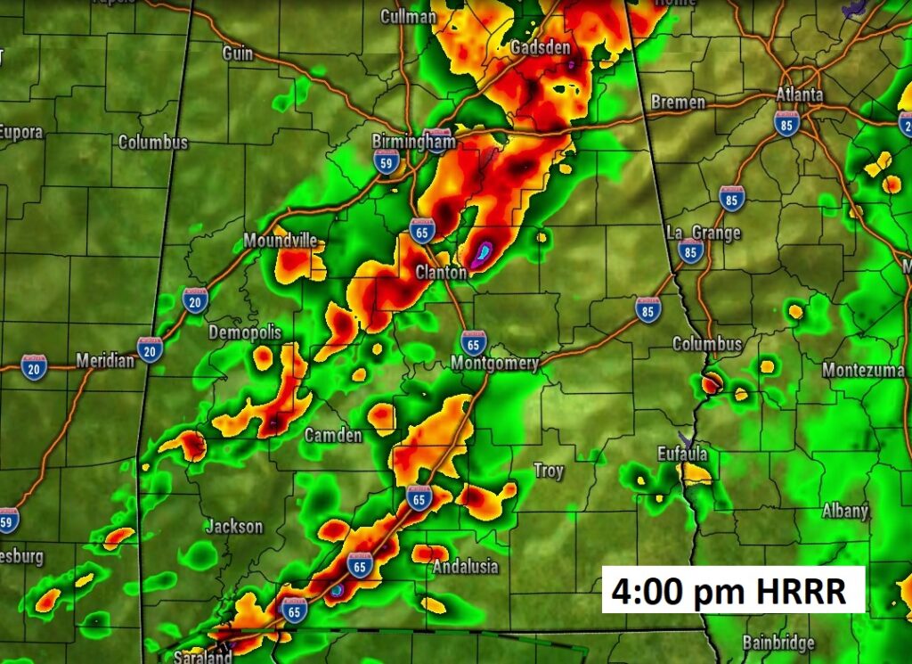
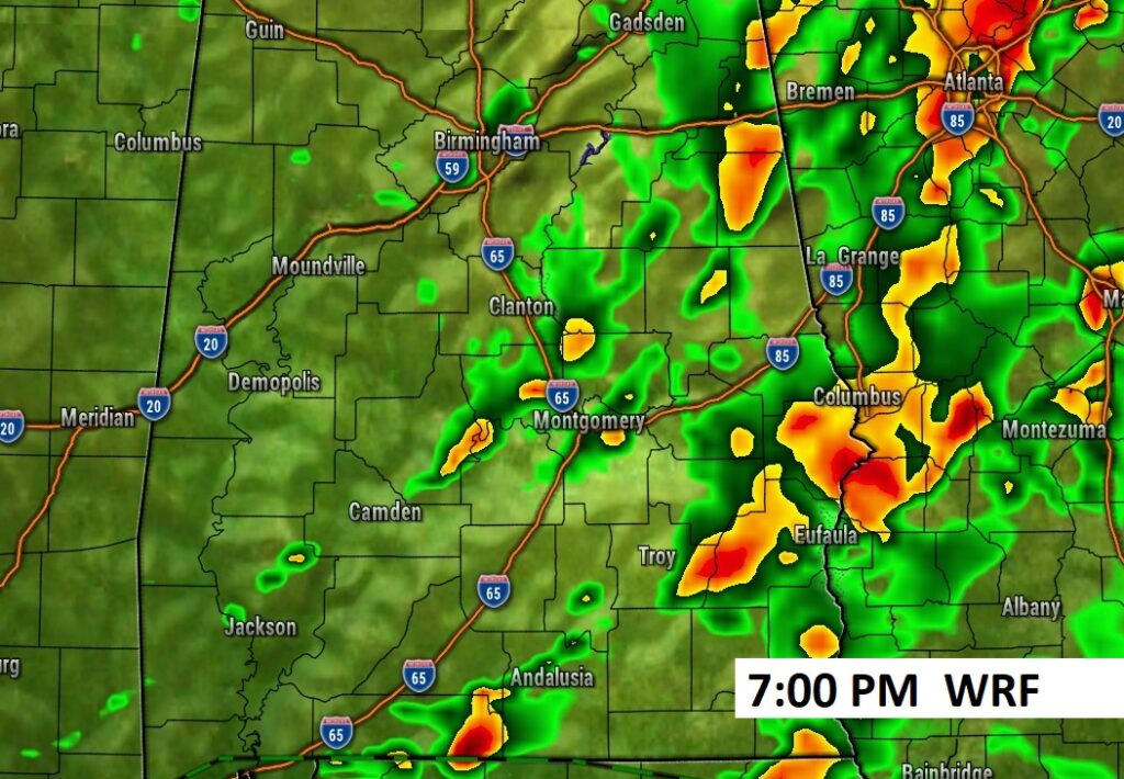
Future Radar: Scattered showers and storms will be rather numerous. Here’s a couple of snapshots late afternoon and into the evening.
Here’s the updated Severe Risk Timing map.
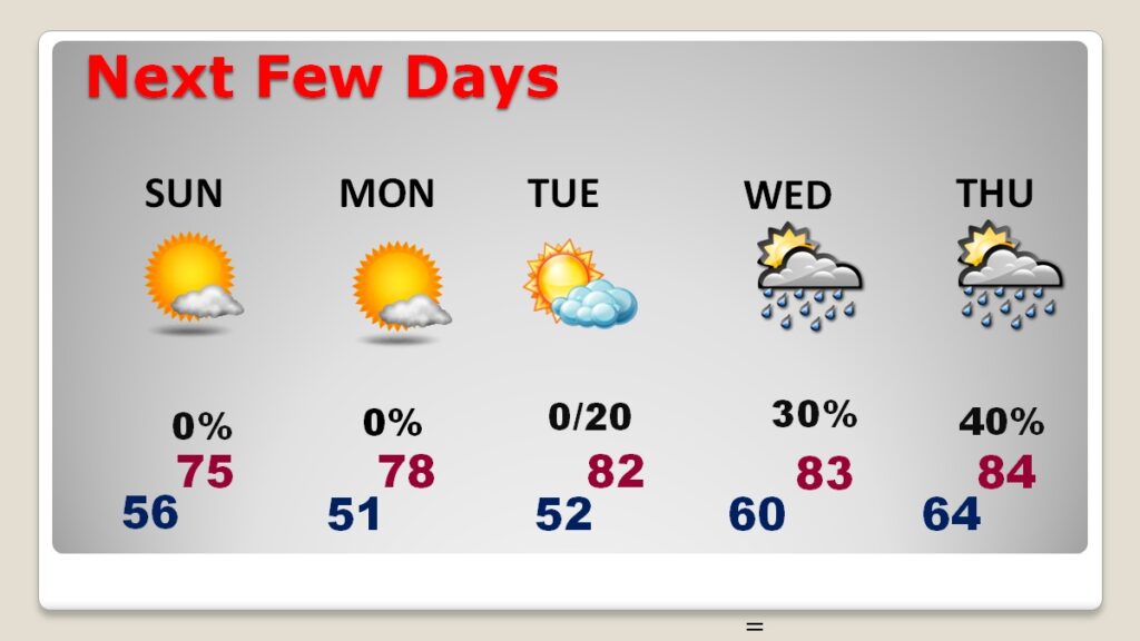
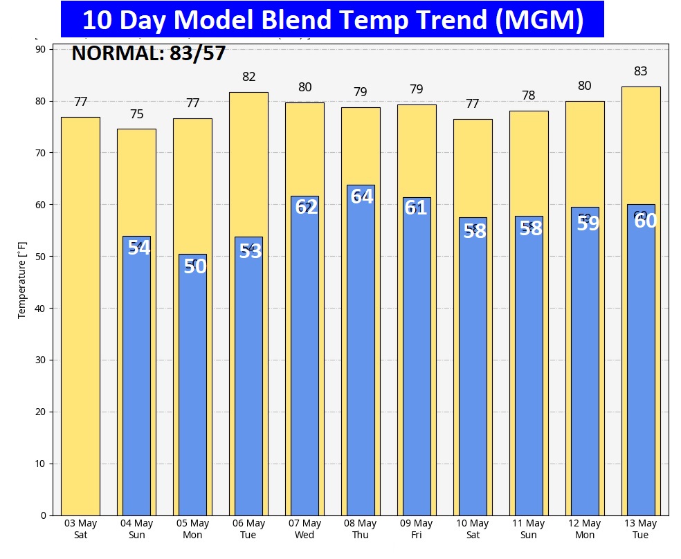
NEXT FEW DAYS: Much cooler, less humid air is also on the way. Highs will be in the 70’s Sunday and Monday. Chilly nights. The coolest mornings will be Monday and Tuesday. Near 50 Monday morning, and lower 50’s Tuesday AM. Sunshine will dominate Sunday through Tuesday. More scattered showers and thunderstorms starting Tuesday night through Thursday.
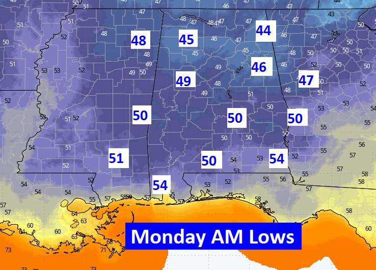
Check out the expected Lows early Monday morning. 40’s north, lower 50’s south. Chilly, Jackets and sweatshirts. (The record is very safe. 42 in 2013)
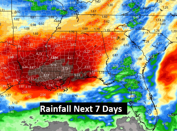
Here’s the expected rainfall through the next 7 days. The lion share will be Wednesday and Thursday. That’s a lotta rain.
Here’s the 10 day model blend temperature trend.
BEACH FORECAST:
Risk of scattered showers and storms could affect your Beach plans especially today. There will be a lingering chance especially early Sunday, High rip current risk especially from Destin eastward through Sunday. Gulf water temperature now at 79.

Thanks for reading the blog. The next scheduled full blog will be Monday morning, Have a nice weekend!
–Rich