
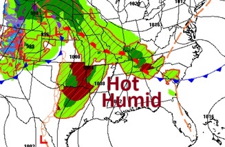
Good morning! Tuesday will be the hottest day with lower 90’s. A powerful line of strong/severe storms will move through the state Tuesday afternoon/Tuesday night ahead of a cold front. That front will deliver some cooler, much less humid air by mid and late week. Lows will reach the upper 50’s by Friday and Saturday mornings. We should be storm-free and nice Wednesday through at least Saturday. Here’s my brief video forecast discussion.
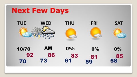
TODAY: Morning cloudiness. Then, a sun/clouds mix. Hot today. High 91. Light SW wind. Mostly Cloudy tonight. Low 70.
NEXT FEW DAYS: Tuesday will be the hottest day with lower 90’s. A powerful line of strong/severe storms will move through the state Tuesday afternoon/Tuesday night ahead of a cold front. That front will deliver some cooler, much less humid air by mid and late week. Lows will reach the upper 50’s by Friday and Saturday mornings.
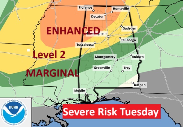
Approaching Cold Front will produce a Severe weather threat for much of the state beginning Tuesday afternoon in the northwest counties and Tuesday night, ending by Wednesday morning.
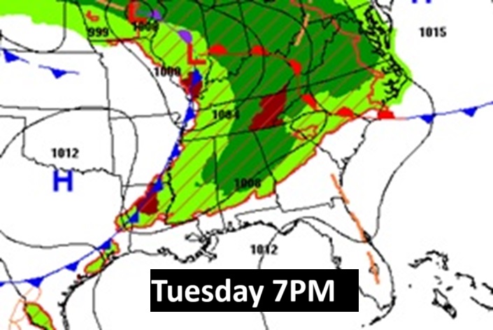
The Storm Prediction Center has a Level 1 Severe Risk almost as far southeast as Montgomery Tuesday night. The threat escalates to a Level 3 risk in northwest Alabama beginning Tuesday afternoon. A couple of tornadoes can’t be ruled out.
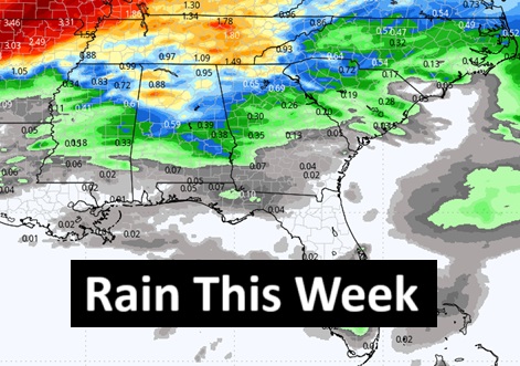
Here’s the rainfall potential map. North Alabama will see the lion share of rainfall totals this week.
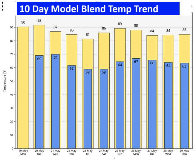
10 Day model blend temperature trend. Highs in the lower 80’s by late week. Lows will reach the upper 50’s by Friday and Saturday mornings. Normal hi/lo 87/62.
Weather radio outage: The National Weather Service will be upgrading their software at their office today through Wednesday. Unfortunately, that means that all their weather radio stations operated by the Birmingham Weather office will be off the air starting this morning and continuing until sometime Wednesday. So with severe weather moving into the state Tuesday night, you need to know that the weather radios will not be operating. That’s why you need our weather app on your phone or tablet if you do not have it already. You can find it in the App Store, but just search searching Rich Thomas Weather.
Thanks for reading the blog. Today everything is normal including LIVE on the Radio of NewsTalk 93.1 WACV. There will be another video forecast discussion and Blog Update in the 4 o’clock hours tomorrow morning. You can always find my forecast updates hourly on the 8 station Bluewater family of stations every day of the year.
–Rich