
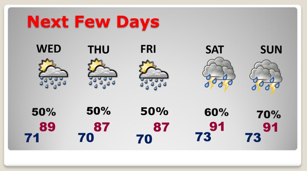
Good morning! Today will likely be the hottest day of the week. Expect a high at or above 90. Changes are the way. The humidity will be rising Wednesday and Thursday as Atlantic tropical moisture along the southeast US coastline spreads eastward. Scattered random showers and storms will return to the forecast Wednesday and Thursday. Scattered showers and thunderstorms will be in greater supply Friday through Sunday, especially in the afternoon and evening hours. Here’s my brief forecast discussion.
TODAY: Mostly sunny. Hotter. High 90-92. Light SE wind. Partly cloudy tonight. Low near 70.
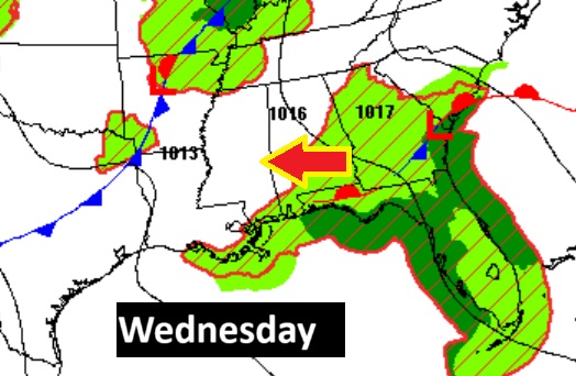
NEXT FEW DAYS: Atlantic Tropical moisture will set the stage for more showers for the rest of the week and the weekend. Scattered random showers and storms will return to the forecast Wednesday and Thursday.
Scattered showers and thunderstorms will be in greater supply Friday through Sunday, especially in the afternoon and evening hours.
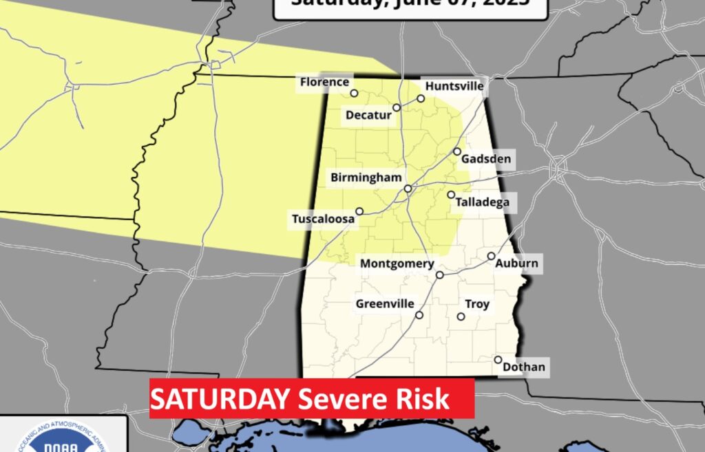
SPC has added a 15% Severe Risk on the Day 5 outlook for Friday as a front approaches.
Expected rainfall will be impressive in spots through Sunday.

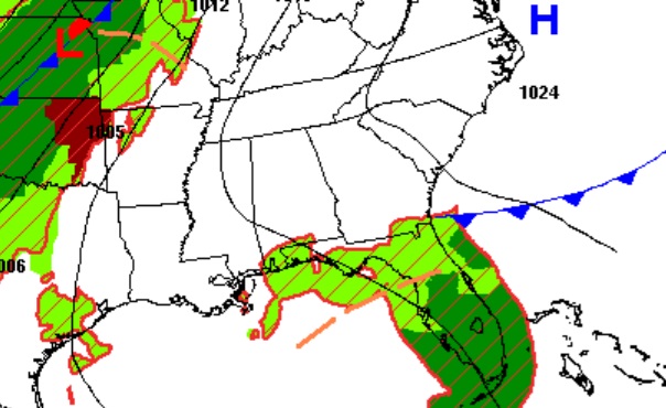
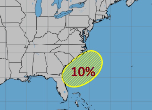
TROPICAL UPDATE: NHC is monitoring a non-tropical low off the SE US coastline. By this weekend, as the low moves northeastward, there is a low chance this low could acquire tropical characteristics. Right now, they are keeping the chances in the low range.
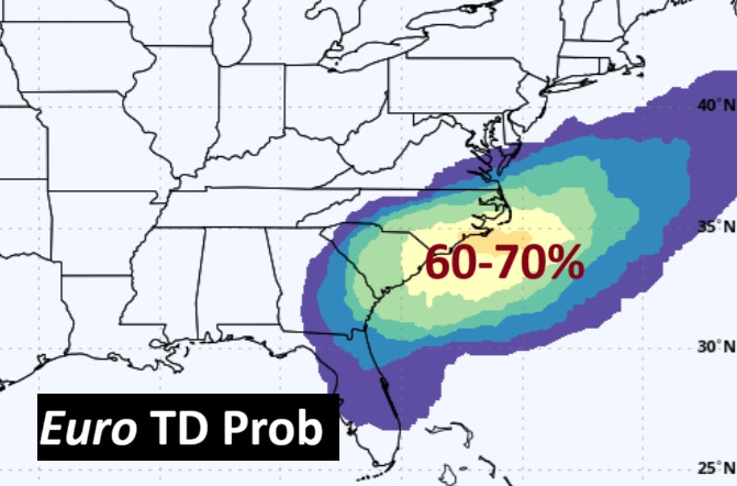
The EURO model is suggesting at least a 60% chance that this system could become a Tropical Depression off the Carolina coast this weekend.
Thanks for reading the blog. Today everything is normal including LIVE on the Radio of NewsTalk 93.1 WACV. There will be another video forecast discussion and Blog Update in the 4 o’clock hours tomorrow morning. You can always find my forecast updates hourly on the 8 station Bluewater family of stations every day of the year.
–Rich