
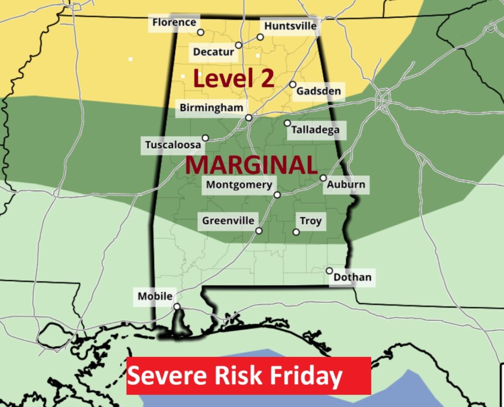
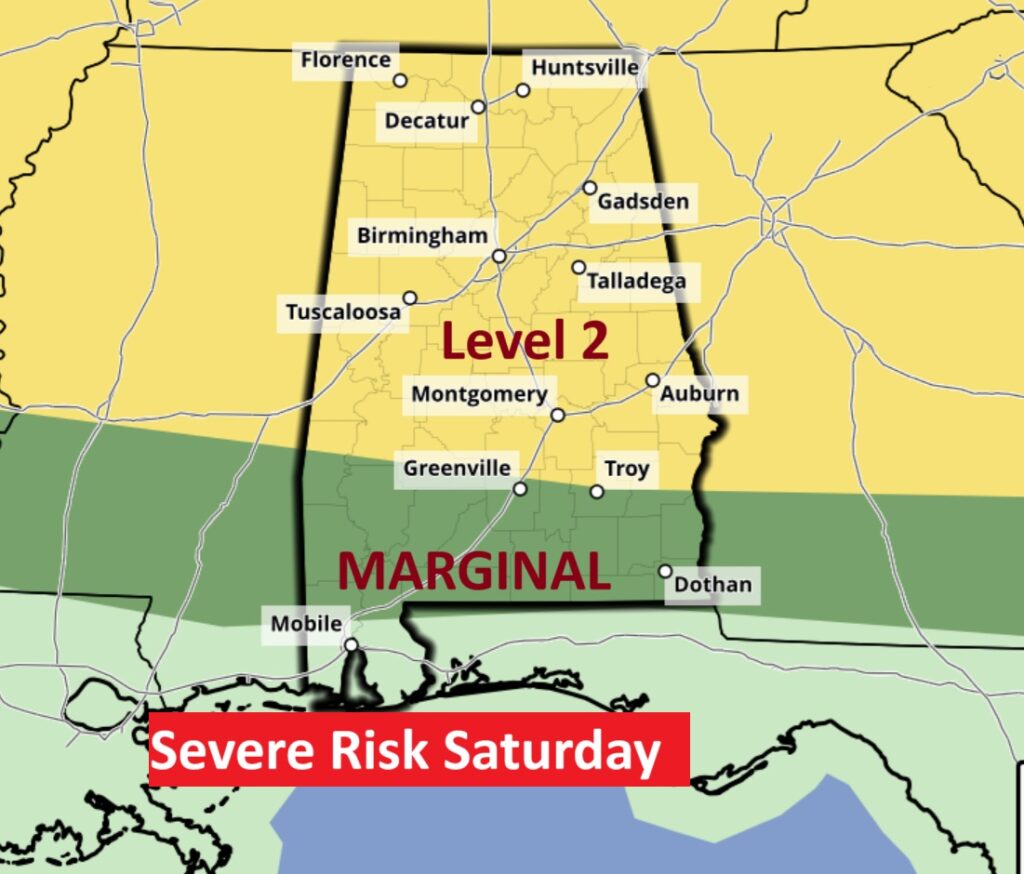
Good morning! The humidity is increasing as tropical Atlantic moisture takes over. Scattered random showers and storms will continue in the forecast again today and Friday. The number of showers and thunderstorms will be in greater supply Saturday through Monday, especially in the afternoon and evening hours. The storms will be random. Some of the storms could be strong to severe especially Saturday Level 2 Severe Risk. Locally heavy downpours.
TODAY: Partial sunshine. High 88. Light SE wind. Random scattered mostly PM Showers and storms. More humid tonight. Low near 70. (Normal hi/lo 90/67)
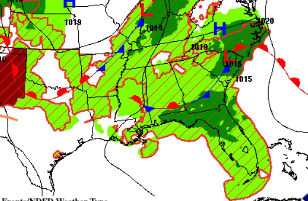
Tropical moisture is increasing across the area.
NEXT FEW DAYS: . Scattered random showers and storms are returning. The number of showers and thunderstorms will be in greater supply especially Saturday through Monday, especially in the afternoon and evening hours. Very humid. Highs in the upper 80’s and lower 90’s.
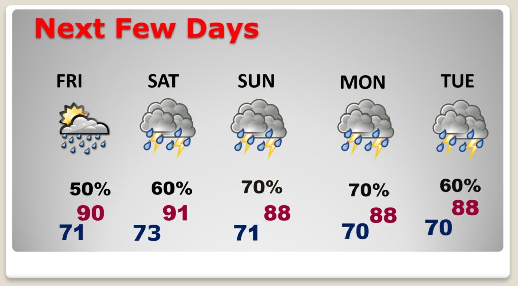
Some of the storms could be strong/severe. Especially Saturday. Level 2 Severe Risk. Damaging wind gusts are possible.
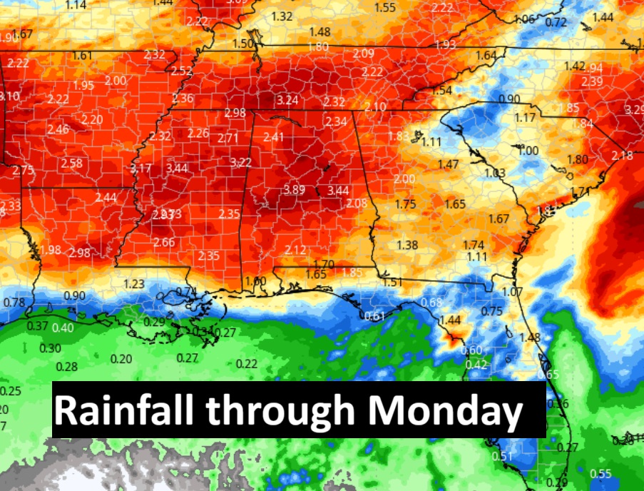
Expected rainfall through Monday. Locally heavy rainfall amounts.
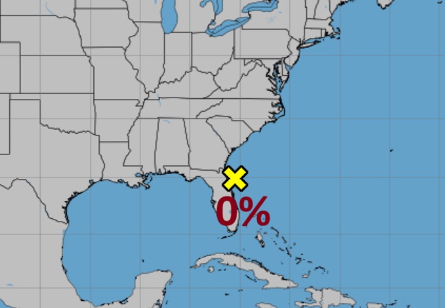
TROPICAL UPDATE: NHC says the concern for that area to watch off the SE coast is now ZERO.
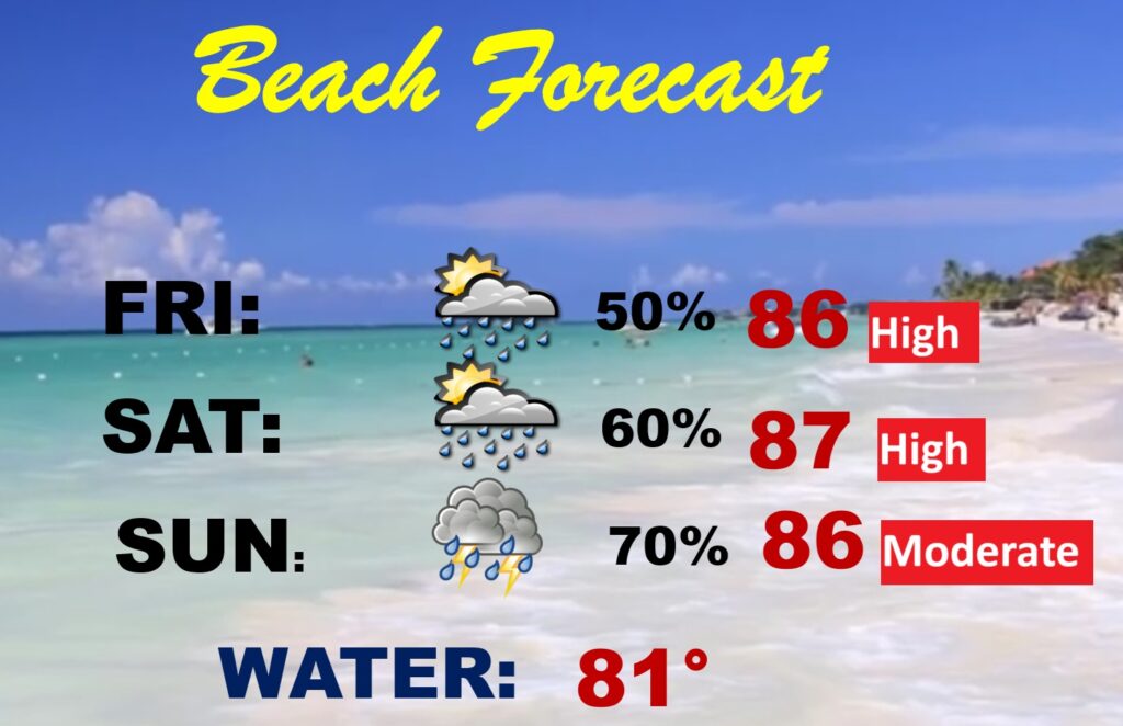
BEACH OUTLOOK: Not a washout, but be flexible with your plans. Numerous showers and storms will be roaming around each day, most numerous in the afternoon and evening.
Thanks for reading the blog. There will be another video forecast discussion and Blog Update in the 4 o’clock hours tomorrow morning. You can always find my forecast updates hourly on the 8 station Bluewater family of stations every day of the year.
–Rich