
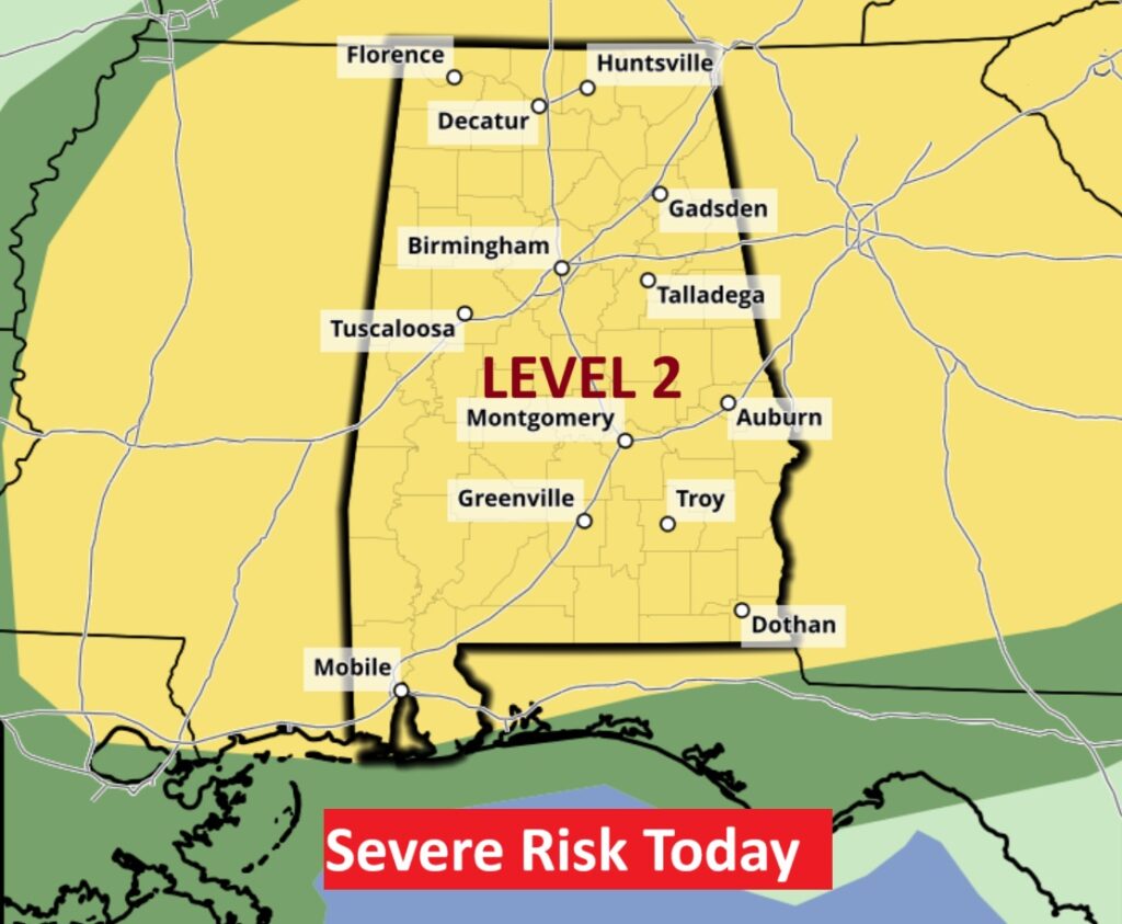
Good morning! Get ready for an extended series of unsettled weather days with higher than normal rainfall probabilities each day through Saturday. Today some storms could once again reach severe limits. SPC has a Level 2 threat today. The greatest risk is damaging straight-line wind gusts and even a few microbursts are possible. We will be tracking multiple storm clusters (MCS) which will traverse the state. There will be likely 2 rounds today – this morning and early this evening. Our weather app will keep you on top of the action with instant push notifications for severe weather watches and warnings. Radar and future radar will keep you up to date on where the storms are and where they are headed. It’s free in the app store. Search Rich Thomas Weather. Stay weather aware. Here’s my brief video forecast discussion.
TODAY: Showers and thunderstorms. There will be likely 2 rounds today this morning and early this evening. Level 2 Severe Risk. Risk of damaging wind gusts. High near 88. Southwest wind 5 to 10 mph. Chance of precipitation is 90%. New rainfall amounts between a half and three quarters of an inch possible.
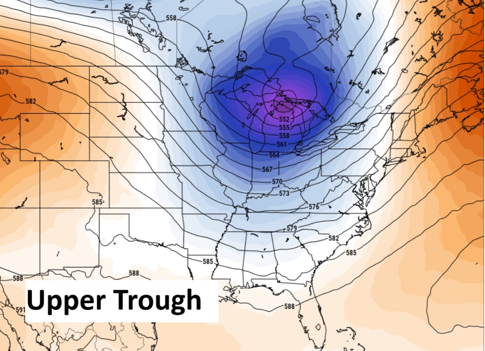
Today..several factors are at play including an approaching frontal system this evening. An upper air trough will keep Alabama’s airmass very unsettled and unstable for the next few days.

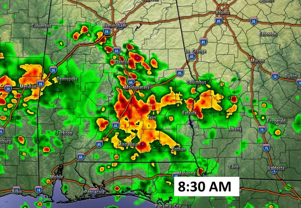
Level 2 SEVERE RISK: No changes to the forecast this morning – expecting 2 rounds of thunderstorms today with severe storms possible in both rounds. Initial round expected this morning, with the thunderstorms already developing in Central MS.
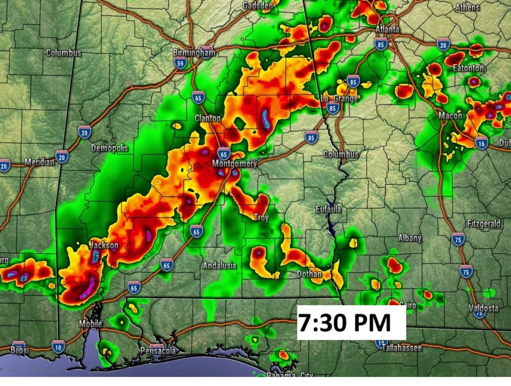
2nd round expected to develop this afternoon through early evening. Damaging wind gust threat.
FUTURE RADAR: Expecting 2 rounds of thunderstorms today with severe storms possible in both rounds. Initial round expected this morning. Second round early this evening ahead of a frontal system.
NEXT FEW DAYS: Not much day to day change. Random Showers and storms will be most numerous in the afternoon and evening hours. High daily rain probabilities continue.
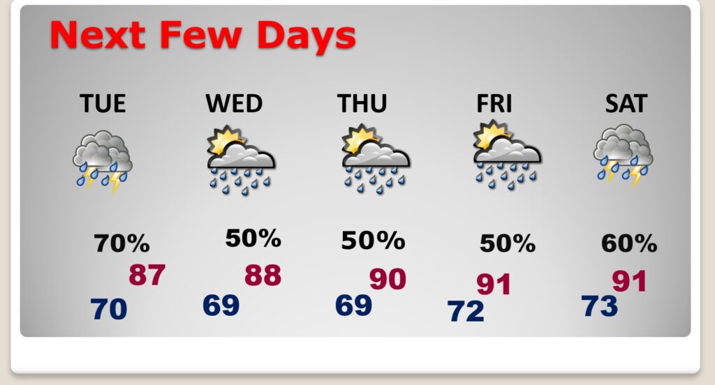
Locally heavy rainfall amounts are possible in spots over the next few days. Tropical downpours. Highs mostly in the 80’s. Lows at night around 70.
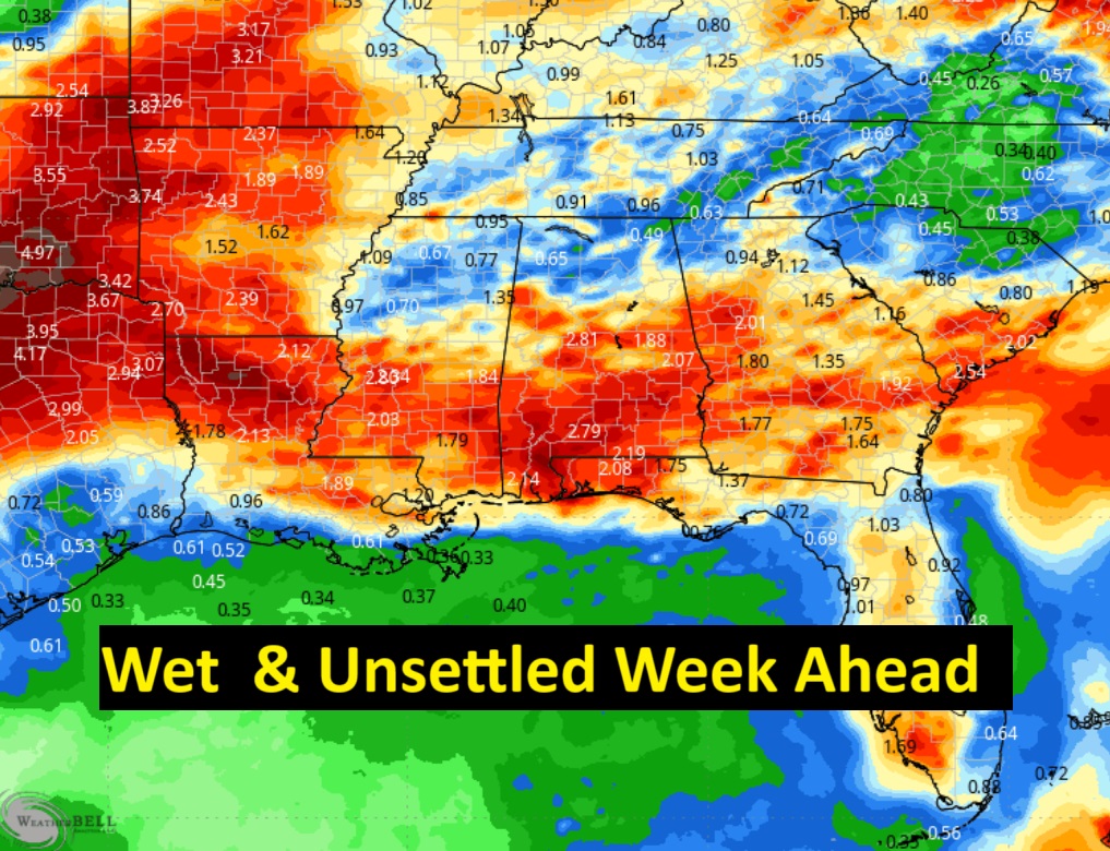
Potential rainfall totals in the week ahead could be significant.
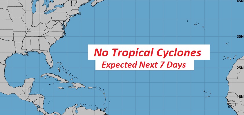
TROPICAL UPDATE: NHC says the Atlantic Basin is quiet for the next 7 days.
Thanks for reading the blog. Today everything is normal including LIVE on the Radio of NewsTalk 93.1 WACV. There will be another video forecast discussion and Blog Update in the 4 o’clock hours tomorrow morning. You can always find my forecast updates hourly on the 8 station Bluewater family of stations every day of the year.
–Rich