
Good morning! We have been telling you about this for a few days. We are easing into a very wet and stormy pattern for the next several days. It’ll not be a complete washout, and the storms will be random. Some towns will get a lot more rain than others. There will be numerous showers and storms, just about anytime, but especially in the afternoon and evening hours. There will be tropical downpours with locally heavy rainfall amounts. Some storms could be strong. Be flexible with your weekend plans here and across the Gulf coast beaches. Here’s my brief video forecast discussion.
TODAY: Limited sunshine. High 88 to 90. Random, scattered to numerous showers and storms will be most likely in the afternoon and evening hours. Low tonight 72. Storm risk fades overnight.
FUTURE RADAR: Random scattered showers and storms, most numerous in the late afternoon and through the evening hours.


NEXT FEW DAYS: The rain faucet is open full blast for the next several days, through early next week. Numerous showers and storms especially in the afternoon and evening for the Father’s Day weekend. Highs in the upper 80’s to near 90. Lows at night in the lower 70’s. Tropical downpours will be numerous. Locally heavy rainfall. Be flexible with your plans.

The influx of tropical moisture will lead to widespread showers and storms soaking the Southeastern US this weekend and beyond.
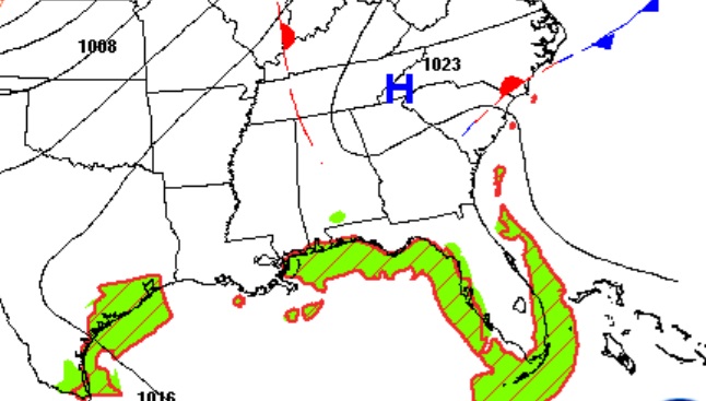
Rainfall amounts will vary quite a bit from town to town, but the very wet pattern will cover the entire Southeast US for several days.

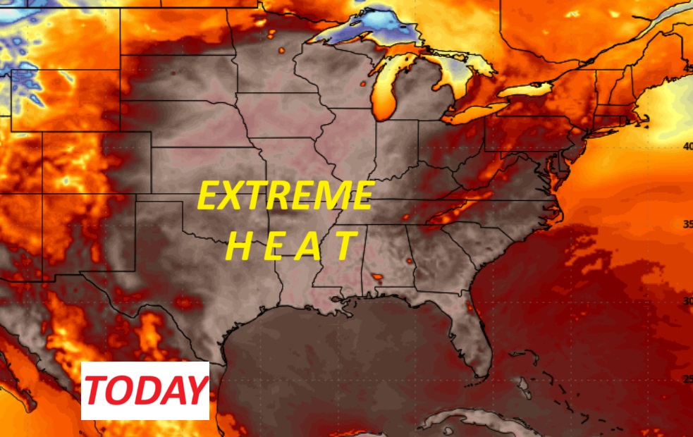
Summer is locked in. Here’s the 10 day temperature trend.

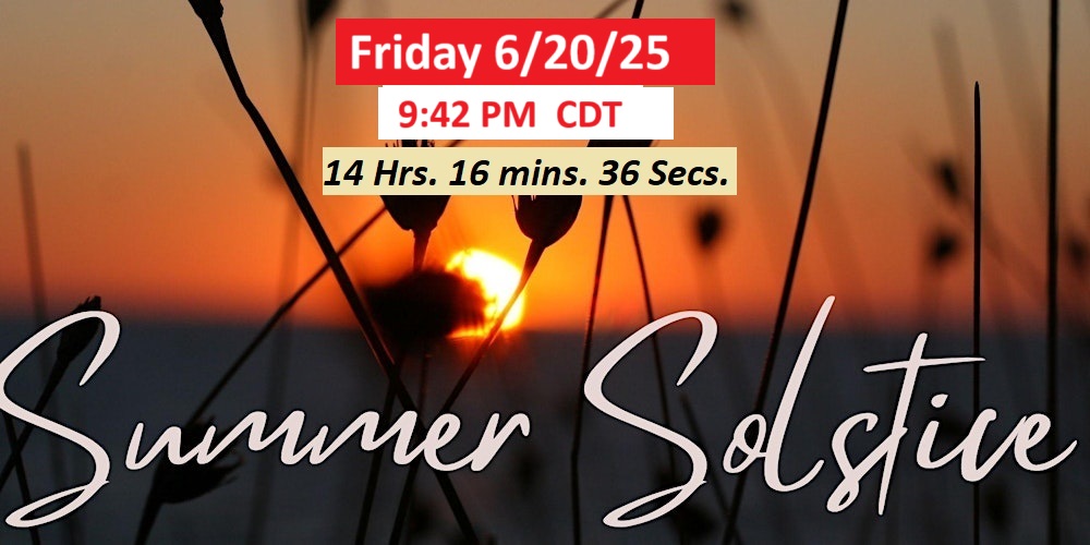
The days are still getting longer for one more week. Summer begins on Friday June 20th at 9:42 PM. Between now and next Friday, we’ll gain an extra 1 minute and 1 second of daylight.
BEACH FORECAST: Be flexible. Numerous showers and storms especially in the afternoon and evening for the Father’s Day weekend and beyond. Gulf water temperature 84. High rip current risk.

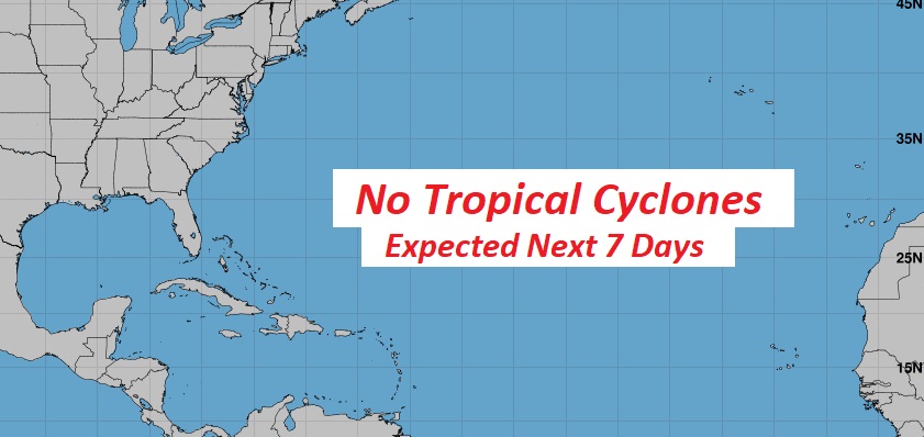
TROPICAL UPDATE: NHC says the Atlantic Basin is quiet for the next 7 days, and very likely for much of the rest of June. Saharan dust continues to flood in across the Tropical Atlantic and the Caribbean.

Thanks for reading the blog. Today everything is normal including LIVE on the Radio of NewsTalk 93.1 WACV. There will be another video forecast discussion and Blog Update in the 4 o’clock hours tomorrow morning. You can always find my forecast updates hourly on the 8 station Bluewater family of stations every day of the year.
–Rich