
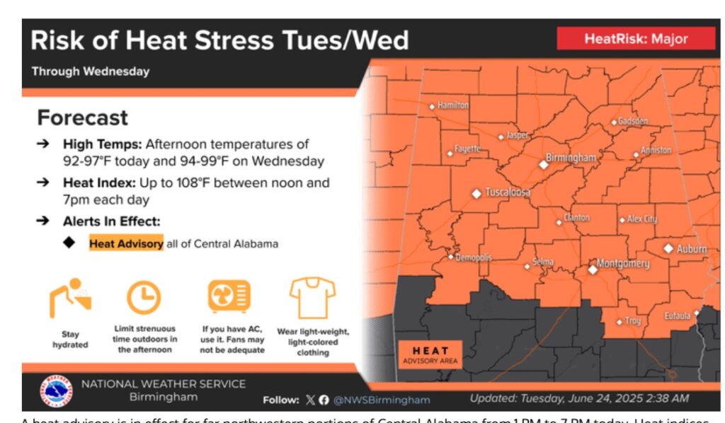
Good morning! That large Upper Heat Dome High continues dominate a huge part of the country. A Heat Advisory is in effect through Wednesday evening. The heat index will likely reach the 105+ danger range. Scattered PM storms are back in the forecast starting Wednesday through the end of the week. On Wednesday, some storms could be strong/severe. Big Heat can produce big storms. Here’s my brief forecast discussion.
TODAY: Heat Advisory. Sunshine. Hot and humid again. Most towns stay dry. High upper 90’s.. Triple digit Heat Index near or above 105. Low tonight mid 70’s.
A massive Upper High Heat Dome dominates a huge part of the nation with Dangerous Heat. By late week the strength of the high will start to decrease.
NEXT FEW DAYS: The Heat Advisory continues through at least Wednesday evening. The Heat index will reach the 105 Danger Range. Nighttime lows in the extremely humid low to mid 70’s. Scattered PM storms are back in the forecast starting Wednesday through the end of the week.

On Wednesday, some storms could be strong/severe. Big Heat can produce big storms.

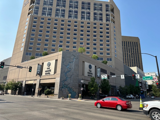
Thanks for reading the blog. PLEASE NOTE I’m attending American Meteorological Society Broadcast Conference in Boise, Idaho.
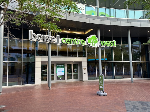
Good morning Boise! With temperatures in the low 50s and dewpoint in the 30s after yesterday’s high of 77. What a far cry from Montgomery, Alabama with a heat index of 105 to 108 today. Beautiful setting beautiful weather, beautiful city and a great hotel for this 52nd AMS Broadcast Conference. Conference business begins this morning at 8:30.


I’ll be here through Friday. So, my blog updates to you will be very.
short, concise. I’ll be dealing with the conference but it’s also a vacation. And, it’s a reunion with all my buddies who are meteorologist from in various cities around this country.
The next Blog update is scheduled for early tomorrow morning. Have a nice day! Stay hydrated!
–Rich