
Good morning! With the intense heat yesterday, we expected strong to severe storms. During the evening there were many warnings and a Severe Thunderstorm Watch. Storms were impressive. Expect middle 90’s again today and Friday. Heat index well into triple digits. Even today and Friday some storms reaching severe limits. Big Heat can produce big storms. Slow down. Scattered PM strong storms each day through next Wednesday. Take it easy. Stay hydrated.
YESTERDAY: MGM high was 95 with a max Heat Index of 109. Peak wind gust 38 mph. Airport: .30”
TODAY: Lots of sunshine. Hot and humid again. Again, today, some PM storms could be strong/severe. Big Heat can produce big storms. High middle 90’s. Triple digit Heat Index near or above 105. Low tonight mid 70’s.
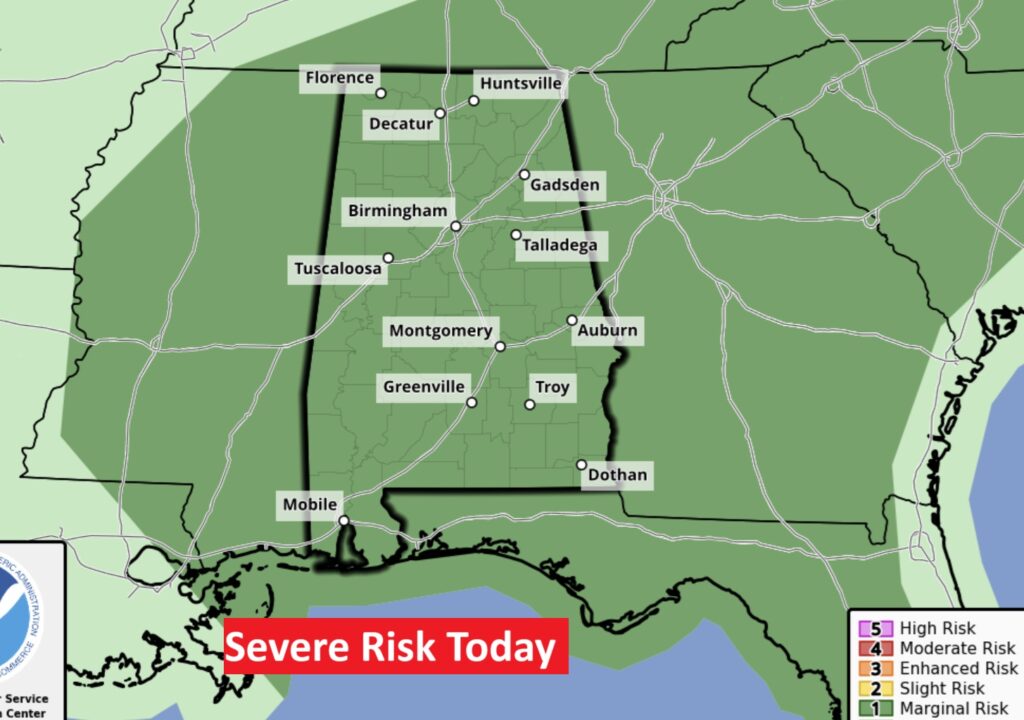
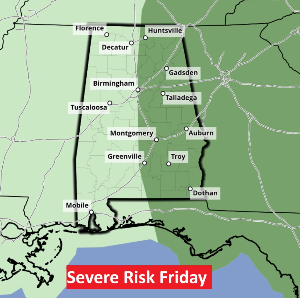
SPC has many of us in a Level 1Severe Risk today. Damaging wind gusts possible in some storms. Downburst risk. Tomorrow a Level 1 Marginal Risk for much of the eastern part of the state. Again, big heat can produce Big Storms.
FUTURE RADAR: Again, suggesting some of the stronger storms may be in the evening hours again. Here’s an 8:30 PM snapshot.

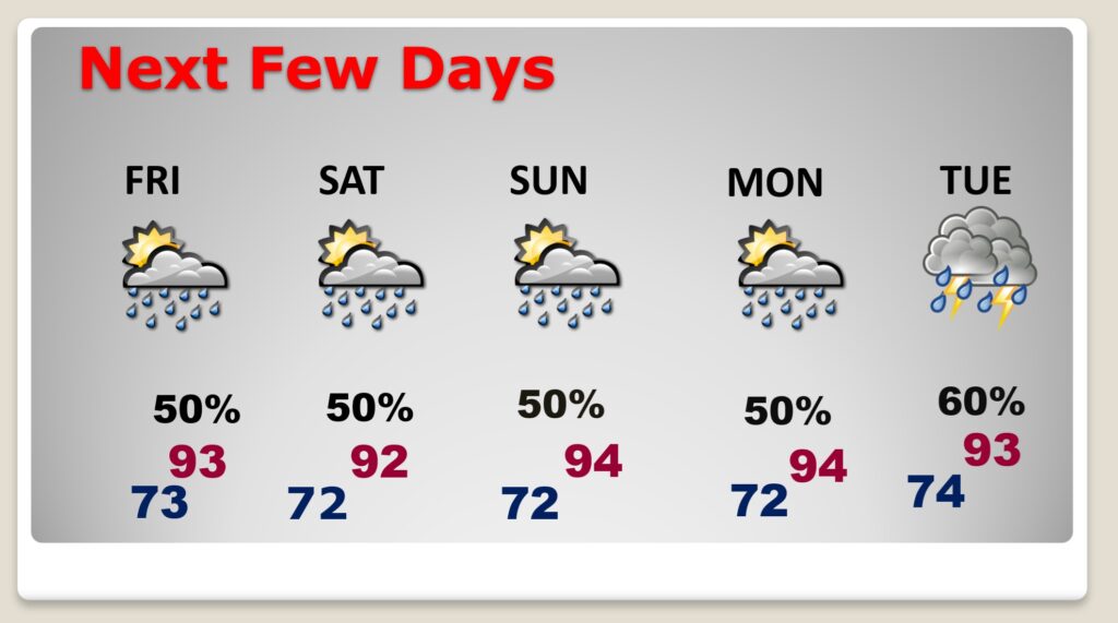
NEXT FEW DAYS: With highs in the middle 90’s, expect the Heat index to stay at or above 100. Nighttime lows in the extremely through the end through the end of the week and this weekend. Scattered PM strong storms each day through next Wednesday.
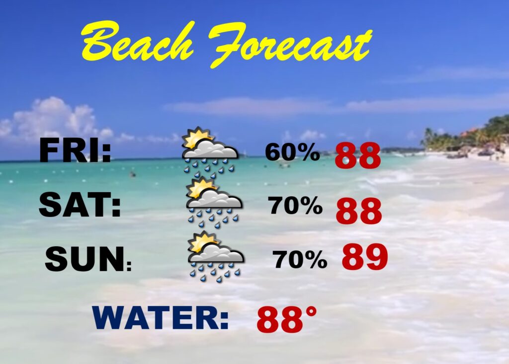
BEACH FORECAST: A few strong storms will be lurking at times. Yesterday was crazy stormy at the Beach.
Thanks for reading the blog. PLEASE NOTE I’m attending the American Meteorological Society Broadcast Conference in Boise, Idaho. I’ll be here through Friday. So, my blog updates to you will be very short, concise.
The next Blog update is scheduled for early tomorrow morning. Have a nice day! Stay hydrated!
–Rich