
UPDATE:
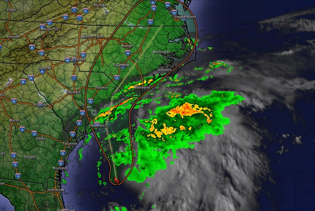
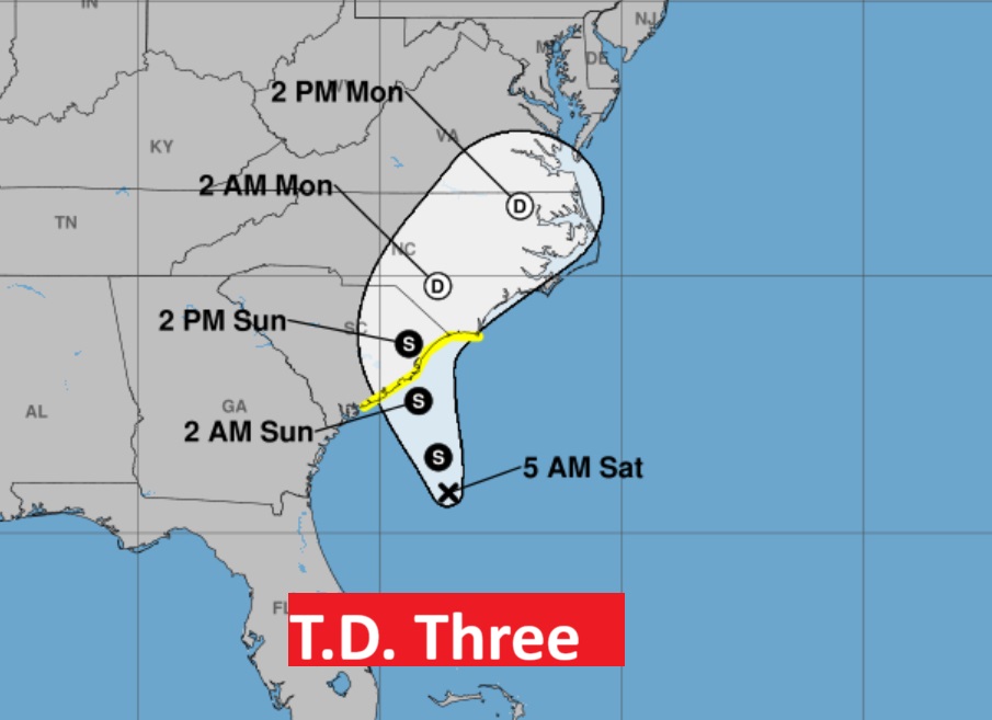
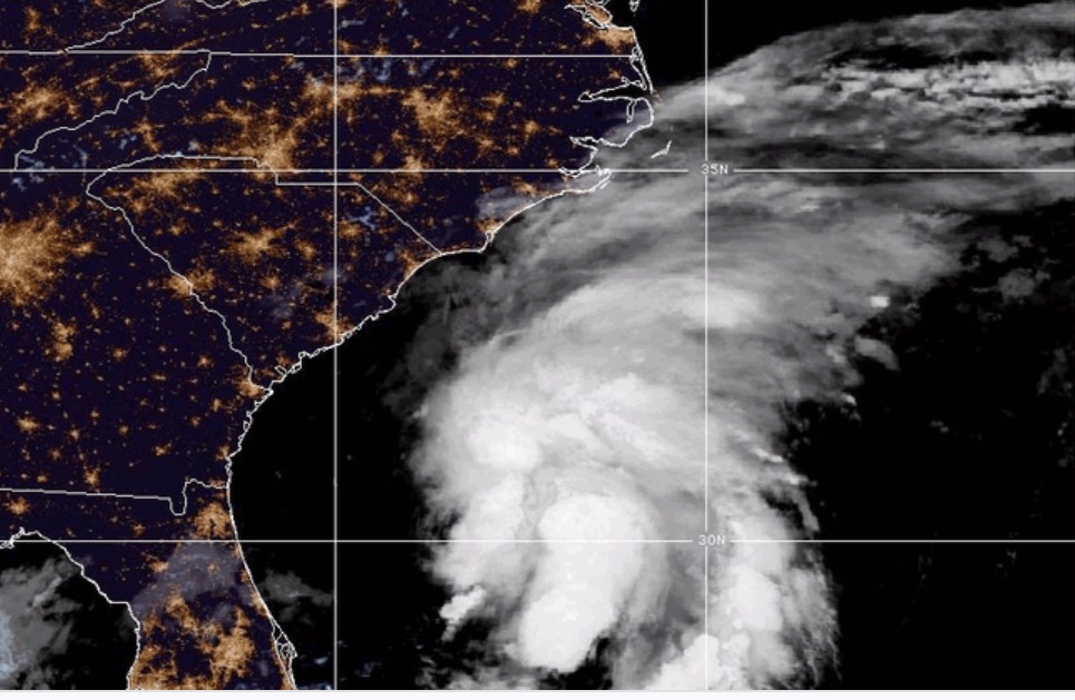
BULLETIN: It’s a girl. TD3 is promoted to Tropical Storm. Chantal is born 150 miles SSE of Charleston. the center of Chantal is expected to move across the coast of South Carolina Sunday morning.
https://www.nhc.noaa.gov/text/refresh/MIATCPAT3+shtml/051151.shtml?
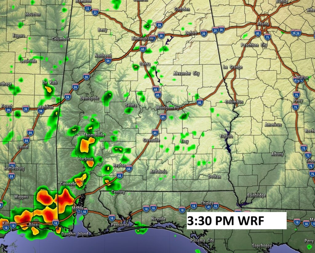
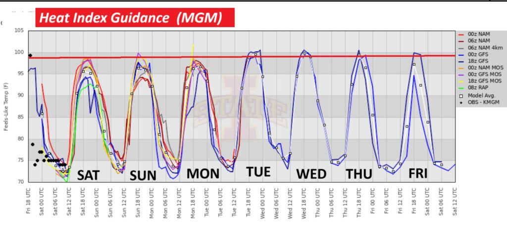
Good morning! Yesterday, on the 4th of July, we had a forecast bust. We were expecting a mostly dry day. We were expecting radar to be quiet. Mother nature had other ideas. A cluster of storms developed. There were several warnings as a weak westward moving disturbance was just enough to fire up a band of heavier storms. There were locally heavy holiday downpours. Today, though and storms should be very isolated in nature. Highs will be in the middle 90’s again today. Today’s rain chance is 20% or less. Widely scattered storms will dot the landscape Sunday. The heat index will be close to 100 each day, but should stay below Heat Index criteria. The number of Scattered PM storms will start to increase Monday through Wednesday. Off the SE coast Tropical Depression is close to Tropical Storm Strength. It should cause heavy rain as it nears the Carolina coast today.
TODAY: Mostly sunny. Hi 95. Rain chance 10% at best. Low tonight 73. Light wind.
The better rain chances will be in Alabama’s costal counties today. Elsewhere showers will be rather isolated in nature.
NEXT FEW DAYS: Widely scattered, Isolated storms return Sunday and scattered storms Monday and Tuesday and Wednesday, perhaps more numerous Thursday. Highs most days will be inn the mid 90’s. Heat index near or above 100. Lows at night in the low to mid 90’s.
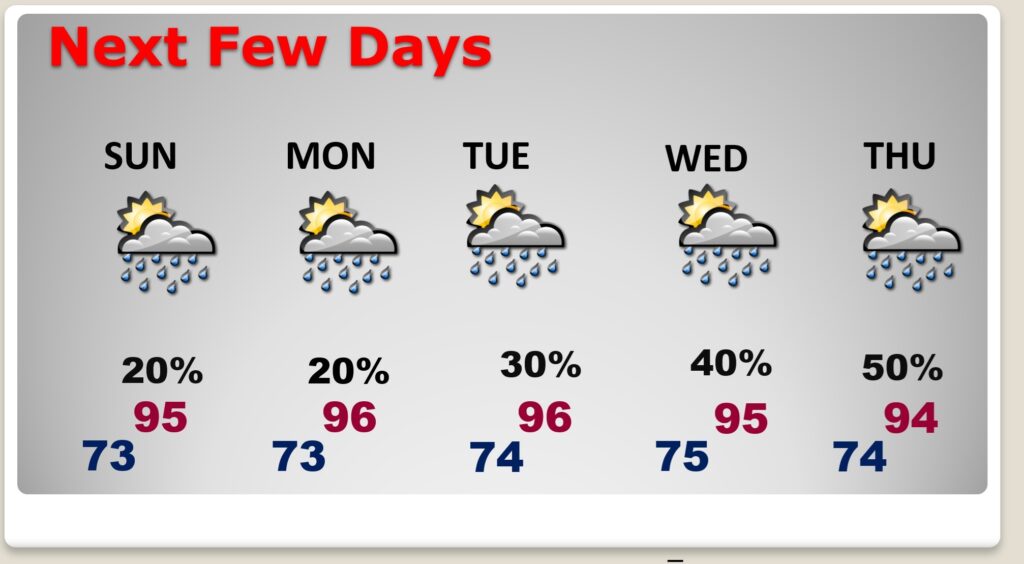
The heat index will be close to 100 each day, but should stay below Heat Index criteria.
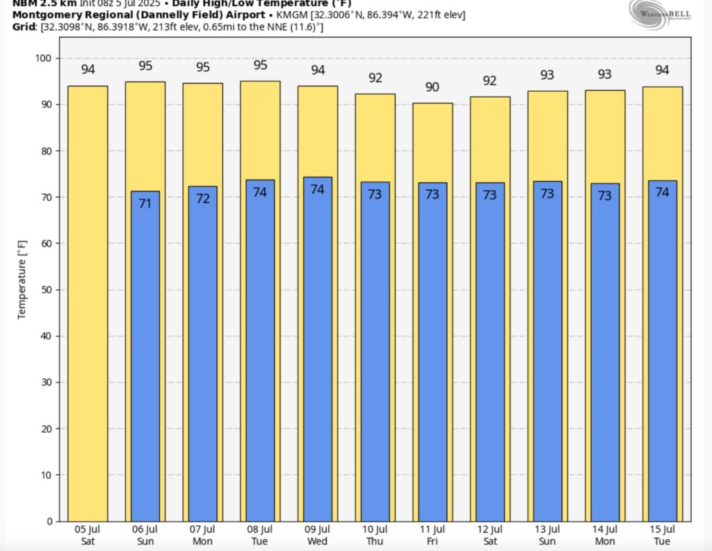
10 Day Model Blend Temperature trend shows some hot days ahead.
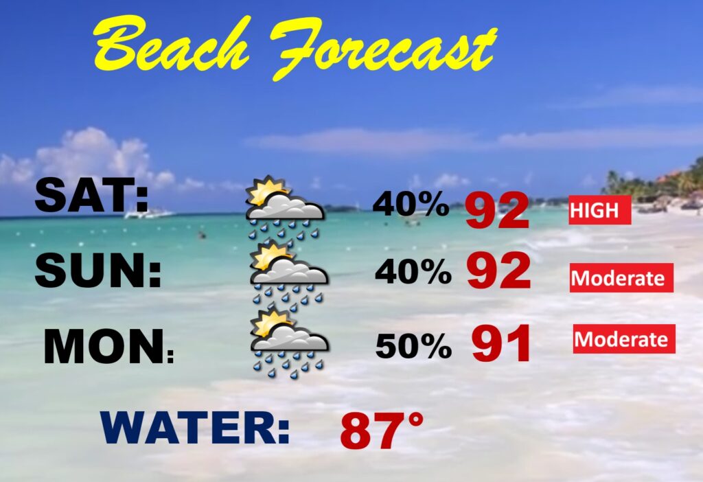
BEACH FORECAST: Random scattered PM storms, but not a wash out. Highs in the lower 90’s. Gulf water 87. Mostly moderate rip current risk.
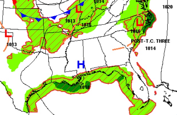
TROPICAL OUTLOOK: Invest 92-L became a Tropical Depression 3 yesterday evening. The depression may be close to tropical storm Chantal strength. For now though, the initial intensity is being held at 35 mph intensity. An Air Force Reserve Reconnaissance mission is scheduled to sample the system later this morning and should provide more in-situ information about the cyclone later today. .DEPRESSION NEARING TROPICAL STORM STRENGTH… …TROPICAL STORM WATCH EXTENDED EASTWARD… As of 5:00 AM EDT the center of Three was located near 30.8, -78.6 with movement NNE at 2 mph. The minimum central pressure was 1010 mb with maximum sustained winds of about 35 mph.
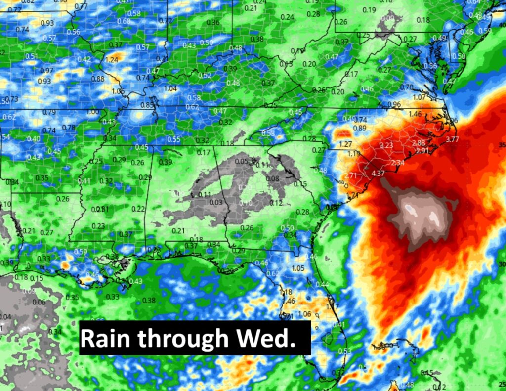
Look at the expected rainfall associated with the tropical system near the Carolinas.
Tragic Fireworks explosion on the dock at Blue Creek on Lake Martin. This was exactly when it happened. Lots of injuries reported and life flights landing.

The next scheduled Blog update and Video Discussion is scheduled for Monday morning in the 4 o’clock hour. Have a nice holiday weekend!
–Rich