
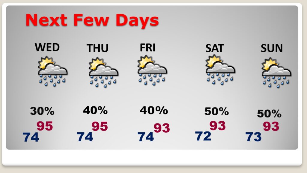
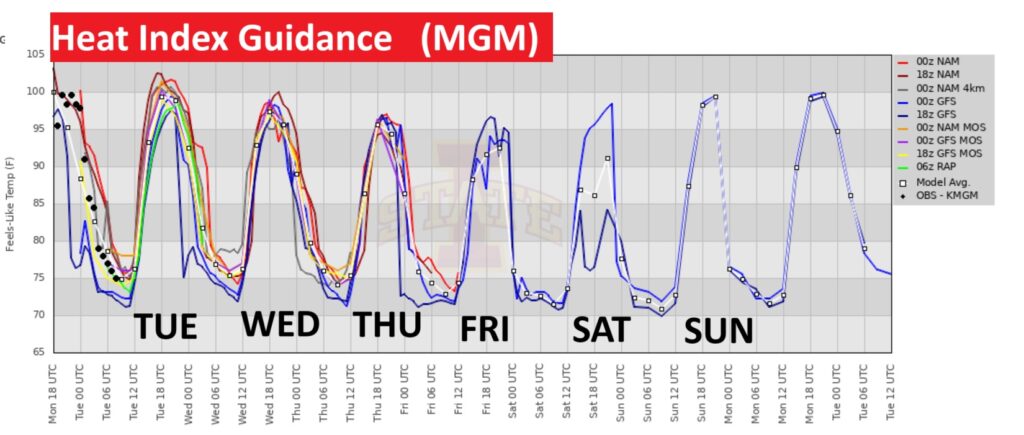
Good morning! Today will be yet another hot and humid July day. Highs will be in the middle 90’s today through Thursday. The heat index may reach it’s highest level today: 100 to 105. Scattered Random downpours will be around each day. But, the number of PM storms will tend to be more numerous by Thursday through Saturday, most numerous in the afternoon and evening hours. Locally heavy rainfall in spots. Here’s a brief video forecast discussion
TODAY: Mostly sunny. Hi 95. Heat index 100 to 105. Scattered Random mostly afternoon & evening storms. Low tonight 74. Light wind.
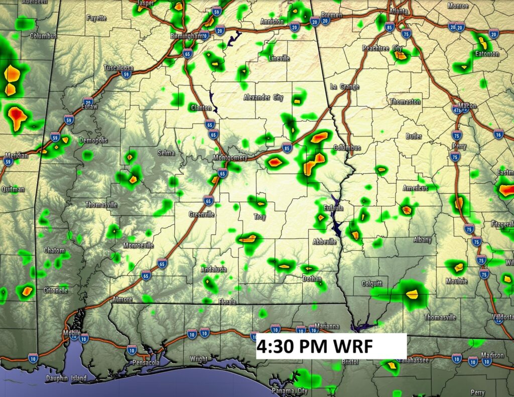
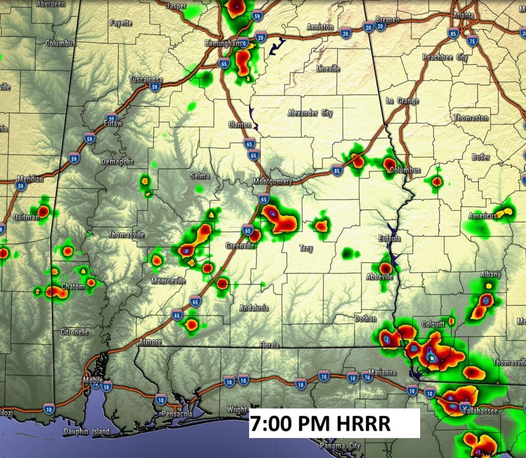
FUTURE RADAR: Spotty storms will be a little more numerous today, but not much.
NEXT FEW DAYS: Scattered random mostly afternoon and evening storm, perhaps more numerous by Thursday, Friday and Saturday . Highs most days will be inn the mid 90’s. Heat index near or above 100. Lows at night in the low to mid 70’s.
The heat index will be highest today: 100 to 105.
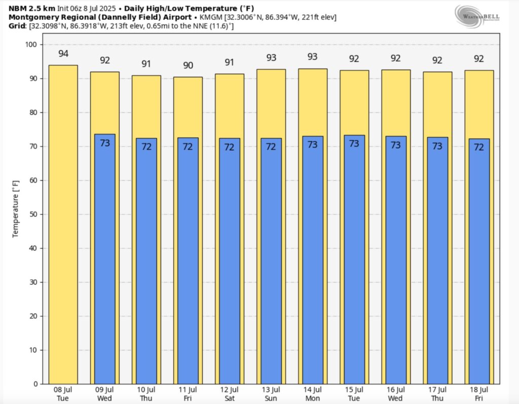
10 Day Model Blend Temperature trend. Little day to day change.
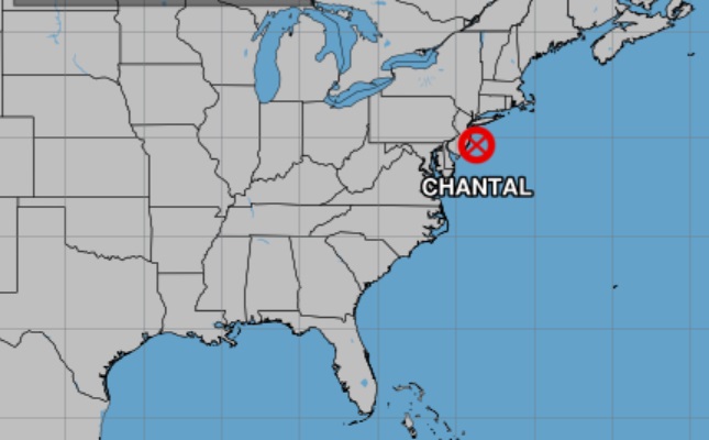
TROPICAL OUTLOOK: Post Tropical Depression Chantal, located off the New Jersey coast. The rest of the Atlantic basin remains quiet.
Thanks for reading the blog. Today everything is normal including LIVE on the Radio of NewsTalk 93.1 WACV. There will be another video forecast discussion and Blog Update in the 4 o’clock hours tomorrow morning. You can always find my forecast updates hourly on the 8 station Bluewater family of stations every day of the year.
–Rich