
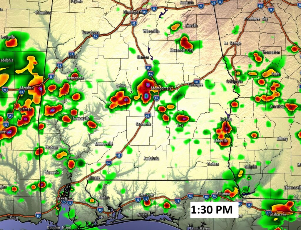
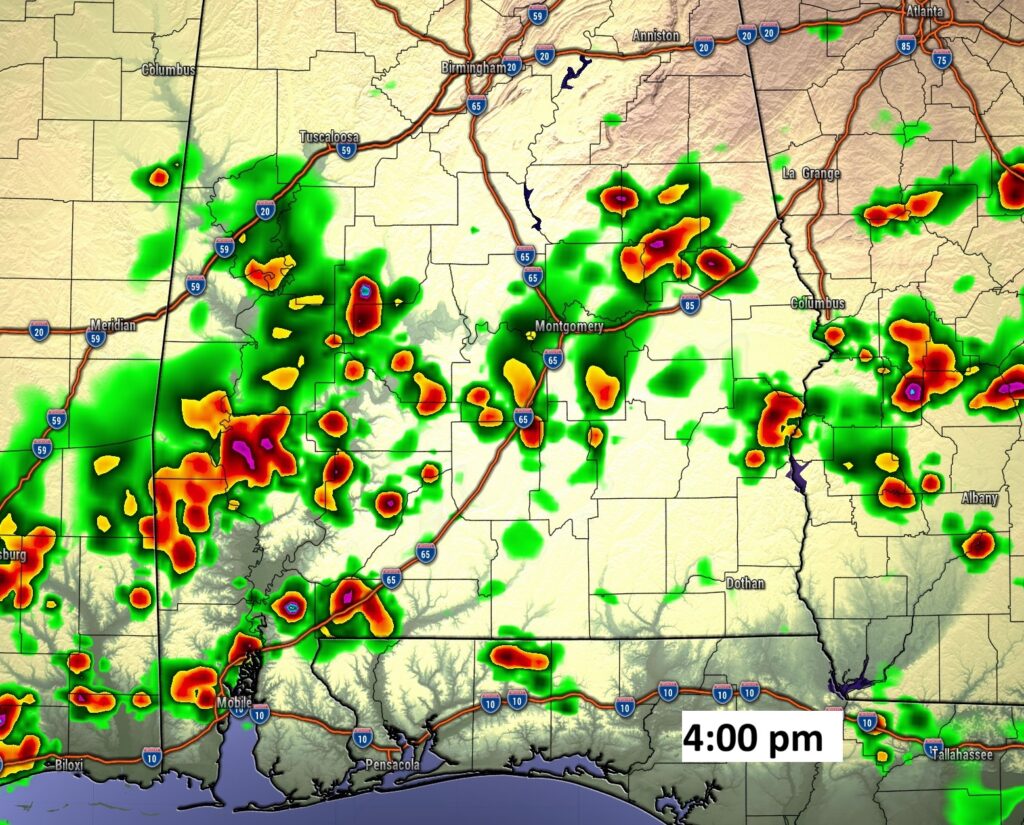
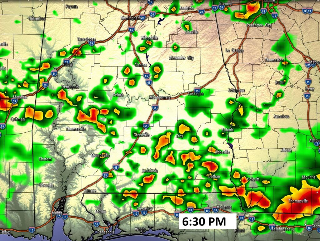
Good morning! Radar will be quite colorful and active today. PM storms will become much more numerous today, Friday and Saturday. The storms will be random. Kind of a feast or famine pattern. The heat and humidity is still locked in for several days. Highs will reach the low to mid 90’s. The Heat index, each day, will reach the 100 to 105 level. Lows at night in the muggy low to mid 70’s. Meanwhile, the tropics remain quiet for now. Here’s a brief video forecast discussion.
TODAY: Sun/cloud mix. Hi 94. Heat index 100 to 105. Random Scattered to numerous showers & storms. Low tonight 74. Light wind.
FULL BUCK MOON: Moonset this morning 5:12 AM. Full moon at 3:37PM. Moonrise this evening 8:15 PM. Moonset tomorrow morning 6:15 AM.

FUTURE RADAR: Radar will be quite colorful and active today. PM storms will become much more numerous.
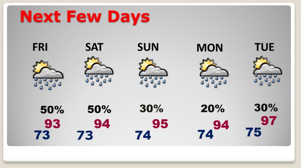
NEXT FEW DAYS: Scattered to numerous PM showers and storms, particularly Friday and Saturday. Highs most days will be in the low to mid 90’s. Heat index near or above 100. Lows at night in the low to mid 70’s.
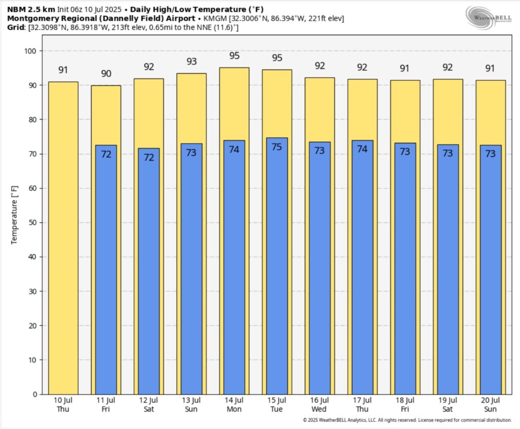
10 Day Model Blend Temperature trend. Intense heat will continue. Look at next week.
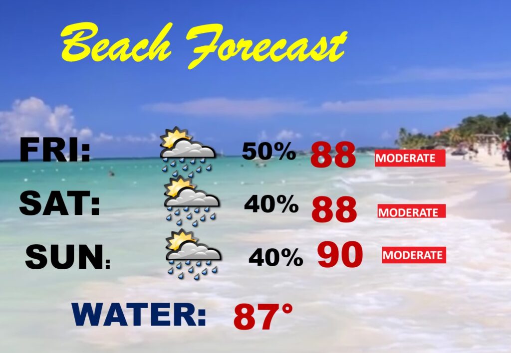
BEACH OUTLOOK: It’s a pretty routine July weekend forecast. Spotty scattered random storms. Dry much of the time. Moderate rip current risk. Water temperature in the upper 80’s.
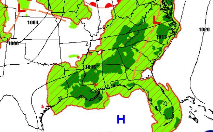
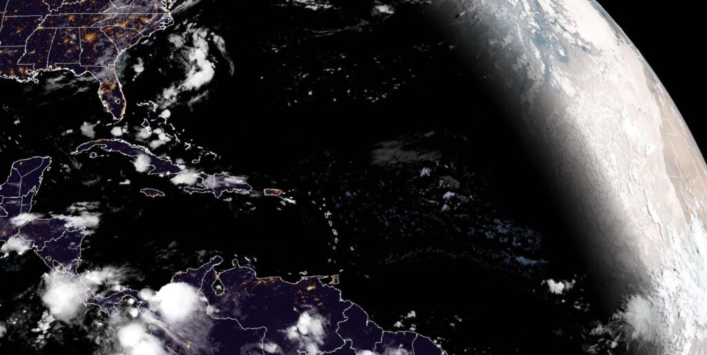
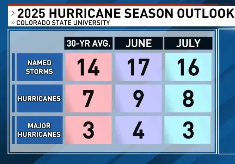
TROPICAL OUTLOOK: The Tropical Atlantic basin continues to look quiet for now. Hostile atmospheric dynamics continue to stifle tropical development.
Meanwhile, the Tropical experts at Colorado State University have dialed back their Hurricane Season Forecast just a little bit.
Thanks for reading the blog. Today everything is normal including LIVE on the Radio of NewsTalk 93.1 WACV. There will be another video forecast discussion and Blog Update in the 4 o’clock hours tomorrow morning. You can always find my forecast updates hourly on the 8 station Bluewater family of stations every day of the year.
–Rich