
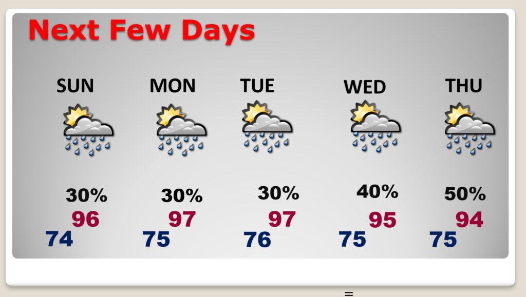
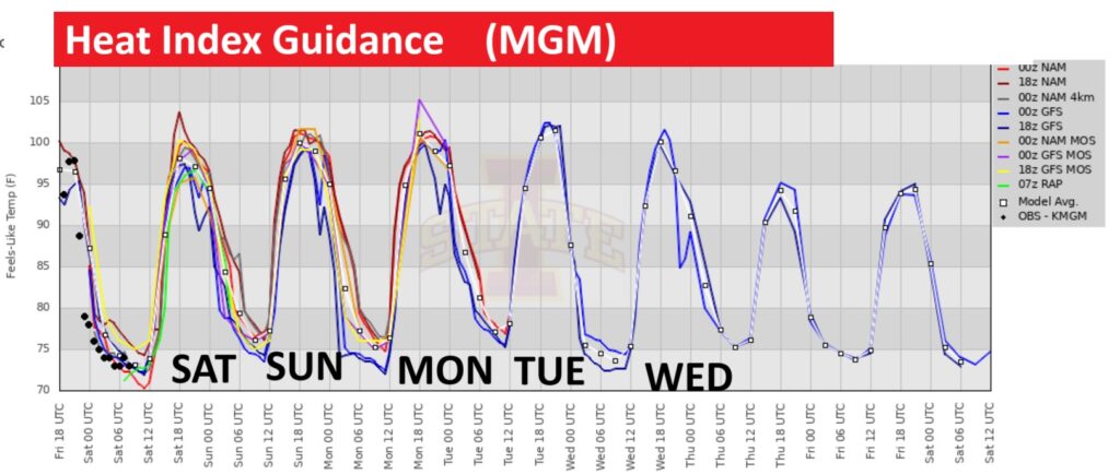
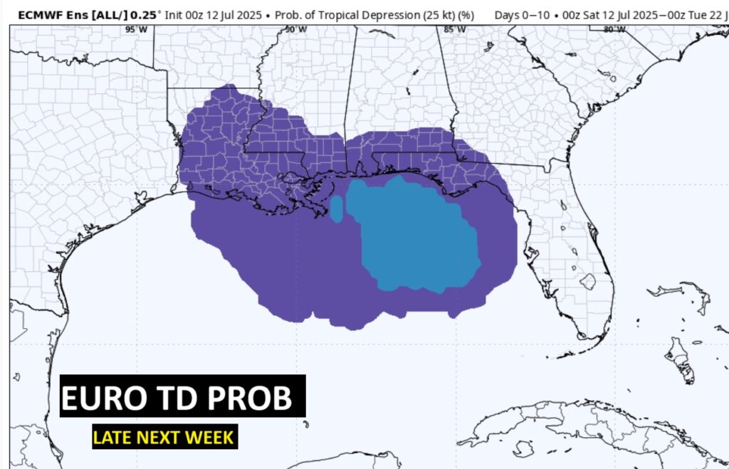
Good morning! Hot and humid with lots of sunshine. Radar may be a little more routine today, as far as the number of PM storms. Scattered PM showers and storms will be around Sunday through Thursday. High in the mid 90’s Sunday, and perhaps upper 90’s Monday and Tuesday. The Heat Index will be near or above the 105 Danger Level. It’ll be close to Heat Advisory criteria. However Late next week, we’ll be watching the northern Gulf for a possible spin up.
TODAY: Sun/cloud mix. Hi mid 90’s. Heat index 102-106 Random Scattered PM showers & storms. Low tonight 74. Light wind.
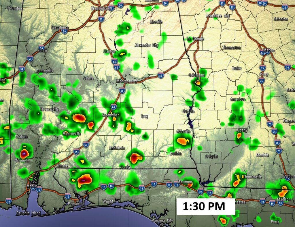
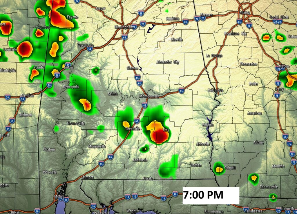
FUTURE RADAR: A little more routine on Future Radar today.
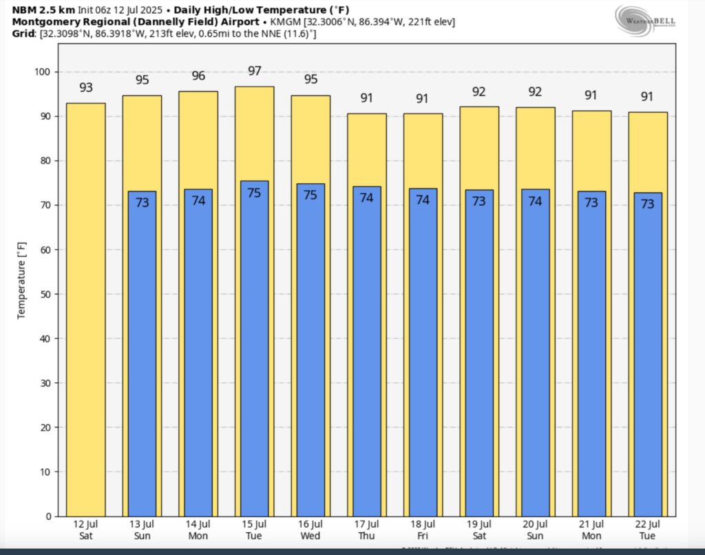
NEXT FEW DAYS: Scattered PM showers and storms Sunday through Thursday. High mid 90’s Sunday and perhaps upper 90’s Monday and Tuesday. The Heat Index will be near or above the 105 Danger Level. Close to Heat Advisory criteria. Lows in the muggy 70’s at night.
The HEAT INDEX will be near or above the 105 danger range.
10 Day Model Blend Temperature trend. The heat peaks early next week.
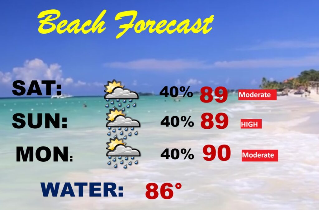
BEACH OUTLOOK: Pretty routine July weekend forecast. Spotty scattered random storms. Dry much of the time. Moderate rip current risk. Water temperature in the upper 80’s.
TROPICAL OUTLOOK: The Tropical Atlantic basin continues to look quiet for now. However, late next week, we’ll be watching the northern Gulf for a possible spin up. Take a look at the EURO model.
The next scheduled Blog update and Video Discussion is scheduled for Monday morning in the 4 o’clock hour. Have a nice weekend!
–Rich