
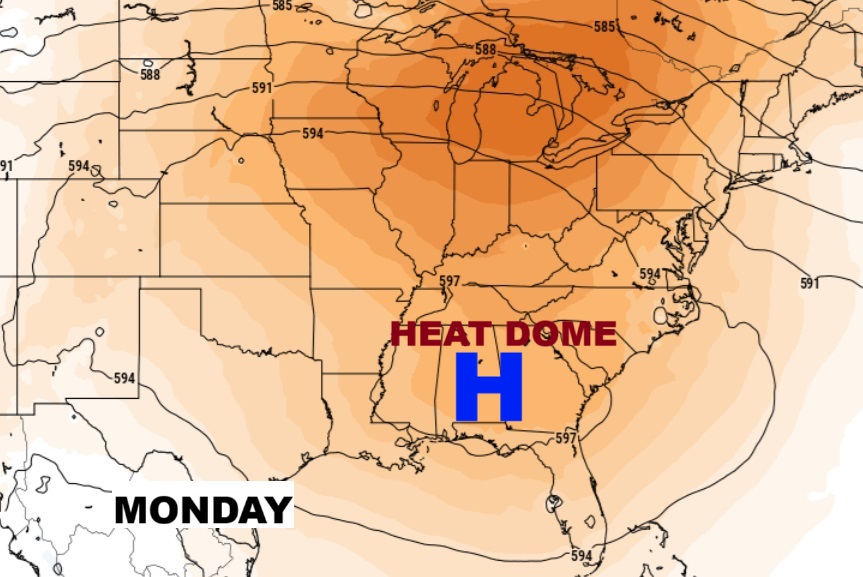
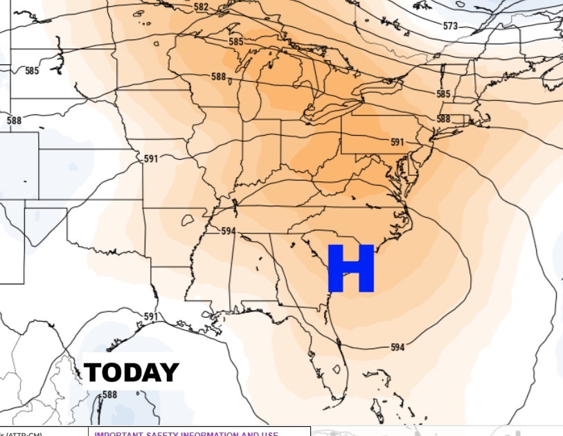
Good morning! Radar will be rather active again today. Scattered random storms. Sunshine will be limited at times. Highs will be in the low to mid 90’s. Over the weekend the number of storms will start to thin out and become widely scattered. That massive Heat Dome Upper High centered near the SE coast today will migrate westward to right over Alabama. This will promote the highest temperatures of the summer so far and the most dangerous heat indices so far. Here’s my brief forecast discussion.
TODAY: Sun/cloud mix. High near 93. Heat index100+. Random Scattered PM showers & Storms. Low tonight 75.
The center of the massive Heat Dome remains is briefly shifting eastward through the weekend. It will migrate westward again early next week.
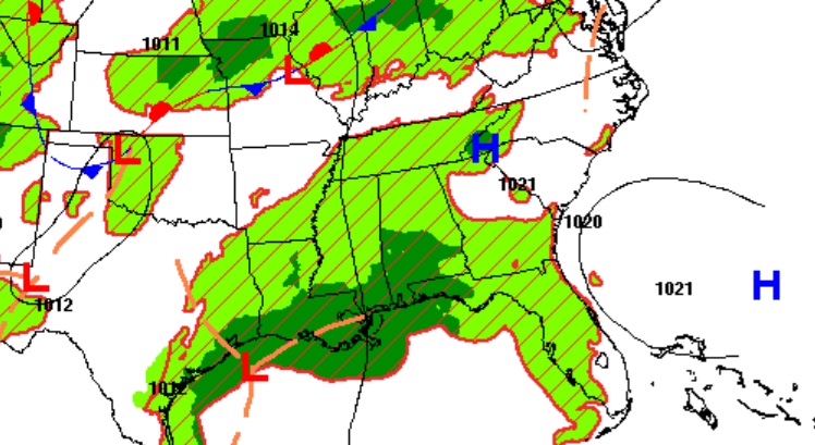
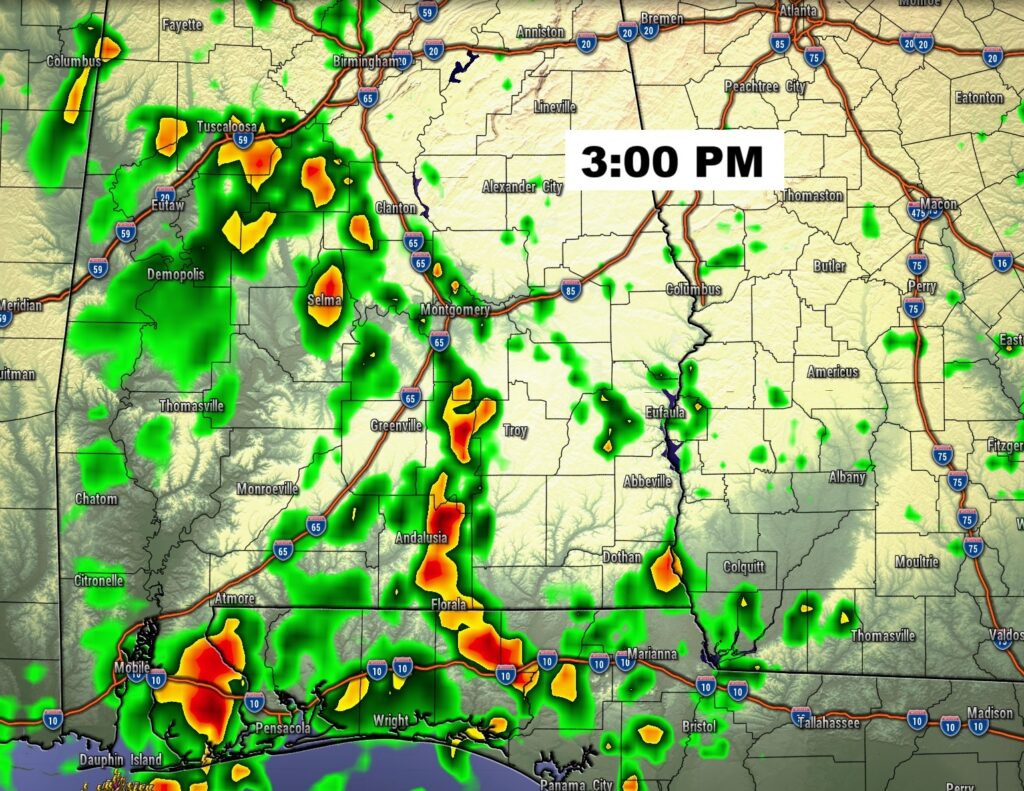
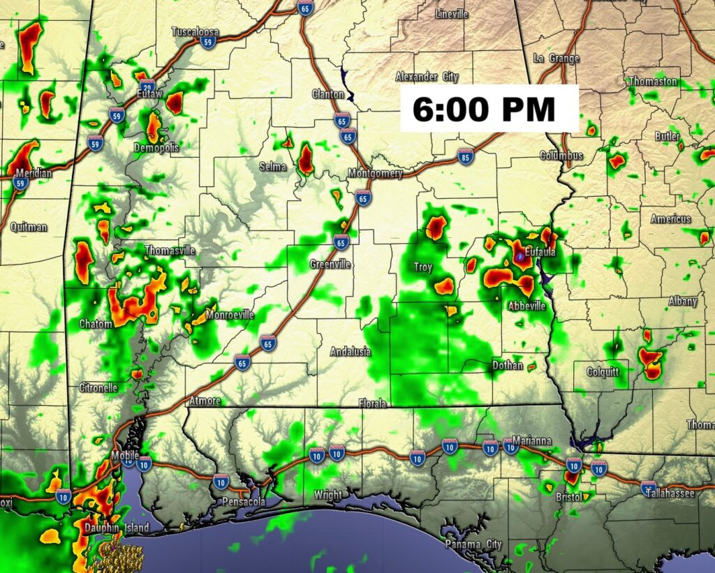
FUTURE RADAR: Radar will be rather active again today. Scattered random storms.
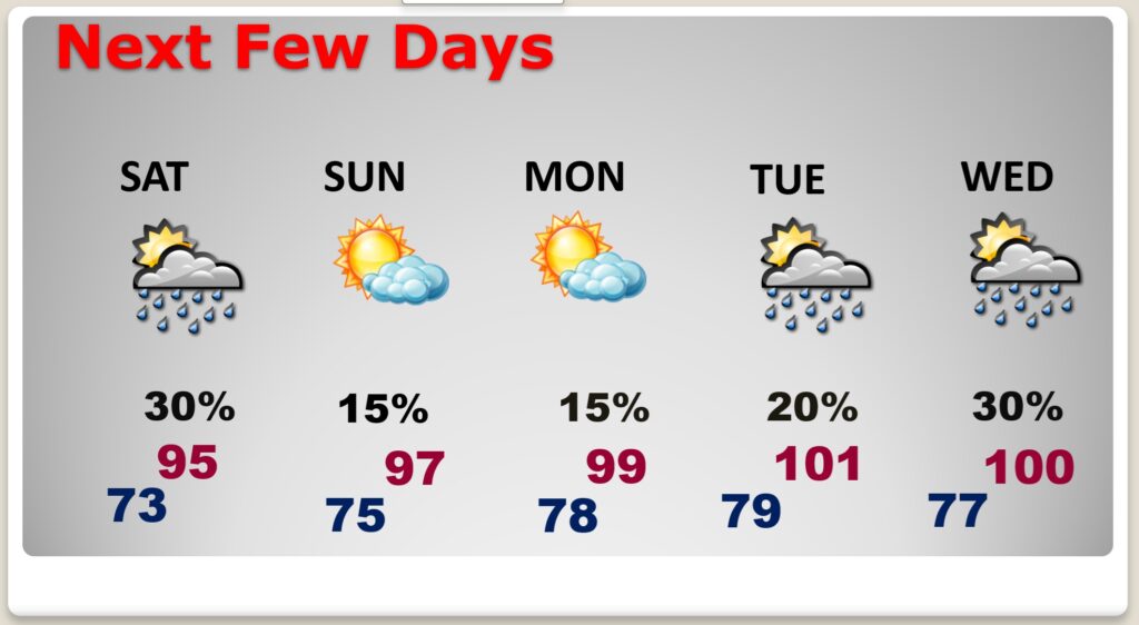
NEXT FEW DAYS. Expect low to mid 90’s through Sunday, and upper 90’s to near 100 Monday through Wednesday. Low at night in the muggy mid 70’s. Very little day to day change. Scattered random mostly afternoon and evening storms. Storms will become very isolated Sunday through Tuesday.
The Heat index will be in extremely dangerous territory, especially Sunday through Tuesday.
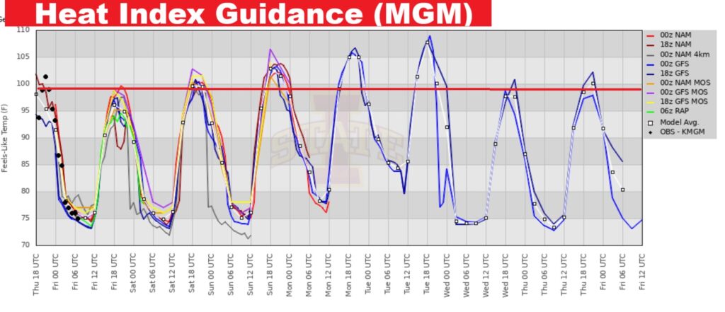
Here’s the 10 Day Model Blend Temperature Trend. The hottest days will be early next week. No relief in sight.

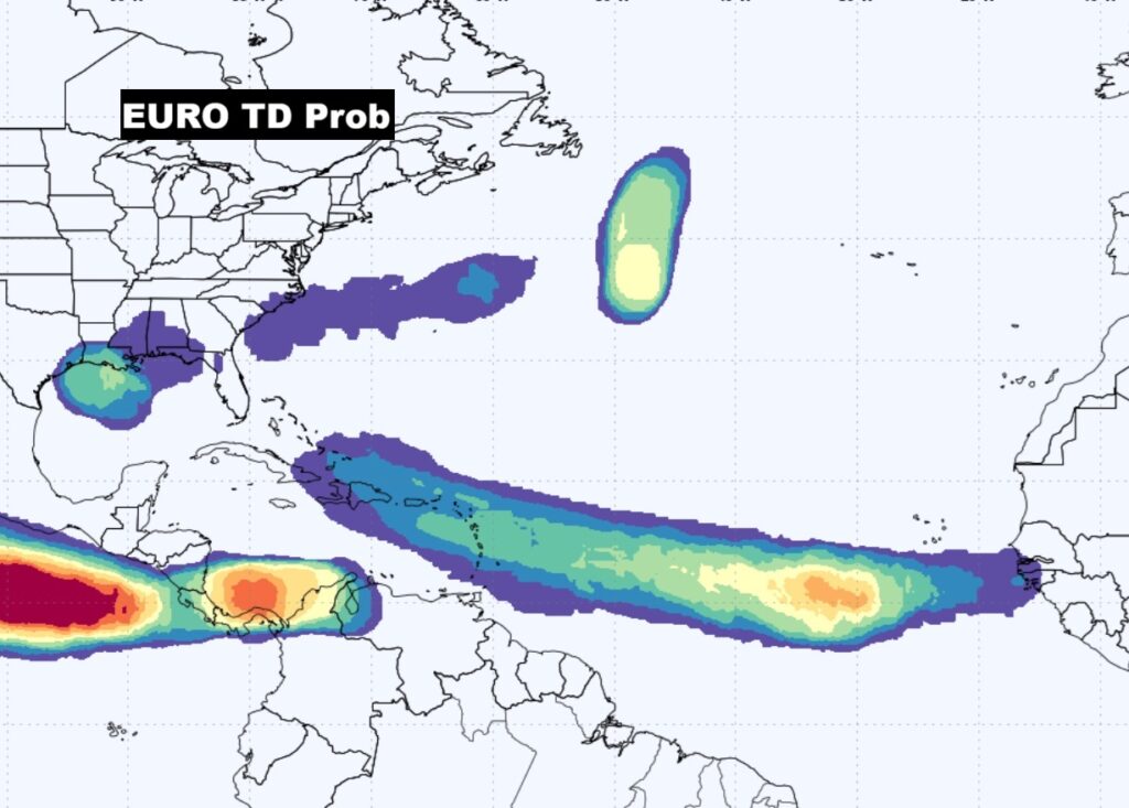
TROPICAL OUTLOOK: NHC is still monitoring the tropical disturbance in the NW Gulf with a low 10% risk of tropical development.

Elsewhere, The tropics are coming alive. The EURO is highlighting several areas to watch across the Atlantic basin, especially in the Tropical Atlantic MDR.
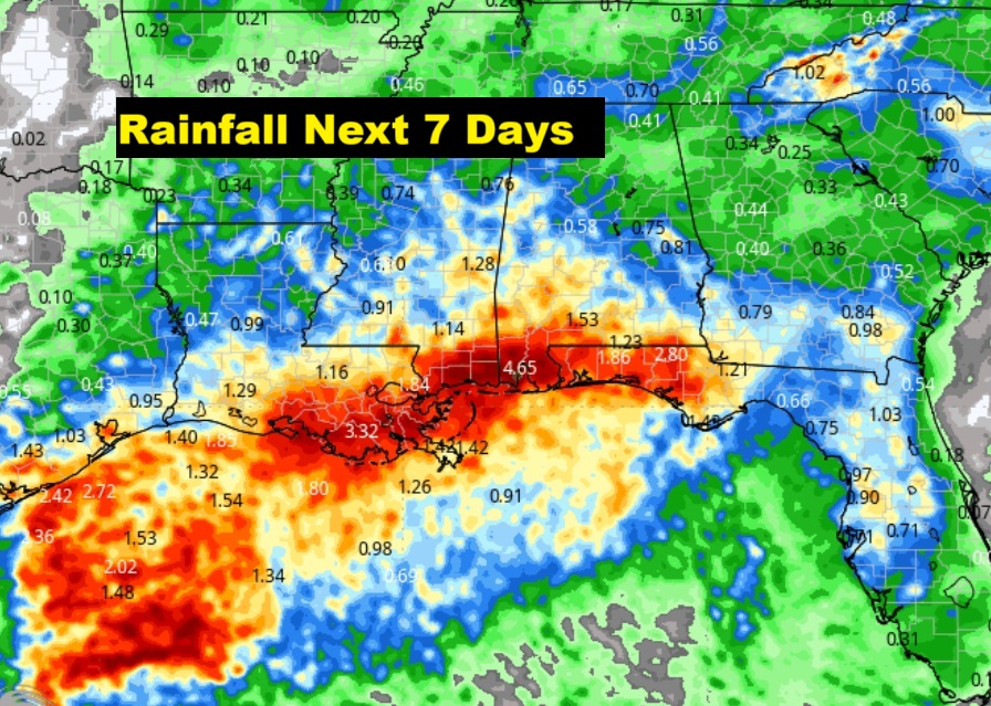
The heaviest rainfall will stay near and south of the coast.
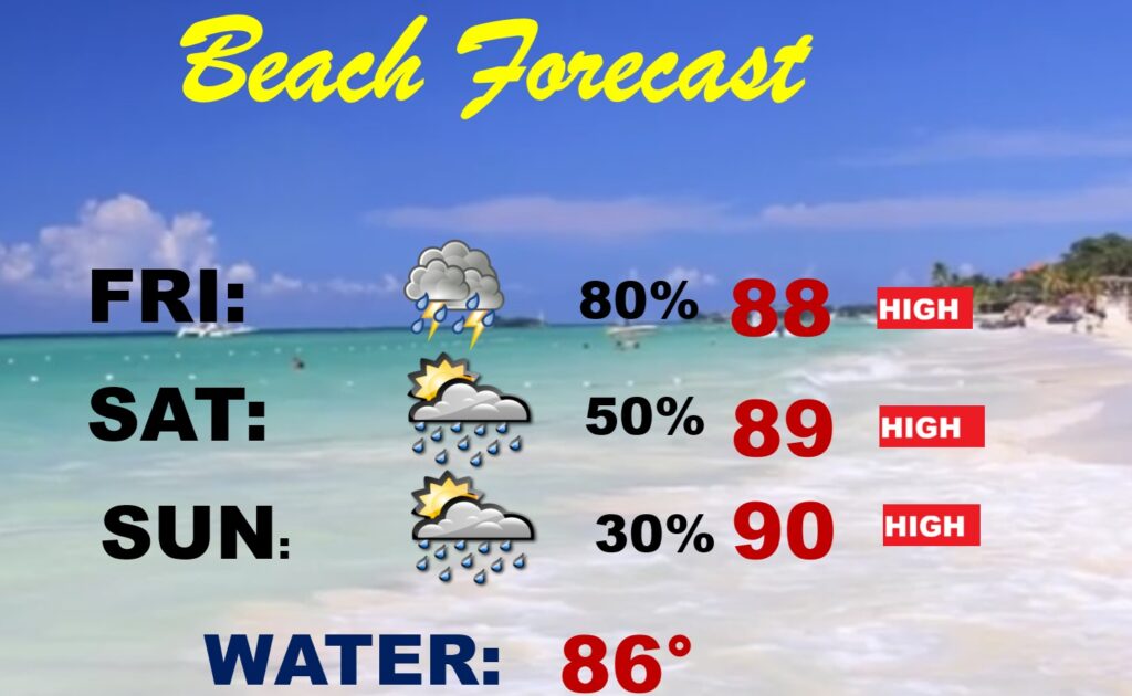
BEACH OUTLOOK: By far, the highest rainfall probability is today. The rain probability by Saturday and Sunday is more routine.Highs in the upper 80’s to near 90. High rip current risk, especially from Destin east to Panama City.
Thanks for reading the blog. Today everything is normal including LIVE on the Radio of NewsTalk 93.1 WACV. There will be another video forecast discussion and Blog Update in the 4 o’clock hours tomorrow morning. You can always find my forecast updates hourly on the 8 station Bluewater family of stations every day of the year.
–Rich