
Good morning! Say goodbye to scorching heat. Relief is on the way. Much more reasonable temperatures are in our future.
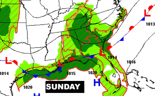
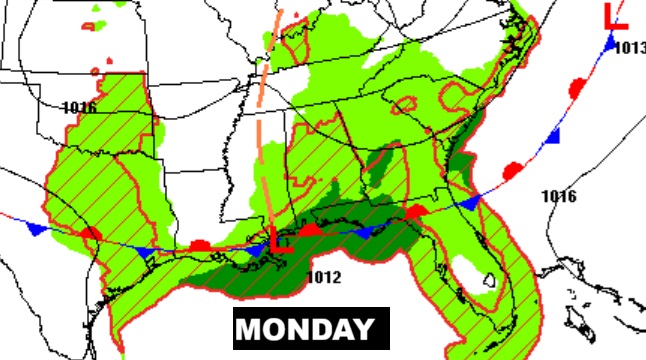
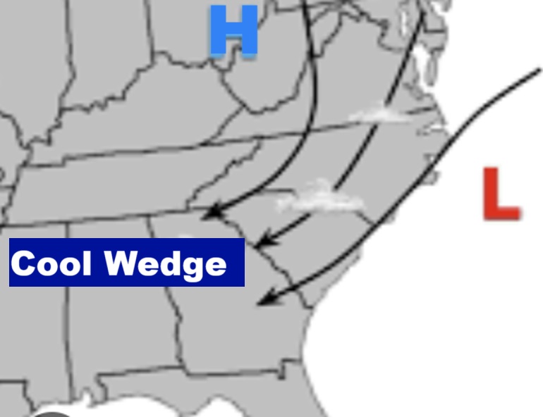
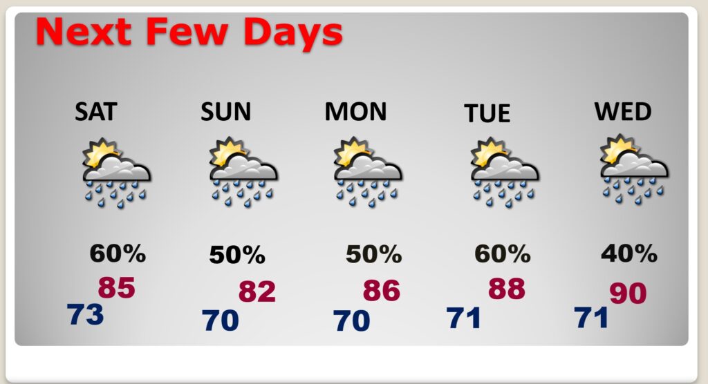
The front that went through yesterday has stalled near the coast. Waves of low pressure will move along the front. Expect more Scattered to numerous random storms for the next few days. Meanwhile, a “cool wedge” will allow some nicer cooler air to migrate into the state. Highs will only be in the 80’s Sunday through the middle of next week.
TODAY: Sunshine will be limited. High near 91. Random Scattered to numerous showers and thunderstorms today. Low tonight lower 70’s.
The front that moved southward through the state yesterday has now stalled near the Gulf Coast. Waves of low pressure will move along the front, keeping the risk of scattered to numerous storms in the forecast each day.

COOL WEDGE: The combination of high pressure of high pressure along the east coast and low pressure off the coast will create a northeasterly wind flow which will allow some much cooler air to migrate down the Appalachian mountain chain into Alabama.
FUTURE RADAR: Random storms will be rather numerous at times.
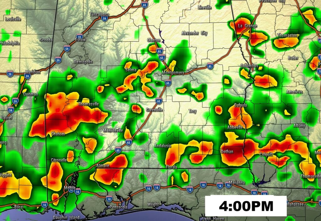
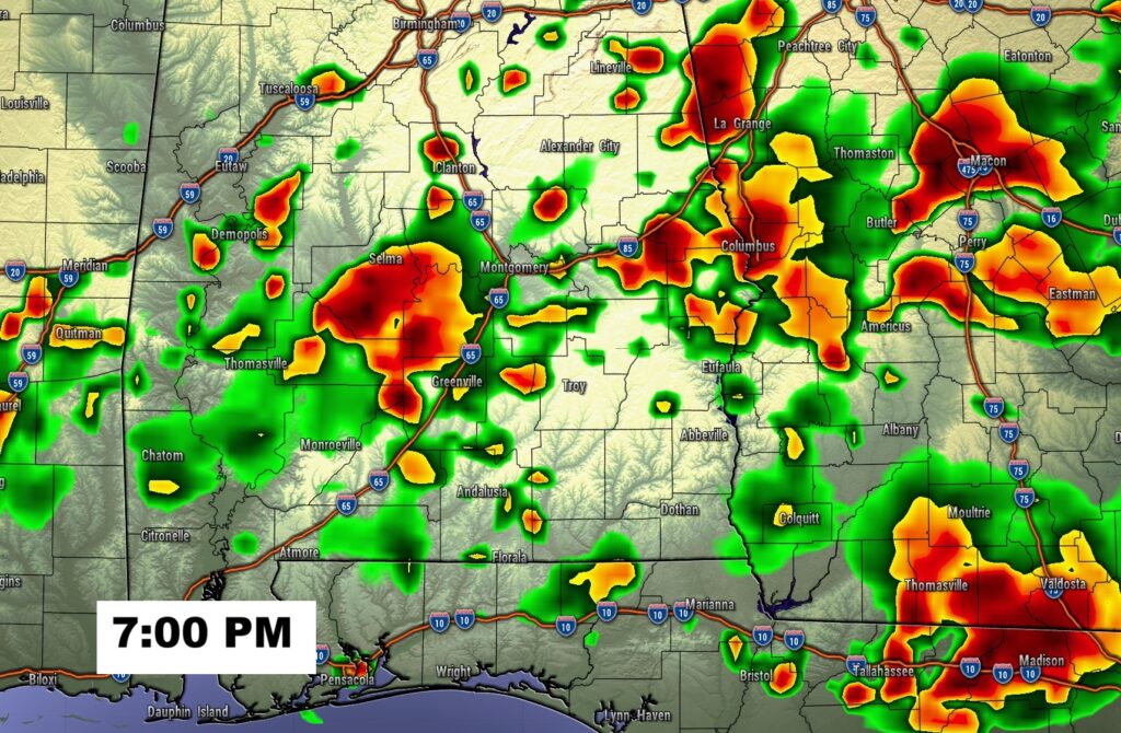
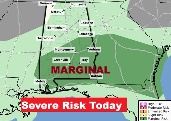
SPC has a Marginal Severe Risk for much of the southern half of the state. Some storms could be severe with damaging wind gusts.
NEXT FEW DAYS: Scattered to numerous random storms are back in forecast each day through the weekend. Temperatures will start to be more reasonable over the weekend. Mid 80’s by Sunday. Lower 80’s by Monday. A nice change.
Here’s the 10 Day Model Blend Temperature Trend. Much more reasonable temperatures ahead.

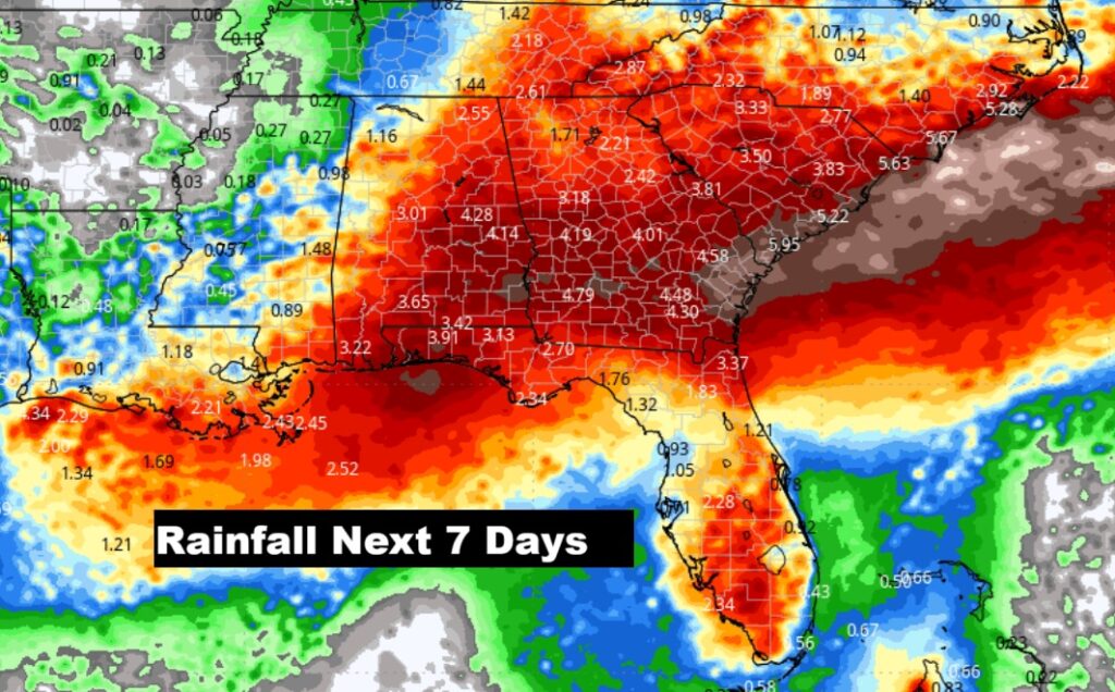
Wet times across the southeast US over the next few days.
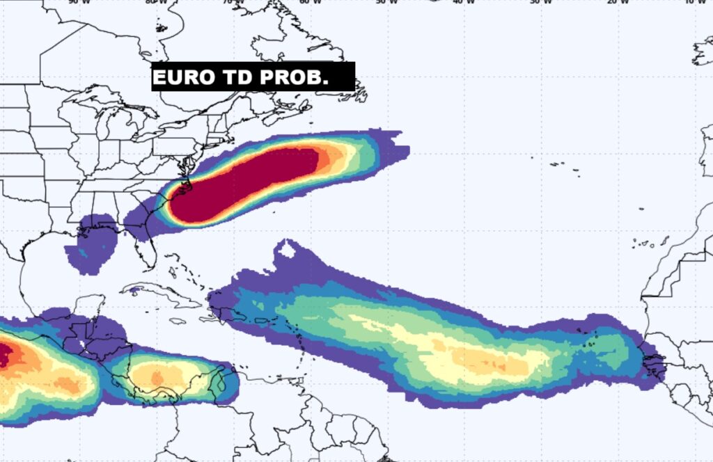
TROPICAL OUTLOOK: NHC is not tracking any systems right now, but the EURO model show multiple areas that need to be monitored. In fact the model is screaming about future development off the US East Coast, and another area in the northern Gulf along that stalled front. And, yet another area in the Tropical Atlantic.
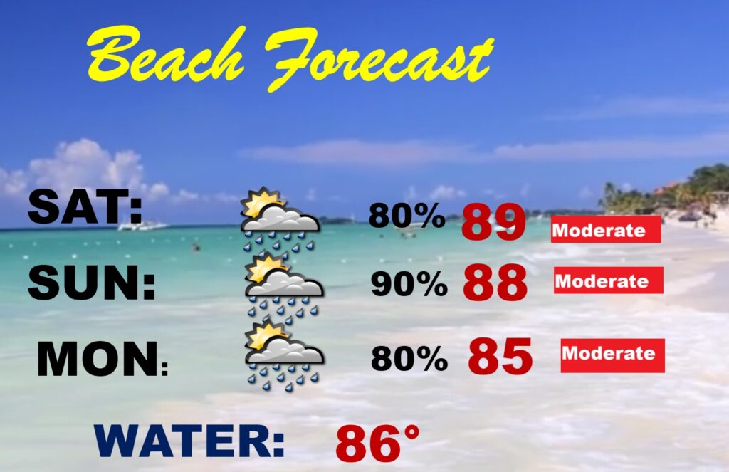
BEACH OUTLOOK: A stalled front near the coast will promote scattered showers and storms. Gulf water temperature is 87. Moderate Rip current risk.
The next scheduled Blog update and Video Discussion is scheduled for Monday morning in the 4 o’clock hour. Have a nice weekend!
–Rich