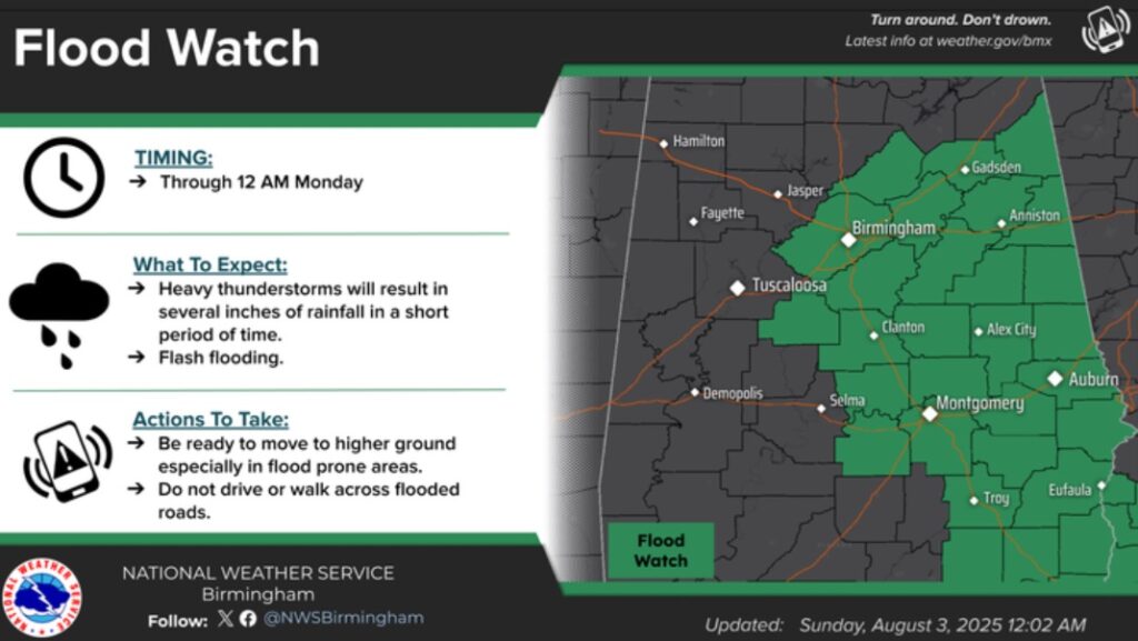
Be prepared for more scattered to numerous Tropical Downpours today. A Flash Flood Watch is in effect east of a Jasper/Selma/Greenville line. The watch extends till Midnight, but it might have to be extended for East Alabama on Monday. Due to the slow movement of the thunderstorms and the intensity of the tropical downpours, some flooding is once again likely in spots. I had .91” in East Montgomery yesterday. Meanwhile, we are getting a nice temperature break. Today will be the first day we fall short of 90 degrees since July 2nd. Today’s High 86. Low tonight 69. High Monday 81. What a nice change! I’ll have a complete forecast video discussion and Blog update in the 4 o’clock hour tomorrow morning. Meanwhile, our Weather App will keep you on top of the action today. It’s FREE in the App store. Just search Rich Thomas Weather.
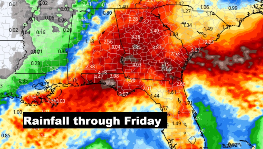
Wet times ahead. Here’s the expected rainfall through Friday.
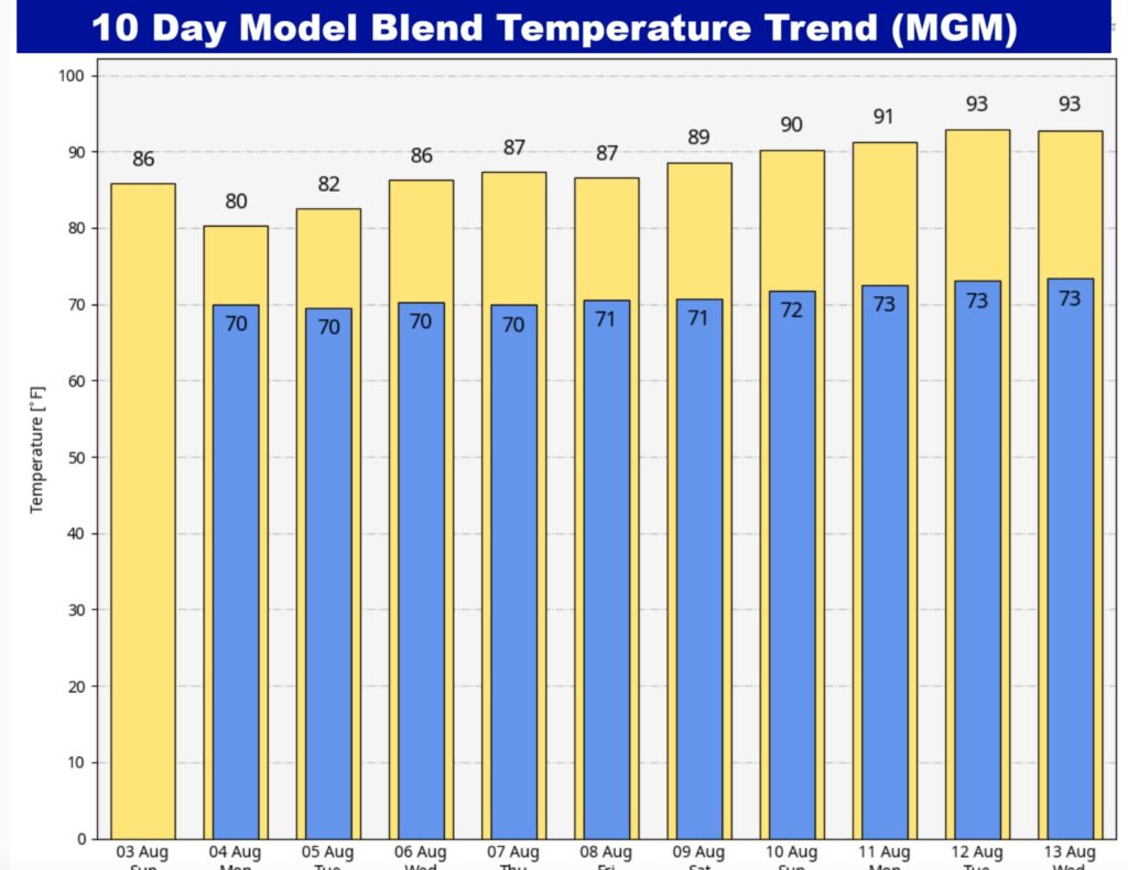
Besides the tropical downpours, temperatures are the other big story. Today will be the first day we fall short of 90 degrees since July 2nd. Today’s High 86. Low tonight 69. High Monday 81. Low 80’s Tuesday. We may have highs below 90 for each of the next 7 days.
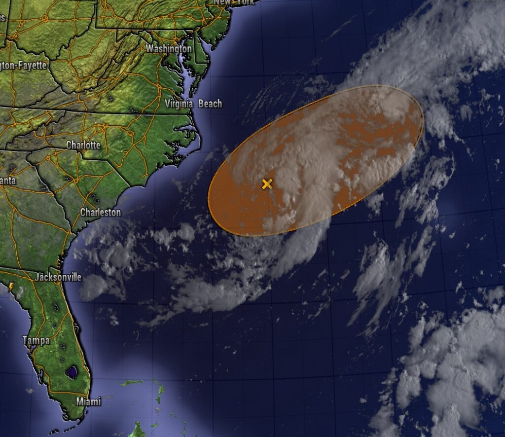
Watching Invest 95-L. A non-tropical area of low pressure located along a frontal boundary off the coast of North Carolina is producing disorganized showers and thunderstorms. Environmental conditions are marginally conducive (50% chance) for this system to become a tropical or subtropical depression or storm today or on Monday while it moves ENE at about 10 mph, away from the coast of North Carolina.