
Good morning! After that record cool, comfortable start to our week. Alabama is warming up again. High 88-90 today and Friday, but nothing crazy on the humidity. Over the weekend we’ll be near 90. A little hotter next week. The chance of you running into random shower or storm today or Friday is 20% or less., A little better by Sunday. Scattered Storms. Here’s my brief video forecast discussion.
CLIMATE: Monday’s high 75. Tuesday 81. Yesterday hi/lo 88/73. Normal 94/72. No Rain.
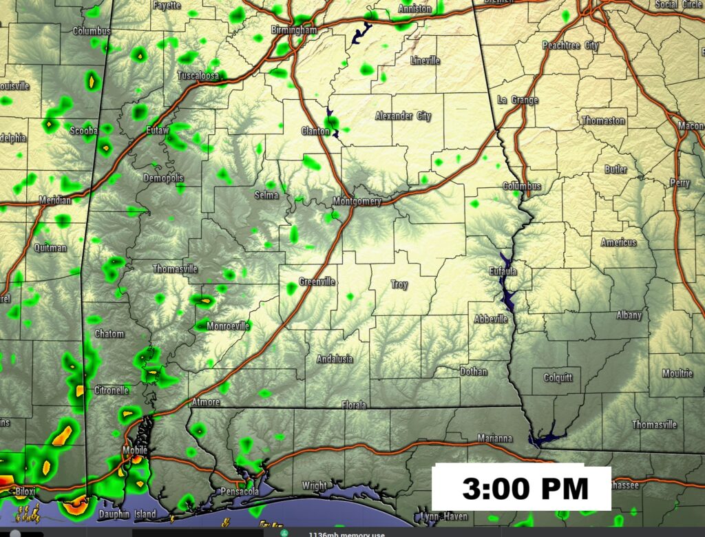
TODAY: Mostly sunny. High near 88-90. Random Widely Scattered showers and thunderstorms today. Low tonight 71.
The risk of you getting wet in your town today is very small, but never zero in the summer.
NEXT FEW DAYS: Relatively small rain chance Friday and Saturday. A little higher by Sunday. Highs near 90 over the weekend and lower 90’s by early next week.

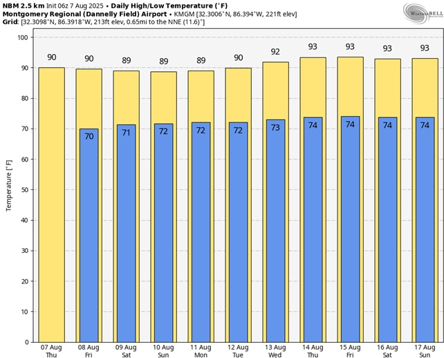
Here’s the 10 Day Model Blend Temperature Trend. It will slowly start to heat up again starting this weekend.
TROPICAL OUTLOOK:
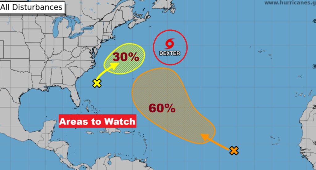
NHC: That area to watch well off the SE coast, now has a 30% chance of development. And, the other one in the Tropical Atlantic with a 60 chance of development in the next 7 days. Dexter is done.
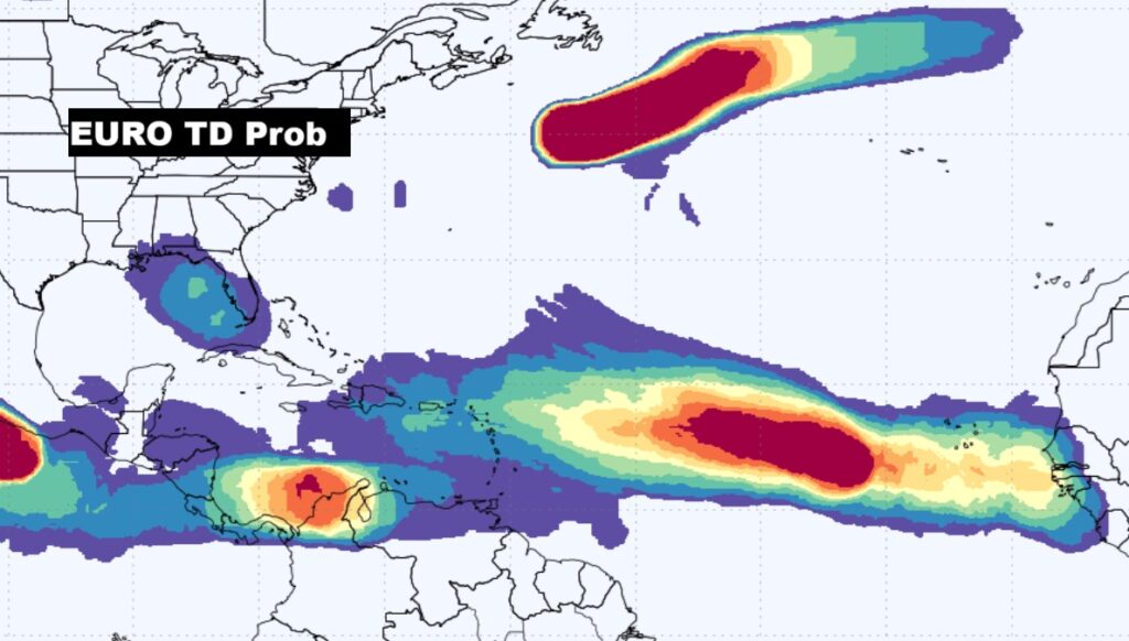
Here’s the EURO Tropical Depression Outlook for the next 7 days. Very likely development in the Atlantic MDR. It’s also signaling we need to watch the NE Gulf.
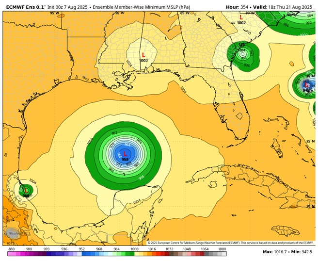
Hmmmmmmm. Take a look at the EURO Ensemble run on 8/21. Interesting.
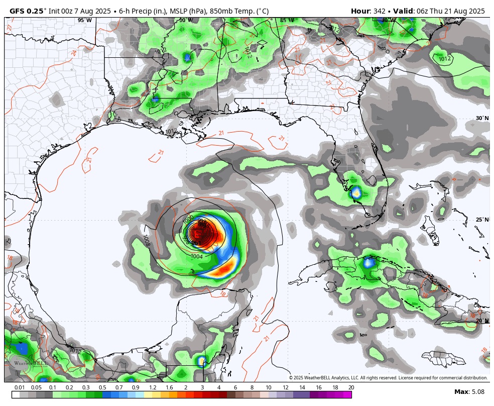
The American GFS shows something similar on Wednesday night August 20th. Still though, the is 13 days out.
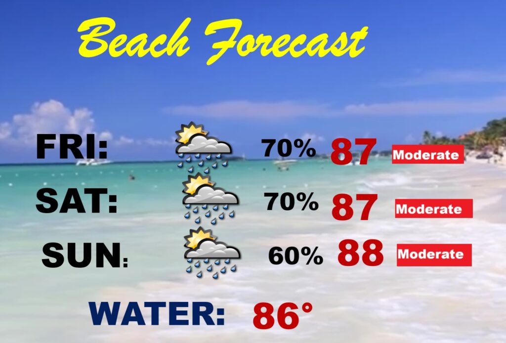
BEACH OUTLOOK: That stubborn stalled front will be the focus for higher than normal rain chances at the Beach this weekend.
Thanks for reading the blog. Today everything is normal including LIVE on the Radio of NewsTalk 93.1 WACV. There will be another video forecast discussion and Blog Update in the 4 o’clock hours tomorrow morning. You can always find my forecast updates hourly on the 8 station Bluewater family of stations every day of the year.
–Rich