
Good morning! Radar will be quite active today and tomorrow. A Tropical Low off the northern Gulf Coast is influencing our forecast. It is responsible for our increase is showers and storms today and tomorrow. Scattered to numerous, random PM showers and storms. Storms will thin out a bit Thursday and especially Friday through Saturday. Highs upper 80’s to near 90 through mid-week. Perhaps middle 90s toward the end of the week. Tropical Storm Erin is moving westward in the Tropical Atlantic. Erin could become a Hurricane by Thursday and maybe a Major Hurricane by Saturday. Erin is likely to turn and probably miss the United States. Here’s my brief video forecast discussion.
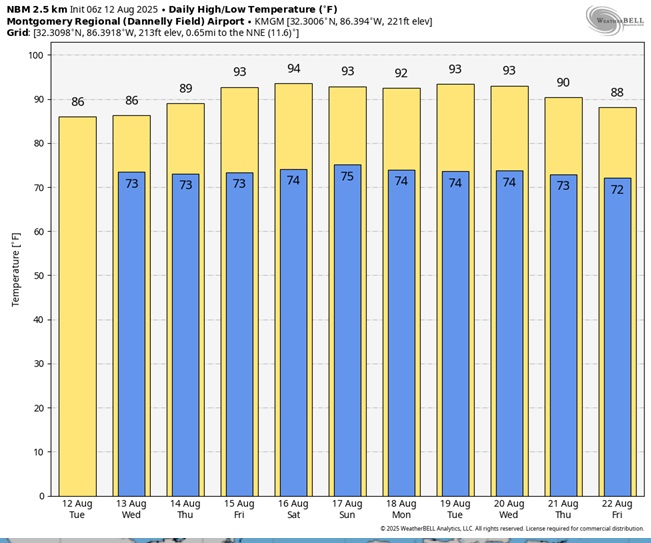
CLIMATE: Yesterdays hi/lo 89 and 75. Normal: 94/72. Rainfall at MGM: .19”
TODAY: Limited sunshine. High 87-90. Random Scattered showers to numerous showers and thunderstorms, mainly PM today. Tropical Downpours. Low tonight 74
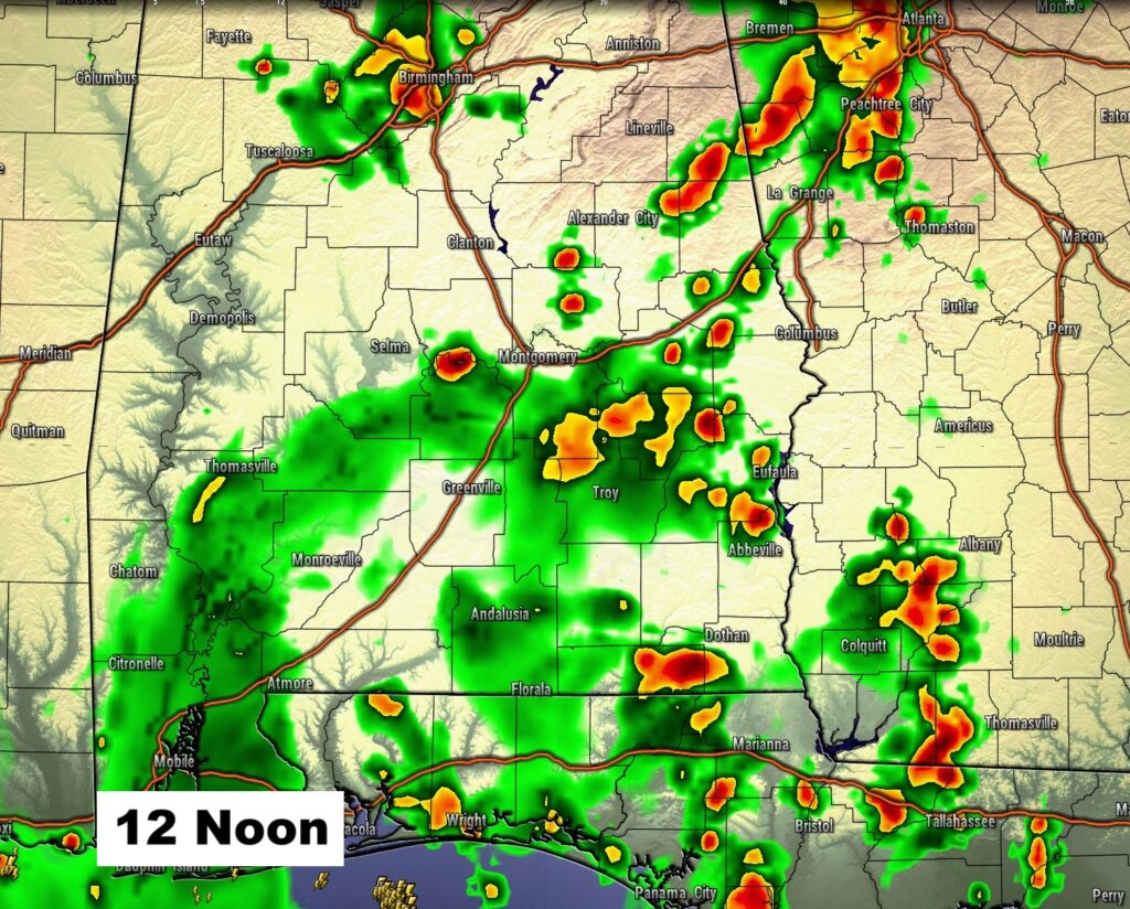
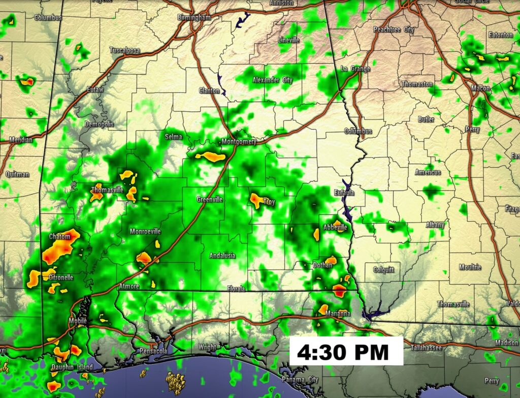
FUTURE RADAR: Radar will be active today and tomorrow. Storms will be more numerous today. Tropical Downpours.
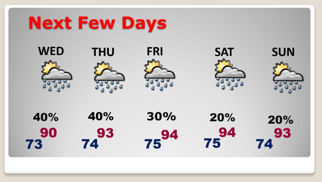
NEXT FEW DAYS: More clouds than sun. Scattered to mostly PM showers and storms each day through Wednesday. Storms thin out a bit Thursday and especially Friday through Saturday. Highs Near 90 through Wednesday. Then, low to mid 90’s by mid-week to late week. Heat Index 100+.
.
Here’s the 10 Day Model Blend Temperature Trend.
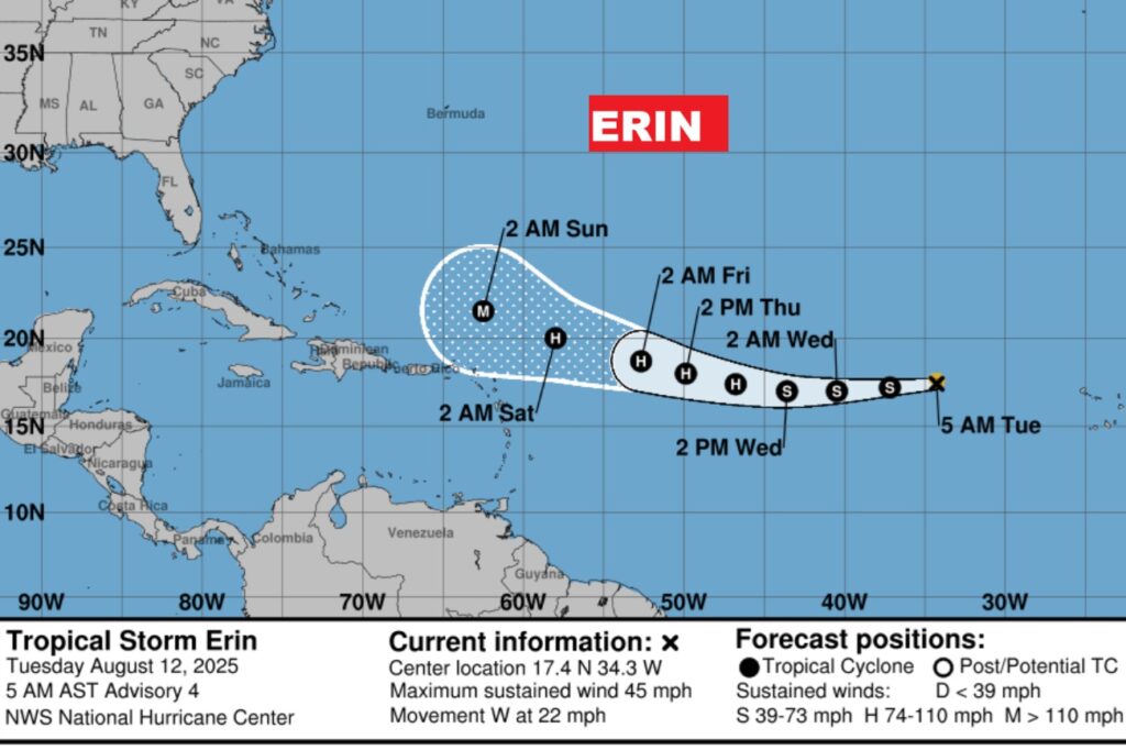
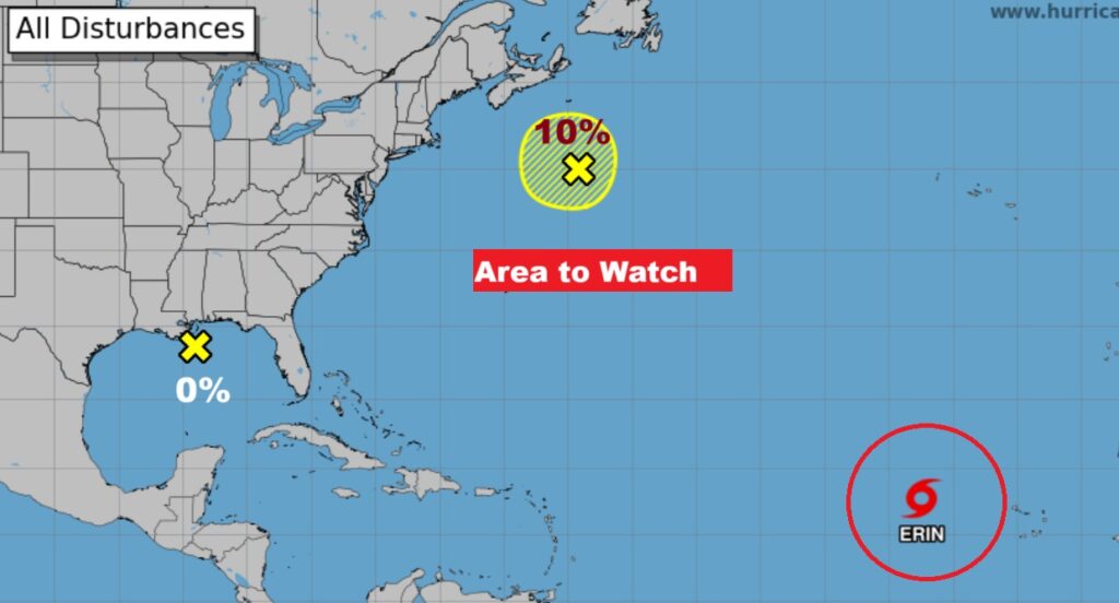
TROPICAL OUTLOOK:
Tropical storm Erin is moving westward in the Tropical Atlantic. Erin could become a Hurricane by Thursday and maybe a Major Hurricane by Saturday. Erin is likely to turn and probably miss the United States.
Here’s the EURO Ensembles – now all showing Erin will likely miss the US and turn into the Atlantic. Fingers crossed. There are a few members which make it a close call.
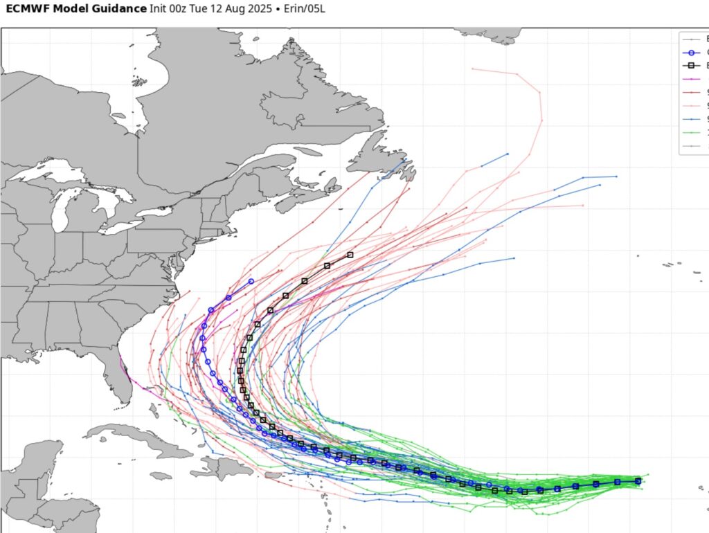
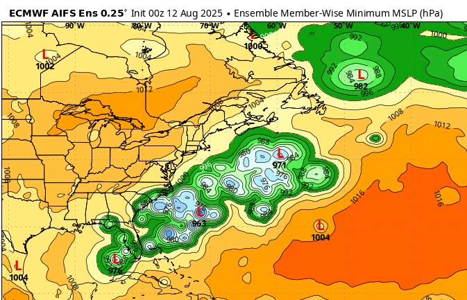
What does this tell you about Erin’s potential Future? Here’s the EURO Ensemble members is next Wed. night 8/20. Quite a spread in possibilities, even though many of the model members keep Erin off the U.S. coast. It’s certainly not a done deal. Stay tuned.
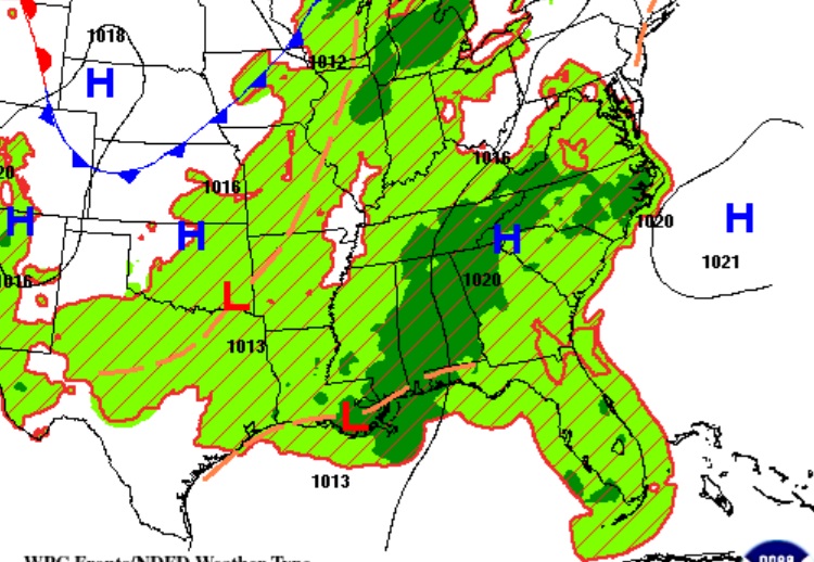
There are two other Areas to Watch including a Tropical Low off the northern Gulf Coast, now given a 0% chance of development. It is responsible for our increase is showers and storms today and tomorrow.
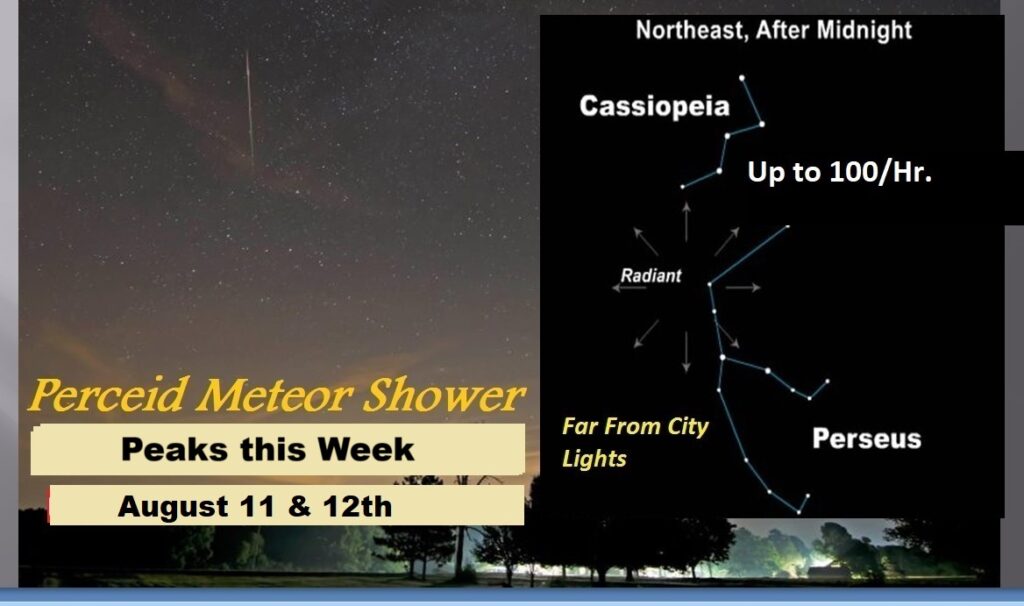
PERCEID METEOR SHOWER: While the Perseid meteor shower is active from July 17 to Aug. 23, the peak is between Aug. 12 and 13 during pre-dawn hours, NASA said. It may be possible to see meteors from the shower as early as 10 p.m. though, according to NASA. Best meteor shower of the year.
Thanks for reading the blog. Today everything is normal including LIVE on the Radio of NewsTalk 93.1 WACV. There will be another video forecast discussion and Blog Update in the 4 o’clock hours tomorrow morning. You can always find my forecast updates hourly on the 8 station Bluewater family of stations every day of the year.
–Rich