
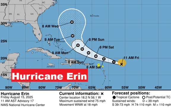
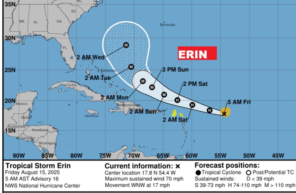
ERIN BECOMES FIRST HURRICANE
(10:00AM 8/15/2025)
Hurricane Erin, in the Tropical Atlantic becomes the first Hurricane of the Atlantic Season with winds of 75 mph. Erin is in a very favorable environment for future rapid intensification and could become a Major potential Category 4 hurricane over the weekend with winds of 140 mph. as it curves northwestward in the Atlantic.
https://www.nhc.noaa.gov/text/refresh/MIATCPAT5+shtml/151446.shtml?
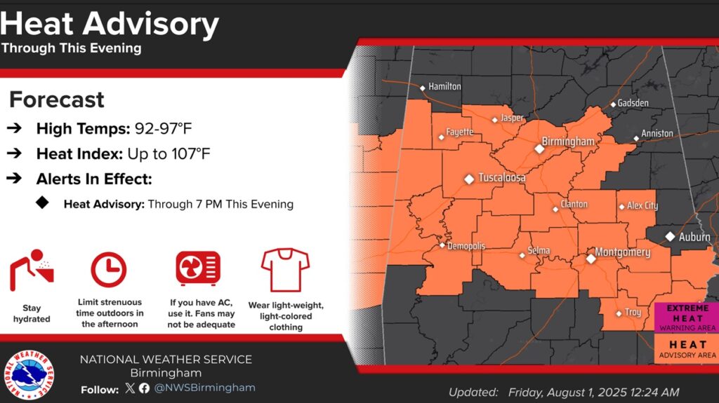
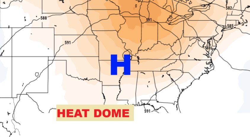
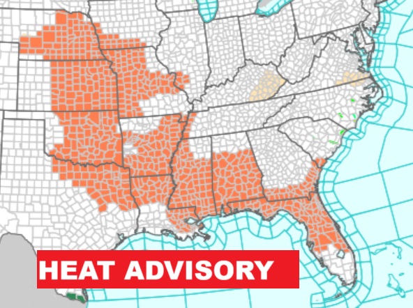
Good morning! A large heat dome is building over the central US, which means fewer storms, more sun and hotter days. A Heat advisory has been issued and covers a multi-state area. Expect dangerous Heat Indices close to or exceeding the dangerous 105 range. Radar is expected to be quite today. Storms will be few and far between through the weekend. Dangerous Hot days will continue well into next week.
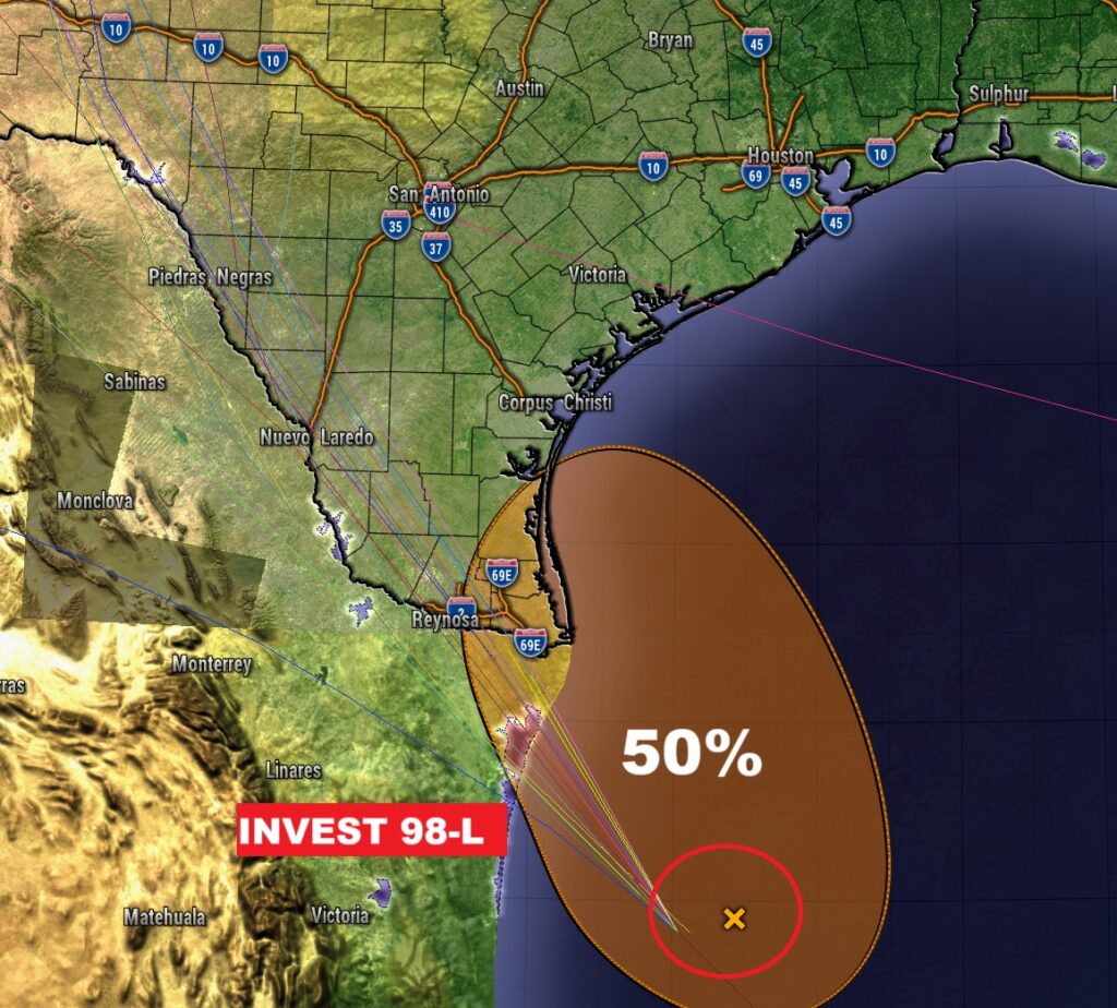
Tropical Storm Erin growing stronger is moving westward in the Tropical Atlantic. Erin could become a Hurricane by Thursday and very likely a Major Hurricane by this weekend. Erin is likely to turn into the open Atlantic and likely miss the United States all together. Meanwhile, in the SW Gulf, Invest 98-L has a 50/50 chance of development. It will be investigated by Air Force RECON this morning as it targets the Texas coast. Here’s y brief forecast discussion.
TODAY: A HEAT ADVISORY has been issued. Sun/cloud mix. High in the low to mid 90’s. Heat index as high as 105, if not higher. Random scattered showers and storms most numerous in the after and evening hours. Low tonight 74.
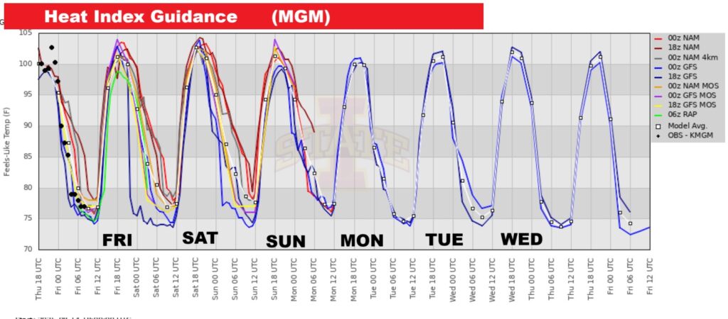
A Heat advisory has been issued and covers a multi-state area. Expect dangerous Heat Indices close to or exceeding the dangerous 105 range.
NO FUN. The Heat Index will be excessive for several days. Dangerous Heat.
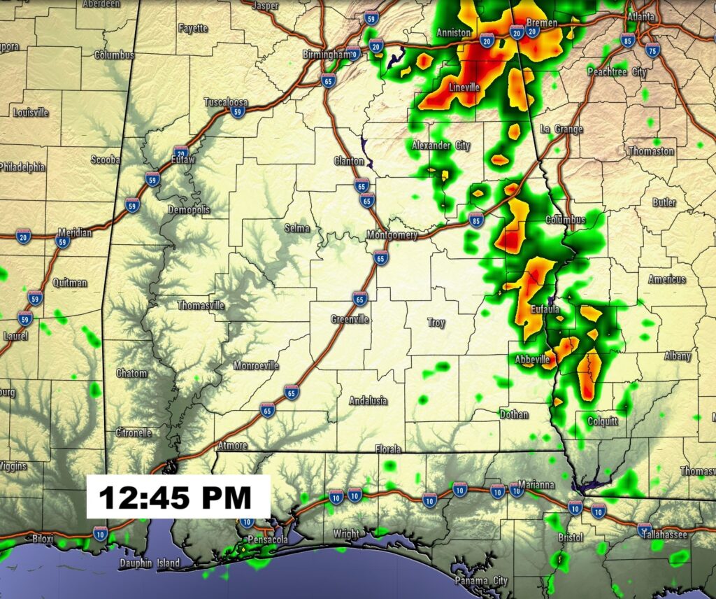
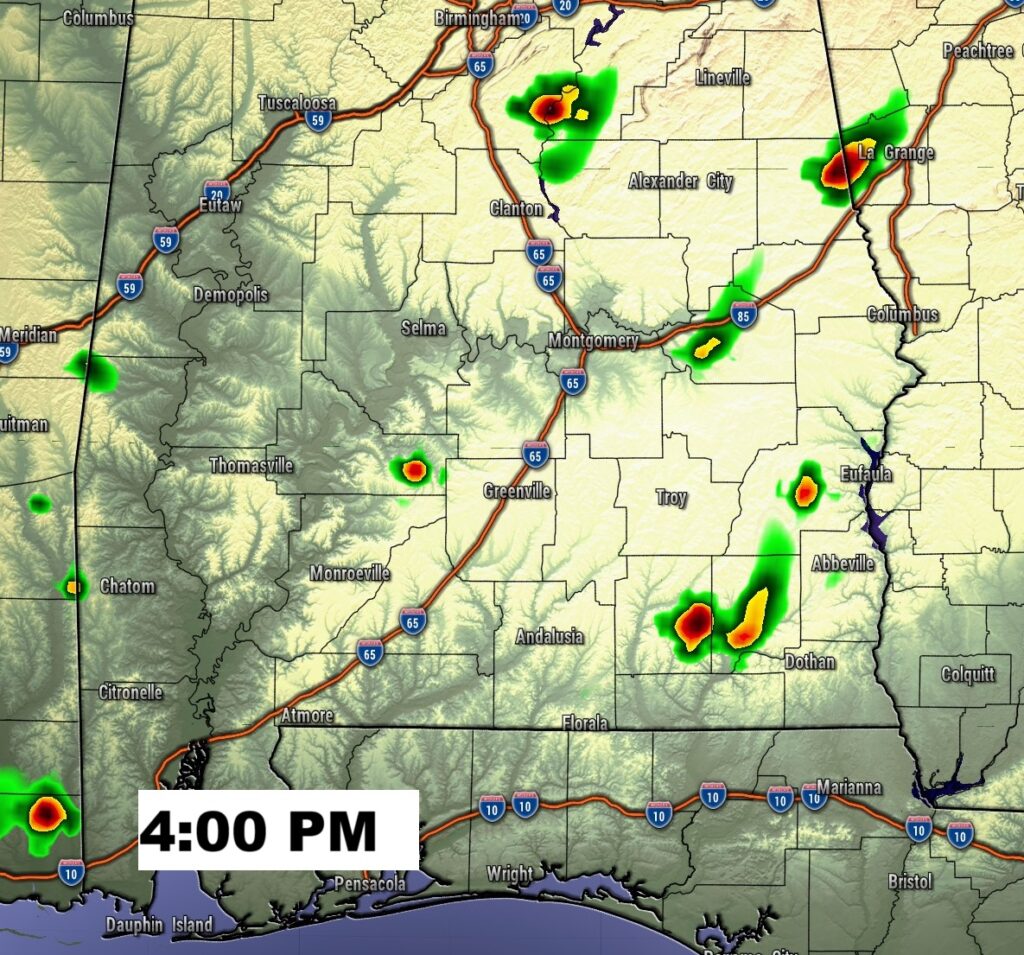
FUTURE RADAR: Radar is expected to be quite today. Storms will be few and far between through the weekend.
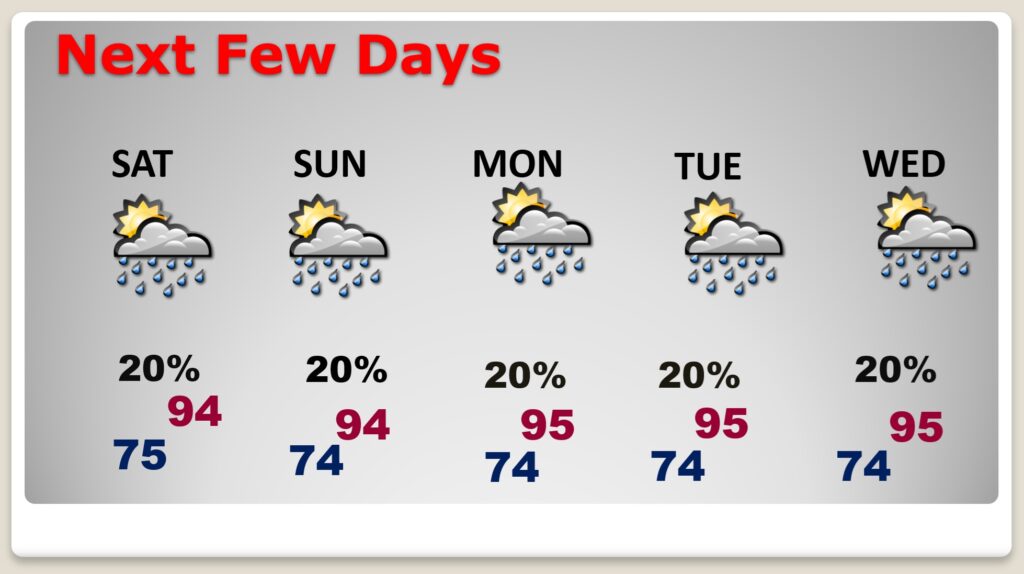
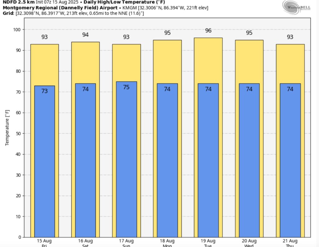
NEXT FEW DAYS: The number of storms will start to thin out, in number over the weekend through early next week. With fewer storms and more sun, expect dangerous hotter days. Expect middle 90s Friday through early next week. Expect dangerous Heat Indices close to or exceeding the dangerous 105 range.
Here’s the 7 Day Temperature Trend. Dangerous Hot days will continue well into next week.
TROPICAL OUTLOOK: Erin is nearing Hurricane strength, likely becoming a Hurricane today. and very likely a Major Hurricane by this weekend. Erin is likely to turn into the open Atlantic and likely miss the United States all together.
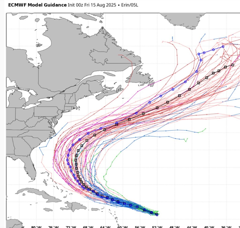
Here’s the EURO Ensembles –all showing Erin will likely miss the US and turn into the open Atlantic, although some model ensemble members make it a close case. Significant wave action and rip currents will affect the US East Coast.
Meanwhile, in the SW Gulf, Invest 98-L has a 50/50 chance of development. It will be investigated by Air Force RECON this morning as it targets the Texas coast. Flooding rains will be the main effect.
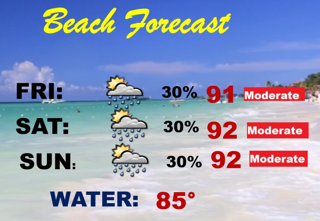
BEACH OUTLOOK: Routine August weekend forecast 30% rain probability is quite normal. Not bad.
Thanks for reading the blog. Today everything is normal including LIVE on the Radio of NewsTalk 93.1 WACV. There will be another video forecast discussion and Blog Update in the 4 o’clock hours tomorrow morning. You can always find my forecast updates hourly on the 8 station Bluewater family of stations every day of the year.
–Rich