
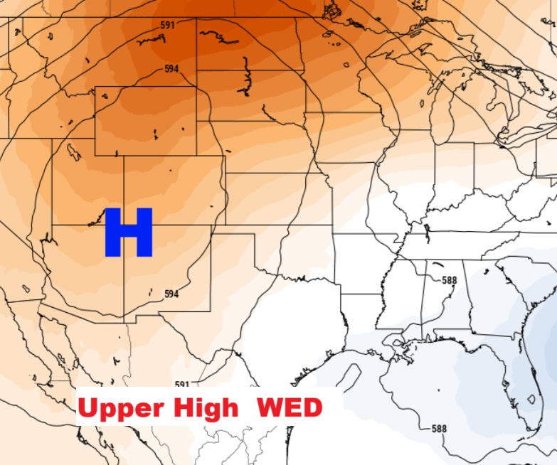
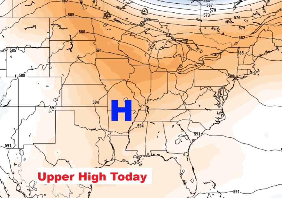
Good morning! Heat and humidity top the weather news again today. Triple digit heat indices remain in place for the rest of the week. Radar is expected to be quiet today and Wednesday. Storms will be few and far between through Thursday. Rain chances will get a little better by the end of the week. The upper level Heat Dome over the central US will migrate westward later in the week. Temperatures will be more reasonable by the weekend and beyond. High temperatures will stay below 90 over the weekend. Meanwhile the tropics continue very busy. Here’s my brief video forecast discussion.
TODAY: Sun/cloud mix. High in the mid 90’s. Heat index as high 101-104. Rain chances not quite zero, but 20% or less. Low tonight mid 70’s.
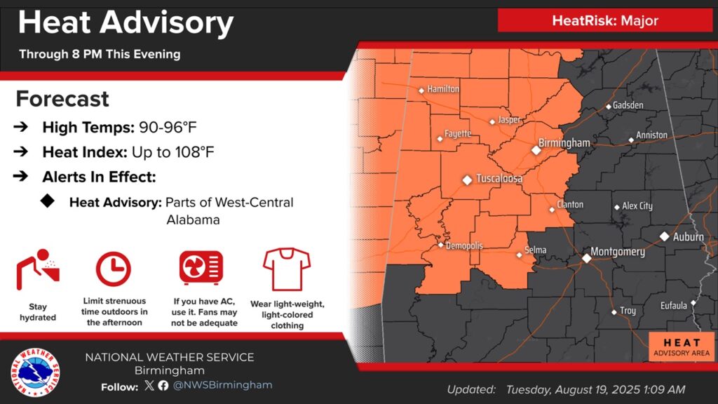
Heat advisory continues for most of west Alabama.
The upper level Heat Dome over the central US will migrate westward later in the week
Dangerous triple digit heat indices remain in place for the rest of the week. Expect weekend improvement.
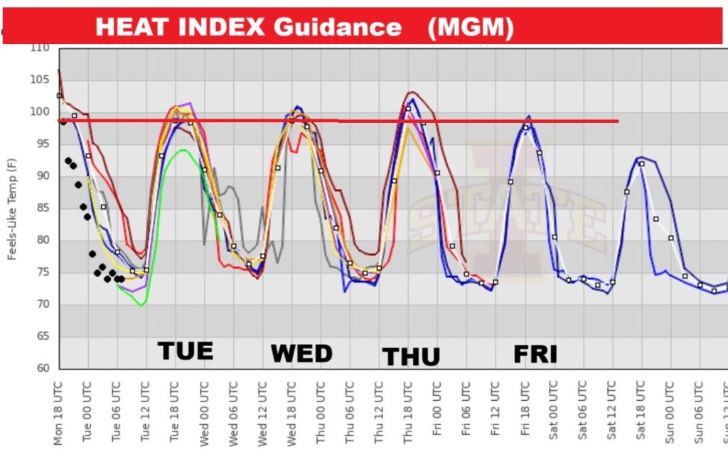
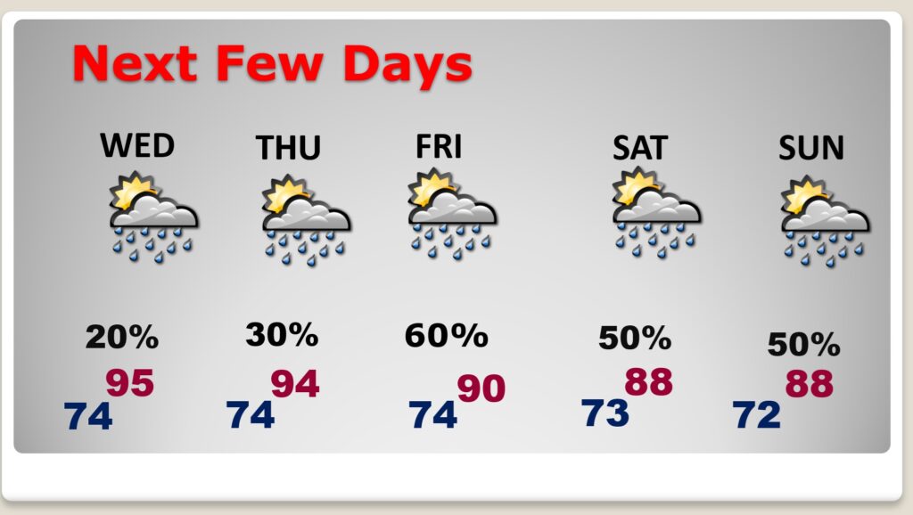
NEXT FEW DAYS: The number of storms will be very isolated in nature through Thursday.. Rain chances will get a little better by the end of the week. Expect more dangerous hot days. Highs in the mid 90’s through Thursday. Temperatures will be more reasonable by the weekend and beyond. High temperatures will stay below 90 over the weekend.
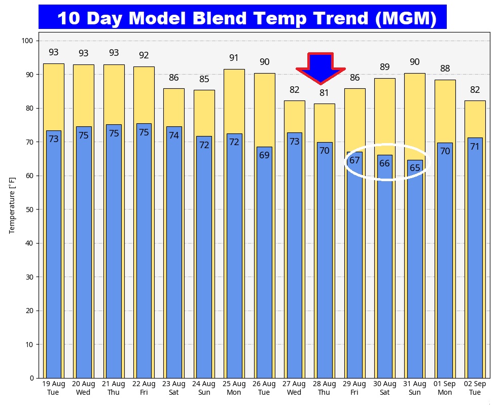
Here’s the 7 Day Temperature Trend. Upper 80’s start over the weekend and beyond.
Want something to look forward to? How about Cooler, drier air and cooler nights in the 60’s. Take a look at next week. Sound nice? Starts the middle of next week prior to Labor Day Weekend and Football.
TROPICAL OUTLOOK:
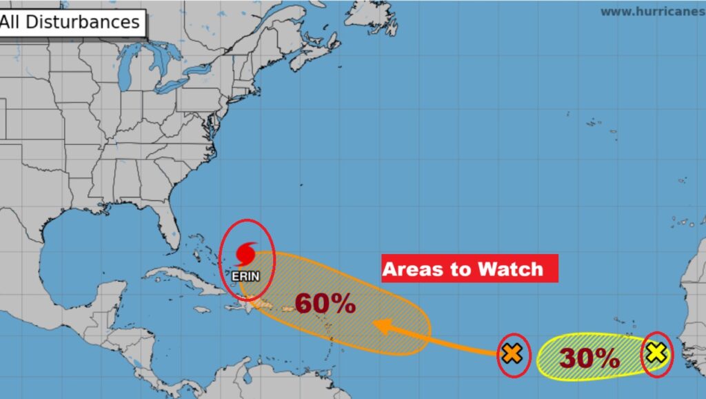
Hurricane Erin’s winds have come down a little bit after peaking 140 yesterday. BUT, the storm is becoming larger. It will have a tremendous wave action and rip current effect in the Bahamas and US East coast for the rest of the week, particularly the Carolinas.
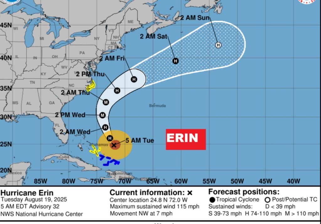
Elsewhere, behind Erin in the Tropical Atlantic, there is an interesting Area To Watch with a 60% chance of development. And there’s a new Area to Watch off the African coast.
Thanks for reading the blog. Today everything is normal including LIVE on the Radio of NewsTalk 93.1 WACV. There will be another video forecast discussion and Blog Update in the 4 o’clock hours tomorrow morning. You can always find my forecast updates hourly on the 8 station Bluewater family of stations every day of the year.
–Rich