
Good morning! Today will be yet another mid 90 degree day with the Heat Index 100+. But, hang on. There’s much better news in the not too distant future. Scattered pop up PM storms will populate the radar today and each day through Sunday, mostly in the afternoon and evening hours. The big news involves a fresh supply of cooler less humid air next week – especially starting Tuesday. Expect conferrable, less humid days and noticeably, pleasantly cool nights. Wait till you see the numbers in the graphics below. Here’s my brief video forecast discussion.
TODAY: Sun/cloud mix. High near 94.. Heat index as high 100+ again. Scattered PM Storms. Low tonight 73.
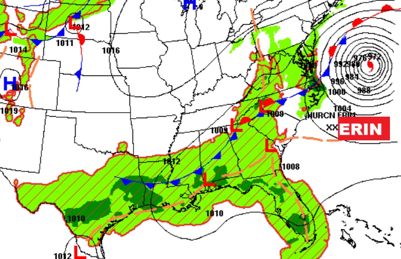
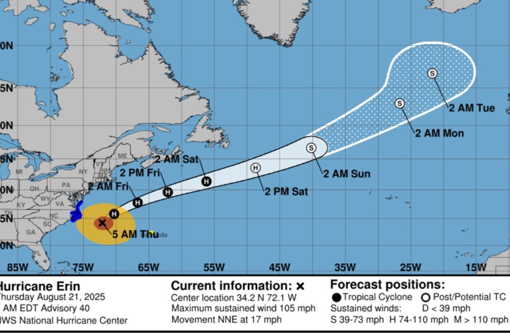
ERIN is still terrorizing the US East coastal states.
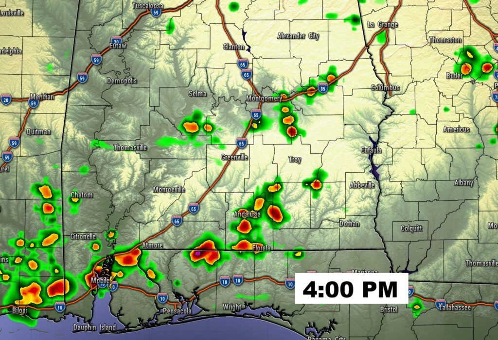
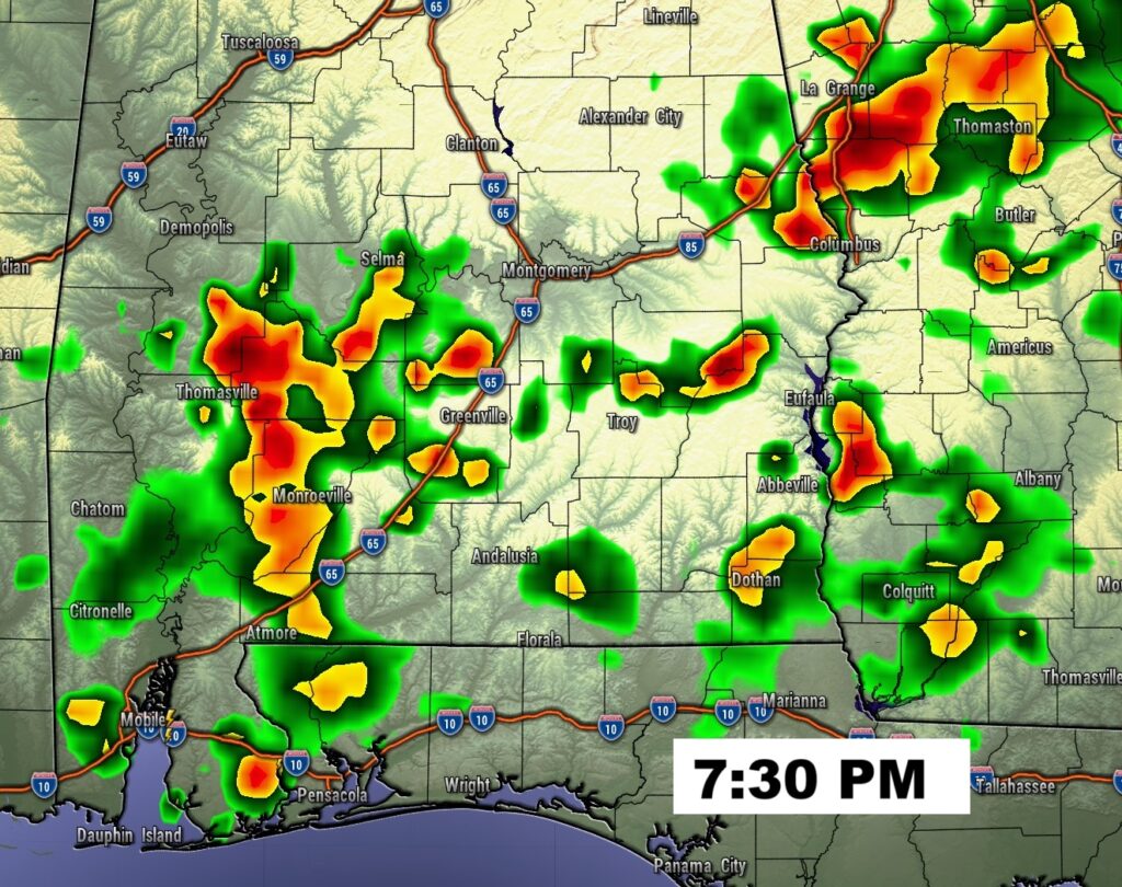
FUTURE RADAR: Scattered random PM storms. Looks like the biggest concentration will be over the southern half of the state.
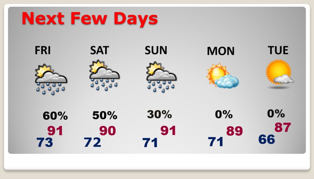
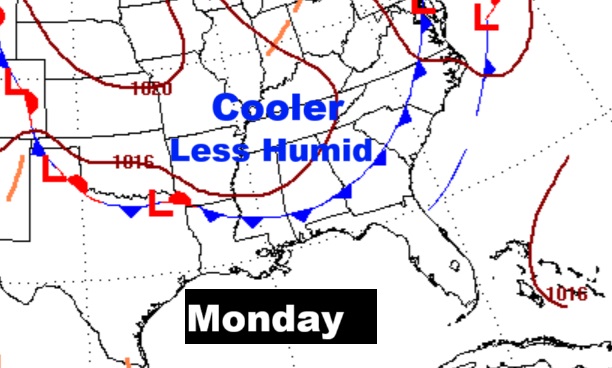
NEXT FEW DAYS: Scattered pop up PM storms will populate the radar today and each day through Sunday, mostly in the afternoon and evening hours. Highs near or above 90 through Sunday. A cool front enters the state Monday. Look for cooler less humid air by Tuesday and beyond. Highs near week in the 80’s and lows in the 60’s at night. It’s the real deal and it’s headed our way.
Here’s the Map for Monday. Some really nice air is in our future.
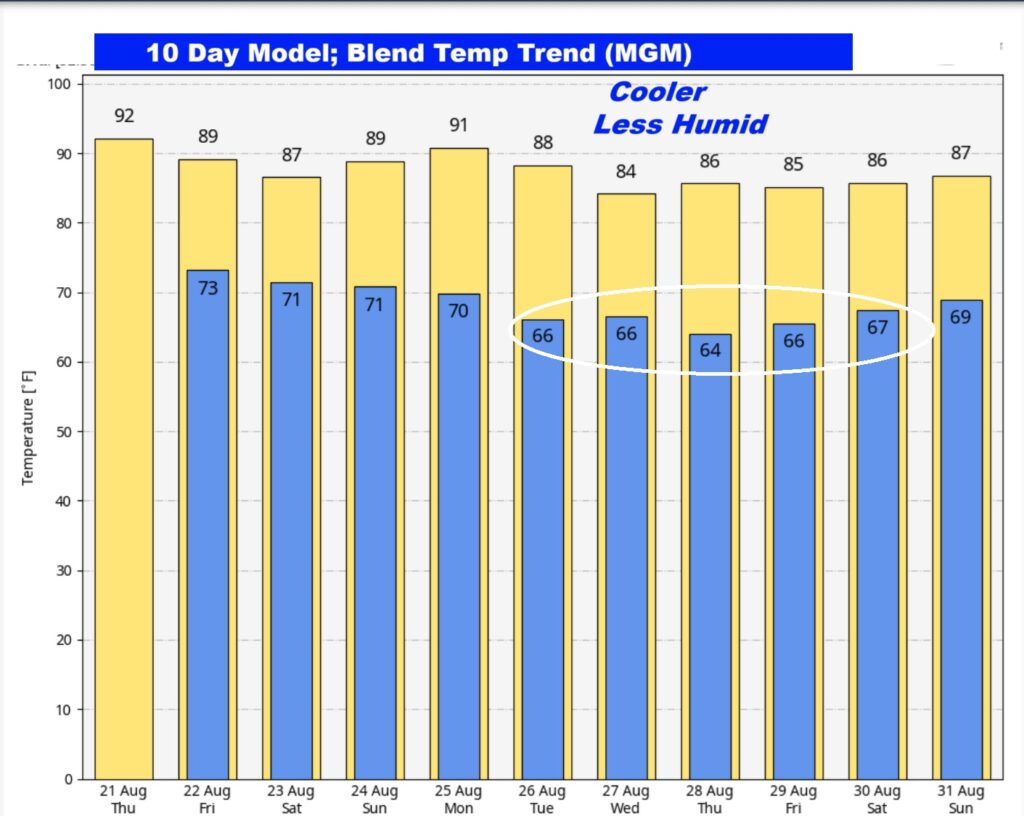
Here’s the 10 Day Temperature Trend. FINALLY, some relief is on the way. Look at the numbers next week as we get closer to the Labor Day Weekend and Football.
TROPICAL OUTLOOK:
Hurricane Erin’s fringe effects will continue to terrorize the US Eastern Seaboard today. It will have a tremendous wave action and rip current effect in the US East coast especially the middle Atlantic states and the Northeast.
Elsewhere, behind Erin in the Tropical Atlantic, there is an Area To Watch with a 70% chance of development. A Tropical Depression will likely form this weekend.
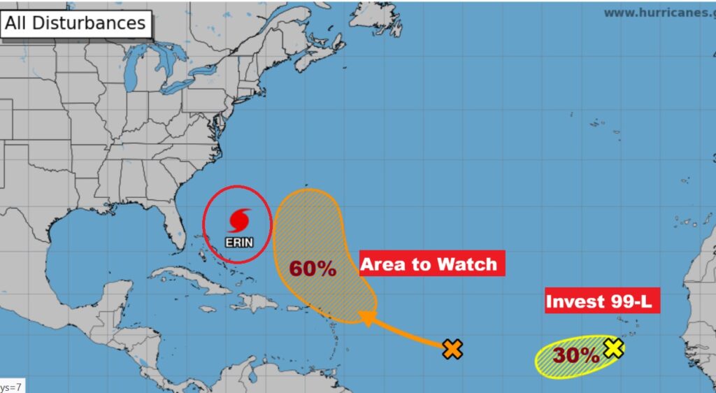
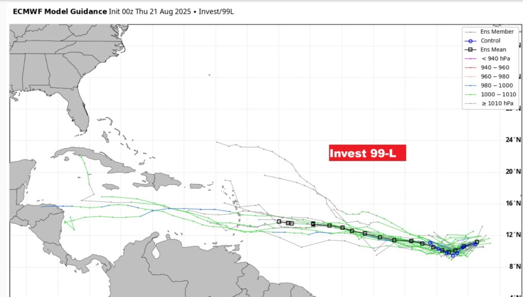
Invest 99-L in the far east Atlantic now has a 40% chance of development in the next 7 days.
If Invest 99-L stays on a southerly track across the Caribbean, we’ll have to watch it several days down the line.
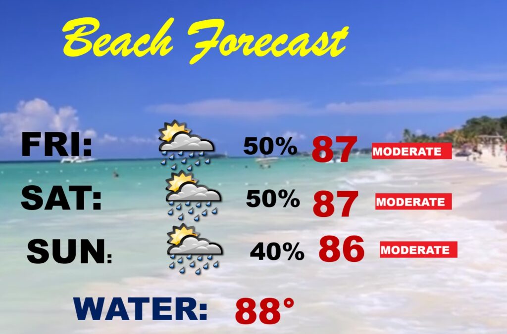
BEACH OUTLOOK: Scattered random PM Storms through Sunday. Moderate Rip Current Risk. Gulf water temperature 88.
Speaking of the Beach, I’m Beachbound today, so my updates tomorrow and Saturday will be very brief There will be another video forecast discussion and Blog I’ll have another Update in the 4 o’clock hours tomorrow morning. You can always find my forecast updates hourly on the 8 station Bluewater family of stations every day of the year.
–Rich