
Good morning! We’ve been enjoying an absolutely beautiful and comfortable weather pattern, featuring low humidity and cool nights. Changes are on the way. We’ll be dry at least through this evening. The next chance of showers and storms begins late tonight and Friday as a disturbance moves across the state. Friday’s high will be held down near 80 because of clouds and showers. Expect more random scattered storms over the Labor Day weekend. But, not a washout. There will be more clouds than sun. Highs in the mid 80’s. Here’s my brief forecast discussion.
TODAY: Sun/cloud mix. Comfortable Low humidity continues. High 86. Increasing clouds this evening and tonight. Risk of showers and storms begins in the overnight hours. Low 66.

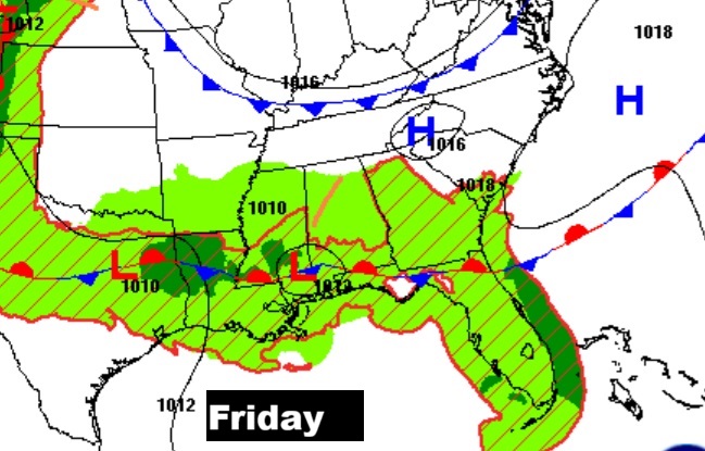
NEXT FEW DAYS: The next chance of showers and storms begins late tonight and Friday as a disturbance moves across the state. Expect more random scattered storms over the Labor Day weekend. By Labor day Monday the storms will be widely scattered to isolated in nature. Highs in the mid 80’s.
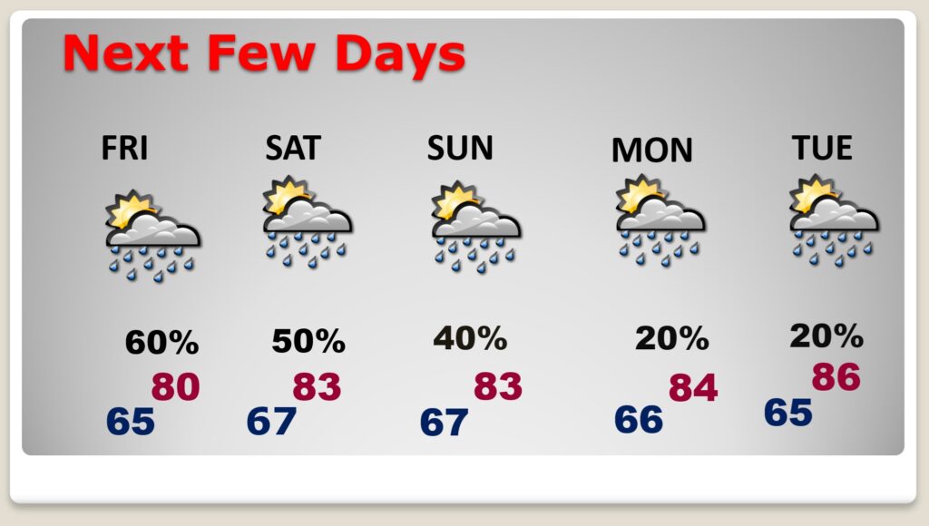
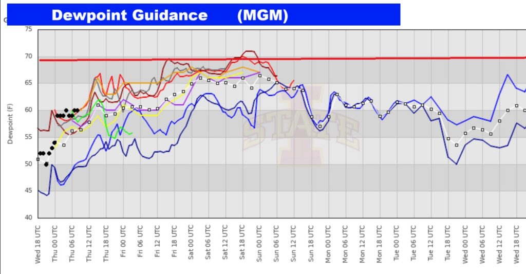
Those NICE comfortable dewpoints will fade away over the weekend.
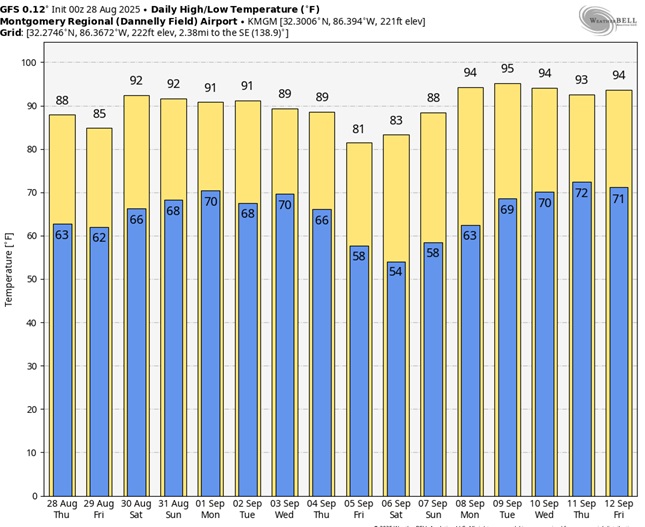
Here’s the 10 Day Temperature Trend. We’re probably going to stay below 90 for a few more days.

The GFS model out 16 days – indicates we could see some more 90+ degree days. Stay tuned.
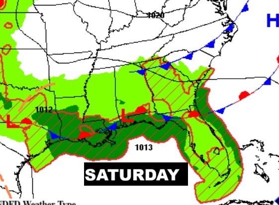
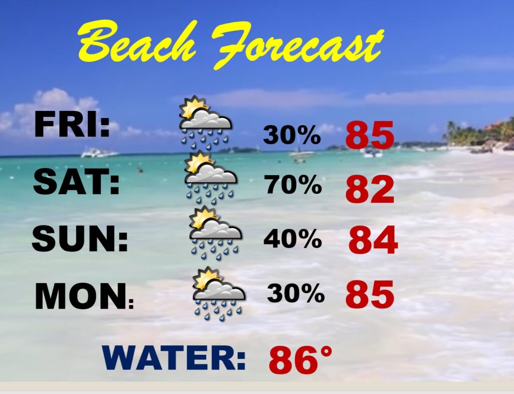
BEACH OLUTLOOK: Be flexible…wet at times. Showers and storms will be rather numerous Saturday.
RAINFALL through MONDAY: Wet at times. Take a look at the Gulf coast.

TROPICAL OUTLOOK:
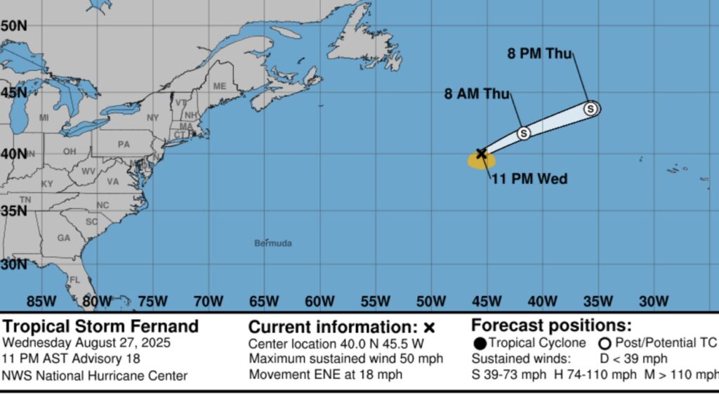
FERNAND is a 50 mph “fish Tropical storm” in the middle of the Atlantic.
There is now a new area to watch in the far east Atlantic off the African Coast.

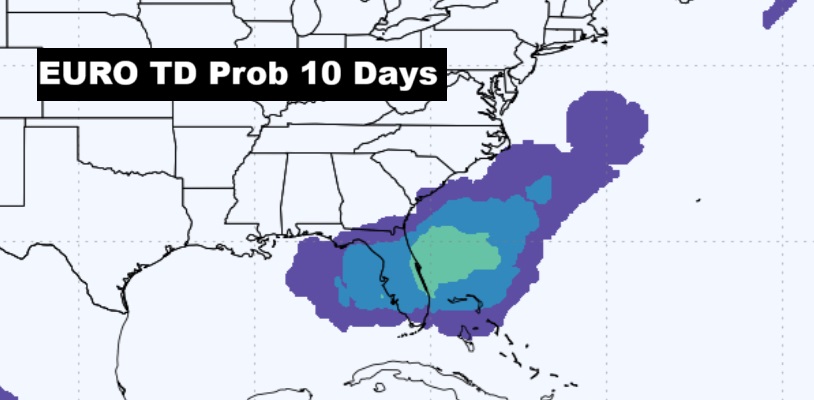
The EURO model suggest we need to watch the East Gulf and the SE coast next week for possible Depression Development.
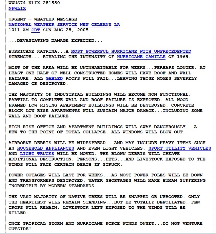
KATRINA SPECIAL WEATHER STATEMENT: 20 years ago today, at the NWS New Orleans office (Located in Slidell – LIX), Meteorologist in Charge, Robert Ricks authored, I still think, the most powerful NWS SPS ever written. I had chill bumps when I read this message at 10:11 AM CDT, Sunday August 28, 2005, one day prior to landfall. Powerful language, which was absolutely appropriate and necessary.
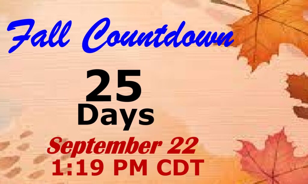
FALL COUUNTDOWN: The Autumnal Equinox is now just 25 days away.
Thanks for reading the blog. Today everything is normal including LIVE on the Radio of NewsTalk 93.1 WACV. There will be another video forecast discussion and Blog Update in the 4 o’clock hours tomorrow morning. You can always find my forecast updates hourly on the 8 station Bluewater family of stations every day of the year.
–Rich