
Good morning! A southward moving cool front will be the weather maker in our state today. We’ll be in the middle 90’s again today. But, Sunday will be not as hot and less humid behind the front. By Monday and Tuesday highs will be in the mid to upper 80’s. Today – Random widely scattered storms will populate the radar, especially in the afternoon and evening. Then, look for a period of dry days. We have no tropical concerns in this part of the world this week, even though we are approaching the peak of the season. The EURO model shows the tropics coming alive mid-month.
TODAY: Sun/Cloud mx. Widely scattered mainly PM showers and storms. Light wind. High 94. Partly cloudy tonight. Low 69.
A southward moving. cool front will be the weather maker in our state today. It’s reach the coast by late tonight.
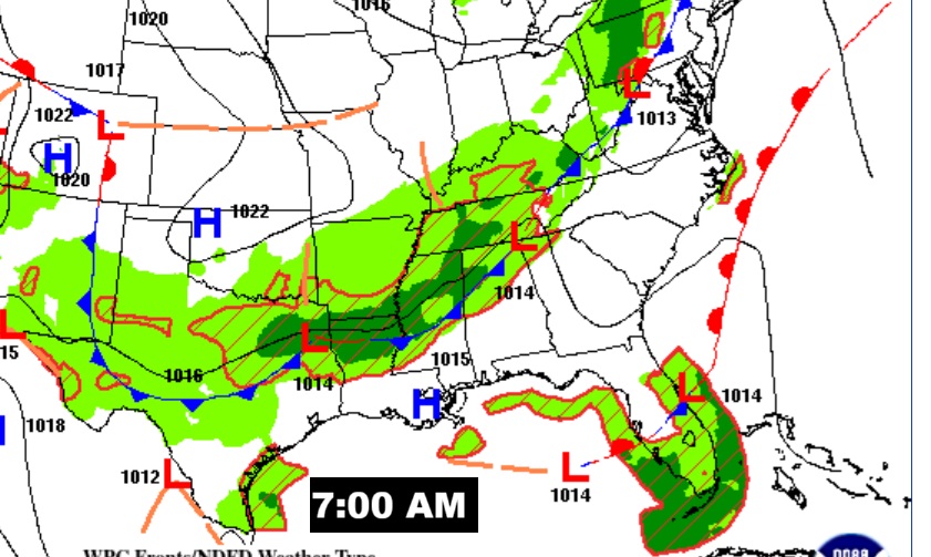
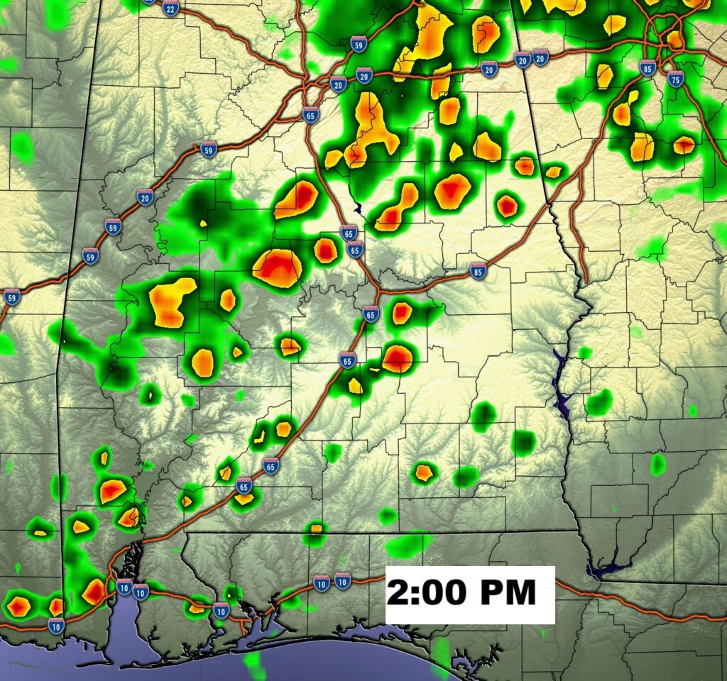
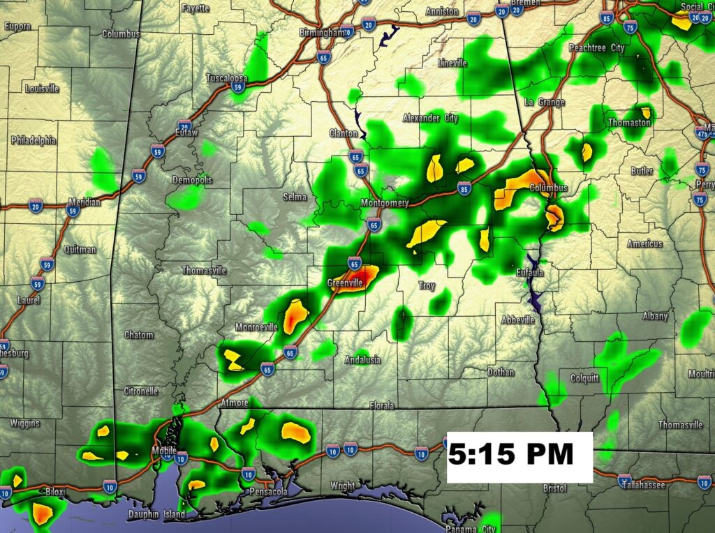
Here’s Future Radar. Best chance of showers/storms will be near and ahead of the front.
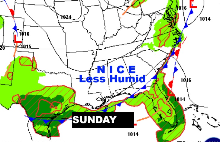
NEXT FEW DAYS:. Sunday will be cooler and less humid behind a cool front. By Monday and Tuesday highs will be in the mid 80’s. We’ll; be back to a dry forecast.
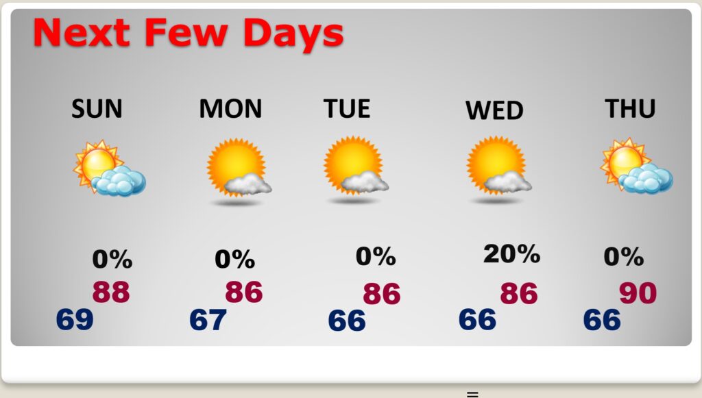
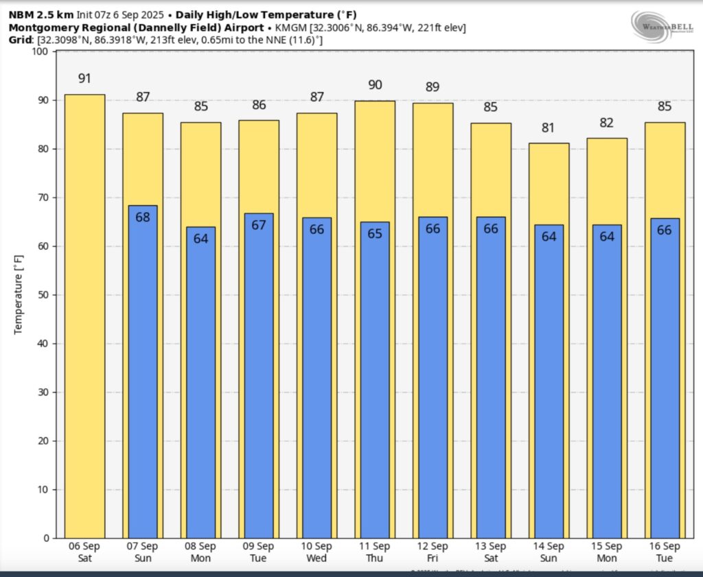
Here’s the 10 Day Temperature Trend. Brief heat relief begins Sunday. Cooler nights. Nice days.
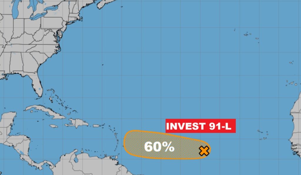
TROPICAL OUTLOOK: Invest 91-Lin the tropical Atlantic is a westward moving Tropical wave. NHC gives this Area a 60% chance of development. A depression is likely by early next week.
Here’s the EURO Probability of Tropical Storm Development.
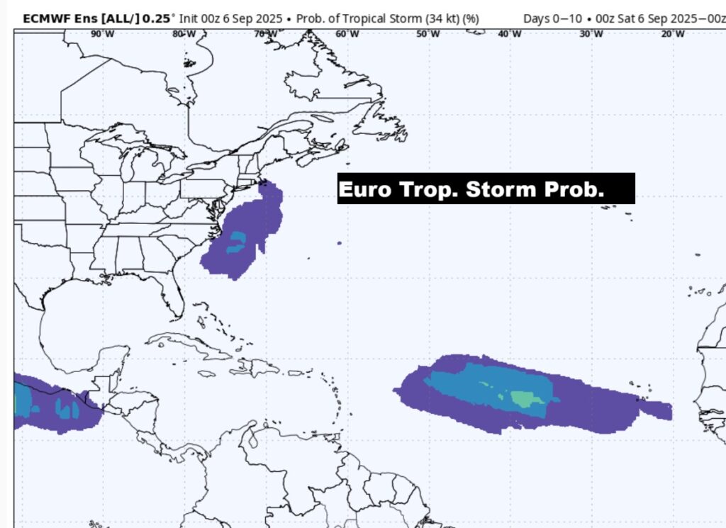
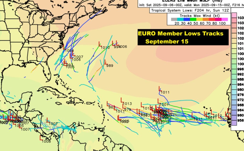
The EURO signals that the tropics will really come alive by the middle of the month.
FALL COUUNTDOWN: The Autumnal Equinox is now just 18 days away.
I’m headed to the National Weather Association 50th Annual Conference in Huntsville today through Wednesday.
The next scheduled Blog update and Video Discussion is scheduled for Monday morning in the 4 o’clock hour. Have a nice weekend!
–Rich