
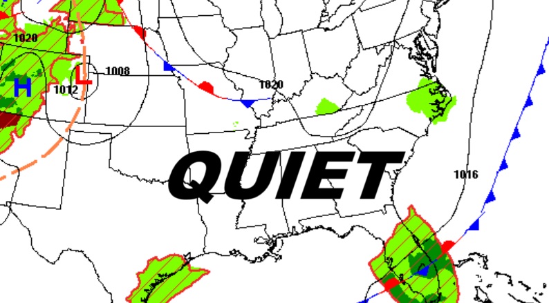
Good morning! The next several days will be storm-free and bone dry. Slowly we’re getting hotter again. Today’s high will be near 90. (Normal hi/lo 91/68) Expect lower 90’s Friday through Monday, and middle 90’s Tuesday. Fortunately, humidity is still very tolerable, and the nights are comfortably cool. I see no storm systems in the next several days. There is a new Area to Watch in the far eastern Tropical Atlantic. NHC says there will be gradual this weekend and beyond as this Tropical Wave moves westward. The statistical peak of the Hurricane Season is today – September 11th. Here’s my brief video forecast discussion.
TODAY: Total sunshine. Warmer. Still Tolerable humidity. High 90. Mainly clear and still comfortably cool tonight. Low 64.
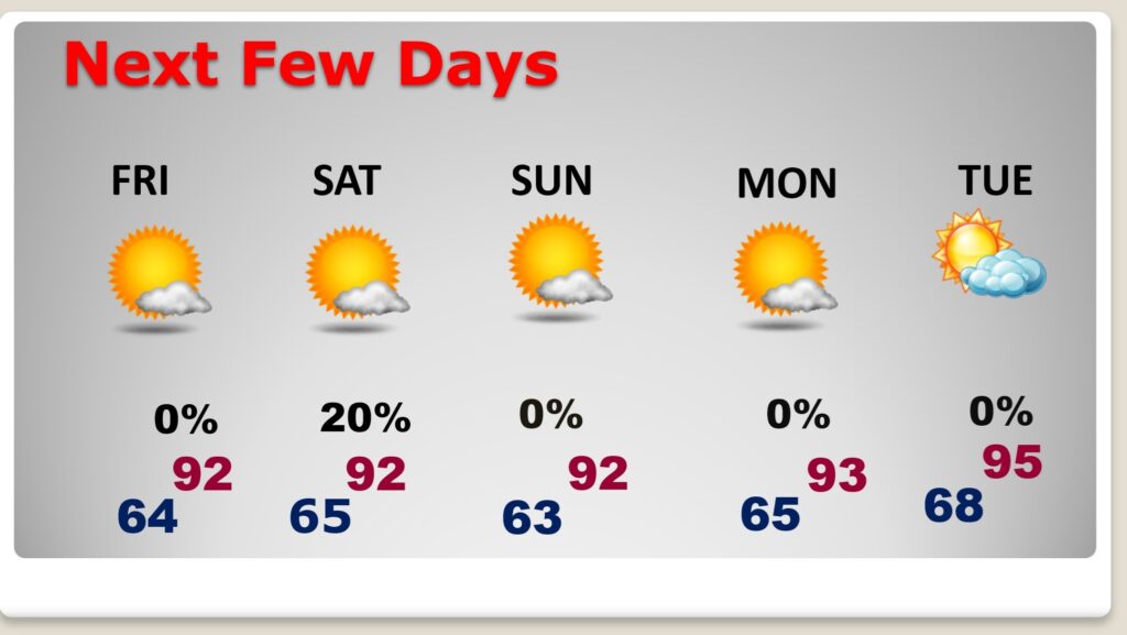
NEXT FEW DAYS: Expect hotter days and the dry/storm free pattern will continue for several more days. Expect lower 90’s Friday through Monday, and middle 90’s Tuesday. Fortunately, humidity is still very tolerable, and the nights are comfortably cool. Lows will be in the 60’s. I see no storm systems in the next several days.
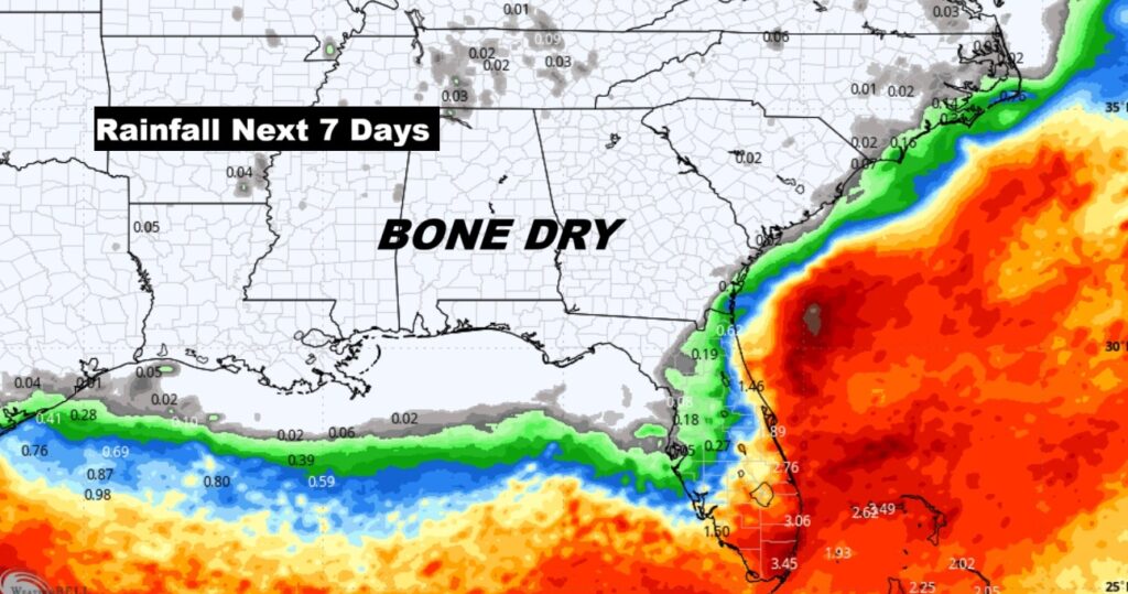
Here’s the projected rainfall for the next 7 days. Storm-free and BONE Dry.
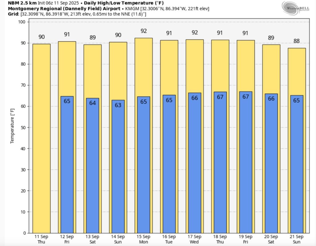
Here’s the 10 Day Temperature Trend. Not done with summer.
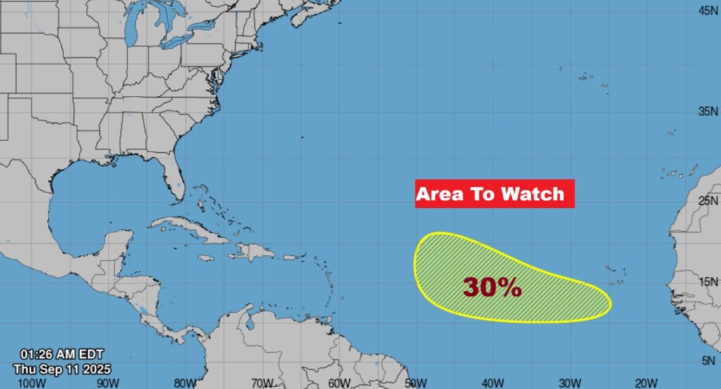
TROPICAL OUTLOOK: The statistical peak of the Hurricane Season is today – September 11th. There is a new Area to Watch in the far eastern Tropical Atlantic. NHC says there will be gradual this weekend and beyond as this Tropical Wave moves westward through the MDR.
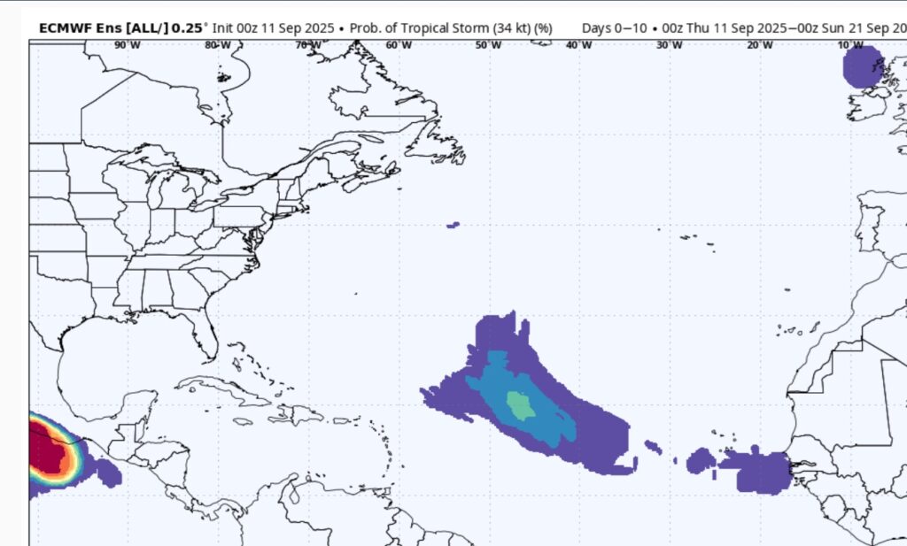
Here’s The EURO Tropical Storm Probability over the next 10 days.
FALL COUUNTDOWN: The Autumnal Equinox is now just 12 days away. The first official day of Fall: Mon, Sep 22, 2025, 1:19 PM
Thanks for reading the blog. Today everything is normal including LIVE on the Radio of NewsTalk 93.1 WACV. There will be another video forecast discussion and Blog Update in the 4 o’clock hours tomorrow morning. You can always find my forecast updates hourly on the 8 station Bluewater family of stations every day of the year.
–Rich