
Good Morning! Not much has change. Maybe a couple of degrees cooler today. Maybe not quite as warm. Yesterday’s high 88. Today’s High 85. (Normal hi/lo 85/61) Nice breeze today. Pleasantly cool tonight. Near 60 by Dawn Friday. Still a dry forecast through at least Saturday. Widely scattered PM showers Sunday through Tuesday. In tropics, besides Hurricane Imelda, there’s two new Areas to Watch. One near the SE US coastline. Here’s my brief video forecast discussion.
TODAY: Mostly sunny. Tolerable humidity. Hi 85. Nice breeze. East 10 to 15 gusts to 20. Mainly clear tonight. Pleasantly cool. Low tonight 60.

NEXT FEW DAYS: Still a dry forecast through at least Saturday. Widely scattered PM showers Sunday through Tuesday. Great weather for the start of the Alabama National Fair. Low to mid 80’s daytime. 60’s at night. Coolest morning will be Friday AM. Near 60 by Dawn.
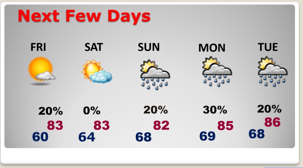
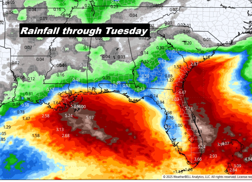
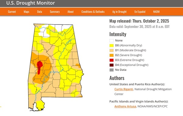
Widely scattered showers are possible Sunday through Tuesday. Not Much. New Drought Monitor Map comes out later this morning.
The new Drought Monitor map just came out. (Comes out every Thursday. Alabama’s drought is getting worse. 95% of the state is in some level of dryness. 51% is at least in a moderate drought. And, at least 14% of the state are in severe or extreme drought. We should be dry at least through Saturday. A few showers will start to pop up Sunday through Tuesday.
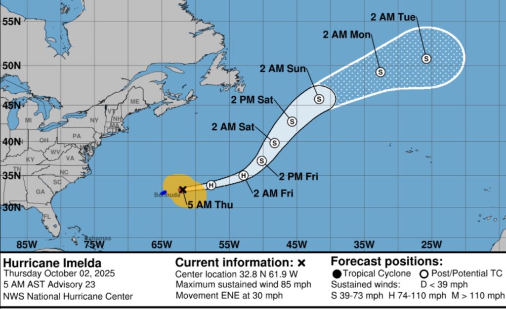
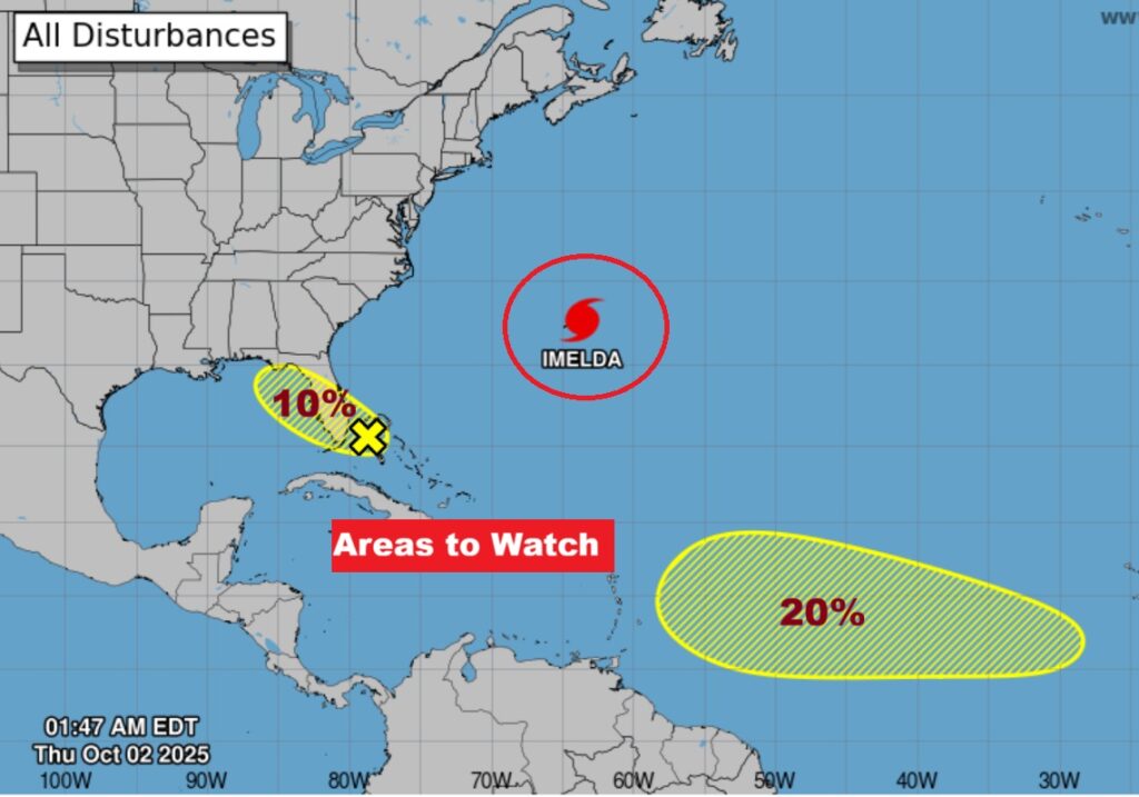
TROPICAL OUTLOOK: Humberto is done. Hurricane Imelda assaulted Bermuda last night. Now, it’s headed out to sea.
There’s two new Areas to Watch. One near the SE US coastline.
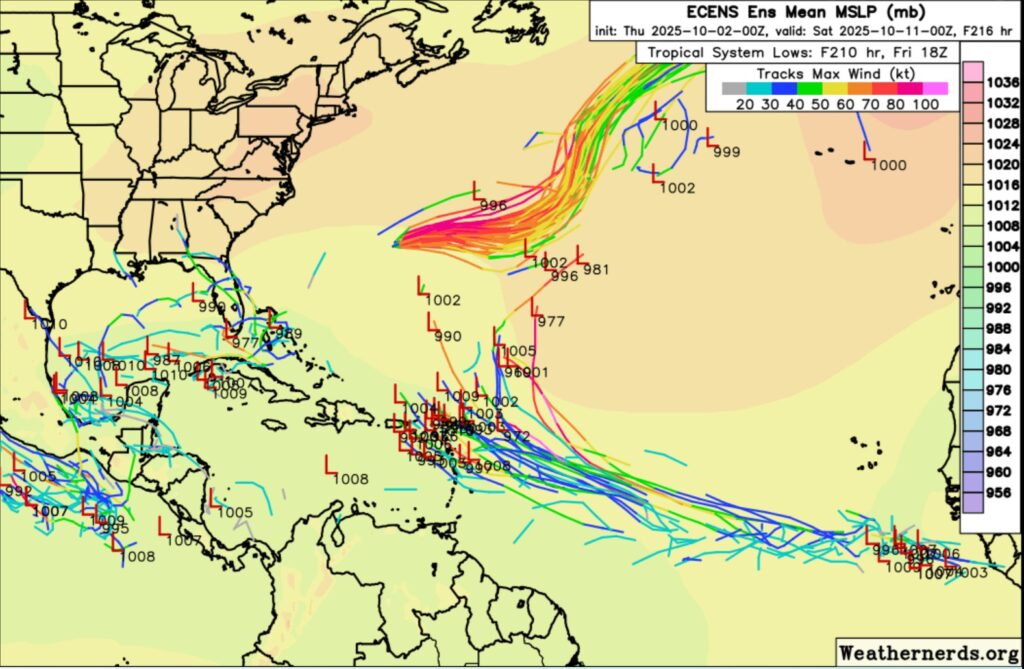
The EURO Ensemble models Member Lows looks interesting. We’ll be keeping a close eye on the Gulf over the next 10 days.
—
Thanks for reading this Blog this morning.
This morning we are LIVE on the radio from 6 to 9 on NewsTalk 93.1. Watch us on TV on CBS 8 and ABC 32. I’ll have another update for you in the morning. Stay weather aware today.
–Rich