
Good Morning! The Cool Front that moved through the state yesterday is now parked on the Gulf Coast. Today will be not quite as warm. But, the lower humidity in our future has not arrived yet. There will be just enough leftover moisture for a stray shower or two. Rain chance is 20% or less. Nicer air is in our future. Friday’s high will be only in the 70’s. Over the weekend, expect jacket weather nights in the 50’s. It should be a great Fall weekend with sunshine, low humidity and highs mostly in the lower 80’s. Here’s my brief video forecast discussion.
TODAY: Sun/cloud mix. Rain Chance not zero, but under 20%. High 82. Light wind. Low tonight 60.
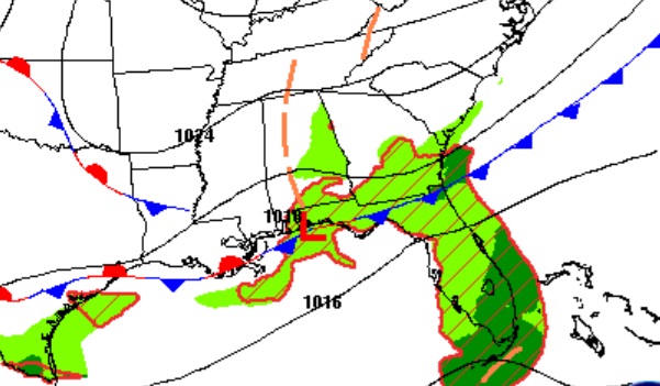
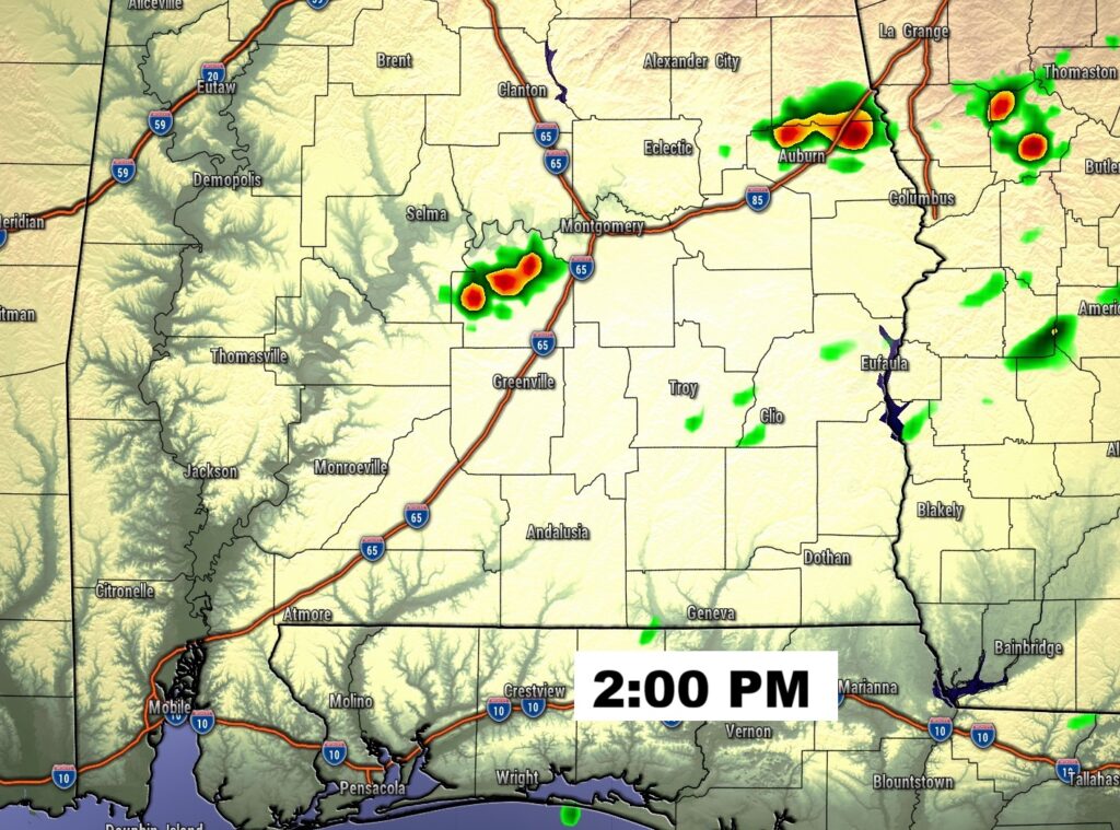
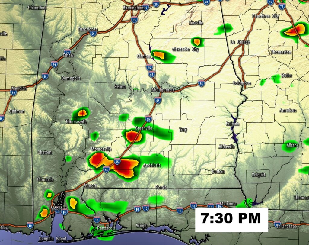
FUTURE RADAR: There will be just enough leftover moisture for a stray shower or two.
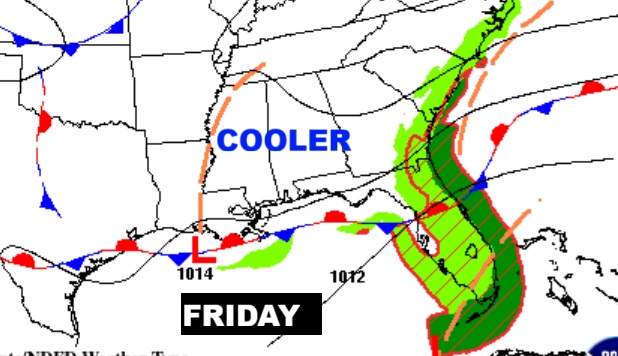
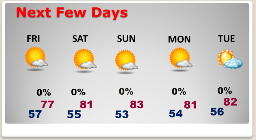
NEXT FEW DAYS: Some nice Fall air is on the way. Friday’s high only in the 70’s. Over the weekend, expect jacket weather nights in the 50’s. It should be a great Fall weekend with sunshine, low humidity and highs mostly in the lower 80’s.
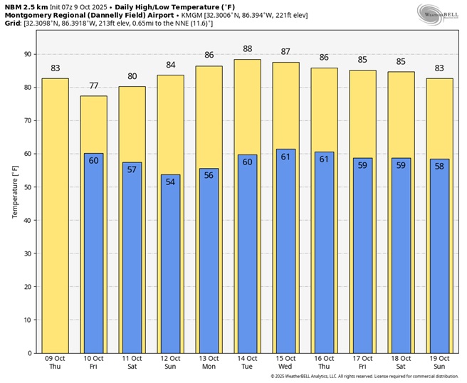
Here’s the 10 day Model Blend temperature trend.
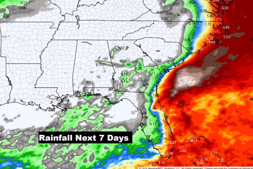
New Drought Monitor comes out tomorrow. Not good. This map speaks volumes. It’s basically a dry forecast for several days.
TROPICAL OUTLOOK:
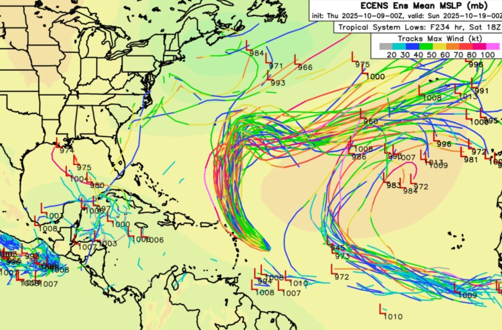
Tropical storm Jerry is likely to be a hurricane soon. It will curve into the open Atlantic. “Fish storm”.
Elsewhere: That Area to Watch in the southwest Gulf has now fizzled.
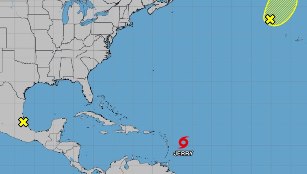
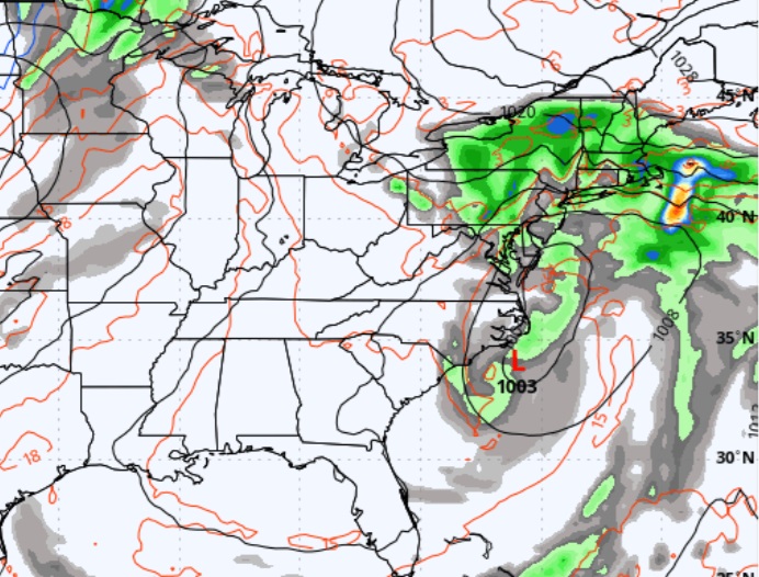
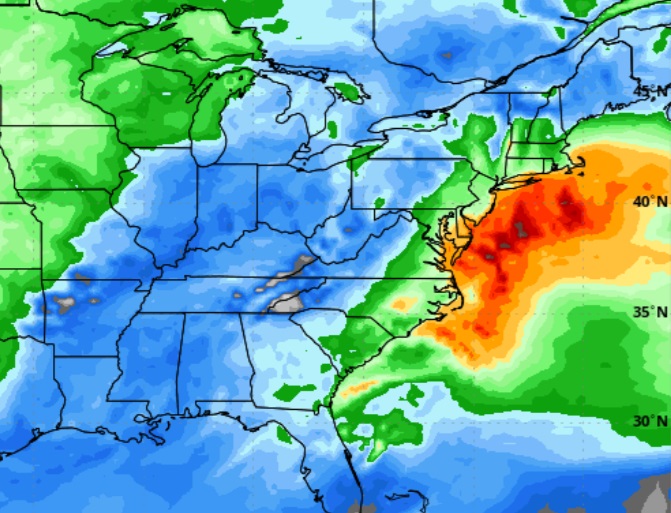
Besides the Tropical activity – there is a POWERFUL Non Tropical Low, a Nor Easter, off the US Middle Atlantic Coast, moving NE along the Atlantic coast. which could produce 40-60 mph wind gusts, along with tremendous wave action.
The EURO Ensemble models Member Lows are still highlighting some potential future trouble from the west Caribbean to Florida and into the Gulf.
—
This morning we are LIVE on the radio from 6 to 9 on NewsTalk 93.1. Watch us on TV on CBS 8 and ABC 32. I’ll have another update for you in the morning. Have a nice day.
–Rich