
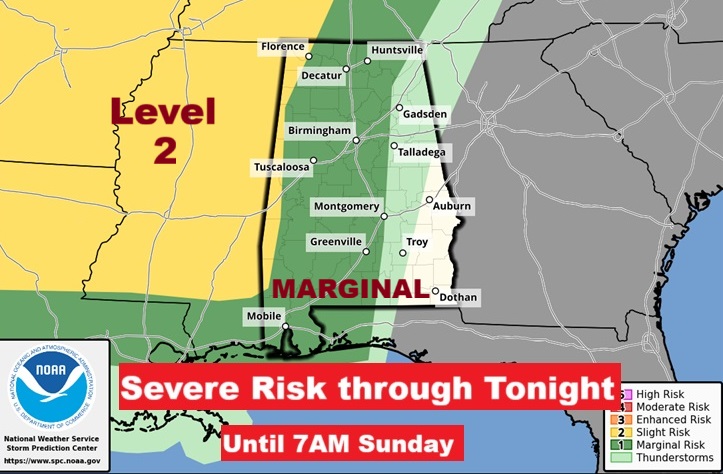
Good morning! Get ready for big changes as an important cold front approaches. Today will be routine: Dry & warm with a sun/cloud mix. Our expected high in the upper 80’s will be the 4th day in a row. We should be dry through the evening hours tonight. Showers and storms late tonight and first half of the day Sunday. Some of the storms could reach severe limits. Level 1 Marginal Severe risk. The cold front will move through by about lunchtime Sunday.
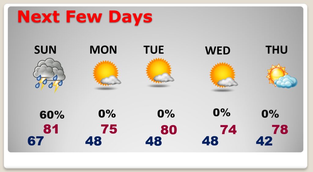
Get ready for the coolest air of the season so far. In fact, most days next week will be in the 70’s and nights in the 40’s. The coolest day will be lower 70’s and breezy Wednesday and coldest morning 42 on Thursday. Get ready for a change of wardrobe!
TODAY: Sun/cloud mix. Very warm for October. High 88. (That would be the 4th day in a row for 88)
We should be Dry through the evening hours this evening. Showers and storms late tonight and first half of the day Sunday. Low 67. (Normal 80/54)
The Cold front is approaching. It will reach Montgomery by about mid-day Sunday and pass into SE Alabama.
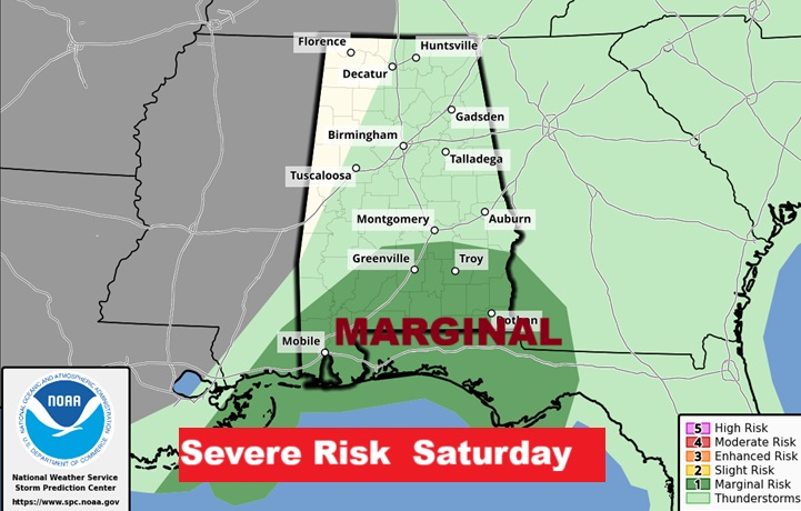
SEVERE RISK LATE TONIGHT AND SUNDAY: First Fall Severe Risk. Marginal Level 1 risk for most of us.
– The primary severe weather threat early Sunday morning is
damaging wind gusts with a secondary risk of a brief tornado
or two.
NEXT FEW DAYS: Get ready for big changes. Showers and storms late tonight and first half of the day Sunday. It will turn much cooler behind the front with upper 40’s by late Sunday night. Coolest air of the season so far. In fact most days will be in the 70’s and nights in the 40’s. The coolest day will be lower 70’s and breezy Wednesday and coldest morning 42 on Thursday. CHILLY stuff is on the way!
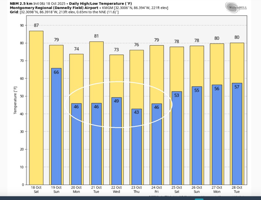
The ten day model blend shows the big cool down.
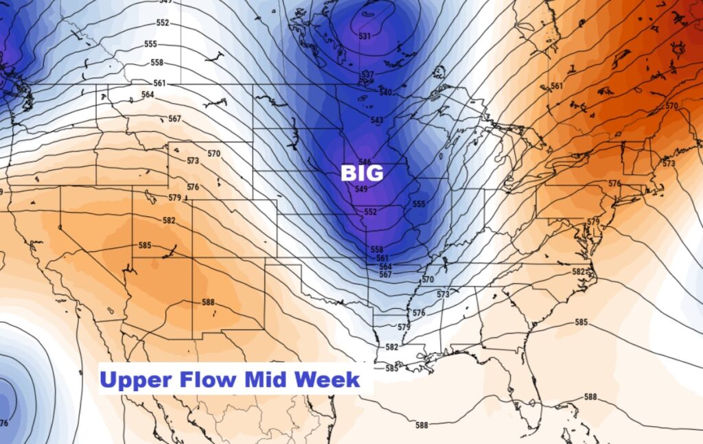
There will. be a secondary Cool Blast mid-week. Chilly stuff.
BIG SPORTS WEEKEND: Timing is everything. There are THREE Huge Events this weekend – including Alabama/Tennessee in Tuscaloosa at 6:30. Auburn/Missouri in Auburn at 6:45. And then there’s a little race in Talladega at 1:pm tomorrow. Right now I feel good about all of these events as far as the storm threat. NO problem for the Auburn game. The Bama game should have long ended by time of severe storms reach Tuscaloosa, probably after Midnight. Talladega may be a potential close call for the race start – but I’m pretty confident that the storms should have past by racetime. See Future radar below.
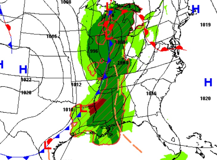
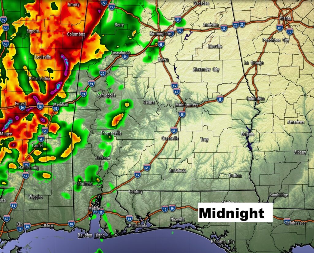
- FUTURE RADAR: Three key times are highlighted here. Look at that mean line of strong/severe storms AT Midnight on Alabama’s west border.
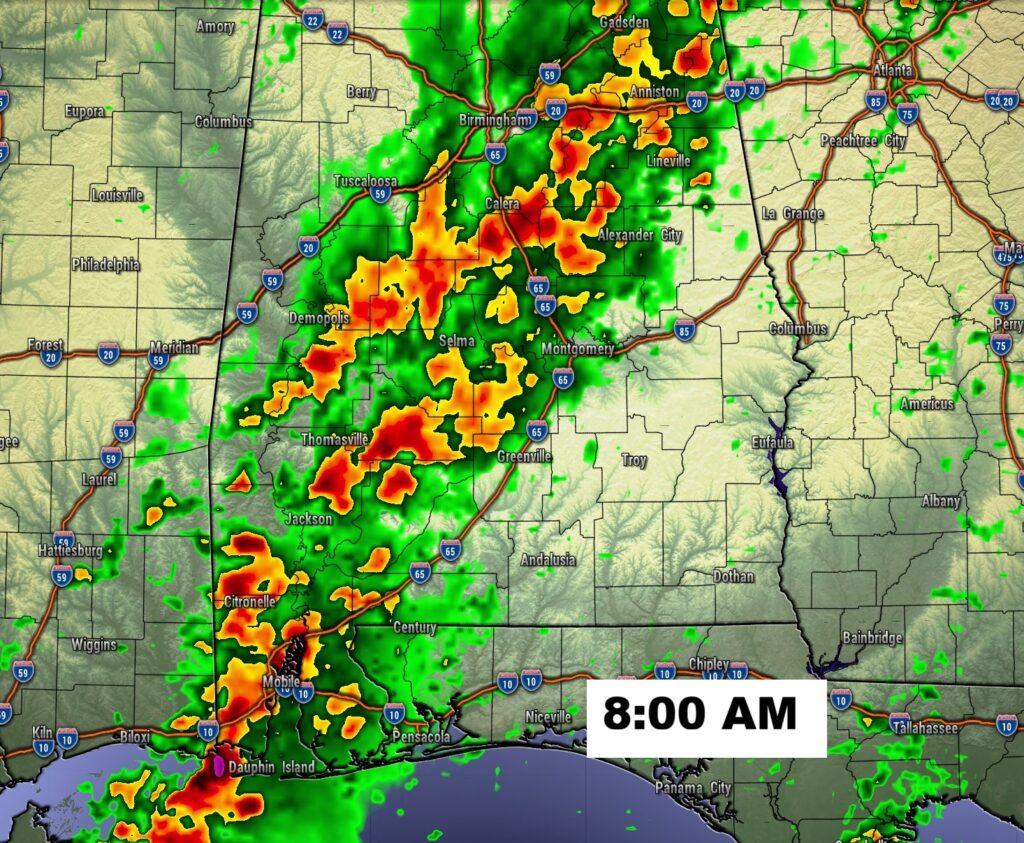
- 8:00 looks like a busy hour for many of us. Stormy morning. Potentially severe storms. Our weather app will keep you on top of the action.
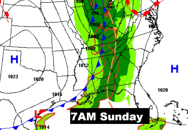
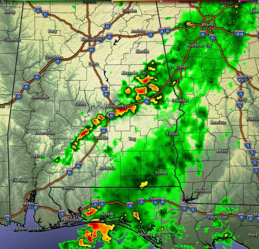
- NOON: Notice the back edge of the rain near Montgomery along the front as the Severe threat shifts southeast.
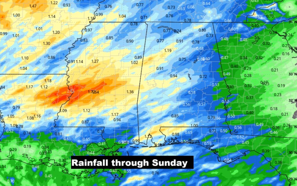
Here’s the expected rainfall. WE NEED RAIN.
TROPICAL:
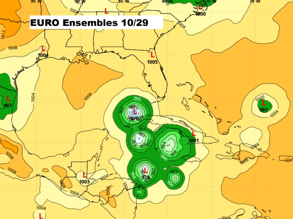
There are Two Areas to Watch. We could care less about the one in the Atlantic – BUT there’s potential Topical Trouble in the Caribbean.
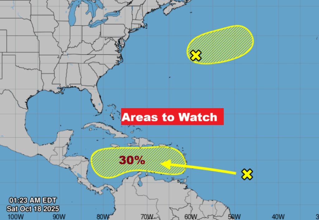
The Global models continues to strongly indicate that the Caribbean needs to be monitored next week for tropical development, with potential migration into the Gulf by the end of this month. Stay tuned.
Eventually, activity could migrate to the Gulf before this month is over. Look at the evidence in the maps below. Not done with the tropics yet.
The next scheduled Blog update and Video Discussion is scheduled for Monday morning in the 4 o’clock hour. Have a nice weekend!
–Rich