
Good morning! Expect another beautiful Fall Day today with a high in the upper 70’s to near 80. We should be be storm-free and dry through Saturday. Daytime highs will be mostly in the upper 70’s to near 80 Friday and Saturday, with cool jacket weather nights. Scattered showers and storms are expected on Sunday, with a lingering chance Monday and Tuesday, as a storm system slides eastward across the Gulf South. Here’s my Brief Video Forecast Discussion.
TODAY: Sunshine. Comfortable humidity. North wind 6 to 13 mph. High upper 70’s to near 80. Mostly clear tonight. Low 47. (Normal 78/52)
NEXT FEW DAYS: Great Fall weather continues with sunshine and highs in the upper 70’s to near 80 through Saturday. Cool jacket weather nights continue. It looks like we will be storm-free and dry through Saturday. Daytime highs will be mostly in the upper 70’s to near 80 Friday and Saturday, with cool jacket weather nights. Scattered showers and storms are expected on Sunday, with a lingering chance Monday and Tuesday.
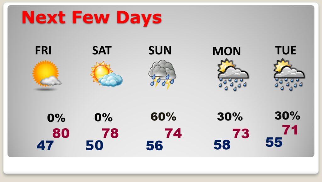
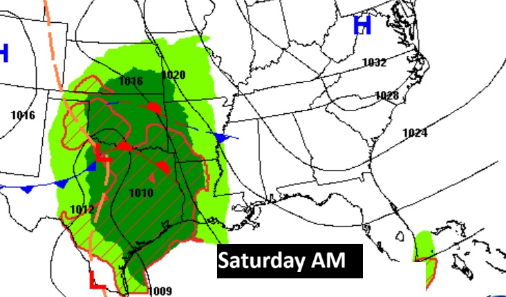
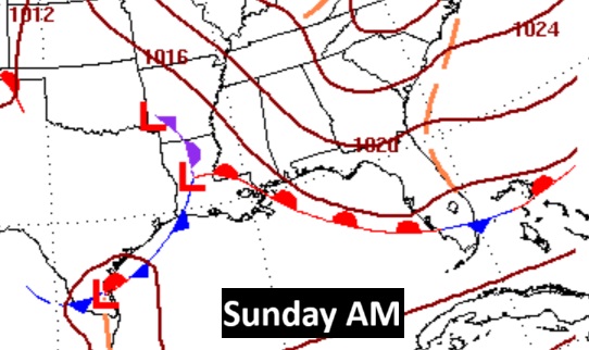
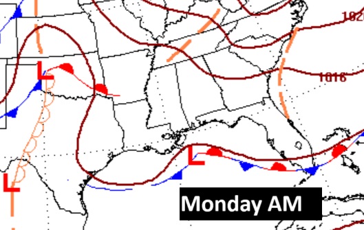
The next significant weather maker is this weekend, as a low pressure storm system slides eastward through the Gulf states. Scattered showers and storms will arrive by Sunday, with a lingering chance Monday and Tuesday.
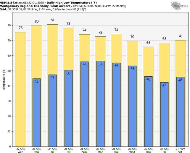
Here’s the 10 Day model blend temperature trend. Some of the very coolest air will be near Halloween.
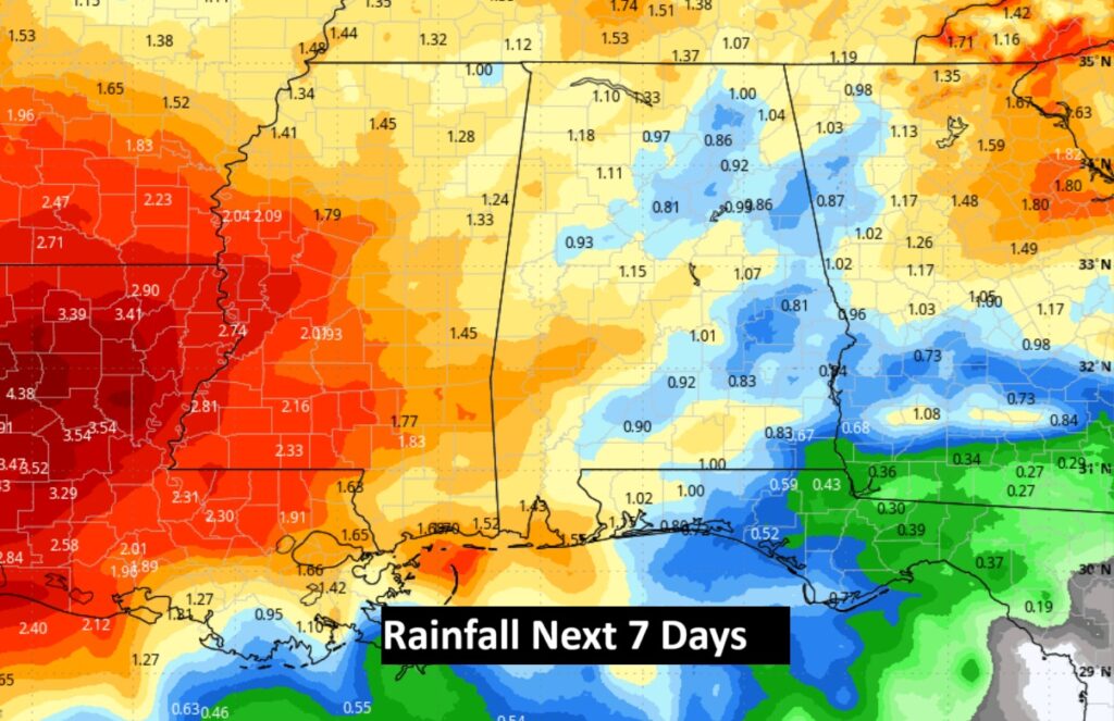
Hopefully some more beneficial rainfall. At least a little. Here’s the rainfall outlook for the next 7 days. New Drought Monitor map comes out this morning.
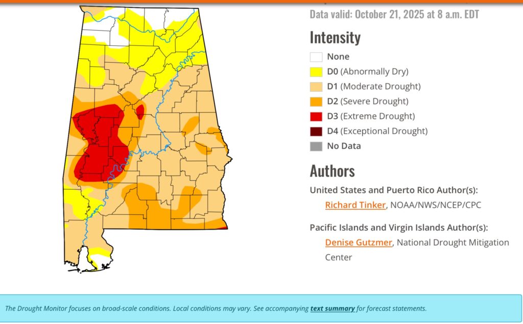
DROUGHT MONITOR: The weekly Drought Monitor Map is out. Last Sunday’s rain did not really help. Currently 72% of the state has a moderate drought or greater, and 26% of the state has a Severe or Extreme drought. Look at that large area of Extreme drought in West Alabama.
TROPICAL:
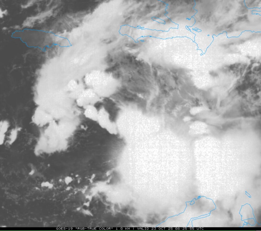
There’s much uncertainty in the future of Tropical storm Melissa. Melissa is expected to become a hurricane by this weekend. It is crawling in the Caribbean moving WNW at 3 mph.
NHC says: Melissa is forecast to meander over the central Caribbean Sea and could potentially become a major hurricane by late this weekend or early next week.
Due to Melissa’s slow motion, the risk of a prolonged period of strong winds, possibly lasting for a day or more, is increasing for Jamaica and the Tiburon peninsula of Haiti
.
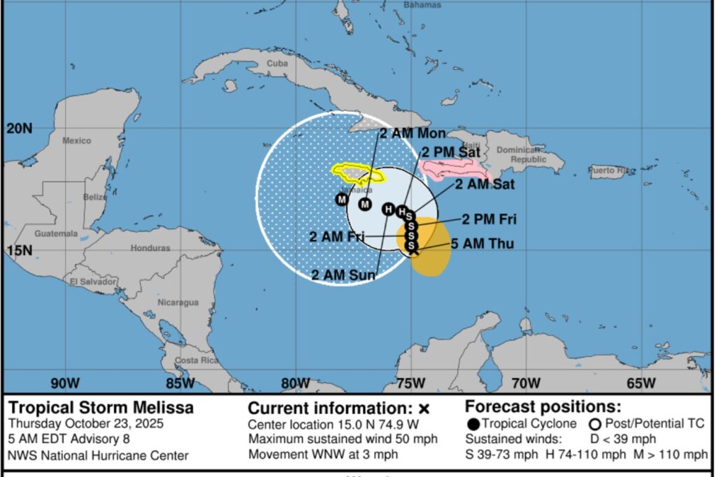
Melissa dominates the central Caribbean.
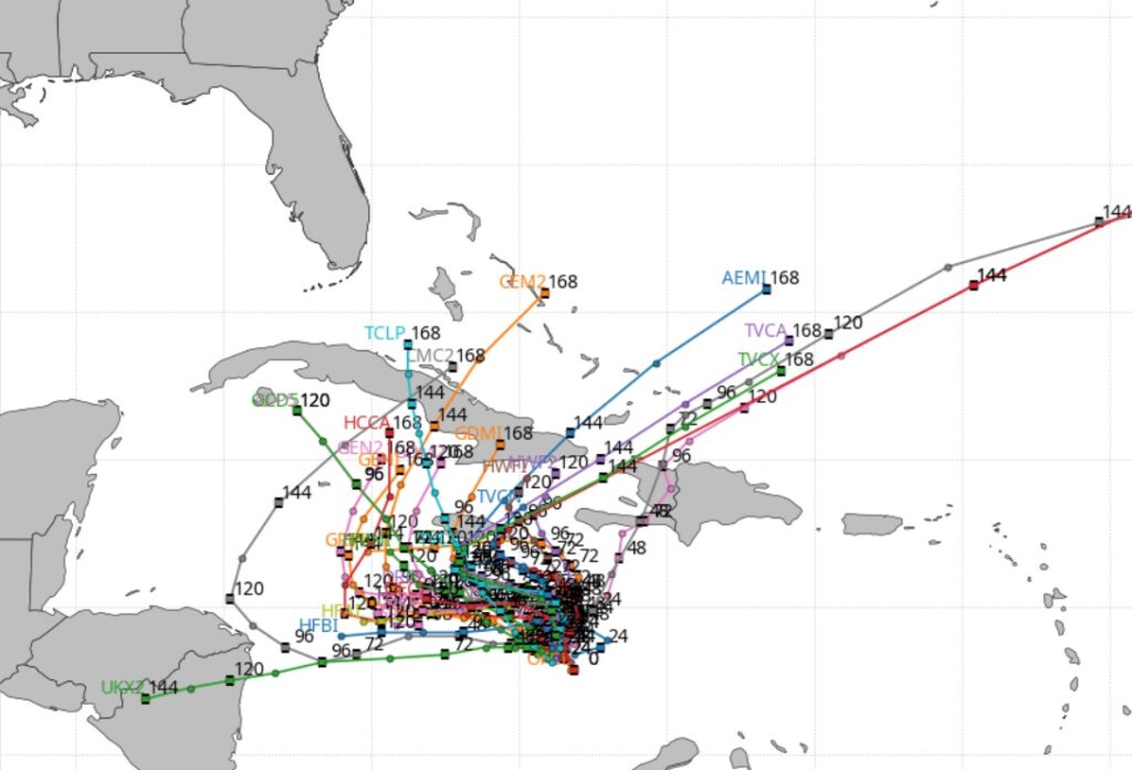
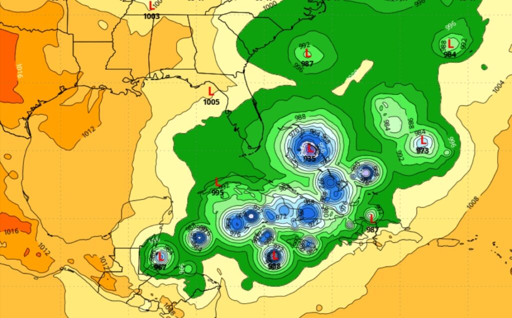
The models indicate Melissa will not move much next few days. Then eventually curving into the Atlantic.
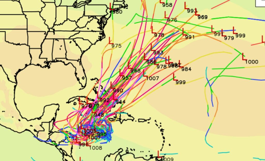
The EURO Ensemble Members shows the forecast dilemma involving Melissa.
Thanks for reading this Blog this morning. This morning we are LIVE on the radio from 6 to 9 on NewsTalk 93.1. I’ll have another update for you in the 4 o’clock hour tomorrow morning. Have a nice day.
–Rich