
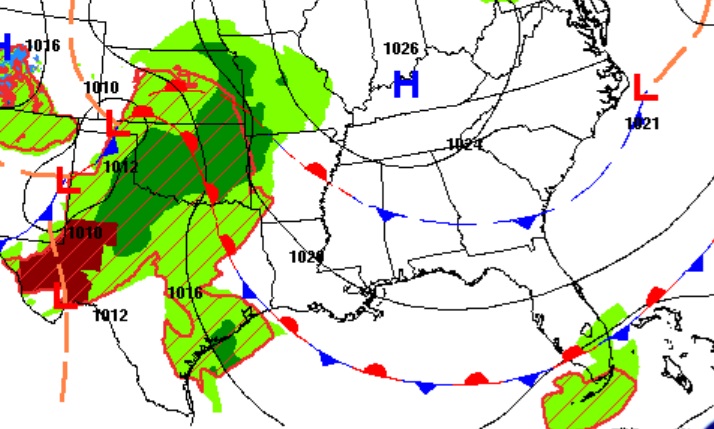
Good morning! Today should be another nearly perfect Fall day with lots of sunshine. Highs will be in the upper 70’s to near 80 Today and Saturday. Nights will not be as cool. We should be storm-free and dry through Saturday. Scattered showers and storms are expected on Sunday and Sunday night, with a lingering chance Monday through Wednesday, as a storm system slides eastward across the Gulf states. Hopefully we’ll see some beneficial rainfall as the drought worsens. SPC has a Marginal Severe Risk for Sunday across the southwest third of the state. Here’s my Brief Video Forecast Discussion.
TODAY: Mostly sunny.. Comfortable humidity. High near 80. Mostly clear tonight. Not quite as cool. Low 52. (Normal 78/51)
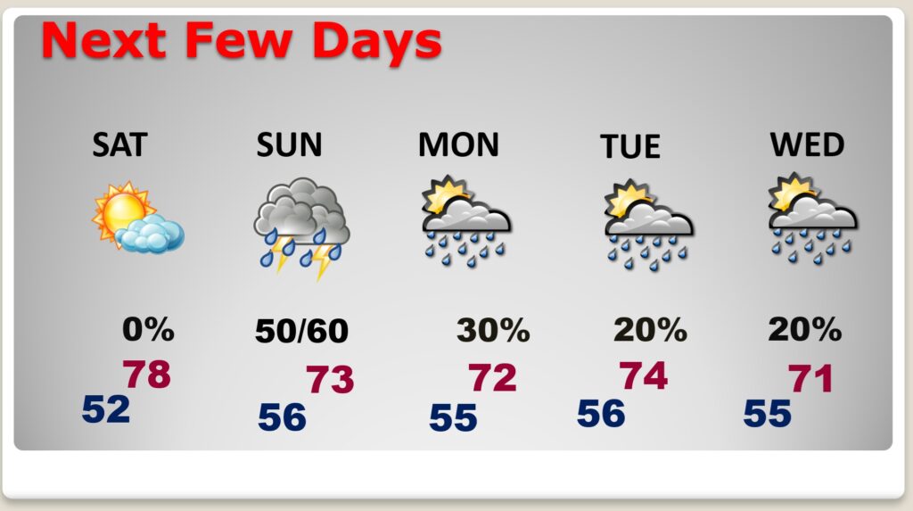
NEXT FEW DAYS: Great Fall weather continues with sunshine and highs in the upper 70’s to near 80 through Saturday.The nights are not as cool. It looks like we will be storm-free and dry through Saturday. Daytime highs will be mostly in the upper 70’s to near 80 Saturday. Scattered showers and storms are expected on Sunday and Sunday night, with a lingering chance Monday through Wednesday
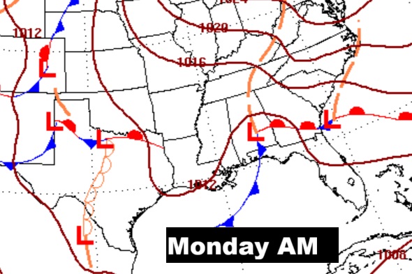
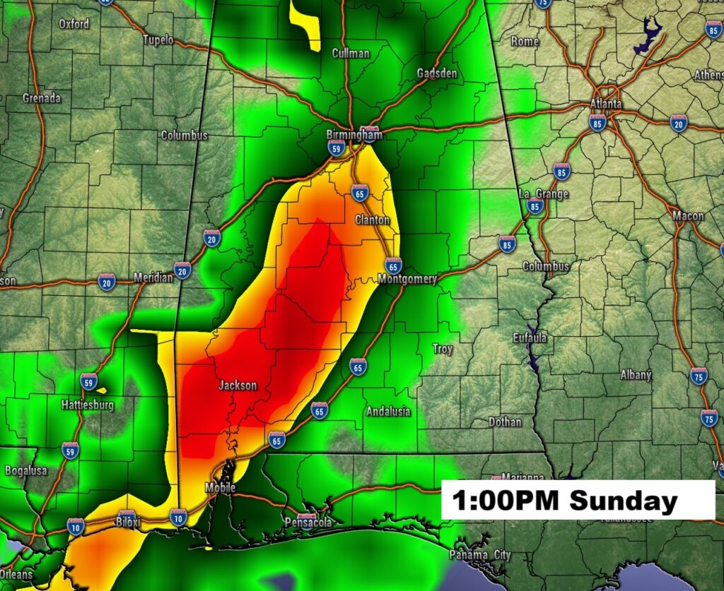
Here’s the set up on Sunday/Monday as a storm system moves east across the Gulf states.
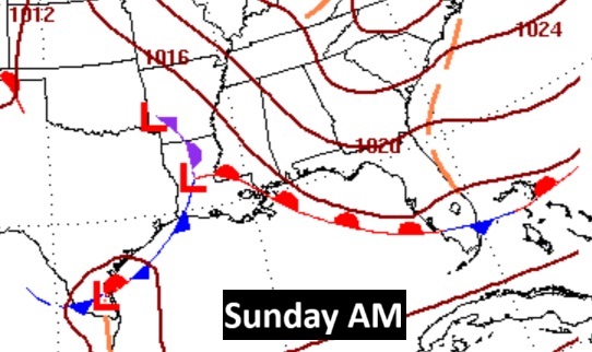
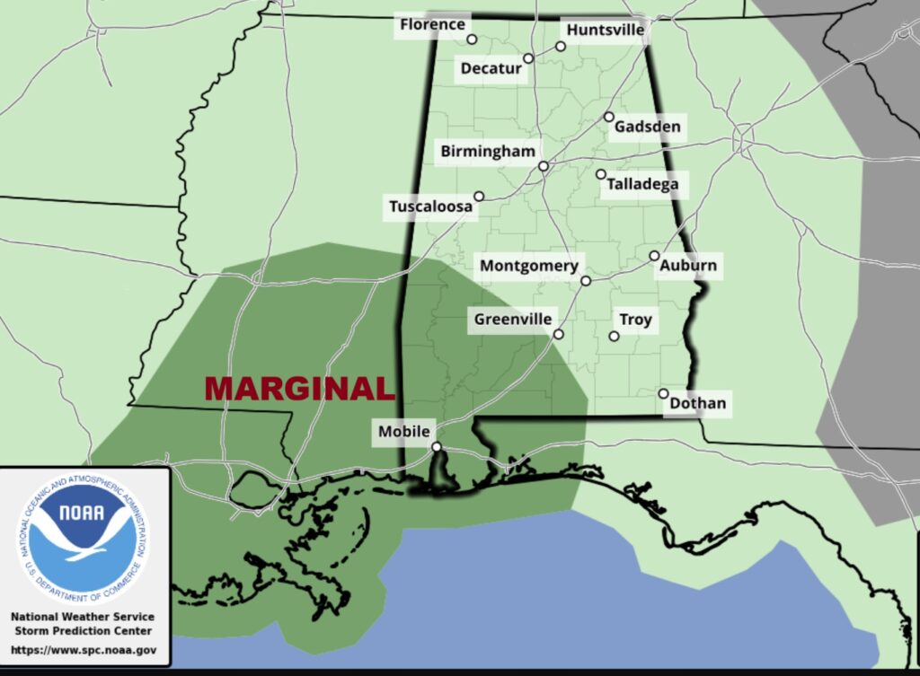
SPC has a Marginal Severe Risk for Sunday across the southwest third of the state.
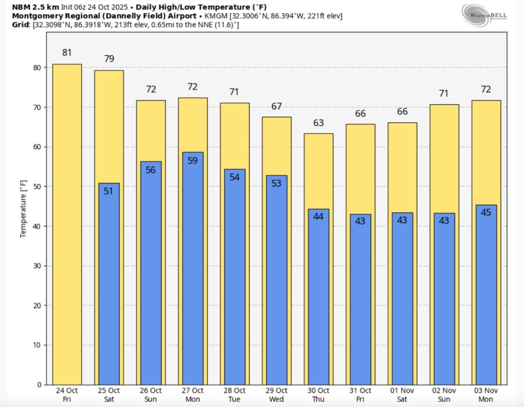
Here’s the 10 Day model blend temperature trend.
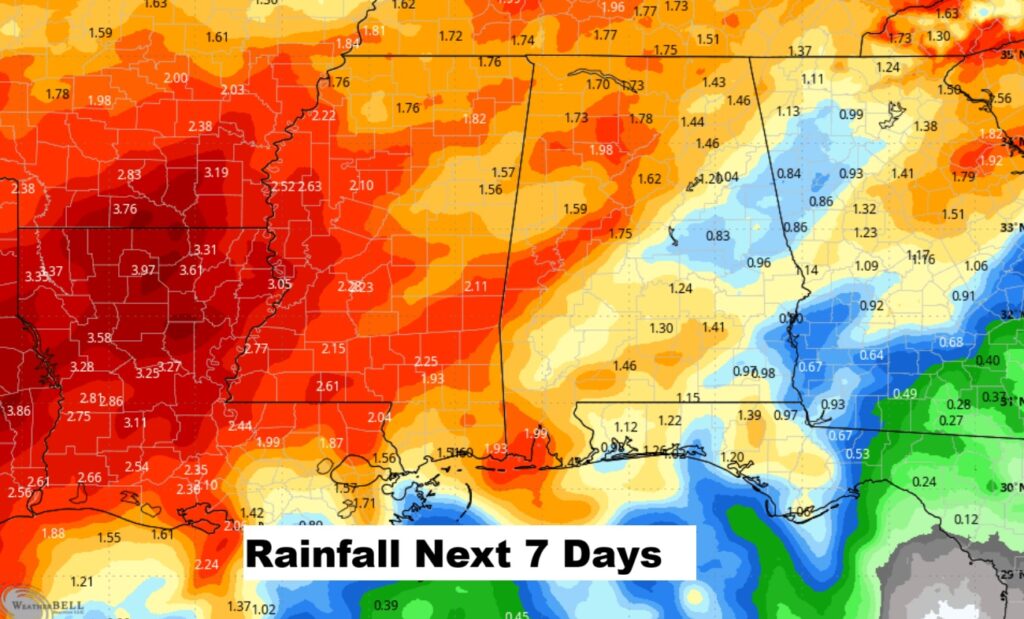
Hopefully some more beneficial rainfall. At least a little. Here’s the rainfall outlook for the next 7 days.
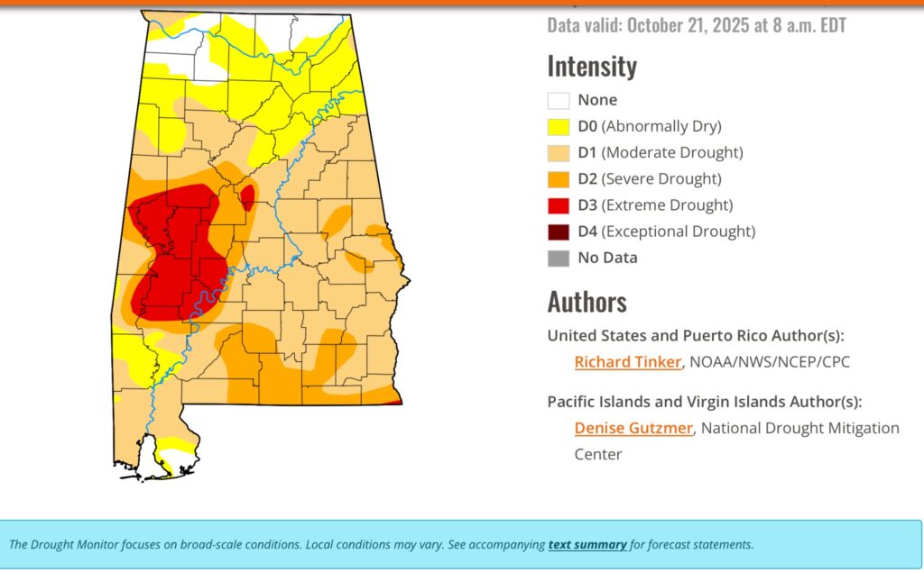
DROUGHT MONITOR: The weekly Drought Monitor Map is out. Last Sunday’s rain did not really help. Currently 72% of the state has a moderate drought or greater, and 26% of the state has a Severe or Extreme drought. Look at that large area of Extreme drought in West Alabama.
TROPICAL:
Mellissa is just a tropical storm now. But it’s expected to become a major hurricane over the weekend as it slowly meanders in the Caribbean. It’s likely to become a major hurricane with potentially disastrous and historic damage for Jamaica.
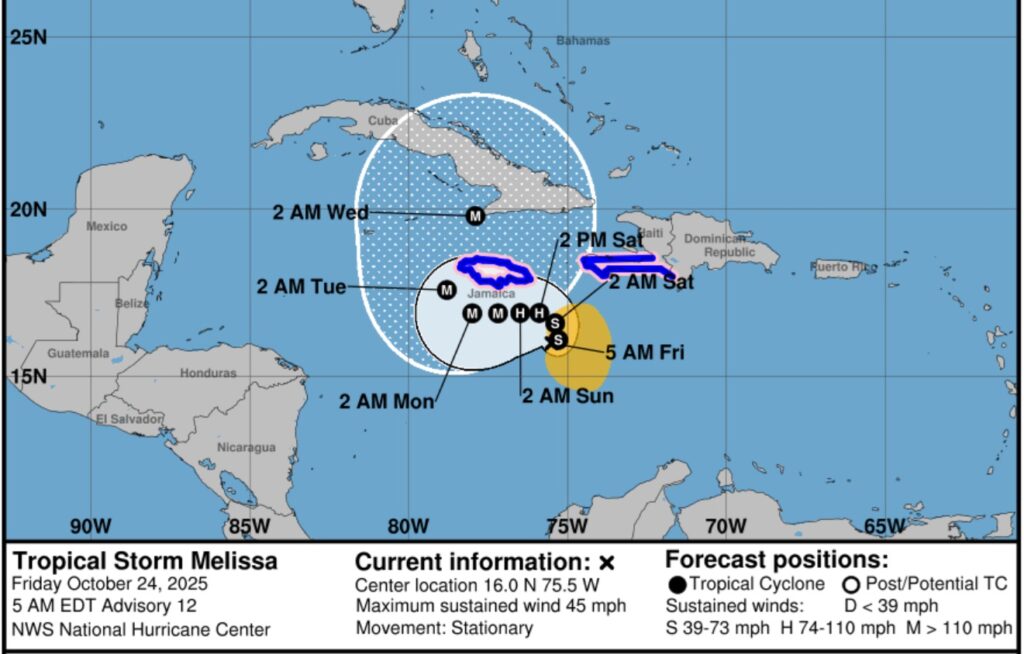
Due to Melissa’s slow motion, the risk of a prolonged period of strong winds, possibly lasting for a day or more, is increasing for Jamaica. A potential disaster is looming.
.
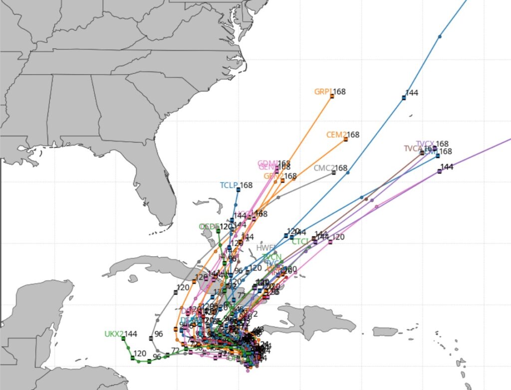
The models indicate Melissa will not move much next few days. Then eventually curving into the Atlantic.
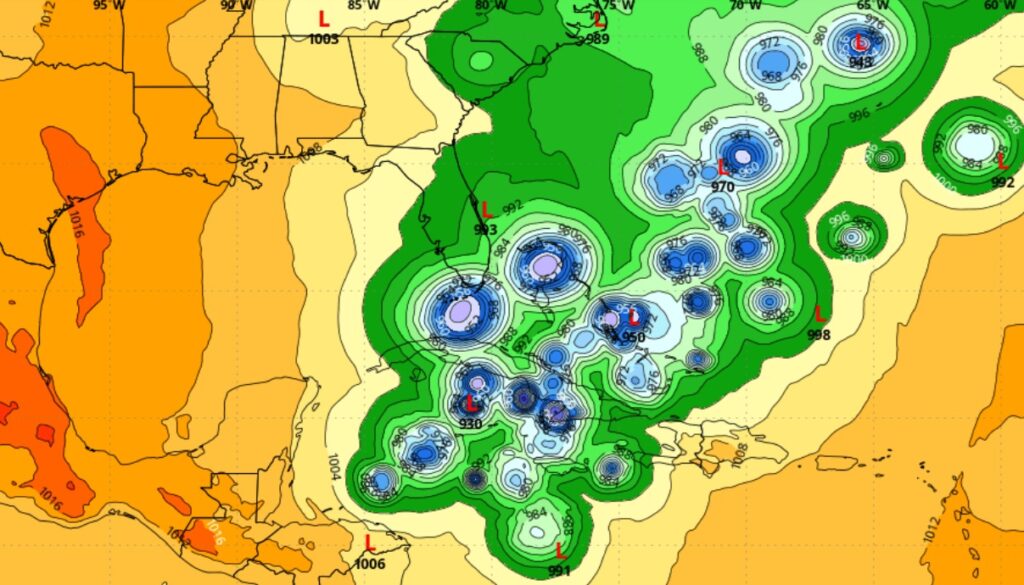
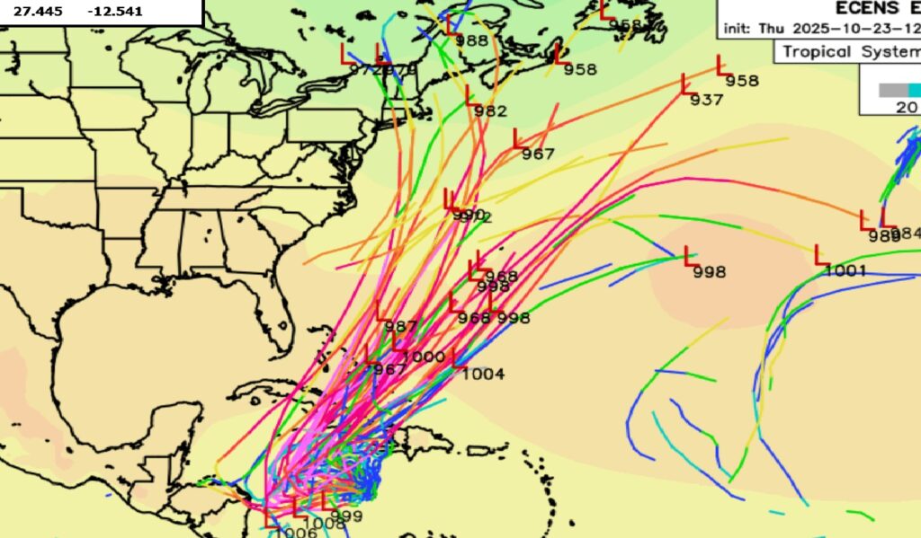
The EURO Ensemble Members shows the forecast dilemma involving Melissa, especially for Jamaica.
The next scheduled Blog update and Video Discussion is scheduled for Monday morning in the 4 o’clock hour. Have a nice weekend!
–Rich