
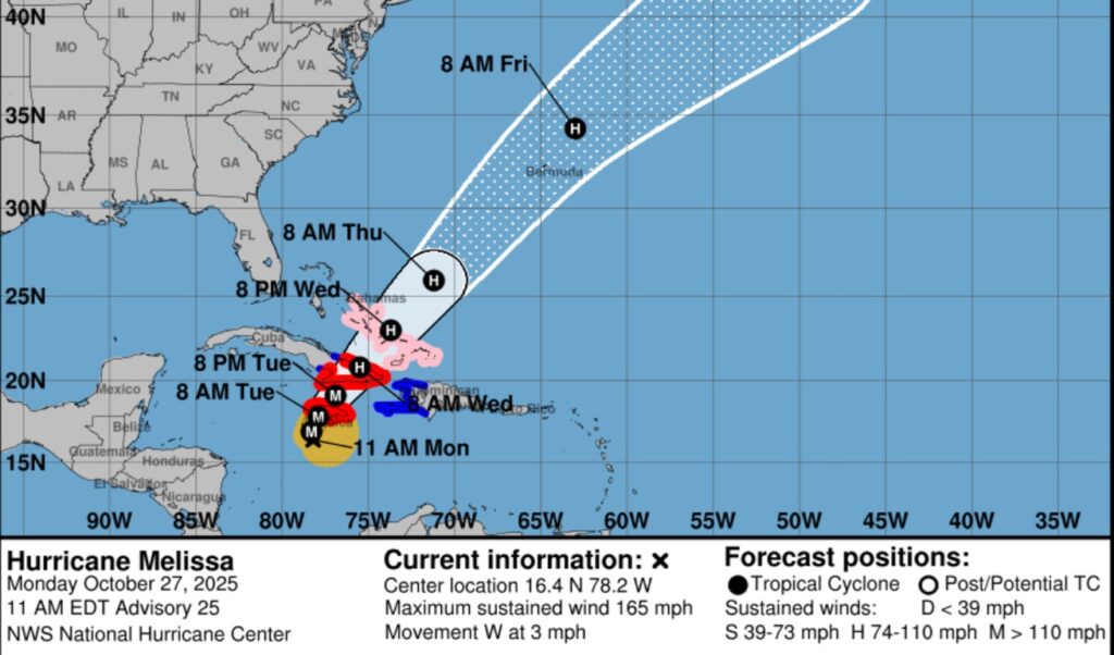
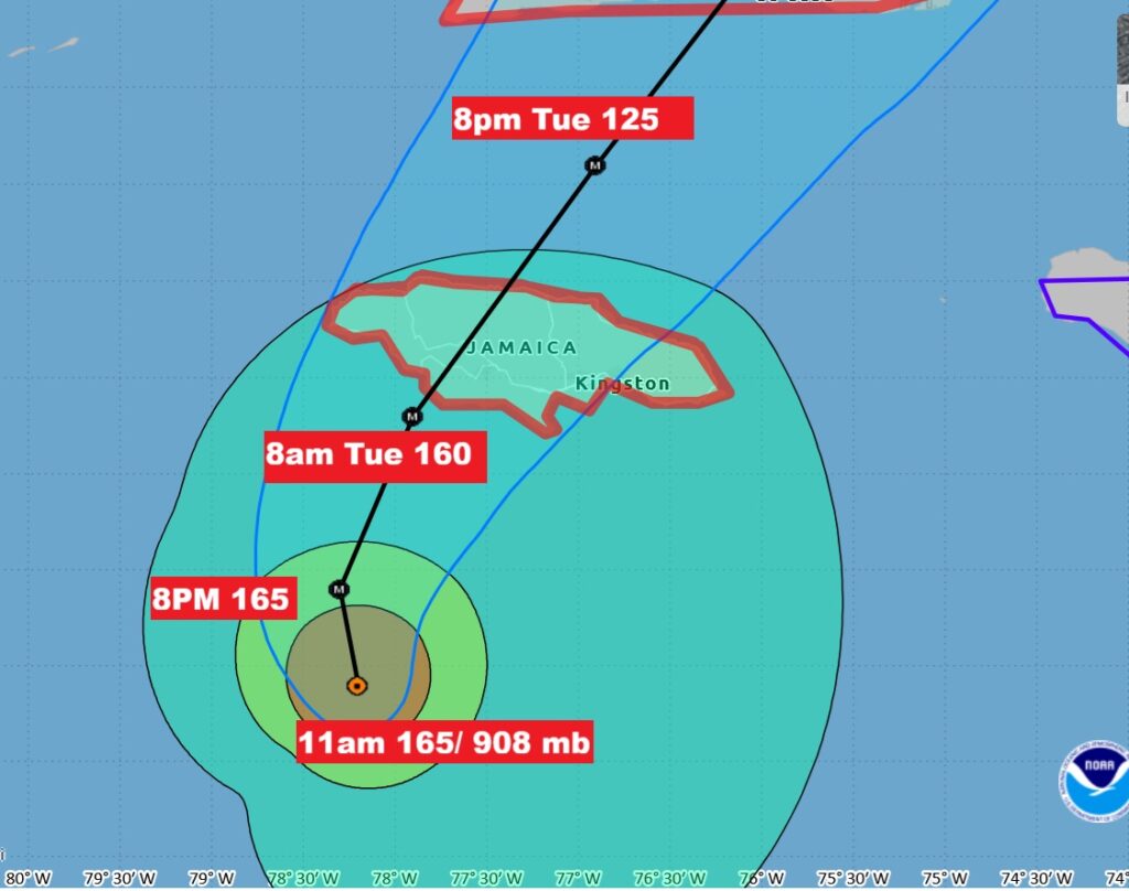
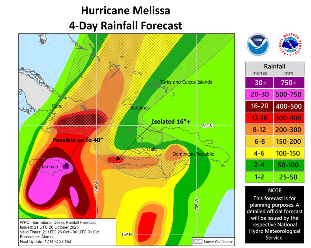
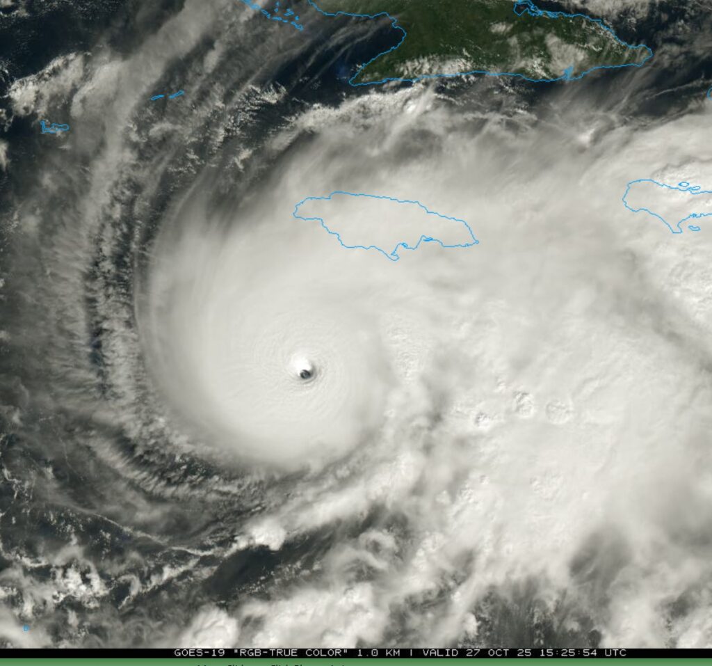
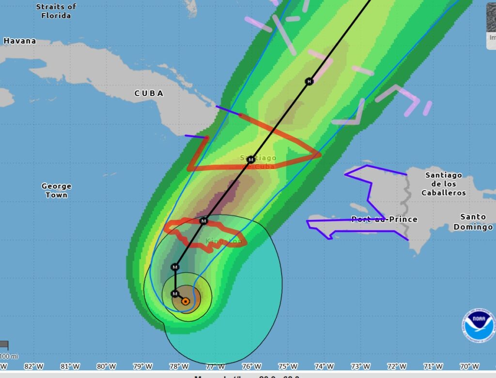
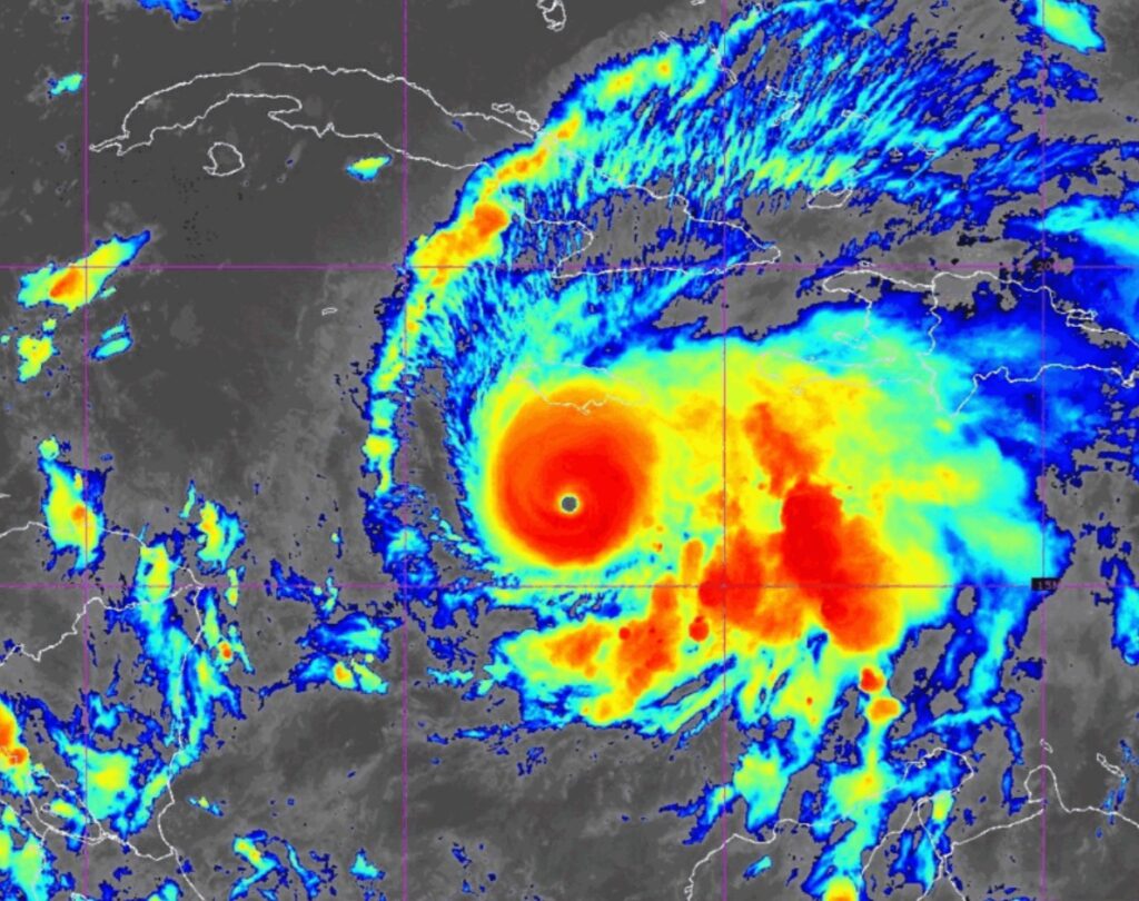
11AM EDT – Hurricane Melissa update — winds 165 mph (Cat 5), pressure lower at 908mbs. Melissa moving west at 3, now 145 miles from Kingston. Melissa has the classic strong hurricane appearance in satellite imagery this morning, with a well-defined 10-nm wide eye. Landfall early Tuesday along the Jamaican coast. Catastrophic damage is expected. Rainfall will be measured in feet. Up to 40″ is possible. A disaster is looming. Jamaica has never had a Cat 5 hurricane landfall.
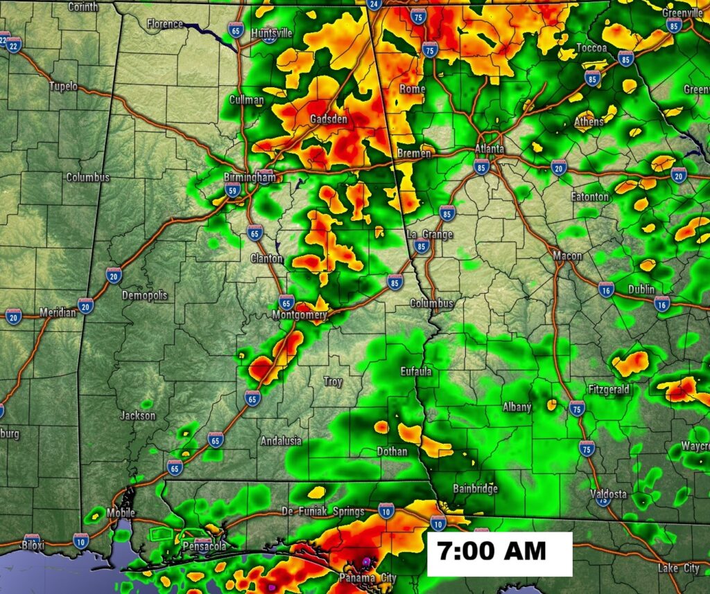
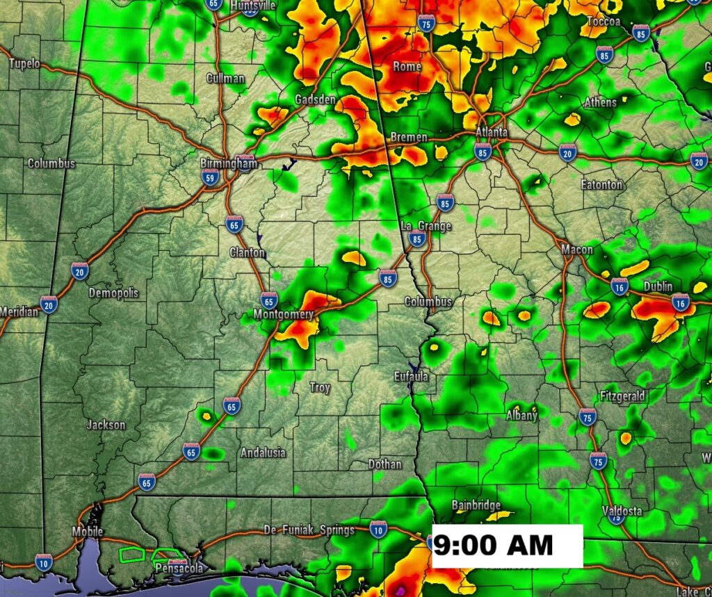
Good morning! There’s still rain on the radar this morning. But, so far, unfortunately, many towns have had disappointing rainfall totals. There’s still a risk of more showers through about mid-day as a frontal system departs the area. Our next weather maker is a cold front that will move across the state overnight Tuesday night into Wednesday, bringing in another decent chance of showers and maybe some thunderstorms. Following the frontal passage, get ready for the coolest air of the fall season so far. Thursday’s high will barely reach 60. We’ll be near or below 40 Thursday night and Friday night. Get ready for a Big Chill in the week ahead. Here’s my Brief Video Forecast Discussion.
TODAY: Showers and thunderstorms before 10am, then a slight chance of showers between 10am and 1pm. High near 65. Northeast wind 5 to 10 mph. Cloudy tonight. Low 54.
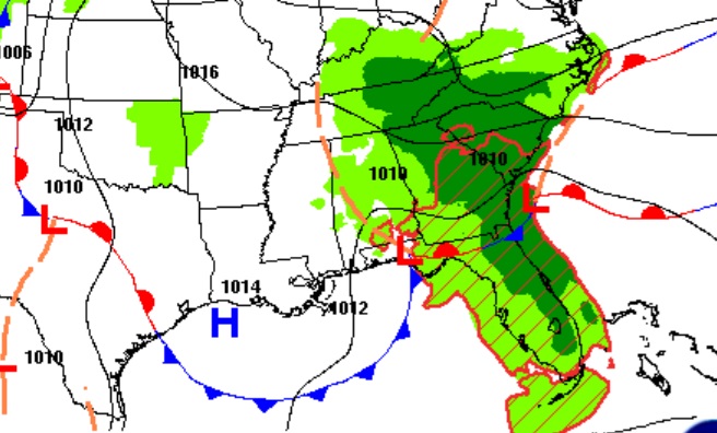
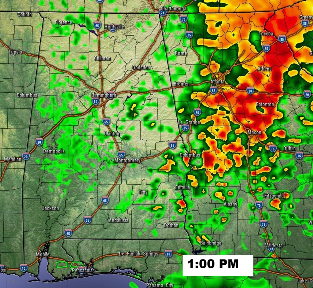
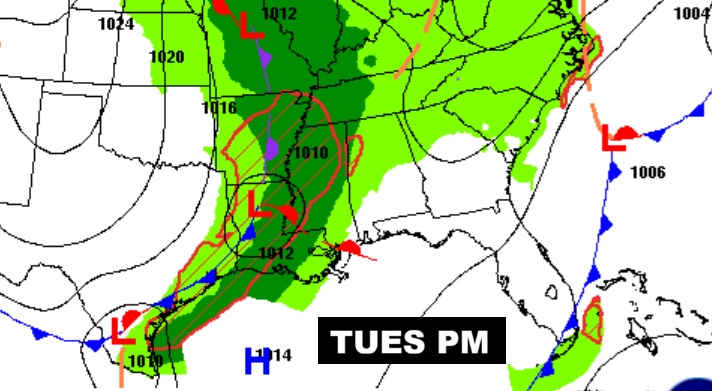
Here’s the set-up at 1:00PM with low pressure located near Dothan.
FUTURE RADAR: The greatest threat of scattered showers is this morning. The risk of showers will move east of the state by mid-day.
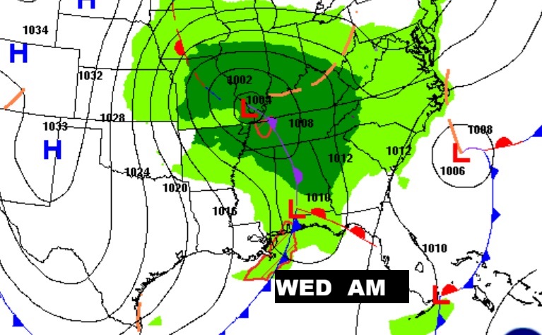
NEXT FEW DAYS: Our next weather maker is a cold front that will move across the state overnight Tuesday night into Wednesday, bringing in another decent chance of showers and maybe some thunderstorms. Following the frontal passage, get ready for the coolest air of the fall season so far. Thursday’s high will barely reach 60. We’ll be near or below 40 Thursday night and Friday night.
A cold front will bring a chance of rain overnight Tuesday night into early Wednesday.
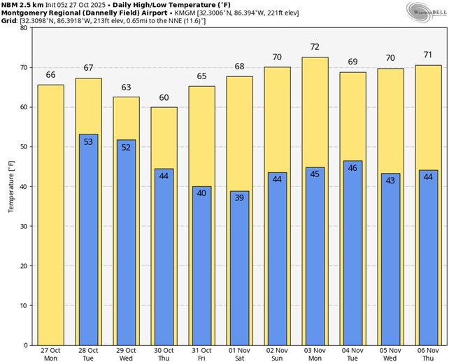
Here’s the 10 Day model blend temperature trend. Cool times ahead. (Normal hi/lo 77/50) Take a look at the numbers for the week ahead. Coolest air of the season, so far. Near 60 for a high Thursday. Upper 30’s Friday night/ Saturday AM.
Hurricane MELISSA UPDATE:
Powerful extremely dangerous Melissa just reached Category 5 status with 160 mph winds as it edges closer to Jamaica. A disaster is looming. Melissa will score a direct hit on Jamaica by tonight and through Tuesday causing, historic, catastrophic damage and prolific flooding measured in feet. It could ultimately be the biggest hurricane disaster in Jamaican history. Then, southeast Cuba and the southeast Bahamas, including the Turks and Caicos before accelerating northeast into the Atlantic.
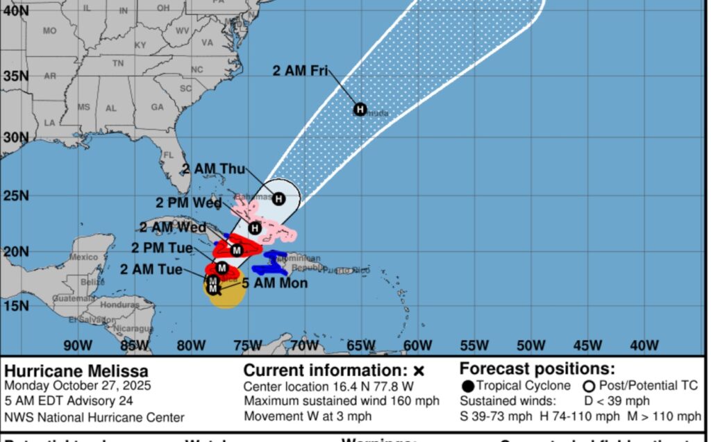
Look at Monster Melissa, still intensifying south of Jamaica. Major Hurricane History in the making.
.Localized rainfall totals could reach and unthinkable 25 to 40 inches. A major disaster is looming.

Thanks for reading this Blog this morning. This morning we are LIVE on the radio from 6 to 9 on NewsTalk 93.1. I’ll have another update for you in the 4 o’clock hour tomorrow morning. Have a nice day.
–Rich