
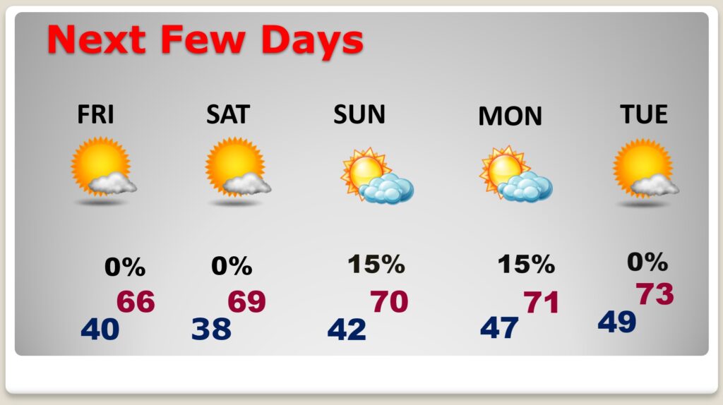
Good morning! Cool air dominates our forecast for the next few days. We may not reach 60 today. Nights will be the coldest of the season so far tonight and Friday night.
Wind gusting to 20+ mph will add a bite to the chill today. We’ll be near 40 tonight and upper 30’s Friday night. Halloween, and the first weekend of November will be nice with lots of sunshine. We’ll be near 70 by Sunday. (Normal 76/49) Expect a significant warming trend next week. Here’s my Brief Video Forecast Discussion.
TODAY: A Few morning sprinkles? Mostly cloudy, with a high near 59. West wind 10 to 15 gusts to 20+ mph. Tonight: Mostly clear, with a low around 40.
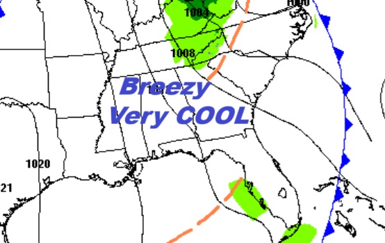
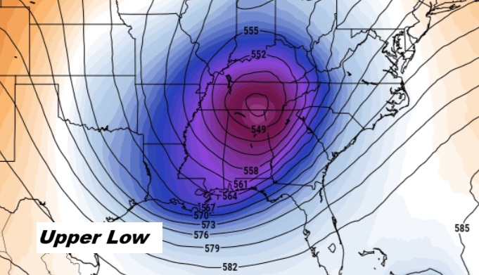
A Closed Upper Low is responsible for a persistent cloud cover, risk of sprinkles and breezy conditions.
NEXT FEW DAYS: Cool air dominates our forecast for the next few days. Days will be well below normal. Nights will be cold. Halloween, and the first weekend of November will be nice with lots of sunshine. Expect a significant warming trend next week. Coldest morning will be Saturday dawn. (Normal 76/49)
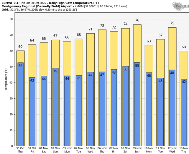
Here’s the 10 Day model blend temperature trend. Quite cool especially next 3 days and nights. Nice warm-up Next Week.
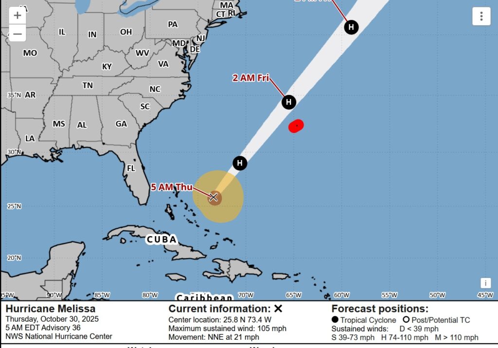
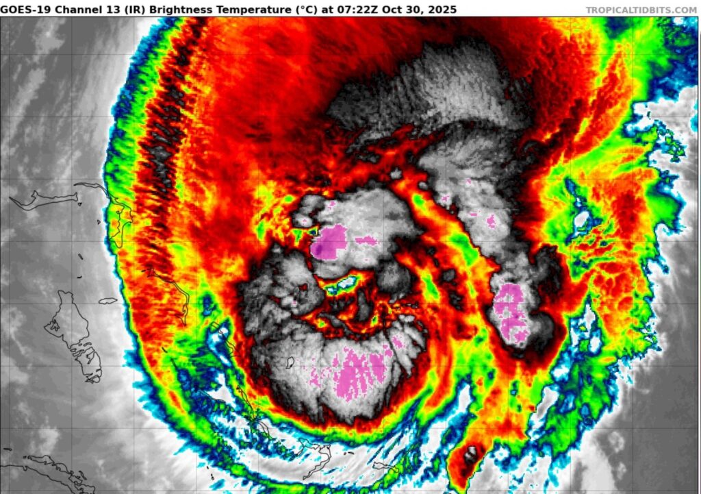
Hurricane MELISSA UPDATE:
Melissa is starting to re-intensify. Melissa has a short window of time to intensify during the next day or so as it remains over warm waters with moderate shear. Hurricane conditions are expected in Bermuda beginning late Today and continuing through tonight. At 4AM CDT: Melissa
.
FALL BACK THIS WEEKEND: This is the weekend Daylight saving time ends and we “fall back” to CST. Set the clocks back one hour before you go bed Saturday Night. Officially the time change happens at 2AM Sunday.

Thanks for reading this Blog this morning. This morning we are LIVE on the radio from 6 to 9 on NewsTalk 93.1. I’ll have another update for you in the 4 o’clock hour tomorrow morning. Have a nice day.
–Rich