
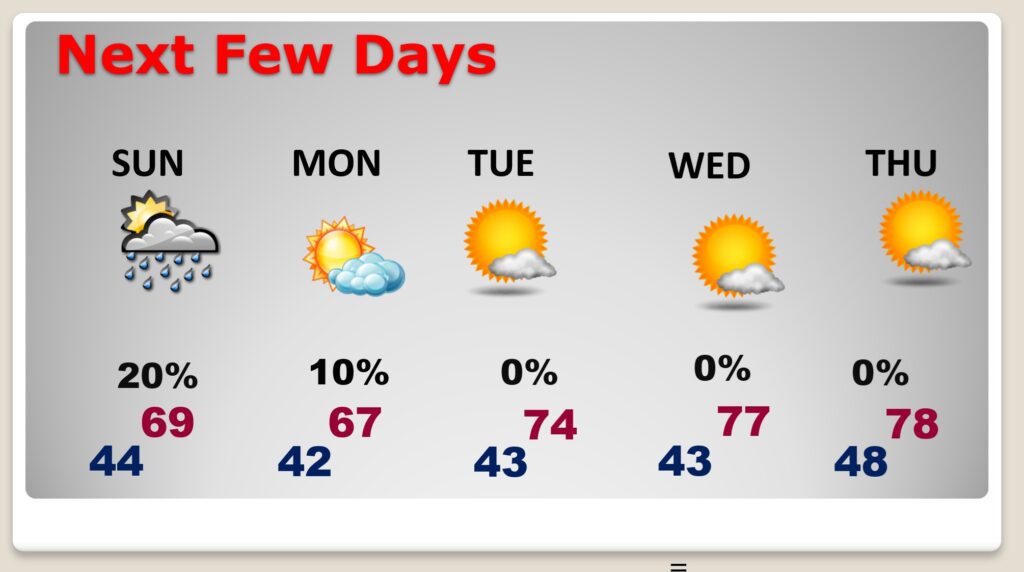
Good Morning! Welcome to November! Friday’s morning’s low of 35 was the coldest of the season so far. However, it was a really nice Hallowwen with a high of 67. Early on this Saturday morning we’ll start in the chilly 30’s again. It will be a pretty nice first weekend of November. Expect highs in the upper 60’s to near 70 today and Sunday. (Normal 75/48). A weak, quick hitting disturbance could bring an isolated shower or two late Sunday afternoon or Sunday night. Besides that, it’s a dry forecast for several day. There will be a significant warming trend next week. We’ll be in the upper 70’s by Thursday. Perhaps close to 80 by Friday.
TODAY: Sunny, with a high near 69. Calm wind. Tonight: Mostly cloudy, chilly, with a low around 44.
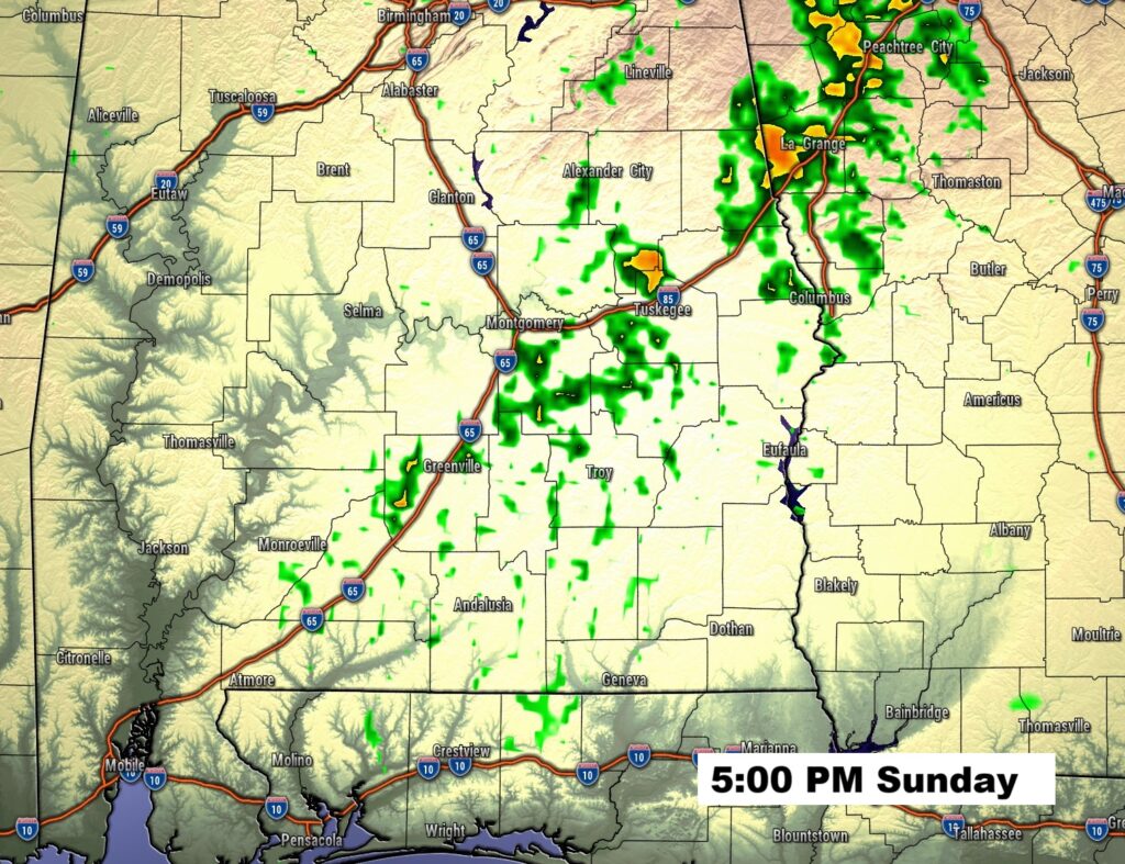
SUNDAY: Mostly sunny, with a high near 69. Winds could gust as high as 20 mph. Small chance of an isolated showers from the afternoon till about 1AM. 20% or less. Low 41 Sunday night. Here’s a Future Radar snapshot.
NEXT FEW DAYS: We’ll be in the upper 60’s to near 70 Sunday. A weak, quick hitting disturbance could bring an isolated shower or two late Sunday afternoon or Sunday night. Besides that, it’s a dry forecast for several day.
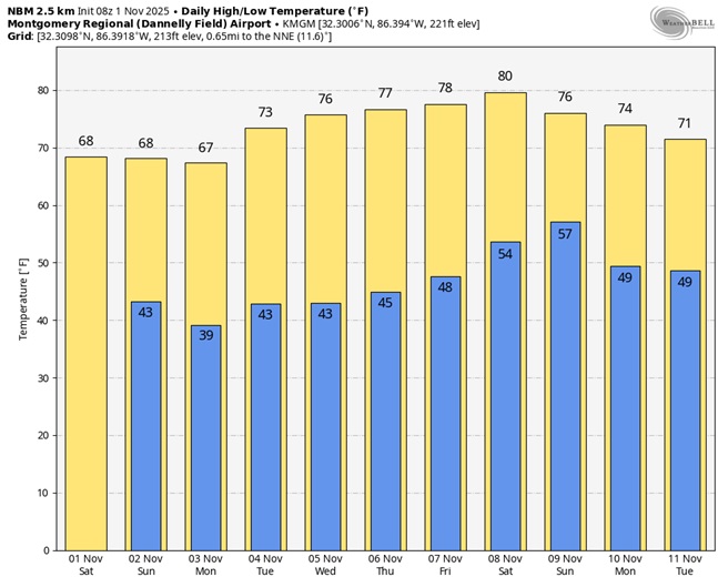
Here’s the 10 Day model blend temperature trend.
FALL BACK THIS WEEKEND: This is the weekend Daylight saving time ends and we “fall back” to CST. Set the clocks back one hour before you go bed tonight. Officially the time change happens at 2AM Sunday.

The next scheduled Blog update and Video Discussion is scheduled for Monday morning in the 4 o’clock hour. Have a nice weekend!
–Rich