
6AM UPDATE:
MONTGOMERY (MGM) has fallen to the 30s for the fifth day in a row! At 6:00AM it’s 36°. Selma has reached freezing, 32°. Alex City 33. Troy 35. Chilly. Normal hi/lo 74/47. Record low 23 1954.
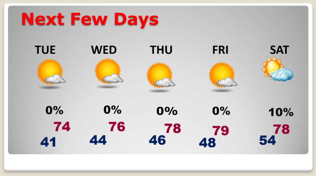
Good Morning! This first full week of November should be very nice indeed. The normal hi/lo is 74/47. Today we’ll be in the upper 60’s again. After today, we’ll climb into the 70’s for the rest of the week. In fact we should reach the upper 70’s Thursday through Saturday. Nights continue to be very chilly. We’ll be close to 40 tonight. But, gradually, even the nighttime lows will slowly start to moderate. Right now, I have us dry through Saturday. A Saturday frontal system currently looks dry, at least for us. Sunny days, and mostly clear nights will dominate.
TODAY: Sunny, with a high near 68. North wind 5 to 10 mph. Clear, chilly tonight. Low 42.
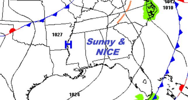
NEXT FEW DAYS: Expect a big warming trend. We’ll be in the 70’s for the rest of the week. In fact we should reach the upper 70’s Thursday through Saturday. Nights continue to be very chilly. But, even the nights will slowly start to moderate. Right now, I have us dry through Saturday. A Saturday frontal system currently looks dry, at least for us. Sunny days, and mostly clear nights will dominate.
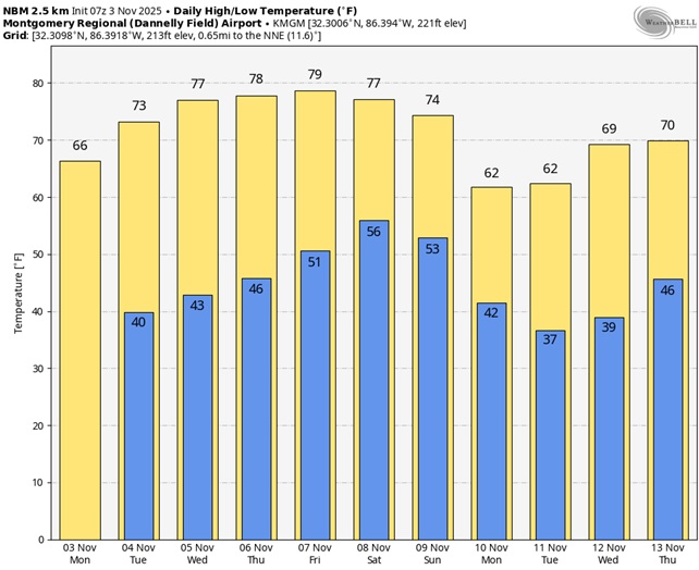
Here’s the 10 Day model blend temperature trend. The next big cooldown starts next week.
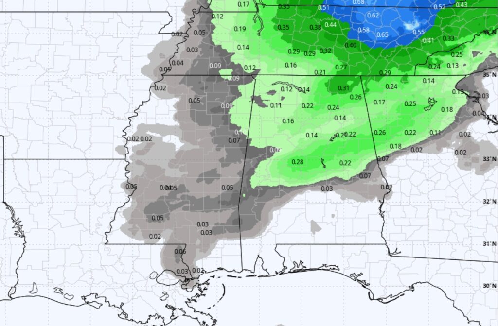
Some parts of our state could see a few showers Saturday ahead of the next front.
Thanks for reading this Blog this morning. This morning we are LIVE on the radio from 6 to 9 on NewsTalk 93.1. I’ll have another update for you in the 4 o’clock hour tomorrow morning. Have a nice day.
–Rich