
Good Morning! Our nice warm pattern continues for now. Yesterday’s high was 79. High today and tomorrow will be in the upper 70’s to near 80. The normal hi/lo is 73/45. The cool nights continue to moderate. An approaching frontal system will bring showers and storms to the state today and especially this evening and tonight. Some storms could reach Severe Limits. Level 1 Marginal Risk. The Main risk will be damaging winds. The Tornado Risk is low but not zero. Stage one cool-down arrives Sunday. Maybe upper 60’s Sunday. But hang on. Get ready for a early season arctic shocker. MUCH Colder air is on the horizon. A surge of Arctic Air will move in. Sunday night will be breezy and cold.. There will be a significant temperature crash. Monday’s high will only reach the 40’s, but wind chill will be a factor. The coldest morning will be Tuesday with the first widespread freeze and lows in the middle 20’s. Here’s my brief video forecast discussion.
TODAY: A chance of showers, with thunderstorms also possible by afternoon. Partly sunny, with a high near 78. TONIGHT: A chance of showers and thunderstorms, then showers likely and possibly a thunderstorm after midnight. Mostly cloudy, with a low around 63.
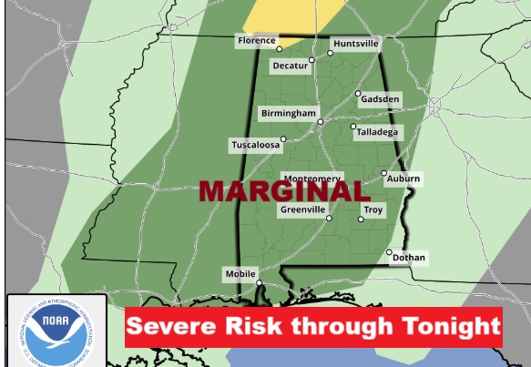
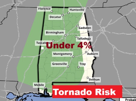
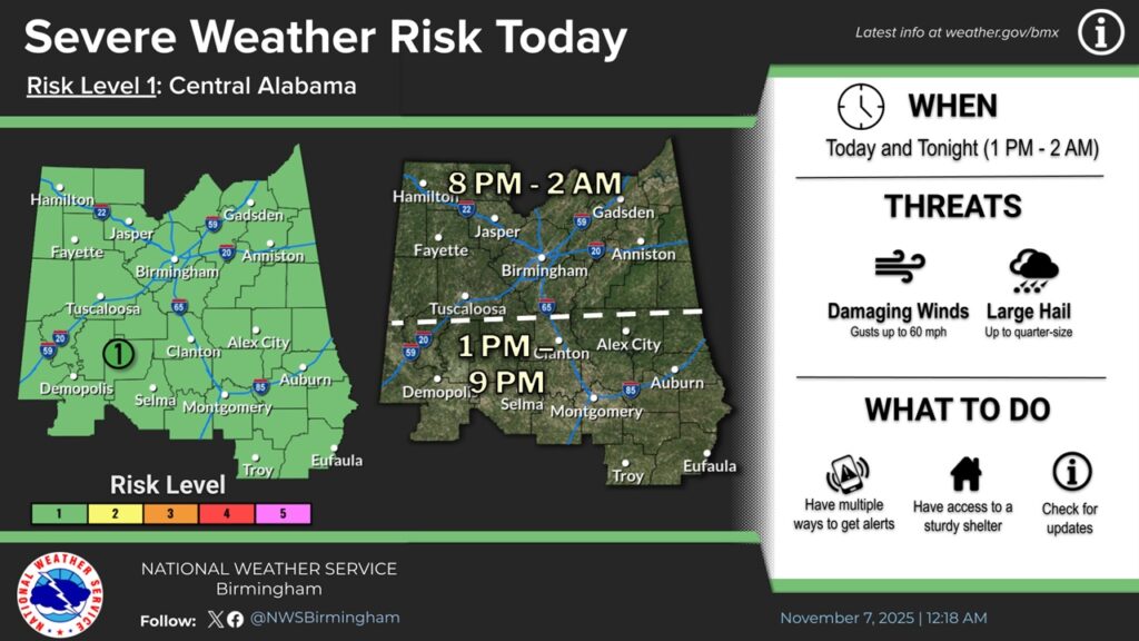
Some storms could reach Severe Limits. Level 1 Marginal Risk. The Main risk will be damaging winds. The Tornado Risk is low but not zero.
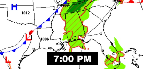
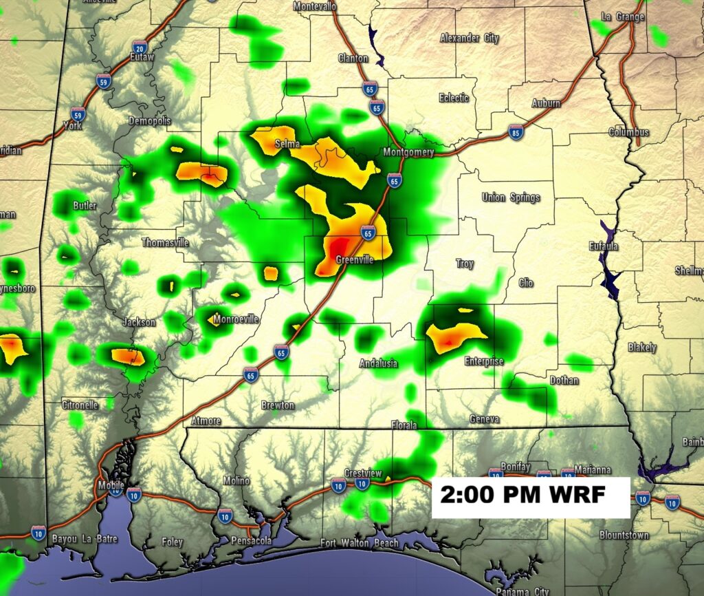
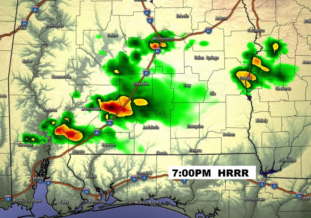
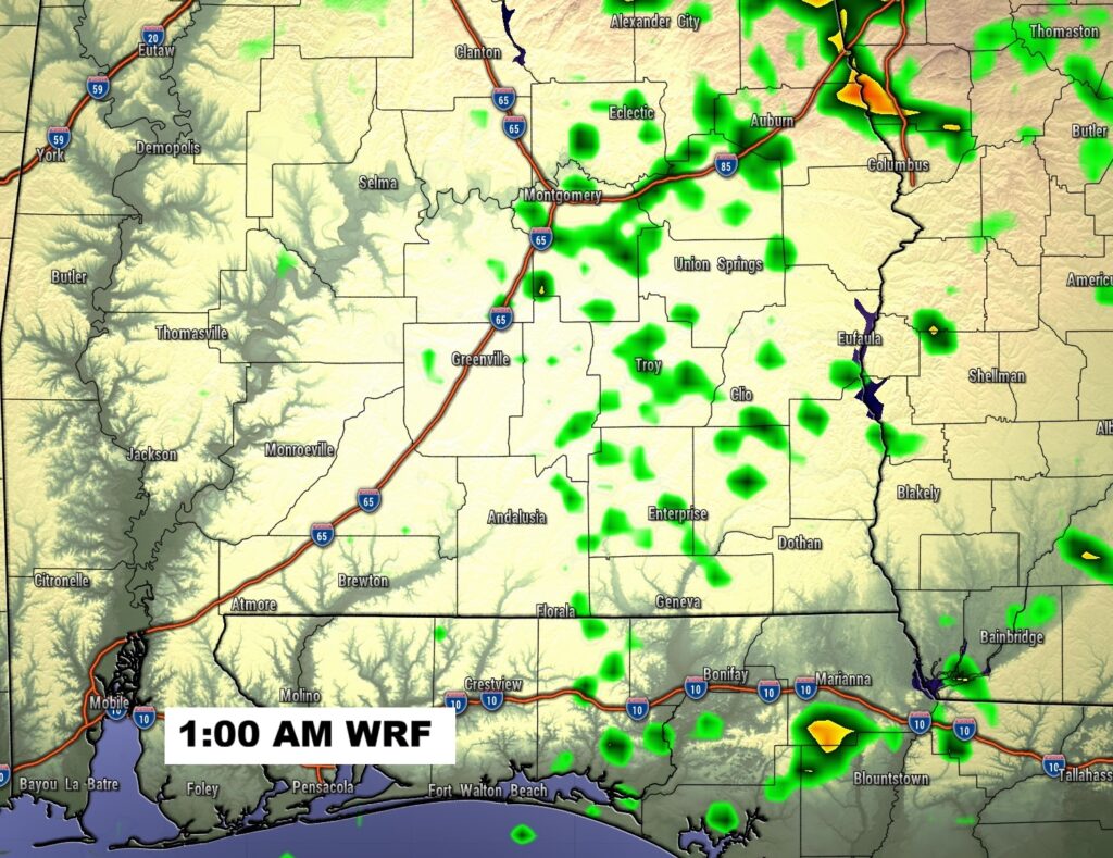
FUTURE RADAR: The threat of showers & storms begins this afternoon into tonight.
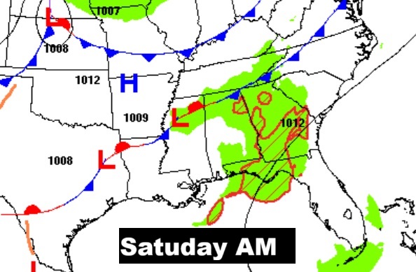
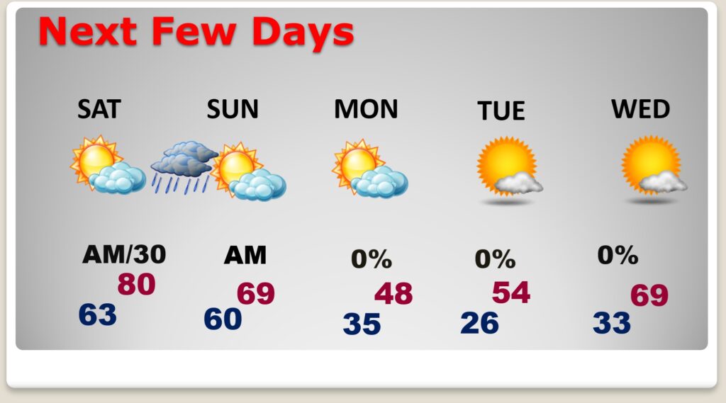
NEXT FEW DAYS: The risk of showers continues Saturday AM early. There will be another shower risk late Saturday night ahead of front two. Stage one cool-down arrives Sunday. Maybe upper 60’s Sunday. . MUCH Colder air is on the horizon, as arctic air engulfs the state. Sunday night will be breezy and cold. Monday’s high will only reach the 40’s, but wind chill will be a factor. The coldest morning will be Tuesday with the first widespread freeze and lows in the middle 20’s. An early sample of WINTER is on the way. Get ready.
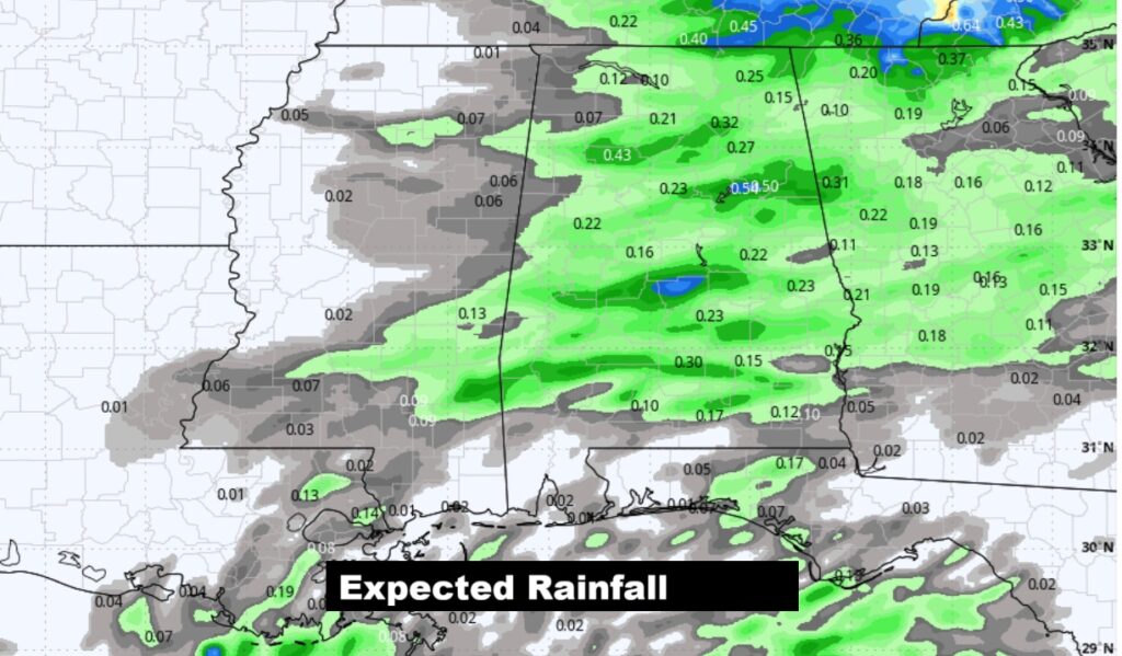
Here’s the expected rainfall. Not much.
Here’s the 10 Day model blend temperature trend. Ther first part of next week will be quite cold for so early in the season. Temperatures will start to recover late week.

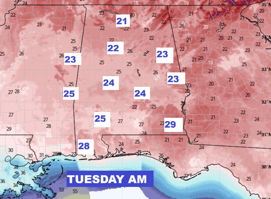
The COLDEST morning could be Tuesday morning. WOW. That’s a RUDE extreme change.
Thanks for reading this Blog this morning. This morning we are LIVE on the radio from 6 to 9 on NewsTalk 93.1. I’ll have another update for you in the 4 o’clock hour tomorrow morning. Have a nice day.
–Rich